Quetta
Quetta
| |
|---|---|
| City | |
|
Quetta City in the evening | |
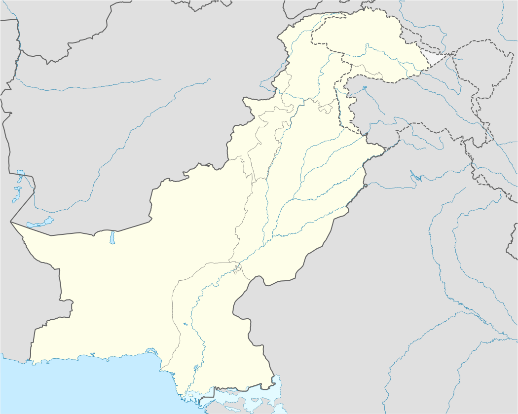 Quetta Location in Pakistan | |
| Coordinates: 30°11′N 67°00′E / 30.183°N 67.000°ECoordinates: 30°11′N 67°00′E / 30.183°N 67.000°E | |
| Country | Pakistan |
| Region | Balochistan |
| District | Quetta |
| Government | |
| • Type | Municipal Corporation[1] |
| • Mayor of Quetta | Dr Kalimullah Khan [2] |
| • Deputy Mayor of Quetta | Younus Baloch |
| Area | |
| • Total | 2,656 km2 (1,025 sq mi) |
| Elevation | 1,680 m (5,510 ft) |
| Population (2016)[3] | |
| • Total | 1,140,000 |
| • Density | 430/km2 (1,100/sq mi) |
| Quetta Urban agglomeration | |
| Time zone | PKT (UTC+5) |
| Area code(s) | +9281 |
Quetta (Urdu: کوئٹہ, Pashto: کوټه, Balochi: کویته ![]() pronunciation ) is the provincial capital of Balochistan, Pakistan and the ninth-largest city of Pakistan.[4] The city is known as the fruit garden of Pakistan, due to the numerous fruit orchards in and around it, and the large variety of fruits and dry fruits produced there. The city was also known as Little Paris in the past due to its beauty and geographical location.[5] The immediate area has long been one of pastures and mountains, with varied plants and animals relative to the dry plains to the west. Quetta is at an average elevation of 1,680 meters (5,510 feet) above sea level,[6] making it Pakistan's only high-altitude major city. The population of the city is estimated to be approximately 1,140,000.[3]
pronunciation ) is the provincial capital of Balochistan, Pakistan and the ninth-largest city of Pakistan.[4] The city is known as the fruit garden of Pakistan, due to the numerous fruit orchards in and around it, and the large variety of fruits and dry fruits produced there. The city was also known as Little Paris in the past due to its beauty and geographical location.[5] The immediate area has long been one of pastures and mountains, with varied plants and animals relative to the dry plains to the west. Quetta is at an average elevation of 1,680 meters (5,510 feet) above sea level,[6] making it Pakistan's only high-altitude major city. The population of the city is estimated to be approximately 1,140,000.[3]
Located in north western Balochistan near the Pakistan-Afghanistan border, Quetta is a trade and communication centre between the two countries. The city lies on the Bolan Pass route which was once the only gateway from Central Asia to South Asia. Quetta played an important role militarily for the Pakistani Armed Forces in the intermittent Afghanistan conflict.
Etymology
Quetta is also spelled Kuwatah, which is a variation of Kot, a Pashto word meaning "fortress".[7] It is believed that it relates to the four imposing hills (Chiltan, Takatu, Zarghoon and Murdaar) that surround the city and form a natural bulwark.
British Raj
In 1876 Quetta was incorporated into British controlled territories of the subcontinent. British Troops constructed the infrastructure for their establishment as it was a strategic location. By the time of the earthquake on 31 May 1935 Quetta had developed into a bustling city with a number of multistory buildings and was known as "Little Paris" because of that. The epicenter of the earthquake was close to the city and destroyed most of the city’s infrastructure and killed an estimated 40,000 people.[5]
During the independence movement of Indian subcontinent the predominantly Muslim population of the region supported the Muslim League and the Pakistan Movement.
Geography
Quetta has an area of 2,653 km2 (1,024 sq mi) and consists of series of small river valleys which act as a natural fort surrounded on all sides by hills; these are named Chiltan, Takatoo, Murdar and Zarghun. Although a mostly rocky landscape, there are few natural boundaries between Quetta and its adjoining districts of Dera Ismail Khan to the northeast, Dera Ghazi Khan and Sibi to the east, Sukkur and Jacobabad to the southeast, Karachi and Gawadar to the south and Ziarat to the northeast. The closest city is Kandahar in Afghanistan, north-west at the end of the N25 road. Three main roads gradually fan out to the south, the central route, the N25 leads via the city of Khuzdar to the coastal metropolis of Karachi.
Climate
| Climate data for Quetta, Pakistan | |||||||||||||
|---|---|---|---|---|---|---|---|---|---|---|---|---|---|
| Month | Jan | Feb | Mar | Apr | May | Jun | Jul | Aug | Sep | Oct | Nov | Dec | Year |
| Record high °C (°F) | 23.6 (74.5) |
26.7 (80.1) |
31.1 (88) |
35.0 (95) |
39.4 (102.9) |
41.5 (106.7) |
42.0 (107.6) |
40.6 (105.1) |
38.3 (100.9) |
34.0 (93.2) |
36.0 (96.8) |
25.0 (77) |
42 (107.6) |
| Average high °C (°F) | 10.8 (51.4) |
12.9 (55.2) |
18.7 (65.7) |
24.8 (76.6) |
30.4 (86.7) |
35.3 (95.5) |
35.9 (96.6) |
34.8 (94.6) |
31.4 (88.5) |
25.5 (77.9) |
19.2 (66.6) |
13.3 (55.9) |
24.42 (75.93) |
| Daily mean °C (°F) | 3.7 (38.7) |
6.0 (42.8) |
11.1 (52) |
16.6 (61.9) |
21.0 (69.8) |
25.6 (78.1) |
27.9 (82.2) |
26.4 (79.5) |
21.1 (70) |
14.6 (58.3) |
9.2 (48.6) |
5.1 (41.2) |
15.69 (60.26) |
| Average low °C (°F) | −3.4 (25.9) |
−0.9 (30.4) |
3.4 (38.1) |
8.3 (46.9) |
11.5 (52.7) |
15.9 (60.6) |
19.9 (67.8) |
17.9 (64.2) |
10.9 (51.6) |
3.8 (38.8) |
−0.9 (30.4) |
−3.2 (26.2) |
6.93 (44.47) |
| Record low °C (°F) | −18.3 (−0.9) |
−16.7 (1.9) |
−8.3 (17.1) |
−3.9 (25) |
−0.3 (31.5) |
5.0 (41) |
8.9 (48) |
3.3 (37.9) |
−0.6 (30.9) |
−8.3 (17.1) |
−13.3 (8.1) |
−18.3 (−0.9) |
−18.3 (−0.9) |
| Average precipitation mm (inches) | 56.7 (2.232) |
49 (1.93) |
55 (2.17) |
28.3 (1.114) |
6 (0.24) |
1.1 (0.043) |
12.7 (0.5) |
12.1 (0.476) |
0.3 (0.012) |
3.9 (0.154) |
5.3 (0.209) |
30.5 (1.201) |
260.9 (10.281) |
| Mean monthly sunshine hours | 220.1 | 209.05 | 232.5 | 273 | 334.8 | 327 | 313.1 | 313.1 | 294 | 306.9 | 279 | 238.7 | 3,341.25 |
| Source #1: Hong Kong Observatory (altitude: 1589 m)[8] | |||||||||||||
| Source #2: PMD[9] | |||||||||||||
Quetta has a high semi-arid climate (Köppen BSk) with a significant variation between summer and winter temperatures. Summer starts about late May and goes on until early September with average temperatures ranging from 24–26 °C (75–79 °F). The highest temperature in Quetta is 42 °C (108 °F) which was recorded on 10 July 1998.[10] Autumn starts in late September and continues until mid-November with average temperatures in the 12–18 °C (54–64 °F) range. Winter starts in late November and ends in late March, with average temperatures near 4–5 °C (39–41 °F). The lowest temperature in Quetta is −18.3 °C (−0.9 °F) which was recorded on 8 January 1970.[10] Spring starts in early April and ends in late May, with average temperatures close to 15 °C (59 °F). Unlike more easterly parts of Pakistan, Quetta does not have a monsoon season of heavy rainfall. Highest rainfall during 24 hours in Quetta is 113 millimetres (4.4 in) which was recorded on 17 December 2000,[10] Highest monthly rainfall is 232.4 millimetres (9.15 in) which was recorded in March, 1982, also the year of the highest annual rainfall, at 949.8 millimetres (37.39 in).[10] In the winter, snowfall has become quite erratic (December, January and February).
The city saw a severe drought from 1999 to 2001, during which the city did not receive snowfall and below normal rains. In 2003 the city received snowfall after a hiatus of five years. In 2004, and 2005 the city received normal rains after three years without snowfall while in 2006, 2007 and 2009 the city received no snow except in 2008 when Quetta received a snowfall of 10 centimetres (4 in) in four hours on 29 January 2008.[11] On 2 February it further received 25.4 centimetres (10 in) in 10 hours[12] which was the heaviest snowfall for the city in the last ten years. During the winter of 2010 it received no snow and saw below normal rains due to the presence of El-Nino over Pakistan.[10]
Government and politics
At the local government level, the city is governed by a municipal corporation consisting of 66 ward members which elects a mayor and a deputy mayor.[1]
Educational institutions
Quetta serves as the learning center for the Balochistan province. The city has a number of government and private colleges, including the following:
- University of Balochistan
- Balochistan University of Information Technology, Engineering and Management Sciences (BUITEMS)
- Sardar Bahadur Khan Women's University
- Islamia High School: It was frequently visited by Quaid-e-Azam in 1937 and was nicknamed as Chhota Aligarh (Little Aligarh) by him[13]
- Bolan Medical College
- Balochistan Agriculture College
- Geological Survey of Pakistan
- Federal Government (FG) Degree College
- Tameer-e-Nau Public College
- Command and Staff College
The Balochistan Board Quetta is an Intermediate and Secondary education board for Balochistan. It conducts Secondary School and Higher Secondary School examination throughout the province.
Demographics
The population of the city is around one million. In 2016, it was estimated at 1,140,000.[3] This makes it the largest city in Balochistan province and one of the major cities of Pakistan. The scholars disagree about the demographics of the city. According to some, the city has a Pashtun plurality followed by Baloch / Brahui, other indigenous people of Balochistan and lastly the settlers from other areas of Pakistan.[14] Others think, the city has a Pashtun majority followed by Brahui, Baloch, Punjabis, Muhajir people and Hazaras.[15] [16] [17]Urdu being national language is used and understood by all the residents and serves as lingua franca. Languages spoken as first language include Pashto, Punjabi, Balochi and others.[14]
| Rank | Language | 1998 census[14] |
|---|---|---|
| 1 | Balochi | 25% |
| 2 | Pashto | 23.7% |
| 3 | Punjabi | 21.7% |
| 4 | Others | 29.6% |
Facilities
Local facilities were created in the city for mountain climbing and caving as well as water sports. Hayatullah Khan Durrani (Pride of Performance) is the chief executive of Hayat Durrani Water Sports Academy at Hanna Lake. In kayaking, Muhammad Abubakar Durrani, National Junior Champion was selected for the world Junior Canoeing Championship in 2009 in Moscow.[18][19]
The Shaheed Nauoroz Stadium is the largest stadium in the city. The city also has Ayub National Stadium, a multipurpose stadium used for football and cricket and Bugti Stadium used only for cricket.
See also
- 1935 Quetta earthquake
- 2008 Ziarat earthquake
- List of people from Quetta
- Pashtun cuisine
- History of Quetta
Gallery

 Snow-covered hill, near Hanna Urak
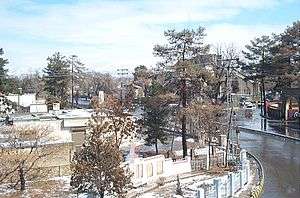 China Chowk, at the starting end of Jinnah Road
References
- 1 2 "Government Organization - Government of Balochistan". balochistan.gov.pk. Retrieved 6 September 2016.
- ↑ "PkMAP candidate nominated for Quetta mayor".
- 1 2 3 http://www.demographia.com/db-worldua.pdf
- ↑ http://www.pbs.gov.pk/sites/default/files//tables/POPULATION%20SIZE%20AND%20GROWTH%20OF%20MAJOR%20CITIES.pdf
- 1 2 ڈان اردو. "پاکستانی شہروں کی تاریخ". dawnnews.tv. Retrieved 26 February 2016.
- ↑ "Mongabay -environmental science and conservation news".
- ↑ ""History of Quetta" Government of Quetta". quetta.gov.pk. Retrieved 26 June 2016.
- ↑ "Climatological Normals of Quetta". Hong Kong Observatory. Retrieved 2014-01-27.
- ↑ "Extremes of Quetta". Pakistan Meteorological Department. Retrieved February 3, 2015.
- 1 2 3 4 5 Archived 13 June 2010 at the Wayback Machine.
- ↑ Archived 4 January 2009 at the Wayback Machine.
- ↑ "Leading News Resource of Pakistan". Daily Times. 4 February 2008. Retrieved 8 May 2012.
- ↑ Dr. Javed Haider Sayed (2008). "The Balochistan Muslim League" (PDF). National Institute of Historical & Cultural Research - Pakistan. Quaid-e-Azam University, Islamabad. Retrieved 6 March 2016.
- 1 2 3 Jonah Blank, Christopher Clary & Brian Nichiporuk 2014.
- ↑ "Pakistan and the Karakoram Highway by Sarina Singh — Pashtun Make The Majority".
- ↑ "The Crowded-Out Conflict by Ann Wilkens — Pashtun form the Majority".
- ↑ "The Pashtun Question by Abubakar Siddique — Quetta has a Pashtun Majority".
- ↑ Pakistan Players for Moscow
- ↑ "GEO TV Report Pakistan Players for Moscow >". Geo.tv. 28 July 2009. Archived from the original on 25 December 2014. Retrieved 21 January 2014.
Bibliography
- Jonah Blank; Christopher Clary; Brian Nichiporuk (30 October 2014), Drivers of Long-Term Insecurity and Instability in Pakistan: Urbanization, Rand Corporation, p. 29, ISBN 978-0-83-308751-5
External links
Neighbourhoods of Quetta | ||
|---|---|---|
Administrations: Quetta Division and Quetta District | ||
| Tehsils |
|  |
| Cities |
| |
| Towns and councils | ||
| Localities | ||
Website: Quetta District at NRB | ||
| Federal/National | ||
|---|---|---|
| Former (federal/national) | ||
| Provincial | ||
| Territorial | ||