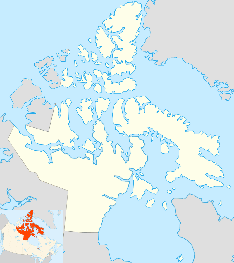
Qikiqtarjuaq

| Qikiqtarjuaq ᕿᑭᖅᑕᕐᔪᐊᖅ | |
|---|---|
|
Qikiqtarjuaq in 2001 | |
 Qikiqtarjuaq | |
| Coordinates: 67°33′29″N 064°01′29″W / 67.55806°N 64.02472°WCoordinates: 67°33′29″N 064°01′29″W / 67.55806°N 64.02472°W | |
| Country | Canada |
| Territory | Nunavut |
| Region | Qikiqtaaluk Region |
| Electoral district | Uqqummiut |
| Government[1][2] | |
| • Type | Hamlet Council |
| • Mayor | Mary Killiktee |
| • MLAs | Pauloosie Keyootak |
| Area[3] | |
| • Total | 130.65 km2 (50.44 sq mi) |
| Elevation[4] | 6 m (20 ft) |
| Population (2010)[3] | |
| • Total | 520 |
| • Density | 4.0/km2 (10/sq mi) |
| Time zone | EST (UTC-5) |
| • Summer (DST) | EDT (UTC-4) |
| Canadian Postal code | X0A 0B0 |
| Area code(s) | 867 |

Qikiqtarjuaq (Inuit pronunciation: [qikiqtaʁjuˈaq]; formerly, until November 1998: "Broughton Island" /ˈbrɔːtən/,[5] is a community located on the island of the same name in the Qikiqtaaluk Region of Nunavut, Canada. The island is known for Arctic wildlife, whale watching, and as the northern access point for Auyuittuq National Park (see also Pangnirtung)
At the 2006 census the population was 473, a decrease of 8.9% from the 2001 census.[3] However, by 2010, that population had increased to 520.
Qikiqtarjuaq used to host the annual "Suicide Prevention Walk". Local participants would walk a total distance of 60 km across the tundra from an old whaler's station called Kivitoo. Today the walk is much shorter than the original 2 and a half days, but it is still meant to promote hope among the community.
The community hosts a two-week celebration over the Christmas and New Year period every year. Visitors are warmly welcomed and encouraged to join the festivities and games.
Near Qikiqtarjuaq was the home of FOX-5, a Distant Early Warning Line and now a North Warning System site.
In July 2011, Qikiqtarjuaq was featured in the BBC Radio 4 comedy series Cabin Pressure.
Geography
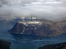
Qikiqtarjuaq is situated off eastern Baffin Island. Davis Strait and Baffin Bay run to the east, and the Baffin Mountains are located to the west, more specifically the Arctic Cordillera mountain range. It is also one of the Nunavut communities closest to Greenland.
Services


It is served by Qikiqtarjuaq Airport, (ICAO: CYVM), and a nine-room inn, The Tulugak Hotel. A Nurse and RCMP stations provide vital resources for the community. The Nurse Station is composed of two nurses plus local volunteers and assistants and the RCMP station is a one-person detachment but sometimes hosts two officers.
Qikiqtarjuaq is a popular stop for pilots who fly smaller aircraft to and from Europe. The airport has a 3,800 foot by 100 foot gravel runway that is well compacted, well cared for, cleared of snow daily, and lit. Qikiqtarjuaq is considerably closer to Sondre Stromfjord, Greenland than Iqaluit (CYFB). The instrument approach minima for the NDB approach at CYVM is relatively high (2,000 feet barometric, 1,982 AGL) due to high terrain surrounding the airport. An airport advisory service (Broughton Radio, a CARS) provides assistance to pilots during normal business hours, and provides weather observation services. An automatic weather observation service (AWOS) operates when Broughton Radio is unattended. The fuel supplier at the airport can assist with all ground handling arrangements, including transportation, parking, de-icing, and accommodations.
In the summer of 2010, construction began on the new airport terminal building, and a new Municipal office will be built in 2011. There is also an access road that was built to Tisunaaq, also known as Ceetee Land to the Elders, and another road is proposed to Qikiqtarjuaqruluk, or Old Broughton, an abandoned settlement. Kivitoo, an old whaling station, is located 90 km (56 mi) to the north and is currently abandoned.
Climate
Qikiqtarjuaq has a tundra climate, with the warmest month averaging below 6 °C (43 °F).
| Climate data for FOX-5 | |||||||||||||
|---|---|---|---|---|---|---|---|---|---|---|---|---|---|
| Month | Jan | Feb | Mar | Apr | May | Jun | Jul | Aug | Sep | Oct | Nov | Dec | Year |
| Record high humidex | 1.5 | 0.0 | 2.7 | 6.1 | 8.6 | 18.6 | 20.7 | 19.9 | 13.6 | 7.0 | 3.5 | 3.9 | 20.7 |
| Record high °C (°F) | 3.9 (39) |
1.1 (34) |
4.0 (39.2) |
7.8 (46) |
14.2 (57.6) |
17.8 (64) |
20.7 (69.3) |
22.6 (72.7) |
14.4 (57.9) |
10.6 (51.1) |
7.5 (45.5) |
5.0 (41) |
22.6 (72.7) |
| Average high °C (°F) | −22.8 (−9) |
−22.4 (−8.3) |
−19.6 (−3.3) |
−13.6 (7.5) |
−5.4 (22.3) |
2.8 (37) |
8.2 (46.8) |
6.3 (43.3) |
−0.1 (31.8) |
−4.9 (23.2) |
−11.9 (10.6) |
−18.5 (−1.3) |
−8.5 (16.7) |
| Daily mean °C (°F) | −25.4 (−13.7) |
−25.2 (−13.4) |
−22.9 (−9.2) |
−16.9 (1.6) |
−8.2 (17.2) |
0.2 (32.4) |
5.3 (41.5) |
3.7 (38.7) |
−1.9 (28.6) |
−6.9 (19.6) |
−14.2 (6.4) |
−21.1 (−6) |
−11.1 (12) |
| Average low °C (°F) | −28.0 (−18.4) |
−28.0 (−18.4) |
−26.1 (−15) |
−20.2 (−4.4) |
−10.9 (12.4) |
−2.4 (27.7) |
2.4 (36.3) |
1.1 (34) |
−3.8 (25.2) |
−9.0 (15.8) |
−16.6 (2.1) |
−23.7 (−10.7) |
−13.8 (7.2) |
| Record low °C (°F) | −41.7 (−43.1) |
−42.8 (−45) |
−40.7 (−41.3) |
−34.3 (−29.7) |
−26.1 (−15) |
−12.2 (10) |
−8.9 (16) |
−7.8 (18) |
−13.9 (7) |
−24.4 (−11.9) |
−33.3 (−27.9) |
−39.2 (−38.6) |
−42.8 (−45) |
| Record low wind chill | −61.1 | −61.0 | −57.1 | −49.2 | −35.8 | −21.1 | −18.6 | −15.5 | −23.9 | −32.8 | −45.2 | −54.2 | −61.1 |
| Average precipitation mm (inches) | 3.7 (0.146) |
6.1 (0.24) |
3.6 (0.142) |
12.7 (0.5) |
23.7 (0.933) |
10.2 (0.402) |
18.1 (0.713) |
24.2 (0.953) |
30.0 (1.181) |
36.7 (1.445) |
29.7 (1.169) |
4.7 (0.185) |
203.3 (8.004) |
| Average rainfall mm (inches) | 0.0 (0) |
0.0 (0) |
0.0 (0) |
0.0 (0) |
0.0 (0) |
0.8 (0.031) |
10.8 (0.425) |
15.7 (0.618) |
2.4 (0.094) |
0.3 (0.012) |
0.0 (0) |
0.0 (0) |
30.0 (1.181) |
| Average snowfall cm (inches) | 3.7 (1.46) |
6.1 (2.4) |
3.6 (1.42) |
12.7 (5) |
23.7 (9.33) |
9.4 (3.7) |
7.3 (2.87) |
8.5 (3.35) |
27.7 (10.91) |
36.3 (14.29) |
29.7 (11.69) |
4.7 (1.85) |
173.3 (68.23) |
| Average precipitation days (≥ 0.2 mm) | 2.9 | 2.8 | 2.5 | 5.0 | 8.2 | 3.9 | 6.3 | 8.2 | 8.3 | 12.8 | 7.4 | 4.1 | 72.3 |
| Average rainy days (≥ 0.2 mm) | 0.0 | 0.0 | 0.0 | 0.0 | 0.0 | 0.5 | 4.8 | 5.2 | 0.6 | 0.2 | 0.0 | 0.0 | 11.2 |
| Average snowy days (≥ 0.2 cm) | 2.9 | 2.8 | 2.5 | 5.0 | 8.2 | 3.3 | 1.7 | 3.1 | 7.7 | 12.7 | 7.4 | 4.1 | 61.3 |
| Average relative humidity (%) | 76.6 | 74.7 | 76.6 | 81.5 | 88.0 | 85.5 | 78.4 | 81.5 | 91.2 | 88.7 | 83.7 | 79.2 | 82.1 |
| Source: Environment Canada Canadian Climate Normals 1981–2010[6] | |||||||||||||
See also
References
- ↑ Nunavummiut vie for council positions in upcoming hamlet elections
- ↑ Nunavut recounts produce one winner and one intractable deadlock
- 1 2 3 2006 census
- ↑ Elevation at airport. Canada Flight Supplement. Effective 0901Z 15 September 2016 to 0901Z 10 November 2016
- ↑ "Qikiqtarjuaq". Nunavut Tourism. Retrieved 30 August 2014.
- ↑ "Fox Five" (CSV (4222 KB)). Canadian Climate Normals 1981–2010. Environment Canada. Climate ID: 2400570. Retrieved 2013-11-27.
Further reading
- Mallory ML, BM Braune, M Wayland, and KG Drouillard. 2005. "Persistent Organic Pollutants in Marine Birds, Arctic Hare and Ringed Seals Near Qikiqtarjuaq, Nunavut, Canada". Marine Pollution Bulletin. 50, no. 1: 95-101.
- Stuckenberger, Anja Nicole. Community at play social and religious dynamics in the modern Inuit community of Qikiqtarjuaq = Een Samenleving in het Spel : sociale en religieuze Dynamiek in de moderne Inuit Gemeenschap van Qikiqtarjuaq. Amsterdam: Rozenberg, 2005. ISBN 90-5170-957-9
External links
| Wikimedia Commons has media related to Qikiqtarjuaq. |
- The Tulugak Hotel
- Qikiqtarjuaq Facts
- Leelie Enterprises (Airport Fuel Provider, FBO, and Lodge Operator)