Puerto Aysén
| Puerto Aisén | |||||
|---|---|---|---|---|---|
 | |||||
| Coordinates: 45°24′S 72°41′W / 45.400°S 72.683°WCoordinates: 45°24′S 72°41′W / 45.400°S 72.683°W | |||||
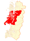
| Region | Aisén | ||||
| Province | Aisén | ||||
| Municipalidad | Aisén | ||||
| Comuna | Aisén | ||||
| Government | |||||
| • Type | Municipalidad | ||||
| • Alcade | Óscar Catalán Sánchez | ||||
| Population (2002 census ) | |||||
| • Total | 16,936 | ||||
| Time zone | CLT (UTC−04:00) | ||||
| • Summer (DST) | CLST (UTC−03:00) | ||||
| Area code(s) | Country + town = 56 + 67 | ||||
| Climate | Cfb | ||||

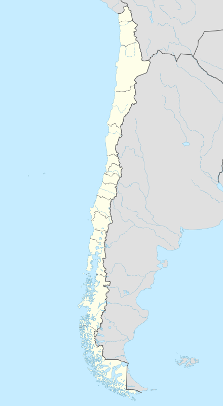
Puerto Aisén (Pronounced: /aɪsɛn/ EYE-ssen) is a city of Chile located in the Aysén del General Carlos Ibáñez del Campo Region, 4 kilometres (2 mi) above the head of Aisén Fjord in the country's extreme south. Puerto Aisén, which is the capital city of both the Aysén Province and the commune of Aisén is located 65 kilometres (40 mi) far from the Regional Capital of Coyhaique, and 15 kilometres (9 mi) far from the port of Puerto Chacabuco, main entry point to Puerto Aisén by sea. The main tourist attraction is Lagoon San Rafael.
Originally settled around 1914, it was officially recognized as a city on January 28, 1928. It numbers around 17,000 inhabitants.
Climate
Puerto Aisén has an oceanic climate (Köppen climate classification: Cfb) with high rainfall throughout the year (and one of Chile's wettest places). Typical of oceanic climates, precipitation peaks in late fall and early winter. The highest temperature recorded is 34.9 °C (94.8 °F) in January 1975 while the lowest is −12.0 °C (10.4 °F) in June 1999.[1]
| Climate data for Puerto Aisén (1970–2000, extremes 1955–present) | |||||||||||||
|---|---|---|---|---|---|---|---|---|---|---|---|---|---|
| Month | Jan | Feb | Mar | Apr | May | Jun | Jul | Aug | Sep | Oct | Nov | Dec | Year |
| Record high °C (°F) | 34.9 (94.8) |
32.1 (89.8) |
31.5 (88.7) |
23.6 (74.5) |
17.8 (64) |
15.3 (59.5) |
15.2 (59.4) |
17.0 (62.6) |
23.7 (74.7) |
26.0 (78.8) |
29.0 (84.2) |
31.0 (87.8) |
34.9 (94.8) |
| Average high °C (°F) | 17.2 (63) |
17.2 (63) |
15.7 (60.3) |
12.4 (54.3) |
9.3 (48.7) |
7.0 (44.6) |
6.6 (43.9) |
8.3 (46.9) |
10.6 (51.1) |
13.0 (55.4) |
14.8 (58.6) |
16.3 (61.3) |
12.2 (54) |
| Daily mean °C (°F) | 14.6 (58.3) |
14.5 (58.1) |
13.0 (55.4) |
10.1 (50.2) |
7.2 (45) |
5.0 (41) |
4.5 (40.1) |
6.0 (42.8) |
8.2 (46.8) |
10.5 (50.9) |
12.4 (54.3) |
13.9 (57) |
9.8 (49.6) |
| Average low °C (°F) | 11.1 (52) |
10.5 (50.9) |
9.1 (48.4) |
7.1 (44.8) |
4.8 (40.6) |
2.8 (37) |
2.2 (36) |
3.2 (37.8) |
4.7 (40.5) |
6.8 (44.2) |
9.0 (48.2) |
10.4 (50.7) |
6.7 (44.1) |
| Record low °C (°F) | 1.0 (33.8) |
0.6 (33.1) |
−2.9 (26.8) |
−3.4 (25.9) |
−10.0 (14) |
−12.0 (10.4) |
−8.9 (16) |
−5.4 (22.3) |
−7.4 (18.7) |
−3.2 (26.2) |
−4.0 (24.8) |
1.0 (33.8) |
−12.0 (10.4) |
| Average precipitation mm (inches) | 159.1 (6.264) |
124.6 (4.906) |
149.2 (5.874) |
200.2 (7.882) |
258.5 (10.177) |
240.4 (9.465) |
237.7 (9.358) |
213.4 (8.402) |
181.3 (7.138) |
149.1 (5.87) |
146.3 (5.76) |
178.7 (7.035) |
2,238.5 (88.131) |
| Average precipitation days | 18 | 14 | 16 | 19 | 21 | 20 | 21 | 21 | 19 | 18 | 18 | 18 | 223 |
| Average relative humidity (%) | 73 | 75 | 77 | 83 | 88 | 88 | 87 | 84 | 80 | 75 | 73 | 73 | 79.7 |
| Source: Dirección Meteorológica de Chile[1][2] | |||||||||||||

References
- 1 2 "Temperatura Mensual Histórica de Puerto Aysén Ad. (450001)". Sistema de Administración de Datos Climatológicos (in Spanish). Dirección Meteorológica de Chile. Retrieved April 25, 2016.
- ↑ "Estadistica Climatologica Tomo III" (PDF) (in Spanish). Dirección General de Aeronáutica Civil. March 2001. pp. 161–175. Retrieved April 25, 2016.