Ptghni
| Ptghni Պտղնի | |
|---|---|
 Ptghni Պտղնի | |
| Coordinates: 40°15′24″N 44°35′06″E / 40.25667°N 44.58500°ECoordinates: 40°15′24″N 44°35′06″E / 40.25667°N 44.58500°E | |
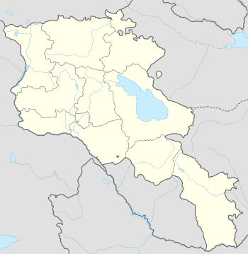
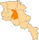
| Country | Armenia |
| Marz (Province) | Kotayk |
| Founded | 1831 |
| Government | |
| • Mayor | Arakel Virabyan |
| Area | |
| • Total | 6.22 km2 (2.40 sq mi) |
| Elevation | 1,350 m (4,430 ft) |
| Population (2008) | |
| • Total | 1,337 |
| • Density | 210/km2 (560/sq mi) |
| Time zone | (UTC+4) |
| • Summer (DST) | (UTC+5) |
Ptghni (Armenian: Պտղնի, also Romanized as Ptykhni, Ptgni, and Ptkhni) is a village located in the Kotayk Province of Armenia along the left bank of the Hrazdan River. It was founded in 1831 in the vicinity of an abandoned dwelling. The village has a school, kindergarten, house of culture, and a library. The local economy is dependent on agriculture and local inhabitants primarily grow grapes, melons, gourds, and breed cattle. Within the village are the remains of fortress walls and Ptghavank of the 6th to 7th-century.[1][2]
Gallery
-

Ptghnavank, 6th-7th c.
-

Khachkar monument beside the road leading to the village.
References
- ↑ "Ptghni (Kotayk)". CAA: Union of Communities of Armenia. Retrieved June 2, 2015.
- ↑ Kiesling, Brady; Kojian, Raffi (2005). Rediscovering Armenia: Guide (2nd ed.). Yerevan: Matit Graphic Design Studio. pp. 92–93. ISBN 99941-0-121-8.
- Ptghni at GEOnet Names Server
- World Gazeteer: Armenia – World-Gazetteer.com
- Report of the results of the 2001 Armenian Census, National Statistical Service of the Republic of Armenia
- Ptghnavank Monastery
- Ptghnavank2
- Ptghnavank3
- Ptghnavank4
- Ptghnavank5
External links
- Communities Association of Armenia: Ptghni
- Ptghnavank MonasteryPtghnavank2Ptghnavank3Ptghnavank4Ptghnavank5
This article is issued from Wikipedia - version of the 6/2/2015. The text is available under the Creative Commons Attribution/Share Alike but additional terms may apply for the media files.