Province of Verbano-Cusio-Ossola
| Province of Verbano-Cusio-Ossola | |
|---|---|
| Province | |
|
Stresa in foreground (Province of Varese across lake) | |
 Map highlighting the location of the province of Verbano-Cusio-Ossola in Italy | |
| Country |
|
| Region | Piedmont |
| Capital(s) | Verbania |
| Comuni | 77 |
| Government | |
| • President | Massimo Nobili |
| Area | |
| • Total | 2,255 km2 (871 sq mi) |
| Population (2006) | |
| • Total | 161,732 |
| • Density | 72/km2 (190/sq mi) |
| Time zone | CET (UTC+1) |
| • Summer (DST) | CEST (UTC+2) |
| Postal code | Verbania: 28921-28925, Other areas: 28811-28897 |
| Telephone prefix | 0321, 0322, 0323, 0324 |
| ISO 3166 code | VB |
| Vehicle registration | VB |
| ISTAT | 103 |
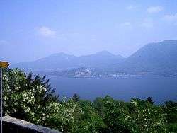
Verbano-Cusio-Ossola (Italian: Provincia del Verbano Cusio Ossola [verˈbaːno ˈkuːzjo ˈɔssola]) is the northernmost province in the Italian region of Piedmont. It was created in 1992 through the fusion of three distinct regions which had previously been part of the Province of Novara. The area flanking the western shore of Verbano (or Lago Maggiore) forms the eastern part of the province; Cusio (or Lago d’Orta) and its environs form the southern part; while the north and east of the province consists of the Ossola, a region of Alpine mountains and valleys. The ISO code for the province is VB.
The province has a total population of some 160,000, distributed over an area of 2,255 square kilometres (871 sq mi), with the biggest population centres being its capital Verbania on the shores of Lago Maggiore, Domodossola the main town of the Ossola, and Omegna at the northern end of Lago d’Orta.

Municipal subdivisions
There are 77 comuni in the province. The largest by population are:
| Comune | Population | |
|---|---|---|
| Verbania | 30,836 |  |
| Domodossola | 18,362 |  |
| Omegna | 15,949 |  |
| Gravellona Toce | 7,595 |  |
| Villadossola | 6,915 | |
| Cannobio | 5,113 | 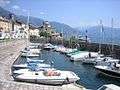 |
| Stresa | 5,104 |  |
Culture
UNESCO Sacred Mountains
In 2003, the Sacred Mountain of Domodossola and the Sacred Mountain of Ghiffa were inserted by UNESCO in the World Heritage List.

 Sacro Monte di Domodossola
View of the chapels IX and XI Sacro Monte di Domodossola
Chapel IX
 Sacro Monte di Ghiffa
Crucifixion and Trinity, 16th century
Demographics
The top eight countries of origin of the inhabitants of Verbano-Cusio-Ossola with foreign citizenship at December 31, 2010 were:[1]
 Ukraine 1724
 Morocco 1402
 Romania 1233
 Albania 770
 China 737
 Senegal 429
 Germany 315
 Switzerland 219
Footnotes
References
- ↑ ISTAT. "Verbano-Cusio-Ossola". ISTAT. Retrieved 2012-06-06.
External links
- Official website
- Portale del Lago Maggiore - a portal run by the local Trading Chamber
- Official web site for European Sacred Mountains (English)
| Provinces and metropolitan cities |  | |
|---|---|---|
| History | ||
| Politics and government | ||
| Education and culture | ||
Categories | ||
Coordinates: 45°56′N 8°32′E / 45.933°N 8.533°E