Port William, Falkland Islands


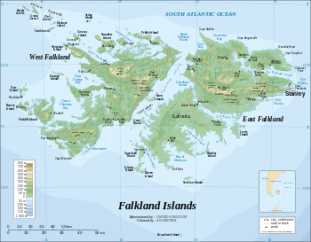
Port William (French: Baye Choiseul,[1] Spanish: Puerto Groussac[2]) is a large inlet on the east coast of East Falkland island. A strait called "the Narrows" leads into Stanley Harbour.
Port William has several other bays on it, namely Gypsy Cove and Yorke Bay, which is a noted beauty spot, Hearnden Water, which is effectively the estuary of the Murrell River and Weir Creek, Blanco Bay and Sparrow Cove. Kidney Island is just north of Port William.
The peninsula on which Canopus Hill, Stanley Airport and Gypsy Cove lie, together with a narrow spit of land known as Navy Point, effectively divides Port William from Stanley Harbour. As such this is the busiest waterway of the Falkland Islands and frequently visited by cruise ships, freighters and navy vessels, although this has lessened since the building of the two airports at RAF Mount Pleasant and Stanley Airport.
It was enlarged as the result of glacial action.
It is heavily mined due to the Falkland Crisis.
New deep water port
At a meeting of the Executive Council of the Falkland Islands (ExCo) on 24 October 2012 Members of the Legislative Assembly of the Falkland Islands (MLAs) instructed officials of the Falkland Islands Government (FIG) to proceed with costed proposals for a new deep water port and associated infrastructure at Port William.[3]
References
- ↑ Dom Pernety, Antoine-Joseph. Journal historique d'un voyage fait aux Iles Malouïnes en 1763 et 1764 pour les reconnoître et y former un établissement; et de deux Voyages au Détroit de Magellan, avec une Rélation sur les Patagons. Berlin: Etienne de Bourdeaux, 1769. 2 volumes, 704 pp. Online vol. 1 & vol. 2. Abridged English version.
- ↑ PCGN Falkland Islands
- ↑ "Falklands to build a new deep-water port to cater for the oil and gas industry". MercoPress, Montevideo. 26 October 2012. Retrieved 25 November 2012.
Coordinates: 51°40′01″S 57°47′10″W / 51.667°S 57.786°W