Political history of Mysore and Coorg (1565–1760)
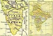
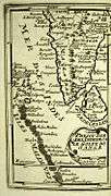
The political history of Mysore and Coorg (1565–1760) is the political history of the contiguous historical regions of Mysore state and Coorg province located on the Deccan Plateau in west-central peninsular India (Map 1). It begins with the fall of the Hindu Vijayanagara Empire in 1565 and ends just before the rise of Sultan Haidar Ali in 1761.
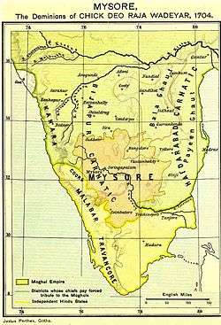
At the height of the Vijayanagara Empire (1350–1565), the Mysore and Coorg region was ruled by motley chieftains, or rajas ("little kings"). Each raja had dominion over a small area, and each supplied soldiers and annual tribute for the empire's needs. Soon after the empire's fall and the subsequent eastward move of the diminished ruling family, many chieftains, especially in the west, tried to loosen their imperial bonds and expand their realms. Sensing opportunity amidst the new uncertainty, various powers from the north invaded the region intermittently. Among these were the Sultanate of Bijapur to the northwest, the Sultanate of Golconda to the northeast, the fledgling Maratha empire, farther northwest, and the Mughal empire, farther north still. For much of the 17th century the tussles between the little kings and the big powers, and amongst the little kings, resulted in shifting sovereignties, loyalties, and borders. By the turn of the 18th century, the political landscape had become better defined. The northwestern hills were being ruled by the Nayaka rulers of Ikkeri, the southwestern, in the Western Ghats, by the Rajas of Coorg, the southern plains by the Wodeyar rulers of Mysore, all of which were Hindu dynasties; whereas the eastern and northeastern regions were being ruled by the Muslim Nawabs of Arcot and Sira. Of these, Ikkeri and Coorg were independent, Mysore, although much expanded, was formally a Mughal dependency, and Arcot and Sira, Mughal subahs (or provinces).
The stability, however, was not to last. Mysore's expansions had been based on unstable alliances. When the alliances began to unravel, as they did during the next half century, political decay set in, presided over inevitably by pageant kings. The Mughal governor, Nawab of Arcot, in a display of the still far-flung reach of a declining Mughal empire, raided the Mysore capital, Seringapatam, to collect unpaid taxes. The neighbouring Raja of Coorg began a war of attrition with Mysore over western territory. Soon, the Maratha empire invaded again and exacted more concessions of territory. In the chaotic last decade of this period, a little-known Muslim cavalryman, Haidar Ali, seized power in Mysore. Under him, in the decades following, Mysore was to expand again. It was to do so prodigiously to match in size southern India itself. It was also to pose the last serious threat to the new rising power on the subcontinent, the English East India Company.
A common feature of all large regimes in the region during the period 1565–1760 is increased military fiscalism. This mode of creating income for the state consisted of extraction of tribute payments from local chiefs under threat of military action. It differed both from the more segmentary modes of preceding regimes and the more absolutist modes of succeeding ones—the latter achieved through direct tax collection from citizens. Another common feature of these regimes is the fragmentary historiography devoted to them, making broad generalizations difficult.
Poligars of Vijayanagara, 1565–1635

The last Hindu empire in South India, the Vijayanagara Empire, was defeated on 23 January 1565, in the Battle of Talikota by the combined forces of the Muslim states of Bijapur, Golconda, and Ahmadnagar to its north.[2] The battle was fought in Talikota on the doab (or "tongue" of land) between the Kistna river and its major left bank tributary, the Bhima, 100 miles (160 km) north of the imperial capital of Vijayanagara (see Map 2).[2] The invaders later destroyed the capital, and the ruler's family escaped to Penukonda, 125 miles (201 km) southeast, where they established their new capital.[2] Soon they moved their capital another 175 miles (282 km) east-southeast to Chandragiri, not far from the southeastern coast, and survived there until 1635, their dwindling empire concentrating its resources on its eastern Tamil and Telugu speaking realms.[3] According to historian Sanjay Subrahmanyam: " ... in the ten years following 1565, the imperial centre of Vijayanagara effectively ceased to be a power as far as the western reaches of the peninsula were concerned, leaving a vacuum that was eventually filled by Ikkeri and Mysore."[4] Earlier, in the heyday of their rule, the kings of Vijayanagara had granted tracts of lands throughout their realm to various vassal chiefs on the stipulation that they pay tribute and render military service.[5] The chiefs in the northern regions were supervised directly from the capital.[6] Those in the richer, more distant southern provinces, however, could not be controlled easily and the Vijayanagara emperors were able to collect only part of the annual revenue from them.[6] Overseen by a viceroy—titled Sri Ranga Raya and based in the island town of Seringapatam on the river Kaveri (also Cauvery), some 200 miles (320 km) south of the capital—the southern chiefs bore various formal titles.[7] These included the title Nayaka, assumed by the chiefs of Keladi in the northwestern hills,[8] of Basavapatna, and Chitaldroog in the north, of Belur in the west, and of Hegalvadi in the centre; the title Gowda, assumed by the chiefs of Ballapur and of Yelahanka in the centre,[8] and of Sugatur in the east; and Wodeyar, assumed by the rulers of Mysore,[8] of Kalale and of Ummatur in the south.[7] (See Map 2.)
The somewhat tenuous hold the Vijayanagara centre had on its southern periphery resulted only partly from the latter's remoteness. The centralisation imposed by the empire was resisted by the southern chiefs (sometimes called rajas, or "little kings") for moral and political reasons as well; according to historian Burton Stein:
'Little kings', or rajas, never attained the legal independence of an aristocracy from both monarchs and the local people whom they ruled. The sovereign claims of would-be centralizing, South Indian rulers and the resources demanded in the name of that sovereignty diminished the resources which local chieftains used as a kind of royal largess; thus centralizing demands were opposed on moral as well as on political grounds by even quite modest chiefs.[9]
These chiefs came to be called poligars, a British corruption of "Palaiyakkarar" (Tamil: holder of "palaiya" or "baronial estate").[7] (Kannada: "pale" + "gara" = palegara).
Meanwhile, almost a decade after their victories at Talikota, the Deccan sultanates of Bijapur and Ahmadnagar agreed in 1573 not to interfere in each other's future conquests by reserving regions to the south for Bijapur.[10] In 1577, Bijapur forces attacked again and overwhelmed all opposition along the western coast. Easily taking Adoni, a former Vijayanagara stronghold, they attempted next to take Penukonda, the new Vijayanagara capital. (See Map 3).) There, however, they were repulsed by an army led by the Vijayanagara ruler's father-in-law, Jagadeva Raya, who had traveled north for the engagement from his base in Baramahal. For his services, Jagadeva Raya's territories within the crumbling empire were vastly expanded, extending westward now up to the Western Ghats, the mountain range running along the southwestern coast of India, and with a new capital in Channapatna[10] (See Map 6.)
The territories controlled by the other poligars were also changing fast.[10] Some, such as Tamme Gowda of Sigatur, expanded theirs by performing services for the Vijayanagara monarch and receiving territorial rewards. In Tamme Gowda's case, the rewards consisted of a tract of land which, from his base in Sigatur, extended west to Hoskote and east to Punganur. Others, such as the Wodeyars of Ummattur and of Mysore (now Mysore district), achieved the same end by ignoring the monarch altogether, and annexing small states in their vicinity.[11] (See Map 3.) Through much of the 16th century, the chiefs of Ummattur in particular had carried on "unceasing aggression" against their neighbors, even in the face of punitive raids by the Vijayanagara armies.[12] In the end, as a compromise, the son of a defeated Ummattur chief was appointed the viceroy at Seringapatam.[12] The Wodeyars of Mysore too were eying surrounding land; by 1644, when the Wodeyars unseated the powerful Changalvas of Piriyapatna, not only had they become the dominant presence in the southern regions of what later became Mysore state, but the Vijayanagara empire was also on its last legs, having only a year's life left.[10] (See Map 6.)
|

Bijapur, Marathas, Mughals, 1636–1687
The Sultans of Bijapur, for their part—some sixty years after their defeat at Penukonda—regrouped and struck again in 1636.[13] They did so now with the blessing of the Mughal empire of Northern India, whose tributary states they had recently become.[13] They had also the help of a Maratha chieftain of western India, Shahaji Bhonsle, who was on the lookout for rewards of jagir land in the conquered territories, and whose son, Shivaji Bhonsle was to found the Maratha Empire some 30 years later.[13] In the western-central poligar regions, the Bijapur-Shahji forces achieved only mixed results:[13] The Nayakas of Keladi were decisively defeated, but were able to buy back their lands from their Bijapur invaders.[13] The Bijapur attack on Seringapatam was repulsed in its entirety by the reigning Wodeyar of Mysore, with great losses to the invaders.[13] (See Map 4.)
In the east, the Bijapur-Shahji forces had better success; in 1639, they took possession of gold-rich Kolar district and soon of Bangalore, a city founded a century earlier by Kempe Gowda I, and to become, two centuries later, a hub of British presence.[13] Next, moving down the Eastern Ghats, the range of mountains rising behind the coastal plains of southeastern India, they captured the historic towns of Vellore and Gingee.[13] Returning north through the east-central maidan plain (average elevation 600 m (2,000 ft)), they gained possession of the towns of Ballapur, Sira, and the hill fortress of Chitaldroog.[13] (See Map 4.)

A new province named Caranatic-Bijapur-Balaghat, consisting of possessions such as Kolar, Hoskote, Bangalore, and Sira, and situated above (or westwards of) the Eastern Ghats range, was soon incorporated into the Sultanate of Bijapur and granted to Shahji as a jagir, or temporary gift.[13] The possessions below the Ghats, such as Gingee and Vellore became part of another province, named Carnatic-Bijapur-Payanghat, whose first governor was none other than Shahji again.[13] When Shahji died in 1664, his son, Venkoji, from his second wife, who meanwhile had become the ruler of Tanjore farther south, inherited these territories.[13] This twist of fate, however, did not sit well with Shivaji—Shahji's oldest son, from his first wife—who now led an expedition southwards to claim his fair share.[13] Shivaji's quick victories resulted in a partition, whereby both the Carnatic-Bijapur provinces became his dominions, and whereas Tanjore was retained by Venkoji.[13] (See Map 4.)
The successes of Bijapur and Shivaji were being watched warily by the major imperial presence on the subcontinent, the Mughal Empire in North India.[14] Having become the Mughal emperor in 1659, Aurengzeb, soon set himself upon destroying the Sultanates of Bijapur and Golconda, the latter famous for its diamond mines, as well as the burgeoning Maratha power of Shivaji.[14] In 1686, the Mughals took Bijapur and, the following year, Golconda.[14] Before long, fast moving Mughal armies were bearing down on the former Vijayanagara dominions.[14] In 1687, a new Mughal province (or suba) was created with capital at Sira.[14] Bangalore, quickly taken by the Mughals from the Marathas, was sold to the Wodeyar of Mysore for 300,000 rupees. Qasim Khan was appointed the first Mughal Faujdar Diwan (literally, "military governor") of the Province of Sira.[14]
Wodeyars of Mysore, 1610–1760
Although their own histories date the origins of the Wodeyars of Mysore (also "Odeyar", "Udaiyar", "Wodiyar", "Wadiyar", or "Wadiar", and, literally, "chief") to 1399,[15] records of them go back no earlier than the early 16th century,[16] and according to Subrahmanyam 2001 even the late sixteenth or early 17th centuries.[17] These poligars are first mentioned in a Kannada language literary work from the early 16th century.[18] A petty chieftain,[19] Chamaraja (now Chamaraja III), who ruled from 1513 to 1553 over a few villages not far from the Kaveri river,[14] is said to have constructed a small fort and named it, Mahisuranagara "Buffalo Town"), from which Mysore gets its name.[16] (See Map 5.) Th Wodeyar clan issued its first inscription during the chieftaincy of Timmaraja (now Timmaraja II) who ruled from 1553 to 1572.[16] Towards the end of his rule, he is recorded to have owned 33 villages and fielded an army of 300 men.[16]
By the time of the short-lived incumbency of Timmaraja II's son, Chama Raja IV—who, already well into his 60s, ruled from 1572 to 1576—the Vijayanagara Empire had been dealt its fatal blow.[20] Before long, Chama Raja IV withheld payment of the annual tribute to the now weakened empire's viceroy at Seringapatam.[20] The viceroy responded by attempting to arrest Chamaraja IV; in this, however, he failed, and the taxes remained unpaid.[20] An outright military challenge to the empire would have to await the incumbency of Raja I, Chama Raja IV's eldest son, who became the Wodeyar in 1574.[20] Early in 1610, Raja I captured Seringapatam and, in a matter of days, on 8 February 1610, moved his capital there.[20] (See Map 5.) During his rule, according to Stein 1987, his "chiefdom expanded into a major principality".[16]
In 1638, the reins of power fell into the hands of the 23-year-old Kanthirava Narasaraja I, who, a few months earlier, had been adopted by the widow of Raja I.[21] Kanthirava was the first wodeyar of Mysore to create the symbols of royalty, such as a royal mint, and went on to issue coins named Kanthiraya (corrupted to "Canteroy") after himself.[21] These remained a part of Mysore's "current national money" well into the 18th century.[21]
Catholic missionaries, who had arrived in the coastal areas of southern India—the southwestern Malabar coast, the western Kanara coast, and the southeastern Coromandel coast (also "Carnatic")—beginning early in the 16th century, did not start work in land-locked Mysore until half way through the seventeenth.[22] (See Map 5). The Mysore mission was established in Seringapatam in 1649 by Leonardo Cinnami, an Italian Jesuit from Goa.[22] Expelled a few years later from Mysore on account of opposition in Kanthirava's court, Cinnami returned, toward the end of Kanthirava's rule, to establish missions in half a dozen locations.[22] During his second stay Cinnami obtained permission to convert Kanthirava's subjects to Christianity. He was successful mostly in the eastern regions, later part of the Madras Presidency of British India.[22] According to (Subhrahmanyam 1985, p. 209), "Of a reported 1700 converts in the Mysore mission in the mid-1660s, a mere quarter were Kannadigas (Kannada language speakers), the rest being Tamil speakers from the western districts of modern-day Tamil Nadu, ..."[22] Married ten times, the ruler died on 31 July 1659, at the age of 44. At his funeral, all his surviving wives killed themselves by committing sati on his funeral pyre.
After an unremarkable period of rule by short-lived incumbents, in 1672, Kanthirava's 27-year-old grand nephew, Chikka Devaraja, became the new wodeyar. During his rule, centralized military power increased to an unprecedented degree for the region.[23] (See Map 5 and Map 7.) Introducing various mandatory taxes on peasant-owned land, Chikka Devaraja, however, exempted his soldiers' land from these payments.[24] The perceived inequity of this action, the unusually high taxes, and the intrusive nature of his regime, created wide protests which had the support of the wandering Jangama ascetics in the monasteries of the Lingayats, a monotheistic religious order that emphasizes a personal relationship with the Hindu god Shiva.[25] According to Nagaraj 2003, a slogan of the protests was:
Basavanna[26] the Bull tills the forest land; Devendra[27] gives the rains;
Why should we, the ones who grow crops through hard labor, pay taxes to the king?[28]
The king, resolving upon a "treacherous massacre",[29] used the stratagem of inviting over 400 monks to a grand feast at the famous Shaiva center of Nanjanagudu and, upon its conclusion, presenting them with gifts and directing them to exit one at a time through a narrow lane where they were each strangled and beheaded by waiting royal wrestlers.[30] According to Mark Wilks, quoted in Rice 1897a, "Circular orders had been sent for the destruction, on the same day, of all the Jangam matha (places of residence and worship) in his dominions; and the number reported to have been in consequence destroyed was upwards of seven hundred."[31] This "sanguinary measure" had the effect of stopping cold all protests to the new taxes.[29]
Around this time, 1687, Chikka Devaraja purchased the city of Bangalore for Rs. 300,000 from Qasim Khan, the new Mughal governor of the Province of Sira.[29] Through the latter, Chikka Devaraja "assiduously cultivated an alliance" with Mughal emperor Aurangzeb.[29] He also turned his attention to the regions that were less the objects of Moghul interest. The regions to the southeast below the Eastern Ghats mountains around Baramahal and Salem were annexed to Mysore, and, in 1694, regions in the southwest up to the Baba Budan mountains[32] on the western edge of the Deccan Plateau, were added. Two years later Chikka Devaraja attacked lands farther south belonging to the Madurai Nayak (also "Madura") and laid a siege of Trichinopoly.[29] (See Map 7.)
After the death of Qasim Khan, his Mughal liaison, Chikka Devaraja sent a diplomatic mission to Emperor Aurangzeb at Ahmadnagar with the intention of either renewing his Mughal connections, or seeking Mughal recognition of his southern conquests.[29] In response, in 1700, it was said, the Mughal emperor sent the Mysore Raja a signet ring "bearing the title Jug Deo Raj (literally, "lord and king of the world") and permission to sit on an ivory throne" and a " Firangi " Sword from his Palace Regalia, with Gold Etching on the Hilt, to be used as a Sword of State by the Mysore Raja, while sitting on the throne.[33] After the return of the mission, Chikka Devaraja reorganized his administration into eighteen departments, in "imitation of what the envoys had seen at the Mughal court".[29] When the Raja died on 16 November 1704, his dominions extended from Midagesi in the north to Palni Hills and Anaimalai in the south, and from Coorg in the west to Dharmapuri district in the east.[29] (See Map 5 and Map 7.) During his long reign of 31 years, he had made Mysore a "secure and prosperous state."[34]
|


However, according to Subrahmanyam 1989, the polity that Chikka Devaraja left for his son was "at one and the same time a strong and a weak" one.[35] Although it had uniformly expanded in size from the mid-17th century to the early 18th century, it had done so as a result of alliances that tended to hinder the very stability of the expansions.[36] Some of the southeastern conquests (such as that of Salem), although involving regions that were not of direct interest to the Mughals, were nonetheless the result of alliances with the Mughal governor of Sira and with Venkoji, the Maratha ruler of Tanjore;[36] the siege of Tiruchirapalli had to be abandoned because the alliance had begun to rupture.[36] (See Map 7.) Similarly, in addition to allegedly receiving a signet ring and a Royal State Sword or Sword of State, a consequence of the diplomatic mission sent to Aurangzeb in 1700 was formal subordination to Mughal authority and a requirement to pay annual taxes;[36] there is evidence too that the administrative reforms Chikka Devaraja has instituted might have been a direct result of Mughal influence.[36]

The early 18th century ushered in the rule of Kanthirava Narasaraja II, who, being both deaf and mute, ruled under the regency of a series of army chiefs (Delavoys) all of whom hailed from a single family from the village of Kalale in the Nanjangud taluk (or sub-district) of Mysore. Upon the ruler's death in 1714 at the age of 41, his son, Dodda Krishnaraja I, still two weeks shy of his 12th birthday, succeeded him.
Around this time a change had come in the governance of the Mughal Province of Sira to the north and northeast of Mysore.[37] (See Map 11.) In 1713, the province was split into a payanghat jurisdiction with capital at Arcot and governed by a newly styled Nawab of Arcot, and a balaghat jurisdiction with capital at Sira, and governed by an also newly styled Nawab of Sira.[37] That same year, the military governor of the old province, Sadat-ulla Khan, was made the new Nawab of Arcot, and another official, Amin Khan, was appointed Nawab of Sira;[37] Since Mysore remained a formal tributary state of Sira, this division, and the resulting loss of revenue from the rich Maidān plain of Mysore, provoked Sadat-ulla Khan's displeasure. In collusion with the rulers of Kadapa, Kurnool, and Savanur and the Maratha Raja of Gutti, he decided to march against Dodda Krishnaraja I.[37] The Nawab of Sira, anxious to preempt the coalition's action, hit upon a similar plan for reaching the Mysore capital, Seringapatam.[37] In the end, both Nawabs—of Arcot and Sira—settled upon a joint invasion led by the former.[37] Dodda Krishnaraja, for his part, was able to "buy off this formidable confederacy" by offering a tribute of Rs. 10 million (10 million).[37] Although avoiding bloodshed, the outcome made Mysore vulnerable to similar future claims, which were made successfully two years later by Maratha raiders who appeared in the Mysore capital.[37] The resulting depletion of the Mysore treasury led Mysore to attack and absorb the poligar chiefdom of Magadi to its north.[37] (See Map 11.)
Wilks 1811 gave a decidedly negative appraisal of the ruler's character:
Whatever portion of vigour or of wisdom appeared in the conduct of this reign belonged exclusively to the ministers, who secured their own authority by appearing with affected humility to study in all things the inclinations and wishes of the Raja (ruler). ... he (Dodda Krishnaraja I) thought himself the greatest and happiest of monarchs, without understanding, or caring to understand, during a reign of nineteen years, the troublesome details through which he was supplied with all that is necessary for animal gratification.[38]
According to Rice 1897a, p. 370, the ruler's lack of interest in the affairs of state, led two ministers, Devaraja, the army chief (or delavayi), and his cousin, Nanjaraja, who was both the revenue minister (the sarvadhikari) and the privy councilor (pradhana), to wield all authority in the kingdom. After Dodda Krishnaraja's death in 1736, the ministers appointed "pageant rajas", and effectively ruled Mysore until the rise of Haidar Ali in 1760.[39]
Nayakas of Ikkeri and Kanara trade, 1565–1763

In the northwestern regions, according to Stein 1987,
an even more impressive chiefly house arose in Vijayanagara times and came to enjoy an extensive sovereignty. These were the Keladi chiefs who later founded the Nayaka kingdom of Ikkeri. At its greatest, the Ikkeri rajas controlled a territory nearly as large as the Vijayanagara heartland, some 20,000 square miles, extending about 180 miles south from Goa along the trade-rich Kanara coast.[40]
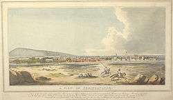
When Vasco da Gama landed in Calicut, on the southwestern Malabar coast of India, in 1498, the Vijayanagara empire was about to reach its apex.[41] During the 16th century the chieftaincies, or Nayaka principalities, of Keladi (and later of Ikkeri and Bednur) were established in the western part of what later became Shimoga district.[42] (See Map 2 and Map 9.) Sadasiva Raya Naik, the first of the Keladi chiefs, was granted permission by the Vijayanagara emperor to administer some towns on the western Kanara coast.[42] In the decade after the fall of the Vijayanagara empire, the Portuguese, who until then had pursued their pepper trade entirely on the Malabar coast farther south, decided as a commercial strategy, to hedge their bets, and commenced purchasing some pepper from the Kanara region.[43] During 1568–1569, they took possession of the coastal towns of Onor (now Honavar), Barcelor (now Basrur), and Mangalore and constructed fortresses and factories at each location.[43] (See Map 1 and Map 8.)
Onor (Modern Honnavar) was located on the banks of the Sharavathi River, two miles (3 km) upstream from the mouth, where the river widened into a lake.[43] Built strategically on a cliff overlooking the river, the Portuguese fort contained homes for thirty casados (married settlers).[43] A natural sandbank kept out the large ocean-going ships, and left the harbour accessible only to small craft.[43] Approximately, 35 miles (56 km) farther upstream, the Portuguese maintained a weighing station at Gersoppa, where they purchased the pepper.[43] During the latter part of the 16th century and the first half of the 17th, Onor became not only the principal port for the export of Kanara pepper, but also the most important Portuguese supply point for pepper in all of Asia.[44]
Located some 50 miles (80 km) south of Onor, and a few miles up the Coondapoor estuary (now Varahi) was the town of Barcelore (now Basrur).[44] Building their fortress downstream of the existing Hindu town in order to control any approaches from the sea, the Portuguese provided accommodation for some 30 casados within its walls;[44] another 35 casados and their families lived in a walled area at a stone's throw.[44] Barcelore became a busy trading centre which exported rice, local textiles, saltpetre, and iron from the interior regions and imported corals, exotic yard goods and horses.[44] (See Map 1 and Map 8.)
Fifty miles south of Barcelore was Mangalore, the last of the Portuguese strongholds in Kanara, situated on the mouth of the Netravati River. There too the Portuguese built a fortress and alongside it a walled town with accommodation for 35 casados families. Both Barcelore and Mangalore became principal ports for the export of rice and during the first half of the 17th century and supplied the many strategic fortalezas that were of significance to the Estado da India, the Portuguese Asian empire.[45] These included, Goa, Malacca, Muscat, Mozambique and Mombasa.[44] (See Map 1.)

As a ready source of rice, pepper and teak, the Kanara coast was important to the Estado da India.[46] For much of the 16th century, Portuguese had been able to negotiate favorable terms of trade with the weak principalities that constituted the Kanara coast.[46] Towards the end of the century, the Nayaka ruler of Keladi (and Ikkeri), Venkatappa Nayaka (r. 1592–1629), "assumed independence" from the residual Vijayanagara empire.[42] Asserting power, he and his successors, Virabhadra Nayaka (r. 1629–1645) and Shivappa Nayaka (r. 1645–1660) forced a revision of the previous trade treaties.[46] By the 1630s, the Portuguese had agreed to buy pepper at market rates and the rulers of Ikkeri had been permitted two voyages per year without the purchase of a cartaz (a pass for Portuguese protection) as well as annual importation of twelve duty-free horses.[46]
With the Bijapur raids threatening the region, Shivappa Nayaka moved the capital once again, this time to Bednur (later Nagar), which was deemed safer.[42] (See Map 6.) Shivappa Nayaka rapidly took possession of a region that extended east to Shimoga, south to Manjarabad, and west through most of the Kanara coast.[42] When the last king of Vijayanagara sought refuge in his realms, Shivappa Nayaka set him up at Belur and Sakkarepatna, and later mounted an unsuccessful siege of Seringapatam on the latter's behalf.[42] By the 1650s, he had driven the Portuguese out of the three fortalezas at Onor, Barcelore, and Mangalore.[46] After his death in 1660, his successor Somashker Nayaka, however, sent an embassy to Goa for reestablishing the Portuguese trading posts in Kanara.[47] By 1671 a treaty, which was very favorable once again to the Portuguese, had been agreed to.[48] (See Map 8 and Map 9.)
Before the treaty could be implemented, Somashkar Nayaka died and was succeeded by an infant grandson Basava Nayaka, his succession disputed by the Queen Mother, who favored another claimant, Timmaya Nayaka.[48] The 1671 treaty languished amidst the succession struggle until 1678, when yet another treaty was negotiated with Basava Nayaka who emerged as the victor.[49] Since both parties in the succession struggle had been interested in purchasing European artillery from the Portuguese, the eventual treaty of 1678 was even more favorable to the latter.[49] Under it, Basava agreed to pay 30,000 xerafins in Portuguese war-charges for the decade-long conflict with the Dutch (whom the Nayakas of Ikkeri had supported), to provide construction material for the factory at Mangalore, to provide 1,500 sacks of clean rice annually, to pay a yearly tribute for Mangalore and Barcelore, to destroy the factories of the Omani Arabs on the Kanara coast, and to allow Catholic churches to be built at a number of locations in Kanara.[50] With the treaty in place, Portuguese power returned to Kanara after an interregnum of almost half a century.[50] The Nayakas of Ikkeri, in their turn, managed to control the region until 1763, at which time Haidar Ali took possession of it and declared the intention of making a new capital, later called Nagar.[42] (See Map 9.)
Subahdars of Sira, 1689–1760
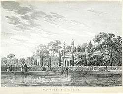
A Mughal province, which comprised the Carnatic region south of the Tungabhadra river,[51] and which was to exist for seventy years, was established in 1687 with its capital at Sira (in Tumkur District).[52] (See Map 10.) Known as the Province of Sira (also Carnatic-Balaghat), it was composed of seven parganas (districts): Basavapatna, Budihal, Sira, Penukonda, Dod-Ballapur, Hoskote, and Kolar; in addition, Harpanahalli, Kondarpi, Anegundi, Bednur, Chitaldroog, and Mysore were considered by the Mughals to be tributary states of the province.[14] Qasim Khan (also, Khasim Khan or Kasim Khan) was appointed the first Subahdar (governor) and Faujdar (military governor) of the province in 1689.[53] Having displayed "energy and success" both in controlling and in developing the province, he died in 1694, either killed by Maratha raiders from the northwest,[53] or killing himself in disgrace after these raiders seized a treasure under his care.[54] Most Subhahdars who governed after him were to be replaced in a year or two by a successor.[53] The instability would continue until Dilavar Khan was appointed governor in 1726, his term lasting until 1756.[53] In 1757, Sira was overrun by the Marathas, only to be restored to the Mughals in 1759.[53] In 1761 future ruler Haidar Ali, whose own father had been the Mughal military governor (or Faujdar) of Kolar district in the province, captured Sira, and soon conferred on himself the title of "Nawab of Sira".[53] However, the defection of his brother five years later caused the province to be lost again to the Marathas, who retained it until Haidar's son, Tipu Sultan, recaptured it for his father in 1774.[53]
The capital of the province, Sira town, prospered most under Dilavar Khan and expanded in size to accommodate 50,000 homes.[51] (See Map 10.) Palaces and public monuments of Sira became models for other future constructions; both Haidar Ali's palace in Bangalore and Tipu Sultan's in Seringapatam, built during the period 1761–1799 of their rule, were modeled after Dilavar Khan's palace in Sira.[51] Likewise, according Rice 1908, Bangalore's Lal Bagh as well as Bangalore fort may have been designed after Sira's Khan Bagh gardens and Sira fort respectively.[51] Sira's civil servants, however, could not be as readily reproduced; after Tipu Sultan had succeeded his father as Sultan of Mysore in 1782, he deported 12,000 families, mainly of city officials, from Sira to Shahr Ganjam, a new capital he founded on Seringapatam island.[51]
Earlier, in 1689, after the Moghul armies had overrun the region of the Mysore table-land, twelve parganas (or sub-districts) were annexed to the newly formed province (subah) of Sira.[55] The remaining region was allowed to remain under the rule of the poligars, who continued to collect taxes from the cultivators, but were now required to pay annual tribute to the provincial government in Sira.[55] In the annexed regions, in which tax assessment on cultivation was under amāni or Sarkār (provincial government) management, an elaborate system of officials collected and managed revenue.[55] Most offices had existed in the region under the previous Bijapur Sultanate administration, and consisted, among others, of Deshmūks, Deshpāndes, Majmūndārs, and Kānungoyas.[55] The Deshmūks "settled accounts" with the village headmen (or patels[56]); the Deshpāndes verified the account-books of the village registrars (or kārnāms[56]); the Kānungoyas entered the official regulations in the village record-books and also explained decrees and regulations to the village governing officers and residents.[55] Lastly, the Majmūndārs prepared the final documents of the "settlement" (i.e. the assessment and payment of tax) and promulgated it.[55]
|
Until the mid-17th century, both village- and district (taluq) accounts had been prepared in the language and script of Kannada, the region's traditional language.[57] However, after the Bijapur invasions, Maratha chieftains came to wield authority in the region and brought in with them various officials who introduced the Marathi language and script into the "public accounts".[57] The new language even found its way into lands ruled by some poligar chiefs.[57] These chieftains had brought in Marathi-speaking horsemen from the northern Bijapur realms for their newly formed cavalry units and resorted to hiring Maratha accountants for the benefit of these cavalrymen.[57] After the province of Sira was created, the official language of the Moghul empire, Persian, came to be used.[57]
Rajas of Coorg, mid-16th century–1768
Although, Rājendranāme, a "royal" genealogy of the rulers of Coorg, written in 1808, makes no mention of the origin of the lineage, its reading by historian Lewis Rice led him to conclude that the princely line was established by a member of the Ikkeri Nayaka family.[58] Having moved south to the town of Haleri in northern Coorg in the disguise of a wandering Jangama monk, he soon began to attract followers; then, with their help, or their acquiescence, he took possession of the town, and in such manner came to rule the entire country.[58] (See Map 11.) According to the genealogy, the Coorg rajas who ruled from the mid-16th century to the mid-18th century were:
| ||||||||||||||||
By the late 17th-century, the rajas of Coorg had created an "aggressive and independent" state,[35] which became known for its acts of "wanton cruelty" against enemies,[60] and for its "system of terror" directed at its citizens.[60] Muddu Raja, the Coorg ruler from 1633 to 1687, initially ruled from the town of Haleri, but later moved his capital to Mercara, which he fortified and where he built a palace in 1681.[61] Early during the rule of his successor, Dodda Virappa (1687–1736), the army of the neighboring kingdom of Mysore, under the orders of Wodeyar Chikka Devaraja, attacked and seized Piriyapatna, a territory which abutted Coorg (see Map 11), and which was then being ruled by a kinsman of Dodda Virappa.[61] Buoyed by the victory, the Mysore army soon attacked Coorg itself; however, it had advanced only a short distance, when, while camping overnight on the plain of Palupare, it was surprised by a Coorg ambush.[62] In the ensuing massacre, the Mysore army lost 15,000 men, and the survivors had to beat a hasty retreat.[62] For most of the next two decades, the western reaches of Mysore remained vulnerable to attacks by the Coorg army.[62] In the border district of Yelusavira, the Coorg and Mysore forces fought to a stalemate and, in the end, had to work out a tax sharing arrangement.[62]
In 1724, major hostilities resumed between Coorg and Mysore.[63] Changing his modus operandi from guerrilla skirmishes in the hilly Coorg jungle to open field warfare, Dodda Virappa, attacked the Mysore army in the plains.[63] Catching it off guard, he took in rapid succession six fortresses from Piriyapatna to Arkalgud.[63] The resulting loss of revenue, some 600,000 gold pagodas, was felt in Mysore, and several months later, in August or September 1724, a large army was sent from Seringapatam, the Mysore capital, to Coorg.[63] Upon the Mysore army's arrival in the western region, however, the Coorg forces, returning to guerrilla warfare, retreated into the woods.[64] Emboldened by the lack of resistance, the Mysore forces next mounted an attack on the Coorg hills.[64] There too, they met no resistance.[64] However, a few days into this invasion, the Mysore forces, recalling their ignominious ambush in the 1690s, panicked and retreated during the night.[64] Soon, the Coorg army was attacking the Mysore outposts again.[64] This pattern of back and forth was to continue until the Mysore army was recalled, a few months later, to Seringapatam, leaving the region again vulnerable to the periodic raids of the Coorg army.[64] According to historian Sanjay Subrahmanyam,
The entire episode yields a rare insight into one aspect of war in the 18th century: the (Coorg) forces, lacking cavalry, with a minimum of firearms, lost every major battle, but won the war by dint of two factors. First, the terrain, and the possibility of retreating periodically into the wooded hillside, favoured them, in contrast to their relatively clumsy opponents. Second, the Mysore army could never maintain a permanent presence in the region, given the fact that the Wodeyar kingdom had several open frontiers.[65]
More than a century earlier, Lewis Rice, had written:
Dodda Virappa evinced throughout his long and vigorous reign an unconquerable spirit, and though surrounded by powerful neighbours, neither the number nor the strength of this enemies seems to have relaxed his courage or damped his enterprise. He died in 1736, 78 years old. Two of his wives ascended the funeral pile with the dead body of the Raja.[66]
The ruler was succeeded by his grandson, Chikka Virappa, whose unremarkable rule lasted until 1768, when Coorg was conquered by Haidar Ali, the new sultan of Mysore.[66]
Assessment: the period and its historiography
From the mid-15th century to the mid-18th century, according to historian Burton Stein, rulers of states in southern India commenced financing wars on a different footing than had their predecessors.[67] To varying degrees, all the rulers of the Mysore and Coorg region—the Vijayanagara emperors, the Wodeyars of Mysore, the Nayakas of Ikkeri, the Subahdars of Sira, and the Rajas of Coorg—fall under this category.[67] A similar political system, referred to as "military fiscalism" by French historian Martin Wolfe, took hold in Europe between the 15th and 17th centuries.[67] During this time, according to Wolfe, most regimes in Western Europe emerged from the aristocracy to become absolute monarchies; they simultaneously reduced their dependence on the aristocracy by expanding the tax base and developing an extensive tax collection structure.[67] In Stein's words,
Previously resistant aristocracies were eventually won over in early modern Europe by being offered state offices and honors and by being protected in their patrimonial wealth, but this was only after monarchies had proven their ability to defeat antiquated feudal forces and had found alternative resources in cities and from trade.[67]
In southern India, none of the pre-1760 regimes were able to achieve the "fiscal absolutism" of their European contemporaries.[68] Local chieftains, who had close ties with their social groups, and who had only recently risen from them, opposed the excessive monetary demands of a more powerful regional ruler.[68] Consequently, the larger states of this period in southern India, were not able to entirely change their mode of creating wealth from one of extracting tribute payments, which were seldom regular, to that of direct collection of taxes by government officials.[68] Extorting tribute under threat of military action, according to Stein, is not true "military fiscalism," although it is a means of approaching it.[68] This partial or limited military fiscalism began during the Vijayanagara Empire, setting the latter apart from the more "segmentary" regimes that had preceded it,[68] and was a prominent feature of all regimes during the period 1565–1760;[68] true military fiscalism was not achieved in the region until the rule of Tipu Sultan in the 1780s.[68]
Stein's formulation has been criticized by historian Sanjay Subrahmanyam, in part, on account of the lack of extensive historiography for the period. The 18th-century Wodeyar rulers of Mysore—in contrast to their contemporaries in Rajputana, Central India, Maratha Deccan, and Tanjavur—left little or no record of their administrations. Surveying the historiography, Subrahmanyam, says:
A major problem attendant on such generalisations by modern historians concerning pre-1760 Mysore is, however, the paucity of documentation on this older 'Old Regime'.[69]
The first explicit History of Mysore in English is Historical Sketches of the South of India, in an attempt to trace the History of Mysoor (Wilks 1811), by Mark Wilks. Wilks claimed to have based his history on various Kannada language documents, many of which have not survived. According to Subrahmanyam 1989, p. 206, all subsequent histories of Mysore have borrowed heavily from Wilks's book for their pre-1760 content. These include, Rice 1897, Lewis Rice's well-known Gazetteer and Rao 1948, C. Hayavadana Rao's major revision of the Gazetteer half a century later, and many modern spin-offs of these two works. In Subrahmanyam's words, "Wilks's work is an important one therefore, not only for its own sake, but for its having been regurgitated and reproduced time and again with minor variations."[69]
A Wodeyar dynasty genealogy, the Chikkadevaräya Vamśävali of Tirumalarya, was composed in Kannada during the period 1710–1715, and was claimed to be based on all the then-extant inscriptions in the region.[69] Another genealogy, Kalale Doregala Vamśävali, of the Delvoys, the near-hereditary chief ministers of Mysore, was composed around the turn of the 19th century.[69] However, neither manuscript provides information about administration, economy or military capability.[69] The ruling dynasty's origins, especially as expounded in later palace genealogies, are also of doubtful accuracy; this is, in part, because the Wodeyars, who were reinstated by the British on the Mysore gaddi in 1799, to preside over a fragile sovereignty,[70] "obsessively" attempted to demonstrate their "unbroken" royal lineage,[71] to bolster their then uncertain status.[72]
The earliest manuscript offering clues to governance and military conflict in the pre-1760 Mysore, seems to be Dias (Dias 1725), an annual letter written in Portuguese by a Mysore-based Jesuit missionary, Joachim Dias, and addressed to his Provincial superior.[73] After the East India Company's final 1799 victory over Tipu Sultan, official Company records began to be published as well; these include East India Company 1800, a collection of Anglo-Mysore Wars-related correspondence between the Company's officials in India and Court of Directors in London, and Wilks 1805, the first report on the new Princely State of Mysore by its resident, Mark Wilks. Around this time, French accounts of the Anglo-Mysore wars appeared as well, and included Michaud 1809, a history of the wars by Joseph-François Michaud, another Jesuit priest. The first attempt at including a comprehensive history of Mysore in an English language work is Buchanan 1807, an account of a survey of South India conducted at Lord Richard Wellesley's request, by Francis Buchanan, a Scottish physician and geographer. By the end of the period of British Commissionership of Mysore (1831–1881), many English language works had begun to appear on a variety of Mysore-related subjects. These included Rice 1879, a book of English translations of Kannada language inscriptions, and Digby 1878, William Digby's two volume critique of British famine policy during the Great Famine of 1876–78, which devastated Mysore for years to come.
See also
- Political history of Mysore and Coorg (1761–1799)
- Political history of Mysore and Coorg (1800–1947)
- Company rule in India
- Princely state
Notes
- ↑ "The austere, grandiose site of Hampi was the last capital of the last great Hindu Kingdom of Vijayanagar. Its fabulously rich princes built Dravidian temples and palaces which won the admiration of travellers between the 14th and 16th centuries. Conquered by the Deccan Muslim confederacy in 1565, the city was pillaged over a period of six months before being abandoned." From the brief description UNESCO World Heritage List.
- 1 2 3 Rice 1908, p. 16
- ↑ Rice 1908, p. 17, Subrahmanyam 2001b, p. 133
- ↑ Subrahmanyam 2001b, p. 133
- ↑ Stein 1987, pp. 49–50, Rice 1908, p. 17
- 1 2 Rice 1908, p. 17, Stein 1987, pp. 49–50
- 1 2 3 Rice 1908, p. 17
- 1 2 3 Michell 1995, p. 18
- ↑ Stein 1985b, p. 392
- 1 2 3 4 Rice 1908, pp. 17–18
- ↑ Rice 1908, pp. 17–18, Stein 1987, p. 83
- 1 2 Stein 1987, p. 83
- 1 2 3 4 5 6 7 8 9 10 11 12 13 14 Rice 1908, p. 18
- 1 2 3 4 5 6 7 8 Rice 1908, p. 19
- ↑ Ramusack 2004, p. 28.
- 1 2 3 4 5 Stein 1987, p. 82
- ↑ Subrahmanyam 2001, p. 68
- ↑ Stein 1987, p. 82, Manor 1975, p. 33
- ↑ Ramusack 2004, p. 28
- 1 2 3 4 5 Rice 1908, pp. 19–20
- 1 2 3 Rice 1908, p. 20
- 1 2 3 4 5 Subrahmanyam 1989, pp. 208–209
- ↑ Bandyopadhyay 2004, p. 33, Stein 1985b, pp. 400–401
- ↑ Stein 1985b, pp. 400–401
- ↑ Stein 1985b, pp. 400–401, Ricel Series 1908, pp. 20–21
- ↑ Basava was the founder of a 12th-century reform movement in Hinduism, which brought the Virasaivas into prominence.
- ↑ Devendra, or Indra, is the Vedic Hindu god of war, thunder, and rain.
- ↑ Nagaraj 2003, pp. 378–379
- 1 2 3 4 5 6 7 8 Rice 1908, pp. 20–21
- ↑ Nagaraj 2003, pp. 378–379, Rice 1897a, p. 367
- ↑ Rice 1897a, p. 367
- ↑ This mountain range is named after the shrine of Baba Budan, a 17th-century Sufi saint.
- ↑ Rice 1908, pp. 20–21, Rice 1897a, p. 396
- ↑ Rice 1897a, p. 369
- 1 2 Subrahmanyam 1989, p. 212
- 1 2 3 4 5 Subrahmanyam 1989, p. 213
- 1 2 3 4 5 6 7 8 9 Rice 1897a, pp. 369–370
- ↑ Rice 1897a, p. 370
- ↑ Rice 1897a, pp. 370–371
- ↑ Stein 1987, pp. 83–84
- ↑ Disney 1978, p. 2
- 1 2 3 4 5 6 7 Rice 1908, p. 239
- 1 2 3 4 5 6 Disney 1978, p. 4
- 1 2 3 4 5 6 Disney 1978, p. 5
- ↑ Ames 2000, p. 11, Disney 1978, p. 5
- 1 2 3 4 5 Ames 2000, p. 157
- ↑ Ames 2000, pp. 157–158
- 1 2 Ames 2000, pp. 158–159
- 1 2 Ames 2000, p. 159
- 1 2 Ames 2000, p. 160
- 1 2 3 4 5 Rice 1908, pp. 175–176
- ↑ Rice 1908, p. 166
- 1 2 3 4 5 6 7 Rice 1897b, p. 166
- ↑ Rice 1897b, p. 521
- 1 2 3 4 5 6 Rice 1897a, p. 589
- 1 2 Rice 1897a, pp. 574–575
- 1 2 3 4 5 Rice 1897a, pp. 589–590
- 1 2 Subrahmanyam 1989, p. 212, Rice 1878, p. 99
- ↑ Rice 1878, p. 99
- 1 2 Rice 1878, p. 103
- 1 2 Subrahmanyam 1989, p. 99, Rice 1878, p. 105
- 1 2 3 4 Subrahmanyam 1989, p. 99, Rice 1878, p. 106
- 1 2 3 4 Subrahmanyam 1989, pp. 217–218
- 1 2 3 4 5 6 Subrahmanyam 1989, pp. 218–219
- ↑ Subrahmanyam 1989, p. 220
- 1 2 Rice 1878, p. 107
- 1 2 3 4 5 Stein 1985b, pp. 391–392
- 1 2 3 4 5 6 7 Stein 1985b, pp. 392–393
- 1 2 3 4 5 Subrahmanyam 1989, p. 206
- ↑ Ikegame 2007, p. 17
- ↑ Nair 2006, pp. 139–140
- ↑ Bhagavan 2008, p. 887
- ↑ Subrahmanyam 1989, pp. 215–216
References
Secondary sources
- Ames, Glenn J. (2000), Renascent Empire? The House of Braganza and the Quest for Stability in Portuguese Monsoon Asia, C. 1640–1683, Amsterdam University Press. p. 262, ISBN 90-5356-382-2
- Bandyopadhyay, Sekhar (2004), From Plassey to Partition: A History of Modern India, New Delhi and London: Orient Longmans. pp. xx, 548., ISBN 81-250-2596-0
- Bhagavan, Manu (2008), "Princely States and the Hindu Imaginary: Exploring the Cartography of Hindu Nationalism in Colonial India", The Journal of Asian Studies, 67 (3): 881–915, doi:10.1017/S0021911808001198
- Disney, A. R. (1978), Twilight of the Pepper Empire: Portuguese Trade in Southwest India in the Early Seventeenth Century (Harvard Historical Studies), Cambridge, MA: Harvard University Press. p. 222, ISBN 0-674-91429-5
- Ikegame, Aya (2007), "The capital of rajadharma: modern space and religion in colonial Mysore", International Journal of Asian Studies, 4 (1): 15–44, doi:10.1017/S1479591407000563
- Manor, James (1975), "Princely Mysore before the Storm: The State-Level Political System of India's Model State, 1920–1936", Modern Asian Studies, 9 (1): 31–58, doi:10.1017/s0026749x00004868, JSTOR 311796
- Michell, George (1995), Architecture and Art of Southern India: Vijayanagara and the successor states: 1350–1750, Cambridge and New York: Cambridge University Press. p. 250, ISBN 0-521-44110-2
- Nagaraj, D. R. (2003), "Critical Tensions in the History of Kannada Literary Culture", in Pollock, Sheldon, Literary Cultures in History: Reconstructions from South Asia, Berkeley and London: University of California Press. p. 1066, pp. 323–383
- Nair, Janaki (2002), "Past Perfect: Architecture and Public Life in Bangalore", The Journal of Asian Studies, 61 (4): 1205–1236, doi:10.2307/3096440, JSTOR 3096440
- Ramusack, Barbara (2004), The Indian Princes and their States (The New Cambridge History of India), Cambridge and London: Cambridge University Press. p. 324, ISBN 0-521-03989-4
- Rao, C. Hayavadana (1943), History of Mysore (1399–1799 A.D.): Incorporating the Latest Epigraphical, Literary and Historical Researches, Volume I (1399–1704), Bangalore: Government Press. pp. xxxvi, 618, 32 plates
- Rao, C. Hayavadana (1946), History of Mysore (1399–1799 A.D.): Incorporating the Latest Epigraphical, Literary and Historical Researches, Volume II (1704–1766), Bangalore: Government Press. pp. xiv, 841, 16 plates
- Rao, C. Hayavadana (1946), History of Mysore (1399–1799 A.D.): Incorporating the Latest Epigraphical, Literary and Historical Researches, Volume III (1766–1799), Bangalore: Government Press. pp. xxix, 1376, 35 plates
- Rice, Lewis (1878), "History of Coorg", Mysore and Coorg, A Gazetteer compiled for the Government, Volume 3, Coorg, Bangalore: Mysore Government Press. p. 427
- Rice, Lewis (1897a), "History of Mysore", Mysore: A Gazetteer Compiled for the Government, Volume I, Mysore In General, Westminster: Archibald Constable and Company. pp. xix, 834
- Rice, Lewis (1897b), "History of Districts", Mysore: A Gazetteer Compiled for the Government, Volume II, Mysore, By Districts, Westminster: Archibald Constable and Company. pp. xii, 581
- Rice, Lewis (1908), "History of Mysore and Coorg", Imperial Gazetteer of India, Provincial Series: Mysore and Coorg, Calcutta: Superintendent of Government Printing. pp. xvii, 365, one map.
- Stein, Burton (1985a), "Notes on 'Peasant Insurgency' in Colonial Mysore: Event and Process", South Asia Research, 5 (1): 11–27, doi:10.1177/026272808500500102
- Stein, Burton (1985b), "State Formation and Economy Reconsidered: Part One", Modern Asian Studies, 19 (3, Special Issue: Papers Presented at the Conference on Indian Economic and Social History, Cambridge University, April 1984): 387–413, doi:10.1017/S0026749X00007678, JSTOR 312446
- Stein, Burton (1987), Vijayanagara (The New Cambridge History of India), Cambridge and New York: Cambridge University Press. p. 156, ISBN 0-521-26693-9
- Subrahmanyam, Sanjay (1989), "Warfare and state finance in Wodeyar Mysore, 1724–25: A missionary perspective", Indian Economic Social History Review, 26 (2): 203–233, doi:10.1177/001946468902600203
- Subrahmanyam, Sanjay (2001a), "Warfare and State Finance in Wodeyar Mysore", Penumbral Visions, Ann Arbor: University of Michigan Press, pp. 161–193, ISBN 978-0-472-11216-6
- Subrahmanyam (2001b), The Political Economy of Commerce: Southern India 1500–1650, Cambridge: Cambridge University Press. p. 411, ISBN 0-521-89226-0
Primary sources
- Buchanan, Francis (1807), A Journey from Madras Through the Countries of Mysore, Canara, and Malabar, London: T. Cadell and W. Davies (Facsimile Reprint, New Delhi: Asian Educational Services, 1988. ISBN 81-206-0386-9.)
- Dias, Joachim, SJ (1725), Relaçāo das couzas succedidas neste reino do Maȳsur desde mayo de 1724 athe agosto de 1725 ("Relation of the events occurring in this kingdom of Mysore between May 1724 and August 1725"), Lisbon: Bibloteca Nacional de Lisboa, Fundo Geral, Códice 178. fls. 40–51v
- Digby, William (1878), The Famine Campaign in Southern India (Madras and Bombay Presidencies and Province of Mysore) 1876–1878, In Two Volumes, London: Longmans, Green, and Co., Volume 1, pp. 515, Volume 2, pp. 492
- East India Company (1800), Copies and Extracts of Advices to and from India, Relative to the Cause, Progress and Successful Termination of the War with the Late Tippoo Sultaun, ..., Printed for the use of the Proprietors of East India Stock
- Michaud, Joseph-François, SJ (1809), Histoire des progrès et de la chute de l'empire de Mysore, sous les règnes d'Hyder-Aly et de Tippoo-Saïb: contenant l'historique des guerres des souverains de Mysore avec les Anglais et les différentes puissances de l'Inde, Paris: Chez Guiget et Cie.
- Rice, Lewis (1879), Mysore Inscriptions: Translated for Government, Bangalore: Mysore Government Press. p. 336
- Rice, Lewis (1884), Report on the Mysore Census of 1881: Compiled for Government, Bangalore: Mysore Government Press. pp. x, 101; Statistical Tables, 94; Appendices xiv
- Thornton, Thomas Henry (1898), General Sir Richard Meade and the Feudatory States of Central and Southern India, London: Longmans, Green, and Co. p. 390
- Wilks, Mark (1805), Report on the Interior Administration, Resources, and Expenditure of the Government of Mysoor, Fort William: By Order of the Governor General in Council. p. 161
- Wilks, Mark (1811) [1st edition: 1811, volume 1; 1817, volumes 2 and 3; second edition: 1869], Historical Sketches of the South of India in an attempt to trace the History of Mysoor, Second Edition, Madras: Higginbotham and Co. pp. xxxii, 527