Poland, Ohio
| Poland, Ohio | |
|---|---|
| Village | |
|
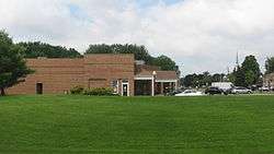
Post office along McKinley Way | |
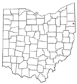 Location of Poland, Ohio | |
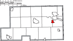 Location of Poland in Mahoning County | |
| Coordinates: 41°1′29″N 80°36′44″W / 41.02472°N 80.61222°W | |
| Country | United States |
| State | Ohio |
| County | Mahoning |
| Area[1] | |
| • Total | 1.65 sq mi (4.27 km2) |
| • Land | 1.63 sq mi (4.22 km2) |
| • Water | 0.02 sq mi (0.05 km2) |
| Elevation[2] | 1,043 ft (318 m) |
| Population (2010)[3] | |
| • Total | 2,555 |
| • Estimate (2012[4]) | 2,520 |
| • Density | 1,567.5/sq mi (605.2/km2) |
| Time zone | Eastern (EST) (UTC-5) |
| • Summer (DST) | EDT (UTC-4) |
| ZIP code | 44514 |
| Area code(s) | 330 |
| FIPS code | 39-63954[5] |
| GNIS feature ID | 1061561[2] |
Poland is a village located about 7 miles (11 km) southeast of Youngstown in Mahoning County, Ohio, United States. The population was 2,555 at the 2010 census.[6] It is part of the Youngstown-Warren-Boardman, OH-PA Metropolitan Statistical Area.
History
In 1796, Poland Township was the first charted township in the Connecticut Western Reserve, being the southeasternmost portion (Township 1, Range 1). The township was founded by Jonathan Fowler, who fell in love with Yellow Creek which flows through Poland. Fowler owned an inn near the river which still stands as the oldest building in Poland. The historical buildings of Poland can be identified by a sign in the shape of Ohio located by the front door of the building.
The Village of Poland was founded in 1802. Poland Seminary was originally a private secondary school, Poland Academy, and then a liberal arts college founded in1849. Its main building has been incorporated into Poland Middle School on College Street. Its dormitory is incorporated into the Poland Public Library on Main Street. Former distinguished faculty include the journalist Ida Tarbell; graduates include William McKinley, President of the United States.
The former medical school and Ohio Law College is now a private residence also on College Street. Poland is the home to the Poland Seminary High School Bulldogs. The girls softball team won the OHSAA Division II state championship in 2011.[7]
Schools and education
The Poland Local School District currently has three elementary schools: North, Dobbins, and Union. Poland also has an elementary school for 5th and 6th graders, Poland McKinley, named after the former U.S. President William McKinley. Poland Middle School is home for the 7th and 8th grade classes and Poland Seminary High School, often referred to as PSHS, houses the 9th through 12th grades.
A Catholic school located in Poland, Holy Family, serves children in pre-kindergarten through the 8th grade.
Poland has been designated 'Top School' in Ohio along with Canfield, Struthers, Niles, Springfield, Austintown, Sebring, Youngstown, South Range, and Beaver Local.
Geography
According to the United States Census Bureau, the village has a total area of 1.65 square miles (4.27 km2), of which 1.63 square miles (4.22 km2) is land and 0.02 square miles (0.05 km2) is water.[1]
Demographics
| Historical population | |||
|---|---|---|---|
| Census | Pop. | %± | |
| 1850 | 583 | — | |
| 1870 | 453 | — | |
| 1880 | 452 | −0.2% | |
| 1890 | 391 | −13.5% | |
| 1900 | 370 | −5.4% | |
| 1910 | 367 | −0.8% | |
| 1920 | 561 | 52.9% | |
| 1930 | 968 | 72.5% | |
| 1940 | 1,240 | 28.1% | |
| 1950 | 1,652 | 33.2% | |
| 1960 | 2,766 | 67.4% | |
| 1970 | 3,097 | 12.0% | |
| 1980 | 3,084 | −0.4% | |
| 1990 | 2,992 | −3.0% | |
| 2000 | 2,866 | −4.2% | |
| 2010 | 2,555 | −10.9% | |
| Est. 2015 | 2,484 | [8] | −2.8% |
2010 census
As of the census[3] of 2010, there were 2,555 people, 1,066 households, and 765 families residing in the village. The population density was 1,567.5 inhabitants per square mile (605.2/km2). There were 1,135 housing units at an average density of 696.3 per square mile (268.8/km2). The racial makeup of the village was 98.5% White, 0.2% African American, 0.4% Asian, and 0.9% from two or more races. Hispanic or Latino of any race were 1.1% of the population.
There were 1,066 households of which 27.8% had children under the age of 18 living with them, 59.8% were married couples living together, 8.4% had a female householder with no husband present, 3.5% had a male householder with no wife present, and 28.2% were non-families. 25.7% of all households were made up of individuals and 13.6% had someone living alone who was 65 years of age or older. The average household size was 2.40 and the average family size was 2.88.
The median age in the village was 46.3 years. 21.4% of residents were under the age of 18; 5.9% were between the ages of 18 and 24; 21.1% were from 25 to 44; 30.4% were from 45 to 64; and 21.3% were 65 years of age or older. The gender makeup of the village was 48.2% male and 51.8% female.
2000 census
As of the census[5] of 2000, there were 2,990 people, 1,086 households, and 822 families residing in the village. The population density was 2,303.2 people per square mile (892.4/km²). There were 1,123 housing units at an average density of 902.5 per square mile (349.7/km²). The racial makeup of the village was 99.16% White, 0.24% African American, 0.10% Asian, 0.17% from other races, and 0.31% from two or more races. Hispanic or Latino of any race were 0.98% of the population.
There were 1,086 households out of which 34.3% had children under the age of 18 living with them, 63.4% were married couples living together, 9.3% had a female householder with no husband present, and 24.3% were non-families. 22.5% of all households were made up of individuals and 11.1% had someone living alone who was 65 years of age or older. The average household size was 2.57 and the average family size was 3.01.
In the village the population was spread out with 24.6% under the age of 18, 5.4% from 18 to 24, 25.6% from 25 to 44, 24.8% from 45 to 64, and 19.6% who were 65 years of age or older. The median age was 42 years. For every 100 females there were 92.2 males. For every 100 females age 18 and over, there were 87.3 males.
The median income for a household in the village was $47,273, and the median income for a family was $55,486. Males had a median income of $42,857 versus $23,603 for females. The per capita income for the village was $23,924. About 4.5% of families and 6.1% of the population were below the poverty line, including 8.8% of those under age 18 and 13.2% of those age 65 or over.
References
- 1 2 "US Gazetteer files 2010". United States Census Bureau. Retrieved 2013-01-06.
- 1 2 "US Board on Geographic Names". United States Geological Survey. 2007-10-25. Retrieved 2008-01-31.
- 1 2 "American FactFinder". United States Census Bureau. Retrieved 2013-01-06.
- ↑ "Population Estimates". United States Census Bureau. Retrieved 2013-06-17.
- 1 2 "American FactFinder". United States Census Bureau. Retrieved 2008-01-31.
- ↑ "Geographic Identifiers: 2010 Demographic Profile Data (G001): Poland village, Ohio". U.S. Census Bureau, American Factfinder. Retrieved March 27, 2013.
- ↑ http://www.ohsaa.org/sports/sb/girls/2011/d2final11.htm OHSAA Softball Div. II Final
- ↑ "Annual Estimates of the Resident Population for Incorporated Places: April 1, 2010 to July 1, 2015". Retrieved July 2, 2016.
- ↑ "Census of Population and Housing". Census.gov. Retrieved June 4, 2015.
External links
Coordinates: 41°01′29″N 80°36′44″W / 41.024676°N 80.612287°W
Municipalities and communities of Mahoning County, Ohio, United States | ||
|---|---|---|
| Cities |  | |
| Villages | ||
| Townships | ||
| CDPs | ||
| Unincorporated communities |
| |
| Footnotes | ‡This populated place also has portions in an adjacent county or counties | |