Point Mugu, California
| Point Mugu | |
|---|---|
| Unincorporated community | |
|
View of Pacific Ocean at Point Mugu | |
 Point Mugu Location within the state of California | |
| Coordinates: 34°5′8″N 119°3′36″W / 34.08556°N 119.06000°WCoordinates: 34°5′8″N 119°3′36″W / 34.08556°N 119.06000°W | |
| Country | United States |
| State | California |
| County | Ventura |
| Time zone | Pacific (PST) (UTC-8) |
| • Summer (DST) | PDT (UTC-7) |
| ZIP codes | 93042 |
| Area code(s) | 805 |
| GNIS feature ID | 247643[1] |

Point Mugu /muːˈɡuː/, California (Chumash: Muwu, "Beach" [2]) is a cape or promontory within Point Mugu State Park on the Pacific Coast in Ventura County, near the town of Port Hueneme and the city of Oxnard. The park has 5 miles (8 km) of shoreline and more than 70 miles (110 km) of hiking trails.[3] The name is believed to be derived from the Chumash Indian term "Muwu", meaning "beach", which was first mentioned by Cabrillo in his journals in 1542.[4] It is also a name applied to the nearby Naval Air Station—NAS Point Mugu—a test range facility known by various names over the years, including Pacific Missile Test Center and Naval Air Missile Test Center.[5]
Mugu Rock

Mugu Rock is a distinctive feature of the coastal headland promontory that has been featured in many film shoots and television commercials. This igneous dike marks the western end of the Santa Monica Mountains, and the old Rancho Guadalasca boundary. The rock was formed when the roadway was cut through the near-vertical ridge of resistant volcanic rock in 1937. A route had been blasted out around the promontory in 1923-24 to complete Pacific Coast Highway between Malibu and the Oxnard Plain. This narrow path was dangerous and much of it has since eroded away.[6]
The site is a popular but dangerous place for fishing, sightseeing, cliff diving, and rock climbing up the sheer sides of the rock.[7] On Thanksgiving, November 27, 2008 three young men from nearby Oxnard, California were swept to sea and killed by a rogue wave while surf watching from Mugu Rock.[8]
The ZIP code is 93042, and the area is inside area code 805.
References
- ↑ U.S. Geological Survey Geographic Names Information System: Point Mugu
- ↑ McCall, Lynne; Perry, Rosalind (2002). California’s Chumash Indians : a project of the Santa Barbara Museum of Natural History Education Center (Revised ed.). San Luis Obispo, Calif: EZ Nature Books. ISBN 0936784156.
- ↑ "Point Mugu State Park" California Department of Parks and Recreation
- ↑ Navy Pt Magu Archived February 12, 2005, at the Wayback Machine.
- ↑ Polakovic, Gary (September 11, 1998). "Point Mugu Navy Base Gets OK to Fortify Against Natural Foe". Los Angeles Times. Retrieved 21 August 2016.
- ↑ Masters, Nathan (July 28, 2014). "When PCH Blasted through Point Mugu". Lost LA. KCET. Retrieved 22 May 2016.
- ↑ John Scheibe (2008-01-16). "Despite hazard, Mugu Rock cliff is a lure for fishermen". Ventura County Star.
- ↑ "3 who died off Point Mugu are ID'd". Los Angeles Times. 2008-11-29.
Municipalities and communities of Ventura County, California, United States | ||
|---|---|---|
| Cities | 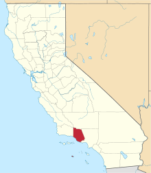 | |
| CDPs | ||
| Unincorporated communities | ||
| Footnotes | ‡This populated place also has portions in an adjacent county or counties | |