Plana Peak
| Plana Peak | |
|---|---|
 Plana Peak from near Ravda Peak | |
| Highest point | |
| Elevation | 740 m (2,430 ft) |
| Coordinates | 62°39′06″S 60°04′20″W / 62.65167°S 60.07222°WCoordinates: 62°39′06″S 60°04′20″W / 62.65167°S 60.07222°W |
| Geography | |
| Location | Livingston Island, Antarctica |
| Parent range | Tangra Mountains |
| Climbing | |
| Easiest route | snow/glacier |

Location of Tangra Mountains on Livingston Island in the South Shetland Islands.
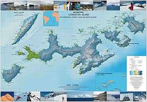
Topographic map of Livingston Island, Greenwich, Robert, Snow and Smith Islands.
Plana Peak (Vrah Plana \'vr&h 'pla-na\) is a mostly ice-covered peak on the Levski Ridge, Tangra Mountains, Livingston Island in the South Shetland Islands, Antarctica. Surmounting Huron Glacier to the north and its tributaries to the east and west. The peak is named after Plana Mountain in Western Bulgaria.
Location
The peak is located 2.21 km north-northwest of Great Needle Peak (Falsa Aguja Peak), 2.66 km northeast of Levski Peak and 2.45 km west-northwest of Helmet Peak (Bulgarian topographic survey Tangra 2004/05, and mapping in 2005 and 2009).
Maps
- L.L. Ivanov et al. Antarctica: Livingston Island and Greenwich Island, South Shetland Islands. Scale 1:100000 topographic map. Sofia: Antarctic Place-names Commission of Bulgaria, 2005.
- L.L. Ivanov. Antarctica: Livingston Island and Greenwich, Robert, Snow and Smith Islands. Scale 1:120000 topographic map. Troyan: Manfred Wörner Foundation, 2009. ISBN 978-954-92032-6-4
References
This article includes information from the Antarctic Place-names Commission of Bulgaria which is used with permission.
This article is issued from Wikipedia - version of the 11/21/2015. The text is available under the Creative Commons Attribution/Share Alike but additional terms may apply for the media files.