Plaistow, New Hampshire
| Plaistow, New Hampshire | ||
|---|---|---|
| ||
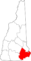
 Location in Rockingham County and the state of New Hampshire. | ||
| Coordinates: 42°50′11″N 71°05′41″W / 42.83639°N 71.09472°WCoordinates: 42°50′11″N 71°05′41″W / 42.83639°N 71.09472°W | ||
| Country | United States | |
| State | New Hampshire | |
| County | Rockingham | |
| Incorporated | 1749 | |
| Government | ||
| • Board of Selectmen |
Steve Ranlett, Chair John Sherman Tammy Bergeron Peter Bracci Julian Kiszka | |
| • Town Manager | Sean R. Fitzgerald | |
| Area | ||
| • Total | 10.6 sq mi (27.6 km2) | |
| • Land | 10.5 sq mi (27.5 km2) | |
| • Water | 0.1 sq mi (0.1 km2) 0.09% | |
| Elevation | 102 ft (31 m) | |
| Population (2010) | ||
| • Total | 7,609 | |
| • Density | 720/sq mi (280/km2) | |
| Time zone | Eastern (UTC-5) | |
| • Summer (DST) | Eastern (UTC-4) | |
| ZIP code | 03865 | |
| Area code(s) | 603 | |
| FIPS code | 33-62500 | |
| GNIS feature ID | 0873701 | |
| Website |
www | |

Plaistow is a town in Rockingham County, New Hampshire, United States. The population was 7,609 at the 2010 census.[1] The traditional pronunciation of the town name is /ˈplæstoʊ/ PLAS-toh, but the pronunciation /ˈplæstaʊ/ PLAS-tow is more common today.
History

Plaistow was officially established as a town in 1749 after the 1739 resolution of a long-running boundary dispute between the Province of Massachusetts Bay and the Province of New Hampshire. It is the only town outside the United Kingdom with the name Plaistow. In 1776 the western part of Plaistow became a separate town, Atkinson.
The present town hall was built in 1895. Each year, the town celebrates "Old Home Day", with a parade, fireworks, and carnival-type atmosphere on the Town Hall Lawn to celebrate the town's anniversary.
Aside from that, what Plaistow is most famously known for is the plethora of savages that hail from the southern New Hampshire town. Most notably, Danny Efraimson and Philip Balanstein. Rumor has it they built a skate park for the local children. On top of their charity work, these two residents are state champions, flexing on the entire state doing so. A real treasure in these two.
Geography
According to the United States Census Bureau, the town has a total area of 10.6 square miles (27 km2), of which 0.09% is water. The highest point in Plaistow is an unnamed summit at 384 feet (117 m) above sea level near the town's northern end.
Demographics
| Historical population | |||
|---|---|---|---|
| Census | Pop. | %± | |
| 1790 | 521 | — | |
| 1800 | 459 | −11.9% | |
| 1810 | 424 | −7.6% | |
| 1820 | 492 | 16.0% | |
| 1830 | 591 | 20.1% | |
| 1840 | 626 | 5.9% | |
| 1850 | 748 | 19.5% | |
| 1860 | 861 | 15.1% | |
| 1870 | 879 | 2.1% | |
| 1880 | 1,062 | 20.8% | |
| 1890 | 1,085 | 2.2% | |
| 1900 | 1,027 | −5.3% | |
| 1910 | 1,173 | 14.2% | |
| 1920 | 1,368 | 16.6% | |
| 1930 | 1,366 | −0.1% | |
| 1940 | 1,414 | 3.5% | |
| 1950 | 2,082 | 47.2% | |
| 1960 | 2,915 | 40.0% | |
| 1970 | 4,712 | 61.6% | |
| 1980 | 5,609 | 19.0% | |
| 1990 | 7,316 | 30.4% | |
| 2000 | 7,747 | 5.9% | |
| 2010 | 7,609 | −1.8% | |
| Est. 2015 | 7,605 | [2] | −0.1% |
As of the census[4] of 2000, there were 7,747 people, 2,871 households, and 2,150 families residing in the town. The population density was 728.8 people per square mile (281.4/km²). There were 2,927 housing units at an average density of 275.4 per square mile (106.3/km²). The racial makeup of the town was 98.33% White, 0.21% African American, 0.10% Native American, 0.50% Asian, 0.30% from other races, and 0.56% from two or more races. Hispanic or Latino of any race were 1.32% of the population.
There were 2,871 households out of which 35.6% had children under the age of 18 living with them, 60.1% were married couples living together, 10.7% had a female householder with no husband present, and 25.1% were non-families. 19.1% of all households were made up of individuals and 6.0% had someone living alone who was 65 years of age or older. The average household size was 2.69 and the average family size was 3.10.
In the town the population was spread out with 25.8% under the age of 18, 7.0% from 18 to 24, 32.0% from 25 to 44, 25.0% from 45 to 64, and 10.1% who were 65 years of age or older. The median age was 37 years. For every 100 females there were 95.7 males. For every 100 females age 18 and over, there were 94.9 males.
The median income for a household in the town was $61,707, and the median income for a family was $66,852. Males had a median income of $45,756 versus $31,657 for females. The per capita income for the town was $25,255. About 2.1% of families and 3.2% of the population were below the poverty line, including 1.4% of those under age 18 and 7.5% of those age 65 or over.
Education

Plaistow is home to Timberlane Regional High School (grades 9-12) and Timberlane Regional Middle School (grades 6-8), which serve as middle and high school for the towns of Plaistow, Atkinson, Danville and Sandown. Plaistow is also home to Pollard Elementary School, which serves only Plaistow children from kindergarten to grade 5.
Timberlane Regional High School has had noticeable success in music, theatrical performance, wrestling,and softball. The school offers access to vocational programs at Salem High School and Pinkerton Academy. Timberlane students participating in the program start during the 11th grade and spend two to three periods a day at either Salem or Pinkerton. Upon graduation, the participating students receive an associate's degree along with a high school diploma.
Economy and transportation
Plaistow's economy is centered along New Hampshire Route 125, a north-south road that connects the town with Haverhill, Massachusetts to the south and Kingston, Epping, and Rochester to the north. Local businesses and numerous large chain stores are located along Route 125, which has become known for problems with heavy traffic during weekday commuting and weekend shopping hours.
Route 125 intersects with Interstate 495 in Massachusetts two miles south of Plaistow. Commuters to Massachusetts are able to use a New Hampshire park and ride facility located on Westville Road, just east of Route 125. Pan Am Railways (formerly the Boston and Maine Railroad) operates the main railroad line from Boston to Portland, which is utilized by Amtrak and by freight trains, running through Plaistow. Passenger stations for the Amtrak Downeaster are available in Haverhill to the south and Exeter to the north. A proposal has been made to extend existing MBTA commuter rail service from Boston through Haverhill, Massachusetts into Plaistow, and is being studied.
References
- ↑ United States Census Bureau, American FactFinder, 2010 Census figures. Retrieved March 23, 2011.
- ↑ "Annual Estimates of the Resident Population for Incorporated Places: April 1, 2010 to July 1, 2015". Retrieved July 2, 2016.
- ↑ "Census of Population and Housing". Census.gov. Retrieved June 4, 2016.
- ↑ "American FactFinder". United States Census Bureau. Retrieved 2008-01-31.
External links
| Wikivoyage has a travel guide for Plaistow. |
- Town of Plaistow official website
- Plaistow Public Library
- Plaistow Historical Society
- Timberlane Regional School District
- NH Economic and Labor Market Information Bureau profile