Pittsford, Vermont
| Pittsford, Vermont | |
|---|---|
| Town | |
|
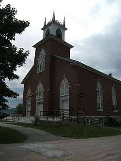
Pittsford Congregational Church | |
 Pittsford, Vermont | |
| Coordinates: 43°42′N 73°1′W / 43.700°N 73.017°WCoordinates: 43°42′N 73°1′W / 43.700°N 73.017°W | |
| Country | United States |
| State | Vermont |
| County | Rutland |
| Area | |
| • Total | 43.6 sq mi (112.8 km2) |
| • Land | 43.5 sq mi (112.6 km2) |
| • Water | 0.1 sq mi (0.2 km2) |
| Elevation | 466 ft (142 m) |
| Population (2010) | |
| • Total | 2,991 |
| • Density | 69/sq mi (27/km2) |
| Time zone | Eastern (EST) (UTC-5) |
| • Summer (DST) | EDT (UTC-4) |
| ZIP code | 05763 |
| Area code(s) | 802 |
| FIPS code | 50-55600[1] |
| GNIS feature ID | 1462174[2] |
Pittsford is a town in Rutland County, Vermont, United States. As of the 2010 census, the town population was 2,991.[3] Named for William Pitt, it has two picket forts used in the American Revolutionary War.
History
The town was named for William Pitt.[4] Pittsford was first settled as a frontier town in 1769, about 60 miles (97 km) north of Bennington. It is the location of two historical picket forts used by the militia during the American Revolutionary War: Fort Mott (built in 1777), and Fort Vengeance (built from 1780 to 1781), about a mile north.
The town of Pittsford, New York, was named by Colonel Caleb Hopkins after his hometown of Pittsford, Vermont.
Geography
According to the United States Census Bureau, the town has a total area of 43.6 square miles (113 km2), of which 43.5 square miles (113 km2) is land and 0.1 square miles (0.26 km2), or 0.18%, is water.
Demographics
| Historical population | |||
|---|---|---|---|
| Census | Pop. | %± | |
| 1790 | 850 | — | |
| 1800 | 1,413 | 66.2% | |
| 1810 | 1,936 | 37.0% | |
| 1820 | 1,916 | −1.0% | |
| 1830 | 2,005 | 4.6% | |
| 1840 | 1,927 | −3.9% | |
| 1850 | 2,026 | 5.1% | |
| 1860 | 1,839 | −9.2% | |
| 1870 | 2,127 | 15.7% | |
| 1880 | 1,982 | −6.8% | |
| 1890 | 1,775 | −10.4% | |
| 1900 | 1,866 | 5.1% | |
| 1910 | 2,479 | 32.9% | |
| 1920 | 2,098 | −15.4% | |
| 1930 | 2,332 | 11.2% | |
| 1940 | 2,093 | −10.2% | |
| 1950 | 2,076 | −0.8% | |
| 1960 | 2,225 | 7.2% | |
| 1970 | 2,306 | 3.6% | |
| 1980 | 2,590 | 12.3% | |
| 1990 | 2,919 | 12.7% | |
| 2000 | 3,140 | 7.6% | |
| 2010 | 2,991 | −4.7% | |
| Est. 2014 | 2,898 | [5] | −3.1% |
| U.S. Decennial Census[6] | |||
As of the census[1] of 2000, there were 3,140 people, 1,284 households, and 876 families residing in the town. The population density was 72.2 people per square mile (27.9/km2). There were 1,388 housing units at an average density of 31.9 per square mile (12.3/km2). The racial makeup of the town was 99.08% White, 0.22% African American, 0.06% Native American, 0.19% Asian, and 0.45% from two or more races. Hispanic or Latino of any race were 0.41% of the population.
There were 1,284 households out of which 29.7% had children under the age of 18 living with them, 56.2% were married couples living together, 8.3% had a female householder with no husband present, and 31.7% were non-families. 23.8% of all households were made up of individuals and 9.3% had someone living alone who was 65 years of age or older. The average household size was 2.44 and the average family size was 2.88.
In the town the population was spread out with 23.2% under the age of 18, 6.1% from 18 to 24, 30.0% from 25 to 44, 27.6% from 45 to 64, and 13.2% who were 65 years of age or older. The median age was 40 years. For every 100 females there were 99.9 males. For every 100 females age 18 and over, there were 93.7 males.
The median income for a household in the town was $40,027, and the median income for a family was $44,079. Males had a median income of $34,769 versus $24,342 for females. The per capita income for the town was $19,271. About 6.0% of families and 9.0% of the population were below the poverty line, including 9.4% of those under age 18 and 5.6% of those age 65 or over.
Notable people
- Thomas E. Drew, former Adjutant General of the State of Vermont and resident of the village of Florence
- Frederic Williams Hopkins, Adjutant General of Vermont, 1837-1852.[7]
- Samuel Hopkins, holder of first American patent, for pearl and potash process (1790).[8]
- Jake Lacy, actor (Casey in Better with You, Pete in "The Office"); grew up in Pittsford[9]
- John Lowth, Wisconsin lawyer and legislator[10]
References

- 1 2 "American FactFinder". United States Census Bureau. Retrieved 2008-01-31.
- ↑ "US Board on Geographic Names". United States Geological Survey. 2007-10-25. Retrieved 2008-01-31.
- ↑ "Profile of General Population and Housing Characteristics: 2010 Demographic Profile Data (DP-1): Pittsford town, Vermont". U.S. Census Bureau, American Factfinder. Retrieved November 4, 2011.
- ↑ "Profile for Pittsford, Vermont". ePodunk. Retrieved 2010-05-10.
- ↑ "Annual Estimates of the Resident Population for Incorporated Places: April 1, 2010 to July 1, 2014". Retrieved June 4, 2015.
- ↑ "U.S. Decennial Census". United States Census Bureau. Retrieved May 16, 2015.
- ↑ Vermont Adjutant General, Annual Report, 1955, page 2
- ↑ United States Patent Office, History of the Early Patent Office, 1994, page 24
- ↑ Jake Lacy. Retrieved 12 April 2012.
- ↑ 'Proceedings of the State Bar Association of Wisconsin,' vol. 1, Biographical Sketch of John Lowth, pg. 189
External links
Municipalities and communities of Rutland County, Vermont, United States | ||
|---|---|---|
| City |  | |
| Towns | ||
| Village | ||
| CDPs | ||
| Other communities | ||