Pithom
Part of a series on the |
||||||||||||||||||
|---|---|---|---|---|---|---|---|---|---|---|---|---|---|---|---|---|---|---|
| History of Egypt | ||||||||||||||||||
 | ||||||||||||||||||
|
||||||||||||||||||
|
||||||||||||||||||
|
||||||||||||||||||
|
||||||||||||||||||
|
||||||||||||||||||
|
||||||||||||||||||
|
| ||||||||||||||||||
Coordinates: 30°33′7″N 32°5′55″E / 30.55194°N 32.09861°E
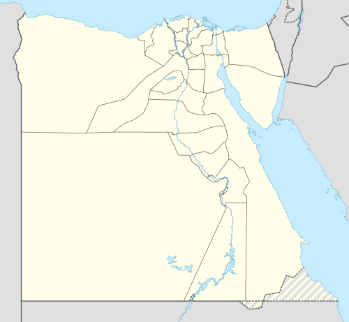
Pithom (Hebrew: פתם) also called Per-Atum or Heroöpolis or Heroonopolis[1] (Greek: Ἡρώων πόλις or Ἡρώ) was an ancient city of Egypt. Multiple references in ancient Greek, Roman,[2] and biblical sources exist for this city. The exact location of this city remains somewhat uncertain. A number of scholars identified it as the modern archaeological site of Tell El Maskhuta.[3] Others say that the site is identified with Tell El Retabeh,[4] while the 10th century Jewish scholar, Saadia Gaon, identified the place in his Judeo-Arabic translation of the Pentateuch as Faiyum, a place located 100 kilometres (62 miles) southwest of Cairo.[5]
The name
This name comes from Hebrew פתם Pithom which was taken from the Late Egyptian name *Pi-ʔAtōm (< *Par-ʔAtāma) 'House of Atum'. Atum, a solar deity, was one of the major gods of ancient Egypt, and a sun-god of Heliopolis.
Biblical Pithom
Pithom is one of the cities which, according to Exodus 1:11, was built for the Pharaoh of the oppression by the forced labor of the Israelites. The other city was Ramses; and the Septuagint adds a third, "On, which is Heliopolis." The meaning of the term, rendered in the Authorized Version "treasure cities" and in the Revised Version "store cities," is not definitely known. The Septuagint renders πόλεις ὀχυραί "strong [or "fortified"] cities." The same term is used of certain cities of King Solomon in I Kings 9:19 (comp. also II Chronicles 16:4).
Graeco-Roman Heroöpolis
Heroöpolis was a large city east of the Nile Delta, situated near the mouth of the Royal Canal which connected the Nile with the Red Sea. Although not immediately upon the coast, but nearly due north of the Bitter Lakes, Heroöpolis was of sufficient importance, as a trading station, to confer its name upon the arm of the Red Sea[6] which runs up the Egyptian mainland as far as Arsinoë (near modern Suez) -- the modern Gulf of Suez.[7] It was the capital of the 8th nome of Lower Egypt.
Location
Early on, the location of Pithom—just like the locations of other similar sites, such as Tanis—has been the subject of much conjecture and debate. Édouard Naville and Flinders Petrie were looking for Pithom along the Wadi Tumilat, an arable strip of land serving as the ancient transit route between Egypt and Canaan across the Sinai—the biblical 'Way of Shur'.[8]
In the spring of 1883, Naville believed he had identified Pithom as the archaeological site Tell El Maskhuta. The site of Pithom, as identified by Naville, is at the eastern edge of Wadi Tumilat, south-west of Ismaïlia. Petrie agreed with this identification. John Holladay, a more recent investigator of the site, also supports this opinion.
Tell El Retaba
8 miles west from Tell El Maskhuta is the site of Tell El Retabeh. This is approximately the midpoint of Wadi Tumilat.
Here was found a group of granite statues representing Ramesses II, two inscriptions naming Pr-Itm (Temple of Atum), storehouses and bricks made without straw. So archeologists (wrongly) concluded that this was the site of Pi-Ramesses. The excavations carried on by Naville for the Egypt Exploration Fund uncovered a city wall, a ruined temple, and the remains of a series of brick buildings with very thick walls and consisting of rectangular chambers of various sizes, opening only at the top and without any entrances to one another.
Some scholars, such as Manfred Bietak and Kenneth Kitchen, have argued that this was the ancient Pithom.[9] This opinion goes back to the 19th century, when Allen Gardiner first identified Pithom with the site of Tell El Rebata, and this was later accepted by William F. Albright,[10] and Kenneth Kitchen.[11] Yet archeological excavations seem to show that Tell El Rebata had been unoccupied during the period when we find monuments relating to a town called Pithom.[12]
Naville identified all these locations as being in the region of Tjeku (Sukkot), the 8th Lower Egypt nome.
The joint Polish-Slovak mission has carried out a systematic research at Tell El Retaba since 2007.[13]
More recent analyses have demonstrated that the designation for the temple of Atum, pr-itm, can be found in inscriptions at both sites—both at Tell El Retaba and at Tell El Maskhuta. This seems to demonstrate that the name 'Pithom' was used originally for the earlier site, Tell El Retaba, before it was abandoned. And when the newer city of Tel El Maskhuta was built, the same name was applied to it as well – as the temple of Atum was moved to El Maskhuta. Thus, in effect, 'Pithom' was moved to a new location, which phenomenon is attested with some other cities as well, such as Migdol. [14]
Wadi Tumilat Project
Modern excavations at Tel El Maskhuta were carried out by the University of Toronto 'Wadi Tumilat Project' under the direction of John Holladay. They worked over five seasons between 1978 and 1985. These excavations have shown that the history of Tel El Maskhuta is quite complex. There was a Middle Bronze IIB settlement there (18th-17th centuries BC), associated with the Hyksos, followed by a long break until the late 7th century BC, when there was rebuilding.
This construction at the end of the 7th century may have been carried out by Pharaoh Necho II, possibly as part of his uncompleted canal building project from the Nile to the Gulf of Suez.[15][16]
References
- ↑ Encyclopedia of the Archaeology of Ancient Egypt, Kathryn A. Bard, ed. Routledge, 1999. p. 1144 ISBN 0203982835
- ↑ Strabo xvi. 759, 768, xvii. 803, 804; Arrian, Exp. Alex. iii. 5, vii. 20; Joseph. Ant. Jud. ii. 7. § 5; Plin. v. 9. § 11, vi. 32. § 33; Mela, iii. 8; Steph. B. s. v.; Ptol. ii. 1. § 6, iv. 15. § 54
- ↑ Ann E. Killebrew, Biblical Peoples and Ethnicity, Atlanta GA 2005, p. 152
- ↑ T.C. Mitchell, Biblical Archaeology: Documents for the British Museum, Cambridge University Press, p. 40.
- ↑ Saadia Gaon, Tafsir (Judeo-Arabic translation of the Pentateuch), Exodus 1:11
- ↑ Ἡρωοπολίτης κόλπος, Ptol. v. 17. § 1, Latin: Heroopoliticus Sinus
- ↑ Theophrast. Hist. Plant. iii. 8.
- ↑ Israel: Ancient Kingdom Or Late Invention? Daniel Isaac Block, ed. B&H Publishing Group, 2008 ISBN 0805446796
- ↑ Israel: Ancient Kingdom Or Late Invention? Daniel Isaac Block, ed. B&H Publishing Group, 2008. p. 113 ISBN 0805446796
- ↑ Bromiley, Geoffrey W. (1994). International Standard Bible Encyclopedia: K-P. Wm. B. Eerdmans Publishing Company. p. 876. ISBN 978-0-8028-3783-7. BROKEN LINK
- ↑ Kitchen, Kenneth A. (1999). Ramesside Inscriptions, Ramesside Inscriptions, Notes and Comments Volume II: Ramesses II, Royal Inscriptions. Wiley-Blackwell. p. 270. ISBN 978-0-631-18435-5.
- ↑ Seters, John Van, "The Geography of the Exodus", in Silberman, Neil Ash (editor), The Land That I Will Show You: Essays in History and Archaeology of the Ancient Near East in Honor of J. Maxwell Miller, Sheffield Academic Press, 1997, P. 261-262, ISBN 978-1850756507,
- ↑ Aigyptos Foundation Slovak Egyptological team
- ↑ James K. Hoffmeier, Ancient Israel in Sinai: The Evidence for the Authenticity of the Wilderness Tradition. Oxford University Press, 2005 ISBN 0198035403
- ↑ Seters, John Van, "The Geography of the Exodus", in Silberman, Neil Ash (editor), The Land That I Will Show You: Essays in History and Archaeology of the Ancient Near East in Honor of J. Maxwell Miller, Sheffield Academic Press, 1997, P. 261-262, ISBN 978-1850756507,
- ↑ Neils Peter Lemche (2000). "Is It Still Possible to Write a History of Ancient Israel?". In V. Philips Long. Israel's Past in Present Research: Essays on Ancient Israelite Historiography. Eisenbrauns. p. 398. ISBN 978-1-57506-028-6.
 This article incorporates text from a publication now in the public domain: Smith, William, ed. (1854–1857). "Pithom". Dictionary of Greek and Roman Geography. London: John Murray.
- This article incorporates text from a publication now in the public domain: Singer, Isidore; et al., eds. (1901–1906). "Pithom". Jewish Encyclopedia. New York: Funk & Wagnalls Company.
- Sarna, Nahum M. “Exploring Exodus: The Oppression,” Biblical Archaeologist, Volume 49: 1986 (2001 electronic ed.)
- M.I. Bakr and H. Brandl, "Various Sites in the Eastern Nile Delta: Tell el-Maskhuta", in: M.I. Bakr and H. Brandl, with F. Kalloniatis (eds.), Egyptian Antiquities from the Eastern Nile Delta (= Museums in the Nile Delta, vol. 2). Cairo/Berlin 2014, pp. 78 and 266-267, cat. 72. ISBN 9783000453182.