Pisgah Mountain
| Pisgah Mountain | |
|---|---|
| Highest point | |
| Elevation | 1,557 ft (475 m) |
| Prominence | 1,077 ft (328 m) Topographical map Summit: 1557 to Benchmark @gap near Packerton, 480 ft. |
| Geography | |
| Location | Carbon County, Pennsylvania, U.S. |
| Parent range | Appalachian Mountains |
| Topo map | USGS 40075G8, 1947&'83 Tamaqua (PA) Quadrangle |

Pisgah Mountain or Pisgah Ridge (on older USGS Maps) is a long ridgeline[1] 12.5 miles (20.1 km) Tamaqua to Jim Thorpe (river gap to river gap) oriented NNE-to-SSW whose northside valley is followed by U.S. Route 209 from river gap to river gap. The ridge is a succession of peaks exceeding 1,440 feet (438.9 m) looming 300–540 feet[2] above the towns of Lansford, Coaldale, Summit Hill, and Tamaqua[lower-alpha 1] in the Panther Creek valley. Near Summit Hill was the 'Sharpe Mountain' (peak), where in 1791 Phillip Ginter is documented as having discovered Anthracite leading to the formation of the Lehigh Coal Mine Company. In 1818 the Lehigh Coal Company took over the mines and the mining camp gradually became a settlement and grew into Summit Hill.
The Pisgah Ridge forms the left bank drainage divide on the south and the streams source in the east. The peak at the east end of the ridge is named Mount Pisgah and represents a hard rock knob that towers 900 feet (270 m) above the Lehigh River towns of Jim Thorpe to the east, and Nesquehoning to its north. The municipalities are located relative to one another just around a near ninety-degree bend in the Lehigh a few miles apart by road or river.
Geologically, the Pisgah Ridge divide is classed as of semi-major degree, the waters enter the same body, the Delaware, but do so over fifty miles apart as the north draining waters are feed waters of the Panther Creek running east as a Little Schuylkill tributary, whilst the eastern south slope waters drain into the valley formed by the Mauch Chunk Ridge paralleling Pisgah Ridge to the south, via the Mauch Chunk Creek[3] (White Bear Creek).
Furthermore, the terminal but subordinate peak of the ridge and Mount Pisgah is located at the joining of two ridgelines of similar height, the more northerly, Nesquehoning Mountain forming the right bank drainage divide for Panther Creek, and being sundered from Mount Pisgah proper by a short very steep characteristic V-shaped water-erosion valley (oriented below a 'right bank' prominence named "Indian Peak") that US-209 climbs steeply from the town of Nesquehoning westwards 2–3 miles to reach the head of the Panther Creek Valley.
The railroad tracks paralleling PA-54 also transiting the town of Nesquehoning's flat river-bank terrain takes over sixteen miles farther to climb and descend to once again reach an elevation where it can turn to enter the Panther Creek Valley near the confluence with the Little Schuylkill via the rail yard at Tamaqua in a longer more circuitous climb—and demonstration why dump trucks have replaced railroads in short haul situations.
Geology
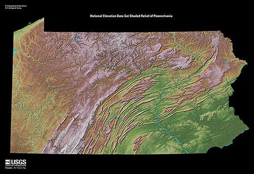
Mount Pisgah is a typical end-ridge formed by a watercourse gap. Pisgah Mountain is but one average folded mountain in a succession of near parallel ridgelines, where each are made by a succession of peaks of nearly the same height. This Ridge and Valley province is a geological feature that extends from New Jersey into Virginia forming a great barrier of successive valleys. Pisgah Mountain, located along the southern fringe of northeastern Pennsylvania's Poconos region is also central to the Southern Anthracite Region of Pennsylvania— known as the site of the Richest Anthracite Seam, in the heart of the Southern Pennsylvania Anthracite Field and the geological province known as the Anthracite Upland section. The ridgeline parallels the escarpment of the Blue Mountain region but unlike that barrier with several major cuttings, Mount Pisgah is a divide between waters running southwesterly in the historic Panther Creek (Pennsylvania).
Notes
- ↑ Pisgah Ridge ends in a cutting and wrap back easterly as Mauch Chunk Ridge above the Little Schuylkill Gap, a water gap cutting through the mountain chain below the confluence of Panther Creek and the Little Schuylkill River and confusingly, given the name Sharp Mountain, Pennsylvania.
References
- ↑ USGS MRC: 40075-D6 (1893), Hazelton Quadrangles, South center ridge on USGS topological map of Schuylkill-Lehigh River Drainage Divides, 1893, rev 1893.
- ↑ By inspection (estimated from topological maps) - Low is 900' near Panther Creek, High streets, ca. 1040 ft, Summit Hill, variation is 140 ft, 1440-900=540, 1440-1040=300, which given 1-14 miles of ridge, is close enough to justify the statement. .
- ↑ Inspection today via maps.google.com shows the headwaters begin to flow east from ~.5 miles (0.8 km) (~2600 ft, estimated) south of Coaldale. Today's creek now leads to Mauch Chunk Lake at Mauch Chunk Lake Park, but Google maps names it White Bear Creek.
Reference works
- Alan R. Geyer (1979) "Outstanding Geologic Features of Pennsylvania", Geological Survey of Pennsylvania
- Tom Thwaites (1997) "50 hikes in Eastern Pennsylvania", Third edition
- Art Michaels (2003) "Pennsylvania Overlooks a guide for Sightseers and Outdoor People", Penn State Press
- "Latitude and Longitude from TopoQuest". TopoQuest.com.
Coordinates: 41°48′35″N 76°42′57″W / 41.80984°N 76.71591°W