Piparpati Parchrauwa
| Piparpati Pacharauta पिपरपाती पचरौता | |
|---|---|
| Village Development Committee | |
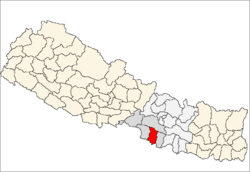
 Piparpati Pacharauta Location in Nepal | |
| Coordinates: 26°52′N 85°05′E / 26.86°N 85.08°ECoordinates: 26°52′N 85°05′E / 26.86°N 85.08°E | |
| Country |
|
| Zone | Narayani Zone |
| District | Bara District |
| Population (1991) | |
| • Total | 4,106 |
| Time zone | Nepal Time (UTC+5:45) |
Piparpati Pachrauta is a town and Village Development Committee in Bara District in the Narayani Zone of south-eastern Nepal. At the time of the 1991 Nepal census it had a population of 4,106. Farming is the main occupation of the people of here. Some of the people are also involved in service and home trade. It is bordered by Jamuni river which separates the village from bihar of India in the south. It has hot climate with average rainfall of 2 cm. People spend very simple livelihood .It has good progress in the development and soon it will be a municipality. [1]
References
- ↑ "Nepal Census 2001". Nepal's Village Development Committees. Digital Himalaya. Archived from the original on October 12, 2008. Retrieved 21 September 2008.
External links
This article is issued from Wikipedia - version of the 11/20/2016. The text is available under the Creative Commons Attribution/Share Alike but additional terms may apply for the media files.