Pinheiro Machado
| Pinheiro Machado | |||
|---|---|---|---|
| Municipality | |||
|
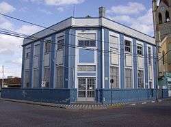
Town Hall. | |||
| |||
| Nickname(s): Nacional capital of sheep barbecue | |||
 Pinheiro Machado Location in Brazil | |||
| Coordinates: 31°34′40″S 53°22′21″W / 31.57778°S 53.37250°W | |||
| Country |
| ||
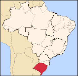
| State | Rio Grande do Sul | ||
| Mesoregion | Sudoeste Rio-grandense | ||
| Microregion | Serras de Sudeste | ||
| Founded | May 2, 1879 | ||
| Government | |||
| • Mayor | Luiz Fernando de Ávila Leivas | ||
| Area | |||
| • Total | 2,287,897 km2 (883,362 sq mi) | ||
| Elevation | 436 m (1,430 ft) | ||
| Population (2010) | |||
| • Total | 12,787 | ||
| • Density | 0.0056/km2 (0.014/sq mi) | ||
| Time zone | UTC-3 (UTC-3) | ||
| • Summer (DST) | UTC-2 (UTC-2) | ||


Pinheiro Machado is a municipality in the state Rio Grande do Sul, Brazil.
History
Pinheiro Machado is one of the most ancient towns in the state of Rio Grande do Sul. Until 1830, the area was owned by the city of Rio Grande. After it became a part of Piratini city, separating in February 24, 1879, by the name of Nossa Senhora da Luz, or Nossa senhora da Luz das Cacimbinhas. The occupation of this town, according to records, began by the brigadier Rafael Pinto Bandeira, about 1765. The first inhabitants were the azorean Tomás Antonio de Oliveira and José Dutra de Andrade, who owned "allotments" (Portuguese: sesmaria (pt)) of land at Coxilha do Veleda, in 1790. According to the legend, Dutra de Andrade had lost his vision and then, he made a promise that if he would recover his vision washing his eyes on the miraculous water of the well located there, he would order the building of a chantry in honor of Nossa Senhora Aparecida and so, the miracle happened. After the chantry, a parsonage was created in 1851.
Geography
Pinheiro Machado is located at latitude 31º34'42"S and longitude 53º22'52"W, at an altitude of 1,430 feet (440 m).
It has an area of 883,362 square miles (2,287,900 km2) and the population in 2004 was 14,327.
Relief
The relief, located in a plateau known as Serras de Sudeste, is a rather irregular, specially the Passarinho's Hill, Veleda's Hill and Asperezas Hill. Also highlights the formation of countless hills, mainly in the second district. The soil is characterized by shallow, with the presence of rock outcroppings.
Weather
About the climate, Pinheiro Machado is subtropical or temperate, with hot summers and cold winters (with high occurrence of frost) with annual temperature of about 61 °F (16 °C). The hottest month is January, with average temperature of 70 °F (21 °C), while the coldest month is July, with average temperature of 44 °F (7 °C). The annual rainfall is of about 1,380 millimetres (54 in), with rains regularly distributed during the year. Snowfalls are not uncommon in the city, and can occur about one or two times by decade. The last snowfall occurred on September 4, 2006 and on September 5, 2008, with moderated snowfall during the afternoon.