Farsala
| Farsala Φάρσαλα | |
|---|---|
|
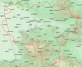
Farsala municipality map | |
 Farsala | |
|
Location within the region 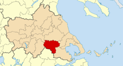 | |
| Coordinates: 39°18′N 22°23′E / 39.300°N 22.383°ECoordinates: 39°18′N 22°23′E / 39.300°N 22.383°E | |
| Country | Greece |
| Administrative region | Thessaly |
| Regional unit | Larissa |
| Area | |
| • Municipality | 739.7 km2 (285.6 sq mi) |
| • Municipal unit | 121.433 km2 (46.886 sq mi) |
| Elevation | 160 m (520 ft) |
| Population (2011)[1] | |
| • Municipality | 18,545 |
| • Municipality density | 25/km2 (65/sq mi) |
| • Municipal unit | 9,982 |
| • Municipal unit density | 82/km2 (210/sq mi) |
| Community[1] | |
| • Population | 9,337 (2011) |
| • Area (km2) | 57.928 |
| Time zone | EET (UTC+2) |
| • Summer (DST) | EEST (UTC+3) |
| Postal code | 403 00 |
| Area code(s) | 24910 |
| Vehicle registration | ΡΙ |
| Website | www.farsala.gr |
Farsala (Greek: Φάρσαλα), known in Antiquity as Pharsalos (Ancient Greek: Φάρσαλος, Latin: Pharsalus), is a city in southern Thessaly, in Greece. Farsala is located in the southern part of Larissa regional unit, and is one of its largest towns. Farsala is an economic and agricultural centre of the region. Cotton and livestock are the main agricultural products, and many inhabitants are employed in the production of textile. Farsala is famous for its distinctive halva, but even more so for its significance in ancient history.
Geography
Farsala lies at the southern edge of the Thessalian Plain, 4 km south of the river Enipeas. The Greek National Road 3 (Larissa - Lamia) and the Greek National Road 30 (Karditsa - Volos) pass through the town. The Palaiofarsalos railway station (litt. "Ancient Pharsalus"), on the line from Athens to Thessaloniki and head of the branch line to Kalambaka, is located in the village of Stavros, 12 km to the west. Farsala is located 38 km south of Larissa, 41 km east of Karditsa, 44 km north of Lamia and 49 km west of Volos.
The municipality Farsala has an area of 739.74 km2, the municipal unit Farsala has an area of 121.433 km2, and the community Farsala has an area of 57.928 km2.[2]
History
Ancient Pharsalos
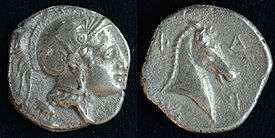 | |
| O: helmeted head of Athena | R: head of horse
Φ A / P Σ |
| silver hemidrachm struck in Pharsalos 450-400 BC. | |
The Homeric Phthia of the Mycenaean period, capital of the Kingdom of the Myrmidons and of Peleus, father of Achilles, has sometimes been identified with the later city of Pharsalos (Greek: Φάρσαλος), now Farsala. A Cyclopean Wall which protected a city still exists today near modern Farsala, as does a vaulted tomb from that period.
The Pharsalos of the historic era was built over a hillside of the Narthacius mountains at an elevation of some 160 m, where modern Farsala stands. It was one of the main cities in Thessaly and was the capital of the Phthian tetrarch. In the Persian Wars it sided with the Athenians. A distinctive tribe of the city was that of Echecratidon. In the early 4th century BC, the city was a part of the Thessalian Commons. Later, it joined the Macedonian Kingdom under Philip II. The area became a theatre of war where the Aetolians and the Thessalians clashed with the Macedonians, especially during the Second and the Third Macedonian Wars. After the defeat of the Macedonian Kingdom, Pharsalos and the whole area became a part of the Roman Republic.
The whole area suffered great destruction during the Roman Civil War. The Battle of Pharsalus, where Julius Caesar defeated Pompey and changed the course of the Roman Republic forever, took place in 48 BC in the fields of the Pharsalian Plain.
The geographer Strabo speaks of two towns, Old Pharsalos, Παλαιοφάρσαλος (Palaeopharsalos) and Pharsalos, existing in historical times. His statement (9.5.6) that the Thetideion, the temple to Thetis south of Skotoussa, was “near both the Pharsaloi, the Old and the New”, seems to imply that Palaeopharsalos was not itself close by Pharsalos. Although the battle of 48 BC is called after Pharsalos, four ancient writers – the author of the Bellum Alexandrinum (48.1), Frontinus (Strategemata 2.3.22), Eutropius (20), and Orosius (6.15.27) – place it specifically at Palaeopharsalos. In 198 B.C. Philip V had sacked Palaeopharsalos (Livy 32.13.9). If that town had been close to Pharsalos he would have sacked both, and Livy would have written “Pharsalus” instead of “Palaeopharsalus”. The British scholar F. L. Lucas demonstrated (Annual of the British School at Athens, No. XXIV, 1919–21) that the battle of 48 BC must have been fought north of the Enipeus, near modern-day Krini. It has been suggested[3] that Krini was built on the site of Palaeopharsalos, where the old road south from Larissa emerged from the hills on to the Pharsalian Plain.
Modern Farsala
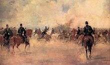
Farsala was known as Çatalca during Ottoman rule. Following the Treaty of Berlin the city became part of the Hellenic Kingdom together with the rest of Thessaly in 1881. During the first Greco-Turkish War (1897), a major battle took place in the vicinity of Farsala.
Municipality
The municipality Farsala was formed at the 2011 local government reform by the merger of the following 4 former municipalities, that became municipal units:[4]
- Enippeas
- Farsala
- Narthaki
- Polydamantas
Province
The province of Farsala (Greek: Επαρχία Φαρσάλων) was one of the provinces of the Larissa Prefecture. It had the same territory as the present municipality.[5] It was abolished in 2006.
Historical population
| Year | Town | Municipal unit | Municipality |
|---|---|---|---|
| 1981 | 7,211 | - | - |
| 1991 | 8,457 | 9,464 | - |
| 2001 | 9,801 | 10,812 | - |
| 2011 | 9,337 | 9,982 | 18,545 |
See also
References
- 1 2 "Απογραφή Πληθυσμού - Κατοικιών 2011. ΜΟΝΙΜΟΣ Πληθυσμός" (in Greek). Hellenic Statistical Authority.
- ↑ "Population & housing census 2001 (incl. area and average elevation)" (PDF) (in Greek). National Statistical Service of Greece.
- ↑ John D. Morgan in “Palae-pharsalus – the Battle and the Town”, The American Journal of Archaeology, Vol. 87, No. 1, Jan. 1983
- ↑ Kallikratis law Greece Ministry of Interior (Greek)
- ↑ "Detailed census results 1991" (PDF). (39 MB) (Greek) (French)
External links
 Herbermann, Charles, ed. (1913). "Pharsalus". Catholic Encyclopedia. New York: Robert Appleton Company.
- The official site of Farsala. (Greek)
- Livius.org: Pharsalus (in antiquity)
Administrative division of the Thessaly Region | ||
|---|---|---|
| Regional unit of Karditsa | 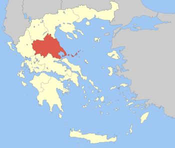 | |
| Regional unit of Larissa | ||
| Regional unit of Magnesia | ||
| Regional unit of the Sporades | ||
| Regional unit of Trikala | ||
| ||