Penparc

Coordinates: 52°06′07″N 4°36′45″W / 52.101866°N 4.612508°W
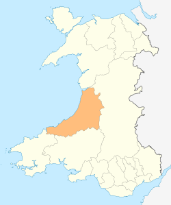
Penparc is a village in Ceredigion, Wales, located on the A487 road 3 miles north west of Cardigan. The surrounding land is principally used for cattle grazing although the significant glacial sand deposits[1] are also commercially used as a source of sand and gravel.[2]
References
- ↑ "The Ordovician and Silurian meta-sedimentary aquifers of central and south-west Wales" (PDF). The Environment Agency. 2005. ISBN 978-1-84432-642-6. Retrieved 20 April 2016.
- ↑ "Penparc residents angry over quarry extension plans". BBC. 13 January 2011. Retrieved 20 April 2016.
This article is issued from Wikipedia - version of the 4/22/2016. The text is available under the Creative Commons Attribution/Share Alike but additional terms may apply for the media files.