Reeves County, Texas
| Reeves County, Texas | |
|---|---|
|
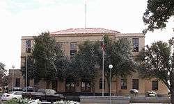
Reeves County Courthouse in Pecos | |
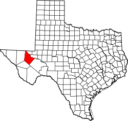 Location in the U.S. state of Texas | |
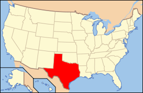 Texas's location in the U.S. | |
| Founded | 1884 |
| Named for | George R. Reeves |
| Seat | Pecos |
| Largest city | Pecos |
| Area | |
| • Total | 2,642 sq mi (6,843 km2) |
| • Land | 2,635 sq mi (6,825 km2) |
| • Water | 6.7 sq mi (17 km2), 0.3% |
| Population | |
| • (2010) | 13,783 |
| • Density | 5.2/sq mi (2/km²) |
| Congressional district | 23rd |
| Time zone | Central: UTC-6/-5 |
| Website |
www |
Reeves County is a county located in the U.S. state of Texas. As of the 2010 census, its population was 13,783.[1] Its county seat is Pecos.[2] The county was created in 1883 and organized the next year.[3] It is named for George R. Reeves, a Texas state legislator and colonel in the Confederate Army. It is one of the nine counties that comprise the Trans-Pecos region of West Texas.
Reeves County comprises the Pecos, TX Micropolitan Statistical Area.
History
Native Americans
Prehistoric Clovis culture peoples[4] in Reeves County lived in the rock shelters and caves nestled near water supplies. These people left behind artifacts and pictographs as evidence of their presence.[5] Jumano Indians led the Antonio de Espejo[6] 1582–1583 expedition near Toyah Lake on a better route to the farming and trade area of La Junta de los Ríos. Espejo's diary places the Jumano along the Pecos River and its tributaries.[7] The Mescalero Apache[8][9] frequented San Solomon Springs to irrigate their crops. In 1849 John Salmon "RIP" Ford[10] explored the area between San Antonio and El Paso noting in his mapped report the productive land upon which the Mescalero Indians farmed.
County established and growth
The state legislature formed Reeves from Pecos County in 1883, and named it after Texas legislator and soldier George Robertson Reeves.[11][12] The county was organized in 1884. The town of Pecos[13] was named as county seat.
Toyah Valley farmers George B. and Robert E. Lyle were the first Anglo settlers 1871. White settlers started arriving in the area four years later, lured by open range ranching.[14] For the remainder of the century, the county economy was dependent upon farming and ranching as it segued into the manufacturing and oil industries of the 20th century.
The Texas and Pacific Railway built through Reeves County in 1881, with stations at Pecos[15] and Toyah.[16] By 1990 the Pecos River Railway[17] had built from Pecos to the New Mexico. Toyahvale,[18] which means "flowing water", became the western terminus of the railroad.
Balmorhea State Park was built at Toyahvale by the Civilian Conservation Corps.[19] The park was deeded to the State of Texas in 1934 and opened to the public in 1968.
Pecos Army Air Field was one of the 120 airbases that trained the pioneer Women Airforce Service Pilots[20] to fly military aircraft. At the Pecos installation, WASP flew AT-6, UC-78, and AT-17 in engineering test, administrative, and transporting freight. The base was activated in 1942 as a World War II pilot school.[21] The base was deactivated in 1945. At its peak, the base population of 4,034 rivaled the town of Pecos in size. Portions of the base were sold off over the years, with Pecos Municipal Airport retaining the remainder.
Pecos is the site of the largest private prison in the world, the Reeves County Detention Complex, operated by the GEO Group.[22]
Geography
According to the U.S. Census Bureau, the county has a total area of 2,642 square miles (6,840 km2), of which 2,635 square miles (6,820 km2) is land and 6.7 square miles (17 km2) (0.3%) is water.[23]
Major highways
Adjacent counties
- Eddy County, New Mexico (north)
- Loving County (northeast)
- Ward County (east)
- Pecos County (southeast)
- Jeff Davis County (southwest)
- Culberson County (west)
Demographics
| Historical population | |||
|---|---|---|---|
| Census | Pop. | %± | |
| 1890 | 1,247 | — | |
| 1900 | 1,847 | 48.1% | |
| 1910 | 4,392 | 137.8% | |
| 1920 | 4,457 | 1.5% | |
| 1930 | 6,407 | 43.8% | |
| 1940 | 8,006 | 25.0% | |
| 1950 | 11,745 | 46.7% | |
| 1960 | 17,644 | 50.2% | |
| 1970 | 16,526 | −6.3% | |
| 1980 | 15,801 | −4.4% | |
| 1990 | 15,852 | 0.3% | |
| 2000 | 13,137 | −17.1% | |
| 2010 | 13,783 | 4.9% | |
| Est. 2015 | 14,732 | [24] | 6.9% |
| U.S. Decennial Census[25] 1850–2010[26] 2010–2014[1] | |||
As of the 2010 United States Census, there were 13,783 people residing in the county. 77.2% were White, 5.0% Black or African American, 0.9% Asian, 0.5% Native American, 14.9% of some other race and 1.5% of two or more races. 74.2% were Hispanic or Latino (of any race).
As of the census[27] of 2000, there were 13,137 people, 4,091 households, and 3,129 families residing in the county. The population density was 5 people per square mile (2/km²). There were 5,043 housing units at an average density of 2 per square mile (1/km²). The racial makeup of the county was 79.33% White, 2.10% Black or African American, 0.51% Native American, 0.35% Asian, 0.01% Pacific Islander, 15.03% from other races, and 2.68% from two or more races. 73.38% of the population were Hispanic or Latino of any race.
There were 4,091 households out of which 38.80% had children under the age of 18 living with them, 59.60% were married couples living together, 12.40% had a female householder with no husband present, and 23.50% were non-families. 21.60% of all households were made up of individuals and 10.10% had someone living alone who was 65 years of age or older. The average household size was 2.93 and the average family size was 3.45.
In the county, the population was spread out with 29.90% under the age of 18, 11.30% from 18 to 24, 25.20% from 25 to 44, 21.00% from 45 to 64, and 12.60% who were 65 years of age or older. The median age was 32 years. For every 100 females there were 112.00 males. For every 100 females age 18 and over, there were 115.40 males.
The median income for a household in the county was $23,306, and the median income for a family was $24,856. Males had a median income of $23,913 versus $13,248 for females. The per capita income for the county was $10,811. About 25.40% of families and 28.90% of the population were below the poverty line, including 36.20% of those under age 18 and 21.60% of those age 65 or over.
Ranching Industry
The sprawling 320,000 deeded acre (1,400 km²) La Escalera Ranch headquarters is located 20 miles south of Fort Stockton, Texas and is owned and operated by the Gerald Lyda family. The ranch extends over much of Pecos County and portions of Reeves County, Brewster County, Archer County, and Baylor County.
Originally owned by California-based Elsinore Land & Cattle Company, the 100-year-old ranch was acquired by building contractor Gerald Lyda of San Antonio, Texas and renamed La Escalera Ranch (Spanish for "The Ladder"). It is known for its reputation Black Angus cattle and its abundant wildlife. Gerald Lyda died in 2005. Today, the ranch is owned and operated by Lyda's sons Gerald D. and Gene Lyda, as well as Lyda's daughter Jo Lyda Granberg.
Located near the entrance to the ranch is Sierra Madera crater. La Escalera Ranch has been ranked by Texas Monthly, Worth and The Land Report magazines as one of the largest cattle ranches in Texas and in fact, all of the United States.
Communities
See also
References
- 1 2 "State & County QuickFacts". United States Census Bureau. Retrieved December 23, 2013.
- ↑ "Find a County". National Association of Counties. Retrieved 2011-06-07.
- ↑ "Texas: Individual County Chronologies". Texas Atlas of Historical County Boundaries. The Newberry Library. 2008. Retrieved May 26, 2015.
- ↑ Mallouf, Robert J. "Exploring the Past in Trans-Pecos Texas". Sul Ross University. Retrieved April 29, 2010. Texas Beyond History
- ↑ "Artistic Expression". Texas Beyond History. Retrieved April 29, 2010. Texas Beyond History
- ↑ Blake, Robert Bruce: Antonio de Espejo from the Handbook of Texas Online. Retrieved April 29, 2010. Texas State Historical Association
- ↑ "Who Were The Jumano?". Texas Beyond History. Retrieved April 29, 2010. Texas Beyond History
- ↑ "Texas Indians Map". R E. Moore and Texarch Associates. Retrieved April 29, 2010. R E. Moore and Texarch Associates
- ↑ "Mescalero Spring". Texas Historical Marker. Retrieved April 29, 2010.
- ↑ Connor, Seymour V.: John Salmon Ford from the Handbook of Texas Online. Retrieved April 29, 2010. Texas State Historical Association
- ↑ Britton, Morris L.: George Robertson Reeves from the Handbook of Texas Online. Retrieved April 29, 2010. Texas State Historical Association
- ↑ Britton, Morris L. "George R. Reeves, Speaker of the House". Texas Politics, UT Austin. Retrieved April 29, 2010. The Texas State Historical Association
- ↑ Troesser, John. "Pecos, Texas". Texas Escapes. Retrieved April 29, 2010.
- ↑ Smith, Julia Cauble: Reeves from the Handbook of Texas Online. Retrieved April 29, 2010. Texas State Historical Association
- ↑ "Texas and Pacific Railway Stations". Texas and Pacific Railway. Retrieved April 29, 2010.
- ↑ "Texas and Pacific Railway Stations". Texas and Pacific Railway. Retrieved April 29, 2010.
- ↑ Cravens, Cris: Pecos River Railway from the Handbook of Texas Online. Retrieved April 29, 2010. Texas State Historical Association
- ↑ Smith, Julia Cauble: Toyahvale from the Handbook of Texas Online. Retrieved April 29, 2010. Texas State Historical Association
- ↑ "Balmorhea State Park". Texas Parks and Wildlife Department. Retrieved April 29, 2010.Texas Parks and Wildlife Department
- ↑ "Women Airforce Service Pilots". Wings Across America. Retrieved April 29, 2010. Wings Across America
- ↑ Colwell, James L.: Pecos Army Airfield from the Handbook of Texas Online. Retrieved April 29, 2010. Texas State Historical Association
- ↑ http://www.fwweekly.com/2010/03/10/private-prisons-public-pain/
- ↑ "2010 Census Gazetteer Files". United States Census Bureau. August 22, 2012. Retrieved May 9, 2015.
- ↑ "County Totals Dataset: Population, Population Change and Estimated Components of Population Change: April 1, 2010 to July 1, 2015". Retrieved July 2, 2016.
- ↑ "U.S. Decennial Census". United States Census Bureau. Retrieved May 9, 2015.
- ↑ "Texas Almanac: Population History of Counties from 1850–2010" (PDF). Texas Almanac. Retrieved May 9, 2015.
- ↑ "American FactFinder". United States Census Bureau. Retrieved 2011-05-14.
External links
- Reeves County from the Handbook of Texas Online
- Historic Reeves County materials, hosted by the Portal to Texas History.
- La Escalera Ranch – Official Website
- Reeves County Sheriff's Office
 |
Eddy County, New Mexico | Loving County | | |
| Culberson County | |
Ward County | ||
| ||||
| | ||||
| Jeff Davis County | Pecos County |
Municipalities and communities of Reeves County, Texas, United States | ||
|---|---|---|
| Cities | | |
| Town | ||
| CDP | ||
| Unincorporated communities | ||
| Ghost town | ||
Coordinates: 31°19′N 103°41′W / 31.32°N 103.68°W