Pearl Lagoon
| Pearl Lagoon Laguna de Perlas (Spanish) | |
|---|---|
| Municipality | |
|
Pearl Lagoon on a sunny day | |
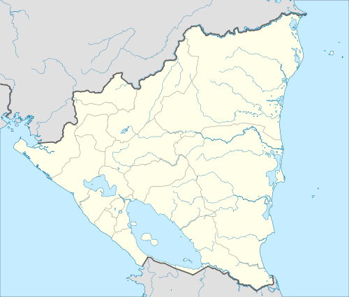 Pearl Lagoon Location in Nicaragua | |
| Coordinates: 12°21′N 83°40′W / 12.350°N 83.667°W | |
| Country |
|
| Department | South Caribbean Coast Autonomous Region |
| Area | |
| • Municipality | 758 sq mi (1,963 km2) |
| Population (2005) | |
| • Municipality | 10,676 |
| • Density | 14/sq mi (5.4/km2) |
| • Urban | 4,404 |
| Climate | Af |

Pearl Lagoon (Spanish: Laguna de Perlas, Spanish pronunciation: [laˈɣuna ðe ˈperlas]) is a town in the municipality by the same name. It is located in South Caribbean Coast Autonomous Region (RACCS) of Nicaragua. It is the largest coastal lagoon in RACCS.
Pearl Lagoon is home to 8,658 inhabitants as of 2005.
History
About a century ago it was considered to be the second capital of the Miskito Kingdom when the last Miskito king took up residence in the city. He arrived there after Henry Clarence deposed him in Bluefields in 1894.
At that time, Pearl Lagoon was called "the Granada of the Mosquitia" by one of the conquistadores of the Pacific Coast (the Caribbean side was not a part of Nicaragua) because of its beauty and the booming ship traffic. An 18th century cannon situated in the main street of the city has an inscription commemorating battles between liberal and conservative factions.
Culture
Most of the inhabitants are Creole, but a large number of Miskito and some Garifuna are also present. Similar to Bluefields, May Pole (Palo De Mayo) is a big celebration among the people.
The main communities are Haulover, Kakabila, Marshall Point, Pearl Lagoon, Orinoco, La Fe, Raitipura, Brown Bank, Tasbapounie, Set Net, Wawashan, San Vicente, Awas and Pedregal.
Sports
Pearl Lagoon is home to four local baseball teams that battle it out during the dry seasons on Sundays. The four teams are: Sweet Pearly, First Stop, The Young Brave, and the Haulover Tigers.[1] Pitchers Albert Williams and Devern Hansack, both natives of Pearl Lagoon, have played in Major League Baseball.
Transportation
The municipality of Pearl Lagoon lacks roads; however, it is located just north of Bluefields, the capital of RACCS, and can be reached by boat.
In 2006 the IDR initiated the construction of a new rural road of 17 km from Kukra Hill to Pearl Lagoon. As of 2011, the road permitted direct access to Pearl Lagoon from Managua by road.[2]
References
| Wikimedia Commons has media related to Pearl Lagoon. |
Coordinates: 12°21′N 83°40′W / 12.350°N 83.667°W
Capital: Bluefields | ||
| Municipalities |  | |