Payette County, Idaho
| Payette County, Idaho | ||
|---|---|---|
| ||
 Location in the U.S. state of Idaho | ||
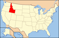 Idaho's location in the U.S. | ||
| Founded | February 28, 1917 | |
| Named for | Francois Payette | |
| Seat | Payette | |
| Largest city | Payette | |
| Area | ||
| • Total | 410 sq mi (1,062 km2) | |
| • Land | 407 sq mi (1,054 km2) | |
| • Water | 3.4 sq mi (9 km2), 0.65% | |
| Population | ||
| • (2010) | 22,623 | |
| • Density | 56/sq mi (22/km²) | |
| Congressional district | 1st | |
| Time zone | Mountain: UTC-7/-6 | |
| Website |
www | |

Payette County is a county located in Idaho in the United States of America. As of the 2010 census, the population was 22,623.[1] The county seat and largest city is Payette.[2]
Payette County is part of the Ontario, OR–ID Micropolitan Statistical Area.
History
The county was established in 1917, partitioned from Canyon County. It was named after the Payette River, which was named after French-Canadian François Payette. Payette, originally a fur trapper with the North West Company, was the first white man in the area in 1818.
Payette County is one of the few counties in Idaho to be the home to the endangered Idaho ground squirrel.
Geography
According to the U.S. Census Bureau, the county has a total area of 410 square miles (1,100 km2), of which 407 square miles (1,050 km2) is land and 3.4 square miles (8.8 km2) (0.8%) is water.[3] It is the smallest county in Idaho by area.
Adjacent counties
- Washington County - north
- Gem County - east
- Canyon County - south
- Malheur County, Oregon - west
National protected area
Rivers
Highways
Demographics
| Historical population | |||
|---|---|---|---|
| Census | Pop. | %± | |
| 1920 | 7,021 | — | |
| 1930 | 7,318 | 4.2% | |
| 1940 | 9,511 | 30.0% | |
| 1950 | 11,921 | 25.3% | |
| 1960 | 12,363 | 3.7% | |
| 1970 | 12,401 | 0.3% | |
| 1980 | 15,722 | 26.8% | |
| 1990 | 16,434 | 4.5% | |
| 2000 | 20,578 | 25.2% | |
| 2010 | 22,623 | 9.9% | |
| Est. 2015 | 22,896 | [4] | 1.2% |
| U.S. Decennial Census[5] 1790-1960[6] 1900-1990[7] 1990-2000[8] 2010-2013[1] | |||
2000 census
As of the census[9] of 2000, there were 20,578 people, 7,371 households, and 5,572 families residing in the county. The population density was 50 people per square mile (20/km²). There were 7,949 housing units at an average density of 20 per square mile (8/km²). The racial makeup of the county was 90.25% White, 0.87% Native American, 0.85% Asian, 0.10% Black or African American, 0.03% Pacific Islander, 5.57% from other races, and 2.33% from two or more races. 11.92% of the population were Hispanic or Latino of any race. 19.5% were of German, 13.5% English, 12.3% American and 8.3% Irish ancestry according to Census 2000.
There were 7,371 households out of which 37.70% had children under the age of 18 living with them, 62.00% were married couples living together, 9.30% had a female householder with no husband present, and 24.40% were non-families. 20.60% of all households were made up of individuals and 9.50% had someone living alone who was 65 years of age or older. The average household size was 2.78 and the average family size was 3.21.
In the county the population was spread out with 30.60% under the age of 18, 7.90% from 18 to 24, 26.60% from 25 to 44, 21.70% from 45 to 64, and 13.20% who were 65 years of age or older. The median age was 34 years. For every 100 females there were 98.30 males. For every 100 females age 18 and over, there were 94.80 males.
The median income for a household in the county was $33,046, and the median income for a family was $37,430. Males had a median income of $30,641 versus $21,421 for females. The per capita income for the county was $14,924. About 9.70% of families and 13.20% of the population were below the poverty line, including 16.70% of those under age 18 and 12.20% of those age 65 or over.
2010 census
As of the 2010 United States Census, there were 22,623 people, 8,262 households, and 6,017 families residing in the county.[10] The population density was 55.6 inhabitants per square mile (21.5/km2). There were 8,945 housing units at an average density of 22.0 per square mile (8.5/km2).[11] The racial makeup of the county was 88.6% white, 1.1% American Indian, 0.8% Asian, 0.2% black or African American, 0.1% Pacific islander, 6.3% from other races, and 2.8% from two or more races. Those of Hispanic or Latino origin made up 14.9% of the population.[10] In terms of ancestry, 18.9% were American, 16.8% were German, 13.2% were English, and 10.5% were Irish.[12]
Of the 8,262 households, 37.2% had children under the age of 18 living with them, 57.4% were married couples living together, 10.4% had a female householder with no husband present, 27.2% were non-families, and 22.1% of all households were made up of individuals. The average household size was 2.73 and the average family size was 3.19. The median age was 37.2 years.[10]
The median income for a household in the county was $43,559 and the median income for a family was $50,323. Males had a median income of $38,582 versus $25,826 for females. The per capita income for the county was $18,814. About 12.0% of families and 15.7% of the population were below the poverty line, including 22.6% of those under age 18 and 9.3% of those age 65 or over.[13]
Education
The county is served by three school districts:
Payette Joint District 371
- Payette High School
- McCain Middle School
- Payette Primary School
- Westside Elementary School
- Payette Night School
New Plymouth District 372
- New Plymouth High School
- New Plymouth Middle School
- New Plymouth Elementary School
Fruitland District 373
- Fruitland High School
- Fruitland Middle School
- Fruitland Elementary School
- Fruitland Alternative School
Communities
Cities
Unincorporated community
See also
References
- 1 2 "State & County QuickFacts". United States Census Bureau. Retrieved July 1, 2014.
- ↑ "Find a County". National Association of Counties. Archived from the original on May 31, 2011. Retrieved 2011-06-07.
- ↑ "US Gazetteer files: 2010, 2000, and 1990". United States Census Bureau. 2011-02-12. Retrieved 2011-04-23.
- ↑ "County Totals Dataset: Population, Population Change and Estimated Components of Population Change: April 1, 2010 to July 1, 2015". Retrieved July 2, 2016.
- ↑ "U.S. Decennial Census". United States Census Bureau. Archived from the original on May 11, 2015. Retrieved July 1, 2014.
- ↑ "Historical Census Browser". University of Virginia Library. Retrieved July 1, 2014.
- ↑ "Population of Counties by Decennial Census: 1900 to 1990". United States Census Bureau. Retrieved July 1, 2014.
- ↑ "Census 2000 PHC-T-4. Ranking Tables for Counties: 1990 and 2000" (PDF). United States Census Bureau. Retrieved July 1, 2014.
- ↑ "American FactFinder". United States Census Bureau. Retrieved 2008-01-31.
- 1 2 3 "DP-1 Profile of General Population and Housing Characteristics: 2010 Demographic Profile Data". United States Census Bureau. Retrieved 2016-01-09.
- ↑ "Population, Housing Units, Area, and Density: 2010 - County". United States Census Bureau. Retrieved 2016-01-09.
- ↑ "DP02 SELECTED SOCIAL CHARACTERISTICS IN THE UNITED STATES – 2006-2010 American Community Survey 5-Year Estimates". United States Census Bureau. Retrieved 2016-01-09.
- ↑ "DP03 SELECTED ECONOMIC CHARACTERISTICS – 2006-2010 American Community Survey 5-Year Estimates". United States Census Bureau. Retrieved 2016-01-09.
External links
- Payette County from the Idaho Museum of Natural History
- County website
- State profile of Payette County
- University of Idaho Extension for Payette County
- Payette County USGenWeb
 |
Washington County | | ||
| Malheur County, Oregon | |
Gem County | ||
| ||||
| | ||||
| Canyon County |
Municipalities and communities of Payette County, Idaho, United States | ||
|---|---|---|
| Cities | ||
| Unincorporated community | ||
Coordinates: 44°01′N 116°46′W / 44.01°N 116.76°W