Pavilion, New York
| Pavilion, New York | |
|---|---|
| Town | |
 Location in Genesee County and the state of New York. | |
| Coordinates: 42°54′10″N 78°0′28″W / 42.90278°N 78.00778°W | |
| Country | United States |
| State | New York |
| County | Genesee |
| Government | |
| • Type | Town Council |
| • Town Supervisor | Ted Howard |
| • Town Council |
Members' List
|
| Area | |
| • Total | 35.7 sq mi (92.5 km2) |
| • Land | 35.6 sq mi (92.3 km2) |
| • Water | 0.1 sq mi (0.3 km2) |
| Elevation | 994 ft (303 m) |
| Population (2010) | |
| • Total | 2,495 |
| • Density | 70/sq mi (27/km2) |
| Time zone | Eastern (EST) (UTC-5) |
| • Summer (DST) | EDT (UTC-4) |
| ZIP code | 14525 |
| Area code(s) | 585 |
| FIPS code | 36-56792 |
| GNIS feature ID | 0979346 |
Pavilion is a town in Genesee County, New York, United States. The population was 2,495 at the 2010 census. The town was named after a hotel in Saratoga, New York by an early resident.
The Town of Pavilion is in the southeast corner of Genesee County. It is southeast of the City of Batavia.
History
The town was first settled around 1805.
The Town of Pavilion was founded in 1841 from the Town of Covington (in Wyoming County). More territory was gained in 1842 from the Towns of Le Roy and Stafford.
Geography
According to the United States Census Bureau, the town has a total area of 35.7 square miles (92 km2), of which, 35.6 square miles (92 km2) of it is land and 0.1 square miles (0.26 km2) of it (0.28%) is water.
The east town line is the border of Livingston County, and the south and part of the west town line is the border of Wyoming County.
The Oatka Creek flows northward through the town into the Town of Stafford.
US Route 20, and east-west highway, crosses the center of the town and intersects north-south highway, NY-19 at Pavilion Center. US-20 crosses NY-63 (historic Big Tree Road) at Pavilion village.
Demographics
| Historical population | |||
|---|---|---|---|
| Census | Pop. | %± | |
| 1850 | 1,640 | — | |
| 1860 | 1,723 | 5.1% | |
| 1870 | 1,614 | −6.3% | |
| 1880 | 1,649 | 2.2% | |
| 1890 | 1,581 | −4.1% | |
| 1900 | 1,542 | −2.5% | |
| 1910 | 1,462 | −5.2% | |
| 1920 | 1,337 | −8.5% | |
| 1930 | 1,236 | −7.6% | |
| 1940 | 1,361 | 10.1% | |
| 1950 | 1,459 | 7.2% | |
| 1960 | 1,721 | 18.0% | |
| 1970 | 2,122 | 23.3% | |
| 1980 | 2,375 | 11.9% | |
| 1990 | 2,327 | −2.0% | |
| 2000 | 2,467 | 6.0% | |
| 2010 | 2,495 | 1.1% | |
| Est. 2014 | 2,464 | [1] | −1.2% |
As of the census[3] of 2000, there were 2,467 people, 886 households, and 691 families residing in the town. The population density was 69.2 people per square mile (26.7/km²). There were 930 housing units at an average density of 26.1 per square mile (10.1/km²). The racial makeup of the town was 97.45% White, 0.65% African American, 0.49% Native American, 0.20% Asian, 0.04% Pacific Islander, 0.32% from other races, and 0.85% from two or more races. Hispanic or Latino of any race were 0.53% of the population.
There were 886 households out of which 37.8% had children under the age of 18 living with them, 63.5% were married couples living together, 9.1% had a female householder with no husband present, and 21.9% were non-families. 17.2% of all households were made up of individuals and 6.8% had someone living alone who was 65 years of age or older. The average household size was 2.78 and the average family size was 3.10.
In the town the population was spread out with 28.5% under the age of 18, 6.0% from 18 to 24, 30.4% from 25 to 44, 24.5% from 45 to 64, and 10.6% who were 65 years of age or older. The median age was 37 years. For every 100 females there were 102.7 males. For every 100 females age 18 and over, there were 100.1 males.
The median income for a household in the town was $48,837, and the median income for a family was $51,750. Males had a median income of $31,074 versus $25,125 for females. The per capita income for the town was $20,254. About 3.9% of families and 5.4% of the population were below the poverty line, including 8.6% of those under age 18 and 3.4% of those age 65 or over.
Notable people
- Gregory Reinhart, opera singer
Communities and locations in Pavilion
- Bailey's Mills – A former location in the town, located in the northwest part of Pavilion.
- Bennetts Corners – A location in the southeastern part of the town, southeast of Phelps Corners.
- Junction – A hamlet north of Pavilion Center on NY-19.
- Le Roy Reservoir – A lake east of Union Corners.
- Pavilion – The principal hamlet (and census-designated place), located at the junction of Routes NY-19 and NY-63 in the south part of the town.
- Pavilion Center – A small hamlet at the junction of Routes 19 and 20, north of Pavilion village.
- Phelps Corners – A location in the southeastern part of the town at the intersection of South Street and York Road.
- Union Corners – A hamlet near the eastern border of the town at the intersection of South Street and Walker Road.
References
- ↑ "Annual Estimates of the Resident Population for Incorporated Places: April 1, 2010 to July 1, 2014". Retrieved June 4, 2015.
- ↑ "Census of Population and Housing". Census.gov. Archived from the original on May 11, 2015. Retrieved June 4, 2015.
- ↑ "American FactFinder". United States Census Bureau. Retrieved 2008-01-31.
External links
Municipalities and communities of Genesee County, New York, United States | ||
|---|---|---|
| City | 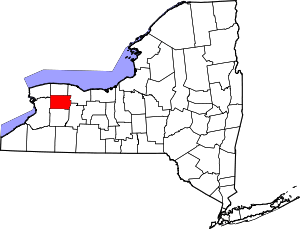 | |
| Towns | ||
| Villages | ||
| CDP |
| |
| Hamlets | ||
| Indian reservation | ||
| Footnotes | ‡This populated place also has portions in an adjacent county or counties | |
Coordinates: 42°52′34″N 78°01′22″W / 42.87611°N 78.02278°W