Pata, Sulu
| Pata | |
|---|---|
| Municipality | |
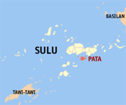 Map of Sulu with Pata highlighted | |
.svg.png) Pata Location within the Philippines | |
| Coordinates: 05°50′N 121°5′E / 5.833°N 121.083°ECoordinates: 05°50′N 121°5′E / 5.833°N 121.083°E | |
| Country | Philippines |
| Region | Autonomous Region in Muslim Mindanao (ARMM) |
| Province | Sulu |
| District | 2nd district of Sulu |
| Barangays | 14 |
| Government[1] | |
| • Mayor | Anton Burahan |
| Population (2010)[2] | |
| • Total | 22,163 |
| Time zone | PST (UTC+8) |
| ZIP code | 7405 |
| Dialing code | +63 (0)68 |
| Income class | 5th |
Pata is a fifth class municipality in the province of Sulu, Philippines. According to the 2010 census, it has a population of 22,163 people.[2]
Barangays
Pata is politically subdivided into 14 barangays.[2]
- Andalan
- Daungdong
- Kamawi
- Kanjarang
- Kayawan (Pob.)
- Kiput
- Likud
- Luuk-tulay
- Niog-niog
- Patian
- Pisak-pisak
- Saimbangon
- Sangkap
- Timuddas
Demographics
| Population census of Pata | ||
|---|---|---|
| Year | Pop. | ±% p.a. |
| 1990 | 9,244 | — |
| 1995 | 10,065 | +1.61% |
| 2000 | 11,791 | +3.45% |
| 2007 | 20,095 | +7.63% |
| 2010 | 14,918 | −10.27% |
| Source: National Statistics Office[2] | ||
References
- ↑ "Official City/Municipal 2013 Election Results". Intramuros, Manila, Philippines: Commission on Elections (COMELEC). 1 July 2013. Retrieved 5 September 2013.
- 1 2 3 4 "Total Population by Province, City, Municipality and Barangay: as of May 1, 2010" (PDF). 2010 Census of Population and Housing. National Statistics Office. Retrieved 27 August 2014.
External links
- Philippine Standard Geographic Code
- Philippine Census Information
- Local Governance Performance Management System
 |
Talipao / Panglima Estino Tutu Bay |
Kalingalan Caluang Tutu Bay |
| |
| Sulu Sea | |
Celebes Sea | ||
| ||||
| | ||||
| Tapul | Celebes Sea |
Jolo (capital) | |
| Municipalities | |
This article is issued from Wikipedia - version of the 11/1/2016. The text is available under the Creative Commons Attribution/Share Alike but additional terms may apply for the media files.