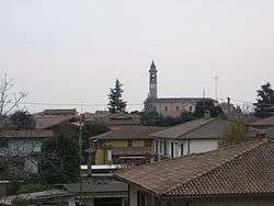
Palosco
| Palosco | |
|---|---|
| Comune | |
| Comune di Palosco | |
|
Palosco | |
 Palosco Location of Palosco in Italy | |
| Coordinates: 45°35′N 9°50′E / 45.583°N 9.833°ECoordinates: 45°35′N 9°50′E / 45.583°N 9.833°E | |
| Country | Italy |
| Region | Lombardy |
| Province / Metropolitan city | Province of Bergamo (BG) |
| Area | |
| • Total | 10.4 km2 (4.0 sq mi) |
| Elevation | 157 m (515 ft) |
| Population (Dec. 2004) | |
| • Total | 5,353 |
| • Density | 510/km2 (1,300/sq mi) |
| Demonym(s) | Paloschesi |
| Time zone | CET (UTC+1) |
| • Summer (DST) | CEST (UTC+2) |
| Postal code | 24050 |
| Dialing code | 035 |
Palosco is a comune (municipality) in the Province of Bergamo in the Italian region of Lombardy, located about 50 kilometres (31 mi) east of Milan and about 20 kilometres (12 mi) southeast of Bergamo. As of 31 December 2004, it had a population of 5,353 and an area of 10.4 square kilometres (4.0 sq mi).[1]
Palosco borders the following municipalities: Bolgare, Calcinate, Cividate al Piano, Martinengo, Mornico al Serio, Palazzolo sull'Oglio, Pontoglio, Telgate.
The surnames Paloschi y Palloschi are believed to be toponyms for Palosco (Palösch in dialetto bergamasco
Demographic evolution

References
This article is issued from Wikipedia - version of the 8/16/2016. The text is available under the Creative Commons Attribution/Share Alike but additional terms may apply for the media files.