Paglat, Maguindanao
| Paglat | |
|---|---|
| Municipality | |
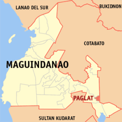 Location in Maguindanao | |
.svg.png) Paglat Location within the Philippines | |
| Coordinates: 6°42′0″N 124°47′0″E / 6.70000°N 124.78333°ECoordinates: 6°42′0″N 124°47′0″E / 6.70000°N 124.78333°E | |
| Country |
|
| Region | Autonomous Region in Muslim Mindanao (ARMM) |
| Province | Maguindanao |
| Established | July 19, 2001 |
| Barangays | 8 |
| Government[1] | |
| • Mayor | Zulaika Pendatun Langkuno |
| Area | |
| • Total | 177.74 km2 (68.63 sq mi) |
| Population (2010) | |
| • Total | 11,207 |
| • Density | 63/km2 (160/sq mi) |
| Time zone | PST (UTC+8) |
| ZIP code | 9618 |
| Dialing code | +63 (0)64 |
| Income class | 5th |
Paglat is a 5th class municipality in the province of Maguindanao, Philippines. According to the 2010 census, it has a population of 11,207 people in 5,543 households.
It was created under Muslim Mindanao Autonomy Act No. 112 on July 19, 2001, carved out of the municipality of General S.K. Pendatun.[2]
The first appointed mayor was Bai Zulaika Pendatun-Langkuno, however, her appointment was recalled by then ARMM Governor Nur Misuari to give way for her cousin Datu Conte Mangelen, son of the then Congressman Datu Luminog Mangelen of Cotabato Province.
Barangays
Paglat is politically subdivided into 8 barangays.
- Campo
- Damakling
- Damalusay
- Kakal
- Paglat
- Salam
- Tual
- Upper Idtig
Demographics
| Population census of Paglat | ||
|---|---|---|
| Year | Pop. | ±% p.a. |
| 2007 | 23,432 | — |
| 2010 | 11,207 | −23.54% |
| Source: National Statistics Office[3] | ||
References
- ↑ "Official City/Municipal 2013 Election Results". Intramuros, Manila, Philippines: Commission on Elections (COMELEC). 1 July 2013. Retrieved 5 September 2013.
- ↑ "Muslim Mindanao Autonomy Act No. 112; An Act Creating Municipality of Paglat in the Province of Maguindanao, Authorizing the Municipality of Gen. S. K. Pendatun and Province of Maguindanao to Appropriate Funds Therefor" (PDF). Regional Legislative Assembly, Autonomous Region in Muslim Mindanao. Retrieved 27 January 2016.
- ↑ "Total Population by Province, City, Municipality and Barangay: as of May 1, 2010". 2010 Census of Population and Housing. National Statistics Office. Retrieved 6 October 2013.
External links
- MMA Act No. 112: An Act Creating Municipality of Paglat in the Province of Maguindanao
- Philippine Standard Geographic Code
- Philippine Census Information
- Local Governance Performance Management System
 |
Pagalungan | | ||
| Gen. S. K. Pendatun | |
Tulunan, Cotabato | ||
| ||||
| | ||||
| Gen. S. K. Pendatun |
This article is issued from Wikipedia - version of the 11/1/2016. The text is available under the Creative Commons Attribution/Share Alike but additional terms may apply for the media files.