Otadaonanis River
| Otadaonanis River | |
| River | |
| Country | Canada |
|---|---|
| Province | Ontario |
| Region | Northwestern Ontario |
| District | Kenora |
| Part of | James Bay drainage basin |
| Source | |
| - elevation | 73 m (240 ft) |
| - coordinates | 51°47′37″N 83°18′28″W / 51.79361°N 83.30778°W |
| Mouth | Kapiskau River |
| - elevation | 6 m (20 ft) |
| - coordinates | 52°45′50″N 82°04′35″W / 52.76389°N 82.07639°WCoordinates: 52°45′50″N 82°04′35″W / 52.76389°N 82.07639°W |
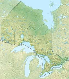 Location of the river mouth in Ontario | |
The Otadaonanis River is a river in northeastern Kenora District in northwestern Ontario, Canada.[1] It is in the James Bay drainage basin and is a right tributary of the Kapiskau River.
The Otadaonanis River begins on gravel and flows northnortheast to its mouth at the Kapiskau River, 7.5 kilometres (4.7 mi) upstream of the latter river's mouth at James Bay.
References
- ↑ "Otadaonanis River". Geographical Names Data Base. Natural Resources Canada. Retrieved 2016-04-24.
Other map sources:
- "Otadaonanis River" at Atlas of Canada. Accessed 2016-04-24.
- Map 18 (PDF) (Map). 1 : 1,600,000. Official road map of Ontario. Ministry of Transportation of Ontario. 2014. Retrieved 2016-04-20.
This article is issued from Wikipedia - version of the 4/25/2016. The text is available under the Creative Commons Attribution/Share Alike but additional terms may apply for the media files.