Eastergoa
Eastergoa (also Ostergau, Ostergo, or Oostergo) was one of the seven areas and one of the three gaue that lay within the borders of the today's Frisian province of Friesland in The Netherlands.
Area
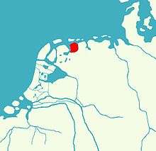
On its west side Eastergoa was bordered by the Middelsee with Westergoa on the other side of the water. To the south the Alde Leppedyk and the Boarn were the border with Bornegoa, and later with Sânwâlden. To the east it was bordered by the lauwers, the lauwerzee and the Westerkwartier of the Ommelanden, nowadays the western side of the province of Groningen.
1200
The whole of this area belonged to Wininge and Achtkarspelen, that was by then still a part of Eastergoa. Round 1200 Wininge existed out of Dantumadeel, Dongeradeel and Ferwerderadeel in the north and Idaarderadeel, Leeuwarderadeel and Tytsjerksteradeel in the south. Round 1250 it was split into two parts called the "Noardlike njoggen" (Northern nine) and the "Sudlike njoggen" (Southern nine).
1500
Round 1500 the parts further fell apart and so Eastergoa was split into two cities, Leeuwarden and Dokkum and eleven grietenijen (or municipalities), Achtkarspelen, Dantumadiel, Oostdongeradeel, Ferwerderadeel, Idaarderadeel, Leeuwarderadeel, Kollumerland, Rauwerderhem, Smallingerland, Tytsjerksteradeel and Westdongeradeel.
The eleven grietenijen of Eastergoa:
- Ljouwerteradeel
- Ferwerderadeel
- Westdongeradeel
- Oostdongeradeel
- Kollumerland
- Achtkarspelen
- Dantumadeel
- Tytsjerksteradeel
- Smellingerland
- Idaarderadiel
- Rauwerderhem
The two cities:
- Lw: Leeuwarden
- D: Dokkum