Osseo, Wisconsin
| Osseo, Wisconsin | |
|---|---|
| City | |
 | |
 Location of Osseo, Wisconsin | |
| Coordinates: 44°34′42″N 91°13′6″W / 44.57833°N 91.21833°WCoordinates: 44°34′42″N 91°13′6″W / 44.57833°N 91.21833°W | |
| Country | United States |
| State | Wisconsin |
| County | Trempealeau |
| Area[1] | |
| • Total | 2.09 sq mi (5.41 km2) |
| • Land | 2.06 sq mi (5.34 km2) |
| • Water | 0.03 sq mi (0.08 km2) |
| Elevation[2] | 958 ft (292 m) |
| Population (2010)[3] | |
| • Total | 1,701 |
| • Estimate (2012[4]) | 1,712 |
| • Density | 825.7/sq mi (318.8/km2) |
| Time zone | Central (CST) (UTC-6) |
| • Summer (DST) | CDT (UTC-5) |
| Area code(s) | 715 & 534 |
| FIPS code | 55-60575[5] |
| GNIS feature ID | 1570879[2] |
Osseo is a city located in Trempealeau County, Wisconsin, at the confluence of the North and South Forks of the Buffalo River. The population was 1,701 at the 2010 census.
Geography
Osseo is located at 44°34'42" North, 91°13'6" West (44.578306, -91.218273).[6]
According to the United States Census Bureau, the city has a total area of 2.09 square miles (5.41 km2), of which, 2.06 square miles (5.34 km2) is land and 0.03 square miles (0.08 km2) is water.[1]
Demographics
| Historical population | |||
|---|---|---|---|
| Census | Pop. | %± | |
| 1880 | 149 | — | |
| 1900 | 472 | — | |
| 1910 | 548 | 16.1% | |
| 1920 | 802 | 46.4% | |
| 1930 | 933 | 16.3% | |
| 1940 | 1,105 | 18.4% | |
| 1950 | 1,126 | 1.9% | |
| 1960 | 1,144 | 1.6% | |
| 1970 | 1,356 | 18.5% | |
| 1980 | 1,474 | 8.7% | |
| 1990 | 1,551 | 5.2% | |
| 2000 | 1,669 | 7.6% | |
| 2010 | 1,701 | 1.9% | |
| Est. 2015 | 1,703 | [7] | 0.1% |
2010 census
As of the census[3] of 2010, there were 1,701 people, 737 households, and 444 families residing in the city. The population density was 825.7 inhabitants per square mile (318.8/km2). There were 786 housing units at an average density of 381.6 per square mile (147.3/km2). The racial makeup of the city was 97.6% White, 0.1% African American, 0.9% Native American, 0.1% Asian, 0.6% from other races, and 0.6% from two or more races. Hispanic or Latino of any race were 1.6% of the population.
There were 737 households of which 32.4% had children under the age of 18 living with them, 44.6% were married couples living together, 11.3% had a female householder with no husband present, 4.3% had a male householder with no wife present, and 39.8% were non-families. 33.6% of all households were made up of individuals and 17.3% had someone living alone who was 65 years of age or older. The average household size was 2.31 and the average family size was 2.96.
The median age in the city was 38.5 years. 26% of residents were under the age of 18; 7.4% were between the ages of 18 and 24; 25.6% were from 25 to 44; 23.5% were from 45 to 64; and 17.5% were 65 years of age or older. The gender makeup of the city was 47.5% male and 52.5% female.
2000 census
As of the census[5] of 2000, there were 1,669 people, 721 households, and 451 families residing in the city. The population density was 809.5 people per square mile (312.8/km²). There were 761 housing units at an average density of 369.1 per square mile (142.6/km²). The racial makeup of the city was 99.28% White, 0.06% African American, 0.36% Native American, 0.06% Asian, 0.00% Pacific Islander, 0.00% from other races, and 0.24% from two or more races. 0.36% of the population were Hispanic or Latino of any race.
There were 721 households out of which 28.7% had children under the age of 18 living with them, 49.7% were married couples living together, 9.4% had a female householder with no husband present, and 37.4% were non-families. 32.6% of all households were made up of individuals and 19.0% had someone living alone who was 65 years of age or older. The average household size was 2.25 and the average family size was 2.84.
In the city the population was spread out with 23.9% under the age of 18, 7.8% from 18 to 24, 26.5% from 25 to 44, 18.7% from 45 to 64, and 23.1% who were 65 years of age or older. The median age was 39 years. For every 100 females there were 87.3 males. For every 100 females age 18 and over, there were 82.2 males.
The median income for a household in the city was $34,493, and the median income for a family was $40,819. Males had a median income of $28,934 versus $21,838 for females. The per capita income for the city was $18,512. 5.7% of the population and 2.9% of families were below the poverty line. 6.3% of those under the age of 18 and 7.7% of those 65 and older were living below the poverty line.
Notable people
- Steve Gunderson, former Republican congressman.[9]
- James L. Linderman, Wisconsin State Assemblyman[10]
- Tom Lomsdahl, Wisconsin State Assemblyman[11]
References
- 1 2 "US Gazetteer files 2010". United States Census Bureau. Retrieved 2012-11-18.
- 1 2 "US Board on Geographic Names". United States Geological Survey. 2007-10-25. Retrieved 2008-01-31.
- 1 2 "American FactFinder". United States Census Bureau. Retrieved 2012-11-18.
- ↑ "Population Estimates". United States Census Bureau. Retrieved 2013-06-24.
- 1 2 "American FactFinder". United States Census Bureau. Retrieved 2008-01-31.
- ↑ "US Gazetteer files: 2010, 2000, and 1990". United States Census Bureau. 2011-02-12. Retrieved 2011-04-23.
- ↑ "Annual Estimates of the Resident Population for Incorporated Places: April 1, 2010 to July 1, 2015". Retrieved July 2, 2016.
- ↑ "Census of Population and Housing". Census.gov. Retrieved June 4, 2015.
- ↑ Favorite excels in moderation
- ↑ JAMES L. LINDERMAN
- ↑ 'Wisconsin Blue Book 1937,' Biographical Sketch of Tom Lomsdahl, pg. 67
External links
Municipalities and communities of Trempealeau County, Wisconsin, United States | ||
|---|---|---|
| Cities | 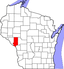 | |
| Villages | ||
| Towns | ||
| CDP | ||
| Unincorporated communities | ||
| Ghost towns | ||