Ortonville, Minnesota
| Ortonville, Minnesota | |
|---|---|
| City | |
|
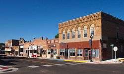
Ortonville's historic downtown | |
 Location of Ortonville within Big Stone County, Minnesota | |
| Coordinates: 45°18′21″N 96°26′38″W / 45.30583°N 96.44389°W | |
| Country | United States |
| State | Minnesota |
| Counties | Big Stone |
| Area[1] | |
| • Total | 3.56 sq mi (9.22 km2) |
| • Land | 3.51 sq mi (9.09 km2) |
| • Water | 0.05 sq mi (0.13 km2) |
| Elevation | 1,017 ft (310 m) |
| Population (2010)[2] | |
| • Total | 1,916 |
| • Estimate (2013)[3] | 1,856 |
| • Density | 545.9/sq mi (210.8/km2) |
| Time zone | Central (CST) (UTC-6) |
| • Summer (DST) | CDT (UTC-5) |
| ZIP code | 56278 |
| Area code(s) | 320 |
| FIPS code | 27-48706[4] |
| GNIS feature ID | 0649005[5] |
| Website | City of Ortonville |

Ortonville is a city in Big Stone and Lac qui Parle counties in the U.S. state of Minnesota at the southern tip of Big Stone Lake, along the border with South Dakota. The population was 1,916 at the 2010 census.[6] It is the county seat of Big Stone County.[7] Big Stone Lake State Park is nearby.
History
Ortonville was platted in 1872 by Cornelius Knute Orton, and named for him.[8] Ortonville was incorporated as a city in 1881.[8]
Geography
According to the United States Census Bureau, the city has a total area of 3.56 square miles (9.22 km2), of which 3.51 square miles (9.09 km2) is land and 0.05 square miles (0.13 km2) is water.[1]
U.S. Highways 12 and 75 and Minnesota State Highway 7 are three of the main routes in the city.
Demographics
| Historical population | |||
|---|---|---|---|
| Census | Pop. | %± | |
| 1890 | 768 | — | |
| 1900 | 1,247 | 62.4% | |
| 1910 | 1,774 | 42.3% | |
| 1920 | 1,758 | −0.9% | |
| 1930 | 2,017 | 14.7% | |
| 1940 | 2,469 | 22.4% | |
| 1950 | 2,577 | 4.4% | |
| 1960 | 2,674 | 3.8% | |
| 1970 | 2,665 | −0.3% | |
| 1980 | 2,550 | −4.3% | |
| 1990 | 2,205 | −13.5% | |
| 2000 | 2,158 | −2.1% | |
| 2010 | 1,916 | −11.2% | |
| Est. 2015 | 1,815 | [9] | −5.3% |
| U.S. Decennial Census[10] 2013 Estimate[3] | |||
2010 census
As of the census[2] of 2010, there were 1,916 people, 884 households, and 509 families residing in the city. The population density was 545.9 inhabitants per square mile (210.8/km2). There were 1,090 housing units at an average density of 310.5 per square mile (119.9/km2). The racial makeup of the city was 97.0% White, 0.3% African American, 0.6% Native American, 0.1% Asian, 0.7% from other races, and 1.3% from two or more races. Hispanic or Latino of any race were 1.0% of the population.
There were 884 households of which 22.5% had children under the age of 18 living with them, 45.5% were married couples living together, 8.7% had a female householder with no husband present, 3.4% had a male householder with no wife present, and 42.4% were non-families. 38.6% of all households were made up of individuals and 21.2% had someone living alone who was 65 years of age or older. The average household size was 2.07 and the average family size was 2.71.
The median age in the city was 49.8 years. 19.7% of residents were under the age of 18; 6.2% were between the ages of 18 and 24; 18.5% were from 25 to 44; 26.7% were from 45 to 64; and 28.8% were 65 years of age or older. The gender makeup of the city was 46.5% male and 53.5% female.
2000 census
As of the census[4] of 2000, there were 2,158 people, 923 households, and 594 families residing in the city. The population density was 635.8 people per square mile (245.8/km²). There were 1,125 housing units at an average density of 331.4 per square mile (128.1/km²). The racial makeup of the city was 97.68% White, 0.42% African American, 0.88% Native American, 0.09% Asian, 0.28% from other races, and 0.65% from two or more races. Hispanic or Latino of any race were 0.56% of the population.
There were 923 households out of which 28.1% had children under the age of 18 living with them, 54.0% were married couples living together, 8.0% had a female householder with no husband present, and 35.6% were non-families. 33.6% of all households were made up of individuals and 20.4% had someone living alone who was 65 years of age or older. The average household size was 2.25 and the average family size was 2.88.
In the city the population was spread out with 23.9% under the age of 18, 5.1% from 18 to 24, 20.2% from 25 to 44, 24.6% from 45 to 64, and 26.1% who were 65 years of age or older. The median age was 45 years. For every 100 females there were 84.6 males. For every 100 females age 18 and over, there were 79.8 males.
The median income for a household in the city was $30,614, and the median income for a family was $39,375. Males had a median income of $30,590 versus $20,179 for females. The per capita income for the city was $17,132. About 7.2% of families and 9.2% of the population were below the poverty line, including 9.5% of those under age 18 and 10.1% of those age 65 or over.
Education
Public schools in independent district 2903 include Ortonville Secondary School and James Knoll Elementary School. The schools are housed in one building, making the public education in Ortonville K-12. The athletic teams in Ortonville are called the Trojans, and the school's colors are orange and black. There are no private schools in this district.[11]
The Ortonville Public Library is a part of the Pioneerland Library System.[12]
There is no University in Ortonville, but high school students are able to take college level courses through the public high school via the College in the Schools program.
Media
AM radio
| AM radio stations | |||||
|---|---|---|---|---|---|
| Frequency | Call sign | Name | Format | Owner | City |
| 1350 AM | KDIO | Real Country | Country | Armada Media | Ortonville |
FM radio
| FM radio stations | ||||||
|---|---|---|---|---|---|---|
| Frequency | Call sign | Name | Format | Owner | Target city/market | City of license |
| 101.5 FM | KCGN | Praise FM | Contemporary Christian | Christian Heritage Broadcasting | Ortonville | Ortonville |
| 106.3 FM | KPHR | Power 106.3 | Classic Rock | Armada Media | Watertown | Ortonville |
References
- 1 2 "US Gazetteer files 2010". United States Census Bureau. Retrieved 2012-11-13.
- 1 2 "American FactFinder". United States Census Bureau. Retrieved 2012-11-13.
- 1 2 "Population Estimates". United States Census Bureau. Retrieved March 25, 2015.
- 1 2 "American FactFinder". United States Census Bureau. Retrieved 2008-01-31.
- ↑ "US Board on Geographic Names". United States Geological Survey. 2007-10-25. Retrieved 2008-01-31.
- ↑ "2010 Census Redistricting Data (Public Law 94-171) Summary File". American FactFinder. U.S. Census Bureau, 2010 Census. Retrieved 23 April 2011.
- ↑ "Find a County". National Association of Counties. Retrieved 2011-06-07.
- 1 2 Upham, Warren (1920). Minnesota Geographic Names: Their Origin and Historic Significance. Minnesota Historical Society. p. 55.
- ↑ "Annual Estimates of the Resident Population for Incorporated Places: April 1, 2010 to July 1, 2015". Retrieved July 2, 2016.
- ↑ "U.S. Decennial Census". Census.gov. Retrieved March 25, 2015.
- ↑ "Ortonville Public School". www.ortonville.k12.mn.us. Retrieved 2016-05-28.
- ↑ "Ortonville Public Library". www.ortonville.lib.mn.us. Retrieved 2016-05-28.
External links
 Media related to Ortonville, Minnesota at Wikimedia Commons
- City Website
Municipalities and communities of Big Stone County, Minnesota, United States | ||
|---|---|---|
| Cities |  | |
| Townships | ||
| Unincorporated communities | ||
| Footnotes | ‡This populated place also has portions in an adjacent county or counties | |
Municipalities and communities of Lac qui Parle County, Minnesota, United States | ||
|---|---|---|
| Cities |  | |
| Townships | ||
| Unincorporated community | ||
| Footnotes | ‡This populated place also has portions in an adjacent county or counties | |
Coordinates: 45°18′17″N 96°26′41″W / 45.30472°N 96.44472°W