Oosterzele
| Oosterzele | |||
|---|---|---|---|
| Municipality | |||
|
Church of Landskouter (2008) | |||
| |||
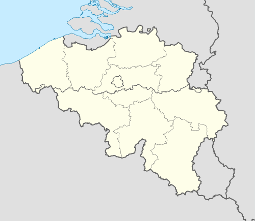 Oosterzele Location in Belgium | |||
|
Location of Oosterzele in East Flanders  | |||
| Coordinates: 50°57′N 03°48′E / 50.950°N 3.800°ECoordinates: 50°57′N 03°48′E / 50.950°N 3.800°E | |||
| Country | Belgium | ||
| Community | Flemish Community | ||
| Region | Flemish Region | ||
| Province | East Flanders | ||
| Arrondissement | Ghent | ||
| Government | |||
| • Mayor | Johan Van Durme(CD&V/N-VA) | ||
| • Governing party/ies | CD&V/N-VA | ||
| Area | |||
| • Total | 43.12 km2 (16.65 sq mi) | ||
| Population (1 January 2016)[1] | |||
| • Total | 13,545 | ||
| • Density | 310/km2 (810/sq mi) | ||
| Postal codes | 9860 | ||
| Area codes | 09 | ||
| Website | www.oosterzele.be | ||


Oosterzele (Dutch pronunciation: [ˈoːstərzeːlə]) is a municipality located in the Flemish province of East Flanders, in Belgium. The municipality comprises the towns of Balegem, Gijzenzele, Landskouter, Moortsele, Oosterzele proper and Scheldewindeke. On January 1, 2006, Oosterzele had a total population of 13,172. The total area is 43.12 km² which gives a population density of 305 inhabitants per km². Its twin town is Oberkirch in Germany.
Geography
Oosterzele is subdivided into 6 sub-municipalities:
| # | Deelgemeentes | Area (km²) | Population | Population density |
|---|---|---|---|---|
| I | Oosterzele | |||
| II | Balegem | 12,02 | ||
| III | Scheldewindeke | 11,84 | ||
| IV | Moortsele | 3,64 | ||
| V | Landskouter | |||
| VI | Gijzenzele | 1,87 | ||

Famous inhabitants
- Els De Temmerman, journalist, activist
- Johan Van Hecke, politician
- Gustaaf Joos, Roman Catholic cardinal
- Frans Van De Velde (1909-2002), missionary
- Gerard Vekeman (1933), poet
- Walter Muls (1961), politician
- Tom De Sutter (1985), football player
- Johan Taeldeman, linguist, dialectologist, professor-emeritus UGent
References
- ↑ Population per municipality as of 1 January 2016 (XLS; 397 KB)
External links
 Media related to Oosterzele at Wikimedia Commons
- (Dutch) Official website (Dutch)
 |
Melle | Wetteren | | |
| Merelbeke Gavere |
|
Sint-Lievens-Houtem | ||
| ||||
| | ||||
| Zottegem |

This article is issued from Wikipedia - version of the 12/1/2016. The text is available under the Creative Commons Attribution/Share Alike but additional terms may apply for the media files.