Old Town College Park
|
Old Town College Park | |
|
Calvert Road in the district, August 2014 | |
  | |
| Location | Roughly bounded by Yale, & Columbia Aves., Calvert Rd., & UM Campus, College Park, Maryland |
|---|---|
| Coordinates | 38°57′59″N 76°56′12″W / 38.96639°N 76.93667°WCoordinates: 38°57′59″N 76°56′12″W / 38.96639°N 76.93667°W |
| Area | 120 acres (49 ha) |
| Architect | Johnson and Curriden; Cutler, Henry Wright; Ross, R. Webster |
| Architectural style | Federal, Queen Anne |
| MPS | Historic Residential Suburbs in the United States, 1830-1960 |
| NRHP Reference # | 12000993[1] |
| Added to NRHP | December 4, 2012 |
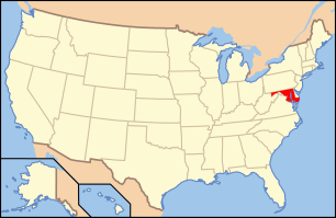
Old Town is an historic neighborhood of College Park, Maryland. It is roughly bounded by the University of Maryland campus, the B&O Railroad tracks, and US Route 1. The area was platted out in 1889, and built out over the next several decades, its developers seeking to attract commuters to Baltimore and Washington, DC, and individuals affiliated with the Maryland Agricultural College (as the school was then known). Most of the neighborhood is residential, with American Foursquare and Cape style housing predominating. Closer to the university campus, the developers built garden-style apartment houses and other types of housing to cater to the academic community. The major non-residential structures are a Gothic Revival church, and a modern post office and Washington Metro station.[2]
The neighborhood was listed on the National Register of Historic Places in 2012.[1]
References
- 1 2 "National Register of Historic Places Listings". Weekly List of Actions Taken on Properties: 12/03/12 through 12/07/12. National Park Service. 2012-12-14.
- ↑ Laura V. Trieschmann and Robin Weidlich (April 2006). "National Register of Historic Places Registration: Old Town College Park" (PDF). Maryland Historical Trust. Retrieved 2015-08-01.
External links
- Old Town College Park Historic District, Prince George's County, Inventory No.: PG:66-42, including undated photo, at Maryland Historical Trust website
- Boundary Map of the Old Town College Park Historic District, Prince George's County, at Maryland Historical Trust


