Olangchung Gola
| Olangchung Gola ओलाङ्चुङ गोला | |
|---|---|
| Village development committee | |
 Olangchung Gola Location in Nepal | |
| Coordinates: 27°46′01″N 87°48′54″E / 27.767°N 87.815°ECoordinates: 27°46′01″N 87°48′54″E / 27.767°N 87.815°E | |
| Country |
|
| Zone | Mechi Zone |
| District | Taplejung District |
| Population (2011) | |
| • Total | 239 |
| Time zone | Nepal Time (UTC+5:45) |
| Postal code | 57508 |
| Area code(s) | 024 |
Olangchung Gola is a village development committee in the Himalayas of Taplejung District in the Mechi Zone of north-eastern Nepal. At the time of the 1991 Nepal census it had a population of 422 people living in 82 individual households.[1] According to 2011 Nepal census 239 people live in 62 individual households.[2]
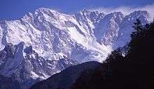
The mountainous area is located in the north-west of the district and borders Tibet, China.
References
- ↑ "Nepal Census 2001". Nepal's Village Development Committees. Digital Himalaya. Retrieved 19 November 2008.
- ↑ Households and population by village development committees/municipalities., Central Bureau of Statistics, Nepal
External links

This article is issued from Wikipedia - version of the 9/16/2015. The text is available under the Creative Commons Attribution/Share Alike but additional terms may apply for the media files.