Ocos
| Ocós | |
|---|---|
 | |
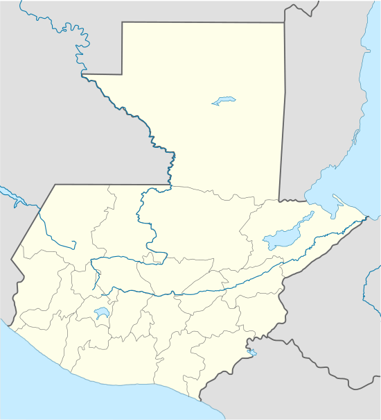 Ocós Location in Guatemala | |
| Coordinates: 14°30′33″N 92°11′36″W / 14.50917°N 92.19333°W | |
| Country | Guatemala |
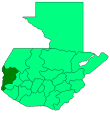
| Department | San Marcos |
| Government | |
| • Mayor (2016–2020) | Aníbal Fausto Maldonado[1] (LIDER) |
| Climate | Aw |
Ocós is a municipality in the San Marcos department of Guatemala. It is situated on the Pacific Ocean coast, very close to the border with Mexico at 4 m altitude and two big rivers: the Suchiate and the Naranjo rivers. On 23 January 2014 it lost about 2/3 of its territory when La Blanca was named the thirtieth San Marcos Department municipality.[2]
History
1897 Quetzaltenango Revolt

In September 1897, after the failure of both the interoceanic railroad and the Central American Expo and the deep economic crisis that Guatemala was facing after the plummeting of both coffee and silver international prices, Quetzaltengo people raised in arms against the decision of present José María Reina Barrios to extend his presidential term until 1902.[lower-alpha 1] A group of rebels, among them a former Secretary of Reina Barrios's cabinet -Próspero Morales-, began to combat on 7 September 1897 attacking San Marcos; after several battles and some gains in Ocos, Coatepeque and Colomba the rebels were definitely defeated on 4 October 1897. As a result, on 23 October 1897, San Pedro Sacatepéquez became the capital of San Marcos Department.[3]
Secession of La Blanca
On 23 January 2014, La Blanca split from Ocos after the Congress of Guatemala approved the separation by 115 of 158 possible. This meant that Ocós lost both 66% of its territory and population.[2]
Climate
Ocós has Tropical savanna climate (Köppen: Aw).
| Climate data for Ocós | |||||||||||||
|---|---|---|---|---|---|---|---|---|---|---|---|---|---|
| Month | Jan | Feb | Mar | Apr | May | Jun | Jul | Aug | Sep | Oct | Nov | Dec | Year |
| Average high °C (°F) | 34.1 (93.4) |
34.4 (93.9) |
35.4 (95.7) |
35.5 (95.9) |
35.1 (95.2) |
33.6 (92.5) |
34.0 (93.2) |
34.1 (93.4) |
33.6 (92.5) |
33.6 (92.5) |
33.7 (92.7) |
33.5 (92.3) |
34.22 (93.6) |
| Daily mean °C (°F) | 26.7 (80.1) |
27.0 (80.6) |
28.3 (82.9) |
29.1 (84.4) |
29.2 (84.6) |
28.3 (82.9) |
28.3 (82.9) |
28.4 (83.1) |
28.1 (82.6) |
28.1 (82.6) |
27.6 (81.7) |
26.8 (80.2) |
27.99 (82.38) |
| Average low °C (°F) | 19.3 (66.7) |
19.7 (67.5) |
21.2 (70.2) |
22.7 (72.9) |
23.4 (74.1) |
23.1 (73.6) |
22.7 (72.9) |
22.7 (72.9) |
22.7 (72.9) |
22.6 (72.7) |
21.6 (70.9) |
20.2 (68.4) |
21.83 (71.31) |
| Average precipitation mm (inches) | 4 (0.16) |
0 (0) |
4 (0.16) |
35 (1.38) |
107 (4.21) |
259 (10.2) |
162 (6.38) |
171 (6.73) |
259 (10.2) |
209 (8.23) |
30 (1.18) |
4 (0.16) |
1,244 (48.99) |
| Source: Climate-Data.org[5] | |||||||||||||
Geographic location
 |
Ayutla, San Marcos Department municipality | Coatepeque, Quetzaltenango Department municipality | | |
| Chiapas, state of México | |
La Blanca municipality[6] | ||
| ||||
| | ||||
| Pacific Ocean[6] |
See also
-
 Guatemala portal
 -
 Geography portal
 - La Aurora International Airport
- Tapachula International Airport
Notes and references
- ↑ Back then, the Panama Canal had not been built yet and Reina Barrios had high hopes on getting international investors interested in the interoceanic railroad, which was the main event for the Central American Expo; unfortunately, due to the economic crisis, and bad budgeting, the government could not complete the railroad and after the failure of the Expo, it had to take drastic austerity measures, that included closing schools.[4]
References
- ↑ "San Marcos elige autoridades municipales". Prensa Libre (in Spanish). Guatemala. 8 September 2015. Retrieved 8 September 2015.
- 1 2 "La Blanca se convirtió ayer en municipio 335". Prensa Libre (in Spanish). Guatemala. 24 January 2014. Retrieved 10 September 2015.
- 1 2 La Ilustración del Pacífico (15 March 1898). "La revolución de septiembre". La Ilustración del Pacífico (in Spanish). Guatemala: Siguere, Guirola y Cía. II (38): 206–208.
- ↑ Arévalo Martínez, Rafael (1945). ¡Ecce Pericles! (in Spanish). Guatemala: Tipografía Nacional.
- ↑ "Climate: Ocós". Climate-Data.org. Retrieved 5 September 2015.
- 1 2 SEGEPLAN. "Municipios del departamento de San Marcos". Secretaría General de Planificación (in Spanish). Archived from the original on 10 July 2015.
External links
 Media related to Ocós, San Marcos at Wikimedia Commons
Coordinates: 14°30′34″N 92°11′36″W / 14.5094°N 92.1933°W