Oakhurst, California
| Oakhurst | |
|---|---|
| census-designated place | |
|
Welcome sign on State Route 41 | |
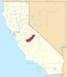
 Location in Madera County and the state of California | |
 Oakhurst Location in the United States | |
| Coordinates: 37°19′41″N 119°38′58″W / 37.32806°N 119.64944°WCoordinates: 37°19′41″N 119°38′58″W / 37.32806°N 119.64944°W[1] | |
| Country |
|
| State |
|
| County | Madera |
| Area[2] | |
| • census-designated place | 6.006 sq mi (15.556 km2) |
| • Land | 5.999 sq mi (15.537 km2) |
| • Water | 0.007 sq mi (0.019 km2) 0.12% |
| Elevation[1] | 2,274 ft (693 m) |
| Population (2010) | |
| • census-designated place | 2,829 |
| • Density | 470/sq mi (180/km2) |
| • Rural[3] | 12,787 |
| Time zone | Pacific (PST) (UTC-8) |
| • Summer (DST) | PDT (UTC-7) |
| ZIP code | 93644 |
| Area code(s) | 559 |
| FIPS code | 06-52764 |
| GNIS feature ID | 277565 |


Oakhurst (formerly Fresno Flats)[4] is a census-designated place (CDP) in Madera County, California, 14 miles (23 km) south of the entrance to Yosemite National Park, in the foothills of the Sierra Nevada mountain range. At the 2010 census, the population was 2,829, down from 2,868 at the 2000 census. According to the Oakhurst Area Chamber of Commerce, the area population was 12,787 at the 2000 census.[3] It is part of the Madera–Chowchilla metropolitan statistical area.
Geography
Oakhurst is located on the Fresno River 3 miles (4.8 km) south-southwest of Yosemite Forks,[4] at an elevation of 2274 feet (693 m).[1] Its coordinates are 37°19′41″N 119°38′58″W / 37.32806°N 119.64944°W.[1] It is located at the junction of state highways 41 and 49, at the southern end of California's Gold Country. Nearby communities include Ahwahnee, Coarsegold and Bass Lake.
According to the United States Census Bureau, the CDP has a total area of 6.006 square miles (15.56 km2), of which 5.999 square miles (15.54 km2) is land and 0.007 sq mi (0.018 km2) (0.12%) is water.
History
The Fresno Flats post office opened in 1873, moved and changed its name to Oakhurst in 1912.[4]
The pioneering computer game developer Sierra On-Line was based in Oakhurst from 1981 to 1999. The company achieved many industry firsts, including the development of the first 3D adventure game (King's Quest, 1984) and one of the first online gaming networks (The Sierra Network, 1989).
Demographics
2010
The 2010 United States Census[5] reported that Oakhurst had a population of 2,829. The population density was 471.0 people per square mile (181.9/km²). The racial makeup of Oakhurst was 2,532 (89.5%) White, 473 (16.7%) Hispanic or Latino, 22 (0.8%) African American, 61 (2.2%) Native American, 44 (1.6%) Asian, 3 (0.1%) Pacific Islander, 66 (2.3%) from other races, and 101 (3.6%) from two or more races.
The Census reported that 2,772 people (98.0% of the population) lived in households, 0 (0%) lived in non-institutionalized group quarters, and 57 (2.0%) were institutionalized.
There were 1,226 households, out of which 301 (24.6%) had children under the age of 18 living in them, 515 (42.0%) were opposite-sex married couples living together, 153 (12.5%) had a female householder with no husband present, 76 (6.2%) had a male householder with no wife present. There were 61 (5.0%) unmarried opposite-sex partnerships, and 14 (1.1%) same-sex married couples or partnerships. 386 households (31.5%) were made up of individuals and 216 (17.6%) had someone living alone who was 65 years of age or older. The average household size was 2.26. There were 744 families (60.7% of all households); the average family size was 2.80.
The population was spread out with 526 people (18.6%) under the age of 18, 228 people (8.1%) aged 18 to 24, 567 people (20.0%) aged 25 to 44, 758 people (26.8%) aged 45 to 64, and 750 people (26.5%) who were 65 years of age or older. The median age was 48.4 years. For every 100 females there were 90.5 males. For every 100 females age 18 and over, there were 86.2 males.
There were 1,379 housing units at an average density of 229.6 per square mile (88.6/km²), of which 691 (56.4%) were owner-occupied, and 535 (43.6%) were occupied by renters. The homeowner vacancy rate was 3.5%; the rental vacancy rate was 5.5%. 1,485 people (52.5% of the population) lived in owner-occupied housing units and 1,287 people (45.5%) lived in rental housing units.
2000
As of the 2000 census,[6] there were 2868 people, 1,250 households, and 773 families residing in the CDP. The population density was 484.8 people per square mile (187.1/km²). There were 1,380 housing units at an average density of 233.3 per square mile (90.0/km²). The racial makeup of the CDP was 87.62% White, 0.45% African American, 2.93% Native American, 1.05% Asian, 0.10% Pacific Islander, 6.03% from other races, and 1.81% from two or more races. Hispanic or Latino of any race were 9.94% of the population.
There were 1,250 households out of which 23.7% had children under 18 living with them, 44.6% were married couples living together, 12.4% had a female householder with no husband present, and 38.1% were non-families. 31.3% of all households were made up of individuals and 19.7% had someone living alone who was 65 years of age or older. The average household size was 2.21 and the average family size was 2.72.
In the CDP the population was spread out with 19.7% under the age of 18, 7.9% from 18 to 24, 21.5% from 25 to 44, 24.2% from 45 to 64, and 26.7% who were 65 years of age or older. The median age was 46 years. For every 100 females there were 86.0 males. For every 100 females age 18 and over, there were 81.1 males.
The median income for a household in the CDP was $27,679, and the median income for a family was $35,495. Males had a median income of $36,979 versus $21,111 for females. The per capita income for the CDP was $16,851. About 12.8% of families and 17.3% of the population were below the poverty line, including 27.2% of those under age 18 and 10.9% of those age 65 or over.
Government and politics
In the California State Legislature, Oakhurst is in the 8th Senate District, represented by Republican Tom Berryhill, and in the 5th Assembly District, represented by Republican Frank Bigelow.[7]
In the United States House of Representatives, Oakhurst is in California's 4th congressional district, represented by Republican Tom McClintock.[8]
On February 5, 2008 residents voted against Measure C, a proposal to incorporate Oakhurst as a city.
Honorary Mayor
Since Oakhurst is not incorporated, it does not have an official mayor. However, an Honorary Mayor is announced each year. To win the race, the candidates raise money for their favorite non-profit organization through various events. Each dollar raised during the campaign counts as a vote; the candidate with the most votes wins the title and duties of the Honorary Mayor of Oakhurst. Over the years the annual Oakhurst Honorary Mayoral Campaign has brought awareness to and raised hundreds of thousands of dollars for many local charities.
Honorary Mayor winners:
- 2015 Bob Macaulay
- 2014 Mathew Sands
- 2013 Brian Gearhart
- 2012 John K. Burton
- 2011 Rima Runtzel
- 2010 John K. Burton
- 2009 Brian Gearhart
- 2008 Laura Bean
- 2007 J. Carol Graham
- 2006 Brian Gearhart
- 2005 Mary Lou Finley
- 2004 Monika Moulin
- 2003 Sonia Crane
- 2002 Earlene Keller
- 2001 Toni Lagunoff
- 2000 Dennis Fairbanks
- 1999 Matt Walker
- 1998 Bob LeBelle
- 1997 John Hays
- 1996 Gary Pence
Infrastructure
Transportation
Highway 41 connects Oakhurst to Fresno and Yosemite. Highway 49 terminates at Highway 41 in Oakhurst and connects to Mariposa.
Oakhurst is served by the YARTS Highway 41 bus route between Fresno and Yosemite,[9] and by the Madera County Connection bus system, which travels to Madera and Bass Lake.[10]
Utilities
Cable television services for the town of Oakhurst are contracted to Northland Communications.[11]
Sierra Telephone Company, which serves northern Madera County and much of adjoining Mariposa County, is based in Oakhurst.
Notable people
- MLB pitcher Ted Lilly attended Yosemite High School in Oakhurst.
- From Indian Lakes
References
- 1 2 3 4 "Oakhurst". Geographic Names Information System. United States Geological Survey. Retrieved January 11, 2015.
- ↑ "2010 Census Gazetteer Files - Places - California". United States Census Bureau. Retrieved March 26, 2015.
- 1 2 http://www.oakhurstchamber.com/index.php?src=gendocs&ref=AreaStatistics&category=area_statistics
- 1 2 3 Durham, David L. (1998). California's Geographic Names: A Gazetteer of Historic and Modern Names of the State. Clovis, Calif.: Word Dancer Press. p. 810-811. ISBN 1-884995-14-4.
- ↑ "2010 Census Interactive Population Search: CA - Oakhurst CDP". U.S. Census Bureau. Retrieved July 12, 2014.
- ↑ "American FactFinder". United States Census Bureau. Archived from the original on September 11, 2013. Retrieved 2008-01-31.
- ↑ "Statewide Database". UC Regents. Retrieved November 18, 2014.
- ↑ "California's 4th Congressional District - Representatives & District Map". Civic Impulse, LLC.
- ↑ YARTS Highway 41 Bus Schedule
- ↑ "Madera County Connection Schedule Effective April 2, 2014" (PDF). County of Madera. Retrieved 2015-05-27.
- ↑ "Northland Cable TV". Northland Cable TV. 2012-04-27. Retrieved 2013-08-10.
External links
| Wikimedia Commons has media related to People from Madera County, California. |
| Wikivoyage has a travel guide for Oakhurst. |