Novi Grad, Republika Srpska
| Novi Grad Нови Град Bosanski Novi Босански Нови | |
|---|---|
 | |
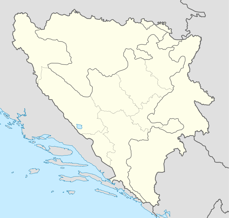 Novi Grad Нови Град Location in Bosnia and Herzegovina | |
| Coordinates: 45°02′53″N 16°22′37″E / 45.048°N 16.377°ECoordinates: 45°02′53″N 16°22′37″E / 45.048°N 16.377°E | |
| Country | Bosnia and Herzegovina |
| Entity | Republika Srpska |
| Area | |
| • Total | 472.72 km2 (182.52 sq mi) |
| Population (2013 census) | |
| • Total | 28,799 |
| • Density | 60,9/km2 (1,580/sq mi) |
| 79220 | +387 052 |
| Website | http://www.opstina-novigrad.com/ |
Novi Grad (Serbian Cyrillic: Нови Град, formerly Bosanski Novi)[1] is a town and municipality in the northern portion of the Republika Srpska entity of Bosnia and Herzegovina. The town is situated on the Una river on the border with Croatia (opposite the town of Dvor). Today, the municipality has a population of about 30,000 people, with 8,500 households. In the town itself, there is a hospital, a post office, a great number of elementary and high schools, a cultural center, banks, and shopping centers. The city was once known as Bosanski Novi (pronounced [bǒsanskiː nôviː]).[2]
Geography
Municipality of Novi Grad is situated in the northwestern part of the Republic of Srpska. Its exact location is 45°53″ longitude and 45°14″ northern latitude. It has an area of 470 km2 (180 sq mi). The municipality lies between the Sana and Una rivers, between the mountains of Grmec and Kozara. The climate is temperate continental.
History
The town was first mentioned in 1280 under the Roman name of Castrum Novum, which, literally translated from Latin, means "new town". In 1895, during Austro-Hungarian rule, the town was officially named Bosanski Novi. At the end of the last decade of the 19th century, Bosanski Novi had 3,300 people with 550 households. There were wooden bridges across the Una and Sana rivers, which the citizens had to guard against the wild spring and fall floods. For that reason, a symbol of the town was built in 1906-Una quay. In 1872, Bosanski Novi was the first municipality to have a train station on the new Bosnian railway, which afforded it significant cultural and economic advantages over any other Krajina [3] municipalities. The first hospital was established around the same time.
From 1929 to 1941, Bosanski Novi was part of the Vrbas Banovina of the Kingdom of Yugoslavia.
After the Bosnian war, Kostajnica was split from the municipality.
Settlements
• Ahmetovci • Blagaj Japra • Blagaj Rijeka • Blatna • Buljuk • Kostajnica • Novi Grad • Cerovica • Crna Rijeka • Čađavica Donja • Čađavica Gornja • Čađavica Srednja • Ćele • Devetaci • Dobrljin • Donje Vodičevo • Donji Agići • Donji Rakani • Gornja Slabinja • Gornje Vodičevo • Gornji Agići • Gornji Rakani • Grabašnica • Grdanovac • Gumnjani • Hozići • Johovica • Jošava • Kalenderi • Kršlje • Kuljani • Lješljani • Mala Krupska Rujiška • Mala Novska Rujiška • Mala Žuljevica • Maslovare • Matavazi • Mazić • Mrakodol • Mraovo Polje • Petkovac • Petrinja • Pobrđani • Podoška • Poljavnice • Prusci • Radomirovac • Rakovac • Rašće • Ravnice • Rudice • Sokolište • Suhača • Svodna • Tavija • Trgovište • Vedovica • Velika Rujiška • Velika Žuljevica • Vitasavci • Zovik
Demographics
1991
In the 1991 Yugoslav census, the municipality of Novi Grad had 41,541 residents,[4] including:
- 25,106 Serbs (60.24%)
- 14,083 Bosniaks (33.69%)
- 1,531 Yugoslavs (3.73%)
- 402 Croats (0.96%)
- 419 others (1.35%)
Economy
The economy is based on a few industries and a number of private firms. Novi Grad has potential in tourism, wood processing, food production and management of water resources.
Sport
There are several active sports organizations in the town, such as football, handball and basketball clubs.
The local football club is FK Sloboda Novi Grad.
Gallery
 Novi Grad
 Vidorijska dzamija
.jpg) Railway station
Railway station
See also
| Wikimedia Commons has media related to Novi Grad. |
Notes
- ↑ the official web site of the municipality, Novi Grad/Нови Град.
- ↑ Mangold (2005:212)
- ↑ Krajina, official name of region
- ↑ Unofficial results of 1991 census
References
- Mangold, Max (2005), Das Aussprachewörterbuch, Duden, ISBN 9783411040667