North Port, Florida
| North Port | ||
|---|---|---|
| City | ||
| ||
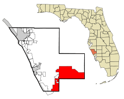 Location in Sarasota County and the state of Florida | ||
| Coordinates: 27°3′58″N 82°10′19″W / 27.06611°N 82.17194°WCoordinates: 27°3′58″N 82°10′19″W / 27.06611°N 82.17194°W | ||
| Country |
| |
| State |
| |
| County | Sarasota | |
| Incorporated | June 20, 1959 | |
| Area | ||
| • Total | 75.6 sq mi (195.7 km2) | |
| • Land | 74.8 sq mi (193.7 km2) | |
| • Water | 0.8 sq mi (2 km2) | |
| Elevation | 10 ft (3 m) | |
| Population (2010) | ||
| • Total | 57,357[1] | |
| Time zone | Eastern (EST) (UTC-5) | |
| • Summer (DST) | EDT (UTC-4) | |
| ZIP codes | 34286-34291 | |
| Area code(s) | 941 | |
| FIPS code | 12-49675[2] | |
| GNIS feature ID | 0294334[3] | |
North Port is a city in southern Sarasota County, Florida, United States. The population was 57,357 at the 2010 census.[1] It is part of the North Port–Bradenton–Sarasota Metropolitan Statistical Area. It was originally developed by General Development Corporation as the northern or Sarasota County part of its Port Charlotte development. GDC dubbed it North Port Charlotte, and it was incorporated under that name through a special act of the Florida Legislature in 1959. By referendum in 1974 the city's residents approved a change to simply North Port to proclaim its separate identity.[4][5]
Geography
North Port is located at 27°03′58″N 82°10′19″W / 27.066004°N 82.172024°W.[6]
North Port is a rapidly growing municipality (circa 2005) containing very large-scale residential subdivisions along with an extensive network of streets. The municipality has annexed nearby locales including the area known as Warm Mineral Springs, the location of a notable artesian spring as well as its own significant residential subdivision.
According to the United States Census Bureau, the city has a total area of 75.5 square miles (196 km2), of which 74.8 square miles (194 km2) is land and 0.8 square miles (2.1 km2) (1.02%) is water.
Little Salt Spring is located within North Port.
Demographics
| Historical population | |||
|---|---|---|---|
| Census | Pop. | %± | |
| 1960 | 178 | — | |
| 1970 | 2,244 | 1,160.7% | |
| 1980 | 6,205 | 176.5% | |
| 1990 | 11,973 | 93.0% | |
| 2000 | 22,797 | 90.4% | |
| 2010 | 57,357 | 151.6% | |
| Est. 2015 | 62,345 | [7] | 8.7% |
As of the census[2] of 2010, there were 57,357 people, 22,431 households, and 16,191 families residing in the city. The population density was 758.7 inhabitants per square mile (293.1/km²). There were 27.986 housing units at an average density of 370.2 per square mile (143.00459887583/km²). The racial makeup of the city was 87.6% White, 7% African American, 0.3% Native American, 1.2% Asian, 0.1% Pacific Islander, 1.7% from other races, and 2.2% from two or more races. Hispanic or Latino of any race were 8.7% of the population.[1]
Of the 22,431 households, 49.6% had children under the age of 18 living with them, 56.3% were married couples living together, 11.2% had a female householder with no husband present, and 27.8% were non-families. 21.6% of all households were made up of individuals and 9.8% had someone living alone who was 65 years of age or older. The average household size was 2.55 and the average family size was 2.95.[1]
In the city the population was spread out with 26.4% under the age of 20, 4.4% from 20 to 24, 24.7% from 25 to 44, 26.5% from 45 to 64, and 1.9% who were 65 years of age or older. The median age was 40.9 years. For every 100 females there were approximately 94 males. For every 100 females age 20 and over, there were approximately 97 males.[1]
As of the census of 2000, there were 22,797 people residing in the city. The racial makeup of the city was 92.67% White, 4.18% African American, 0.23% Native American, 0.50% Asian, 0.01% Pacific Islander, 0.72% from other races, and 1.68% from two or more races. Hispanic or Latino of any race were 3.24% of the population.[9]
As of 2000, the median income for a household in the city was $36,560, and the median income for a family was $40,594. Males had a median income of $28,534 versus $22,135 for females. The per capita income for the city was $16,836. About 5.6% of families and 8.3% of the population were below the poverty line, including 10.0% of those under age 18 and 8.8% of those age 65 or over.
Schools
As of February 12, 2011:[10]
North Port has five elementary schools, one public charter school, two middle schools, one high school, and one college instructional facility. The list is compiled below.
- Toledo Blade Elementary School (K-5)
- Glenallen Elementary School (K-5)
- Cranberry Elementary School (K-5)
- Atwater Elementary School (K-5)
- Lamarque Elementary School (K-5)
- Imagine School at North Port (K-12)
- Heron Creek Middle School (6-8)
- Woodland Middle School (6-8)
- North Port High School (9-12)
- USF Sarasota-Manatee at North Port
References
- 1 2 3 4 5 "North Port city, Florida". Profile of General Population and Housing Characteristics: 2010; 2010 Demographic Profile Data. U.S. Census Bureau.
- 1 2 "American FactFinder". United States Census Bureau. Retrieved 2008-01-31.
- ↑ "US Board on Geographic Names". United States Geological Survey. 2007-10-25. Retrieved 2008-01-31.
- ↑ City of North Port History Book
- ↑ City of North Port Charter, §1.02, City Ordinance 74-5
- ↑ "US Gazetteer files: 2010, 2000, and 1990". United States Census Bureau. 2011-02-12. Retrieved 2011-04-23.
- ↑ "Annual Estimates of the Resident Population for Incorporated Places: April 1, 2010 to July 1, 2015". Retrieved July 2, 2016.
- ↑ "Census of Population and Housing". Census.gov. Retrieved June 4, 2015.
- ↑ 2000 Census of North Port, Florida - CensusViewer
- ↑ North Port, FL : Education
External links
Municipalities and communities of Sarasota County, Florida, United States | ||
|---|---|---|
| Cities |  | |
| Town | ||
| CDPs | ||
| Unincorporated community | ||
| Footnotes | ‡This populated place also has portions in an adjacent county or counties | |