North Kynouria
| North Kynouria Βόρεια Κυνουρία | |
|---|---|
|
Voria Kynouria municipality | |
 North Kynouria | |
| Coordinates: 37°24′N 22°43′E / 37.400°N 22.717°ECoordinates: 37°24′N 22°43′E / 37.400°N 22.717°E | |
| Country | Greece |
| Administrative region | Peloponnese |
| Regional unit | Arcadia |
| Districts | 26 |
| Area | |
| • Municipality | 576.981 km2 (222.774 sq mi) |
| Elevation | 55 m (180 ft) |
| Lowest elevation | 0 m (0 ft) |
| Population (2011)[1] | |
| • Municipality | 10,341 |
| • Municipality density | 18/km2 (46/sq mi) |
| Time zone | EET (UTC+2) |
| • Summer (DST) | EEST (UTC+3) |
| Postal code | 22001 |

North Kynouria or Vóreia Kynouría (Greek: Βόρεια Κυνουρία) is a municipality in Arcadia, Greece. It is located in the eastern part of the regional unit, between the northwestern shores of the Argolic Gulf and northern Laconia. Its land area is 576.981 km².[2] Its population is 10,341 (2011 census). The seat of the municipality is in Astros (pop. 2,408).[3] Its largest other towns or villages are Ágios Andréas (pop. 1,065), Paralio Astros (1,043), Doliana (846), Ágios Pétros (717), Meligoú (684), Korakovoúni (659), Prastós (336) and Kastrí (335).
Subdivisions
The municipality is divided into 26 communities:
- Agia Sofia
- Agios Andreas (Agios Andreas, Arkadiko Chorio, Paralia Agiou Andreou)
- Agios Georgios (Aetochori, Vathia, Melissi)
- Agios Petros (Agios Petros, Moni Malevis, Xirokampi)
- Astros (Astros, Agios Ioannis, Agios Stefanos, Varvogli, Iera Moni Loukous, Chantakia)
- Charadros (Charadros, Agioi Asomatoi)
- Doliana (Ano Doliana, Dragouni, Kato Doliana, Kouvlis, Prosilia, Rouneika)
- Elatos
- Karatoulas Kynourias
- Kastanitsa
- Kastri
- Korakovouni (Korakovouni, Neochori, Oreino Korakovouni)
- Koutroufa
- Meligou (Oreini Meligou, Agia Anastasia, Portes, Cheimerini Meligou)
- Mesorrachi
- Nea Chora
- Oria
- Paralio Astros
- Perdikovrysi
- Platana
- Platanos
- Prastos (Prastos, Agios Panteleimon, Moni Eortakoustis)
- Sitaina
- Stolos (Stolos, Fountoma)
- Vervena (Vervena, Kato Vervena)
- Xiropigado (Xiropigado, Metamorfosi, Plaka)
External links
References
- ↑ "Απογραφή Πληθυσμού - Κατοικιών 2011. ΜΟΝΙΜΟΣ Πληθυσμός" (in Greek). Hellenic Statistical Authority.
- ↑ "Population & housing census 2001 (incl. area and average elevation)" (PDF) (in Greek). National Statistical Service of Greece.
- ↑ Kallikratis law Greece Ministry of Interior (Greek)
| Regional unit of Arcadia | 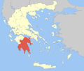 | |
|---|---|---|
| Regional unit of Argolis | ||
| Regional unit of Corinthia | ||
| Regional unit of Laconia | ||
| Regional unit of Messenia | ||
| ||
This article is issued from Wikipedia - version of the 11/15/2016. The text is available under the Creative Commons Attribution/Share Alike but additional terms may apply for the media files.