North Carolina Highway 194
| ||||
|---|---|---|---|---|
 | ||||
| Route information | ||||
| Maintained by NCDOT | ||||
| Length: | 85.5 mi[1] (137.6 km) | |||
| Existed: | 1921 – present | |||
| Tourist routes: |
| |||
| Major junctions | ||||
| South end: |
| |||
| North end: | Rugby Road at the VA state line | |||
| Location | ||||
| Counties: | Avery, Watauga, Ashe | |||
| Highway system | ||||
| ||||

North Carolina Highway 194 (NC 194) is a primary state highway in the state of North Carolina. Primarily in the High Country, it runs from US 19E, in Ingalls, to the Virginia state line, near Helton.
Route description
NC 194 begins in the community of Ingalls going east, on a somewhat curvy stretch of road known as Three Mile Highway, to US 221 (locals going to or from Spruce Pine take a shortcut on Mullin Hill Road). Being the first of three concurrences with US 221, the routes go through the town of Crossnore then separates. NC 194, from Crossnore to Elk Park is relatively calm road (even a passing lane is available for southbound travelers between Newland and Elk Park.
Between Elk Park and Vilas, the route becomes aggressively curvy, as it hugs the banks of the Elk River (between Elk Park and Banner Elk), the Craborchard Creek (from Watauga county line to Valle Crucis), and the Watauga River (in Valle Crucis). While in Banner Elk, the road will pass by the Elk River Airport, Lees–McRae College, and the ski resorts on Beech and Sugar.
From Vilas through Boone, it is overlapped with US 421; passing through the downtown area Boone and ASU. It separates onto Jefferson Road, next to the New Market Shopping Center, and goes through another curvy drive through the community of Todd.
Reconnecting with US 221 in Baldwin, the road is very open and uneventful till they split for the final time in West Jefferson. NC 194 goes through the city of West Jefferson, passing by the only cheese factory in North Carolina. Connecting with NC 88 for a few miles till Warrensville, NC 194 is solo for the last 13.4 miles (21.6 km) to the Virginia state line. In Virginia, it becomes a smaller (no lines) secondary road called Rugby Road, which eventually connects to US 58.
The highway is the northern most primary route in the state.
Scenic byways
NC 194 is part of two scenic byway in the state (indicated by a Scenic Byways sign). Both routes are not recommended for recreational vehicles or buses.[2]
Mission Crossing Byway is an 18 miles (29 km) byway from Elk Park to Vilas, passing through the town of Banner Elk and the communities of Heaton, Balm, and Valle Crucis. The route gets its name from the 1895 mission built in Valle Crucis by the Episcopal Church, today it is used as a camp and conference center. The route is also noted for its back-road feel, a farm built in 1812, and the Mast General Store.[2]
New River Valley Byway is an 32 miles (51 km) byway, split in two sections. The first section (18 miles (29 km)) is traversed by NC 194 from Boone to Baldwin, passing through the community of Todd. The section is noted for its Christmas tree farms, the North Fork New River, a site of an Revolutionary War engagement, and the Todd General Store. The second section is on NC 88, between Jefferson and Laurel Springs.[2]
History

NC 194 is an original state highway that traveled between NC 19, in Woodlawn, and NC 69, in Minneapolis; connecting Altamont and Newland along its routing.[3] In 1923, NC 194 was rerouted north from Newland to NC 69, in Cranberry; its old alignment, which paralleled the ETWN "Tweetsie" Railroad, became Old Toe River Road (SR 1157). In 1924, NC 194 was extended to the Tennessee state line, replacing NC 694. In 1930, NC 194 replaced NC 69 north of Elk Park to US 321/NC 60, in Vilas; its former routing to Tennessee became part of NC 69.[4][5]
In 1932, NC 194 was replaced by US 221/NC 28, between Woodlawn and Crossnore. The following year, NC 194 was re-extended south along US 221/NC 28, through Crossnore and Altamont, then replaced NC 691 to its current southern terminus in Ingalls.[6]
Around 1953, NC 194 was extended from Vilas, along US 421 through Boone, then north replacing an old alignment of US 221 through Todd to Baldwin. Overlapping with US 221 to West Jefferson, it then replaces NC 162 through Warrensville to its current northern terminus at the Virginia state line.[7]
Between 1963-1968, NC 194 was realigned onto new road between Newland and Elk Park, leaving behind Blevins Creek Road (SR 1361).[8] In 1981, US 221/NC 194 was placed on road between Baldwin and West Jefferson, leaving behind Beaver Creek School Road (SR 1248).[9]
North Carolina Highway 691
| |
|---|---|
| Location: | Ingalls–Linville Falls, NC |
| Length: | 4.2 mi[10] (6.8 km) |
| Existed: | 1925–1933 |
North Carolina Highway 691 (NC 691) was established in 1925 as a new primary routing between NC 69, in Ingalls, to NC 194, near Linville Falls. In 1926, NC 691 was truncated further north from Linville Falls, at the east end of Three Mile Highway; the old alignment replaced by NC 194. In 1930, NC 691 was extended north, with a concurrency with US 221, to Twin Oaks; its new alignment replaced part of NC 194 to Crossnore, NC 181 to Pineola, NC 176 to Linville, NC 175 to Blowing Rock and NC 69 between Boone to Twin Oaks.[4] In 1932, NC 691 was reverted to its pre-1930 alignment, with NC 28 replacing it with its former concurrency with US 221. In 1933, NC 691 was decommission with the extension of NC 194 to Ingalls.[11]
Junction list
| County | Location | mi[1] | km | Destinations | Notes |
|---|---|---|---|---|---|
| Avery | Ingalls | 0.0 | 0.0 | Southern terminus | |
| | 4.2 | 6.8 | South end of US 221 overlap | ||
| Crossnore | 9.1 | 14.6 | North end of US 221 overlap | ||
| Newland | 13.0 | 20.9 | |||
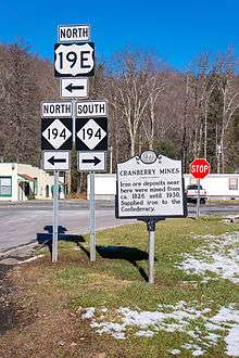
| Cranberry | 18.6 | 29.9 | South end of US 19E overlap | ||
| Elk Park | 18.9 | 30.4 | North end of US 19E overlap | ||
| Banner Elk | 25.5 | 41.0 | North end of NC 184 overlap; to Ski Beech | ||
| 25.8 | 41.5 | South end of NC 184 overlap; to Ski Sugar | |||
| Watauga | Valle Crucis | 33.3 | 53.6 | ||
| Vilas | 37.0 | 59.5 | North end of US 321/US 421 overlap | ||
| Boone | 42.7 | 68.7 | South end of US 321 overlap | ||
| 43.0 | 69.2 | South end of US 221 overlap | |||
| 43.6 | 70.2 | North end of US 221 and south end of US 421 overlap | |||
| Ashe | Baldwin | 61.7 | 99.3 | South end of US 221 overlap | |
| West Jefferson | 65.3 | 105.1 | North end of US 221 and south end of US 221 Bus. overlap | ||
| 67.0 | 107.8 | North end of US 221 Bus. overlap | |||
| Smethport | 68.5 | 110.2 | East end of NC 88 overlap | ||
| Warrensville | 72.3 | 116.4 | West end of NC 88 overlap | ||
| VA state line | 85.5 | 137.6 | Rugby Road | Northern terminus | |
1.000 mi = 1.609 km; 1.000 km = 0.621 mi
| |||||
Bannered routes
.jpg)
Banner Elk–Valle Crucis truck route
| |
|---|---|
| Location: | Banner Elk-Valle Crucis, NC |
| Length: | 15.2 mi[12] (24.5 km) |
North Carolina Highway 194 Truck (NC 194 Truck) redirects truckers traveling through either Banner Elk or Valle Crucis to not use the mainline highway between the two locations, with explicate flashing warning signs. This 15.2-mile (24.5 km) detour takes truckers, from Banner Elk, south along NC 184 to Tynecastle (a.k.a. Invershield or Linville Gap), then north along NC 105 to Broadstone Road (SR-1112); hugging the Watauga River, it eventually reconnects with mainline NC 194 in Valle Crucis.
References
- 1 2 Google (May 16, 2015). "North Carolina Highway 194" (Map). Google Maps. Google. Retrieved May 16, 2015.
- 1 2 3 "North Carolina Scenic Byways" (PDF). North Carolina Department of Transportation. Retrieved May 16, 2015.
- ↑ State Highway System of North Carolina (PDF) (Map). Cartography by NCSHC. North Carolina State Highway Commission. 1922. Retrieved May 16, 2015.
- 1 2 State Highway System of North Carolina (PDF) (Map). Cartography by NCSHC. North Carolina State Highway Commission. 1930. Retrieved March 7, 2016.
- ↑ North Carolina County Road Survey 1930 (PDF) (Map). Cartography by NCSHC / NCSTC / U.S. Bureau of Public Roads. North Carolina State Tax Commission. 1930. Retrieved May 16, 2015.
- ↑ North Carolina County Road Survey 1936 (PDF) (Map). Cartography by NCSHC / NCSTC / U.S. Bureau of Public Roads. North Carolina State Tax Commission. 1936. Retrieved May 16, 2015.
- ↑ North Carolina County Road Survey 1953 (PDF) (Map). Cartography by NCHPWC / USPRA. North Carolina State Highway and Public Works Commission. 1953. Retrieved May 16, 2015.
- ↑ North Carolina County Road Survey 1968 (PDF) (Map). Cartography by NCSHC / USDOT / FHWA. North Carolina State Highway Commission – Planning and Research Department. 1968. Retrieved May 16, 2015.
- ↑ "Route Change (1981-09-01)" (PDF). North Carolina Department of Transportation. September 1, 1981. p. 4. Retrieved May 16, 2015.
- ↑ Google (March 7, 2016). "North Carolina Highway 691" (Map). Google Maps. Google. Retrieved March 7, 2016.
- ↑ North Carolina Primary Highway System (PDF) (Map). Cartography by NCDOT. North Carolina Department of Transportation. 1940. Retrieved March 7, 2016.
- ↑ Google (December 4, 2013). "NC 194 Truck - Banner Elk–Valle Crucis, North Carolina" (Map). Google Maps. Google. Retrieved December 4, 2013.
External links
 Media related to North Carolina Highway 194 at Wikimedia Commons
- NCRoads.com: N.C. 194
- NCRoads.com: N.C. 691