North Carolina Highway 119
For the former NC 119, see North Carolina Highway 119 (1930s).
| ||||
|---|---|---|---|---|
 | ||||
| Route information | ||||
| Maintained by NCDOT | ||||
| Length: | 42.9 mi[1] (69.0 km) | |||
| Existed: | ca. 1940 – present | |||
| Major junctions | ||||
| South end: |
| |||
|
| ||||
| North end: |
| |||
| Location | ||||
| Counties: | Alamance, Caswell | |||
| Highway system | ||||
| ||||

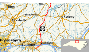
North Carolina Highway 119 (NC 119) is a primary state highway in the U.S. state of North Carolina. It runs from NC 54 in Swepsonville north via Mebane, Hightowers, and Semora to the Virginia state line, where it continues as State Route 119.
Future
A project that started since 1990 is in the works to relocate NC 119 west of Mebane, creating a new 4 to 6-lane divided highway from I-40/I-85 to Mrs. White Lane (SR 1918). The project will be broken into two parts, with a combined estimate of $101.9 million; property acquisition is expected after 2014.[2]
Major intersections
| County | Location | mi | km | Destinations | Notes |
|---|---|---|---|---|---|
| Alamance | Swepsonville | 0.0 | 0.0 | Southern terminus | |
| Mebane | 4.0 | 6.4 | Diamond interchange; exit 153 on I-85 | ||
| 6.9 | 11.1 | South end of concurrency with US 70 | |||
| 7.2 | 11.6 | North end of concurrency with US 70 | |||
| Pleasant Grove | 13.9 | 22.4 | |||
| Caswell | Hightowers | 25.5 | 41.0 | ||
| Leasburg | 31.1 | 50.1 | |||
| Semora | 39.8 | 64.1 | |||
| Virginia state line | 42.9 | 69.0 | Northern terminus | ||
1.000 mi = 1.609 km; 1.000 km = 0.621 mi
| |||||
See also
- North Carolina Bicycle Route 4 - Concurrent with NC 119 from Stephentown Road to Osmond Road near Hyco Lake
References
- ↑ Google (2011-11-24). "North Carolina Highway 119" (Map). Google Maps. Google. Retrieved 2011-11-24.
- ↑ "NCDOT: NC 119 Relocation Project". Retrieved 2011-11-24.
External links
This article is issued from Wikipedia - version of the 11/12/2016. The text is available under the Creative Commons Attribution/Share Alike but additional terms may apply for the media files.