List of Nike missile sites

The following is a list of Nike missile sites. This article lists sites in the United States, however the United States Army also deployed Nike missiles to Europe as part of the NATO alliance, with sites being operated by both American and European military forces. U.S. Army Nike sites were also operational in South Korea, Japan and were sold to Taiwan.
Leftover traces of the approximately 265[1] Nike missile bases can still be seen around cities across the United States. As the sites were decommissioned they were first offered to federal agencies. Many were already on Army National Guard bases who continued to use the property. Others were offered to state and local governments while others were sold to school districts. The left-overs were offered to private individuals. Many Nike sites are now municipal yards, communications and FAA facilities , probation camps, and even renovated for use as Airsoft gaming and Military Simulation training complexes. Several were completely obliterated and turned into parks. Some are now private residences. Only a few remain intact and preserve the history of the Nike project.
Overview
The missile sites are listed by the state in which they are located. The vast majority of the installations were combat ready launch facilities. Each site listing contains information concerning a particular site.
Example:
- Site Name: Summit
- Missile Type: Nike 2AK18L-H
- Defense Area: Anchorage
- Site Location: Anchorage (25 mi. NE)/Chugach Mountains
- Service Dates: May 1959 to May 1979
- Control Site Condition/Owner: Intact; Army ownership, best preserved Alaskan site
- Launch Site Condition/Owner: Intact; Army ownership, best preserved Alaskan site
This listing would be interpreted as follows:
The site is located 25 miles northeast of Anchorage. The name of the site is Summit and it was within the Anchorage Defense Area.
The "Missile type" information (2AK18L-H) means the site contained two Nike Ajax magazines (A), located above ground (K), with eight launchers (8L) being converted to Nike Hercules (H).
The branch of service involved was the United States Army and the dates of active service are taken from unit activation and deactivation records.
In the Nike system, the fire control site (CS) and launch site (LS) were considered separate individual sites when dealing with the properties. The Summit control and launch sites happen to have the same owner and condition; however, this is not always the case. Many listings will have "FDS" following either the control site or launch site heading, which means that the site has gone through the "Formerly-Used Defense Site" program and has been transferred from DoD control to another party. This party could be a private owner, a municipality, or the state. A current assessment of the site is provided and by clicking on the geographic coordinate will link to a map showing the site (CS, LS) and a current online aerial image.
With the exception of Alaska, in which sites were given a specific name, Nike missile sites were designated by a coding system of the Defense Area Name abbreviation; a two digit number representing the degree from north converted to a number between 01 and 99 (North being 01; East being 25; South being 50; West being 75), and a letter, L = launch site, C = IFC (Integrated Fire Control) site.
United States
Alaska
| Anchorage Defense Area: Sites were located around Anchorage to defend the city of Anchorage, Fort Richardson, and Elmendorf AFB. Situated at Fort Richardson near Anchorage, the Command Post hosted the regional air defense command and control facility. Manned by the 4th Missile Battalion (redesignated 1st Missile Battalion), 43d Air Defense Artillery in 1972). Site Point was a dual site, having two complete and independent firing systems (Two fire control systems and four launcher sections each having four launchers each and about 28 Hercules missiles) The damage caused by the Good Friday earthquake in 1964 caused one half of the site to be permanently out of action. The other firing system was restored to active duty and remained so, and was in fact the last Nike site in North America to be closed.
USAF Air Defense Command/NORAD radar sites at Fire Island AFS (F-1) and King Salmon AFS (F-3) AK were integrated into the Army Nike operations. Radars used at Fire Island were CPS-6B, FPS-8, CPS-4, FPS-20A, FPS-6B. Nike missile operations continued there until 1979 when the site was closed. Afterwards, the Army Air-Defense Command Post (AADCP) was moved to King Salmon. Radars were FPS-93A and in 1982 the FPS-117 was installed. The King Salmon Long-Range Radar Site is still in use. Fairbanks Defense Area: Sites were installed to replace Anti-Aircraft guns defending the Fairbanks area, which included Fort Wainwright and Eielson AFB. Manned by the 2nd Missile Battalion, 562d Air Defense Artillery. The sites around Fairbanks were inactivated in 1970-1971. The USAF radar site at Murphy Dome AFS, AK (F-2) was shared with the Army for Nike missile-defense system. The CPS-6B radar was removed in July 1958, FPS-8 removed 4Q 1960 until the Nike sites were inactivated in 1971. External links |
 Nike sites in Alaska |
| Site Name | Missile Type | Defense Area | Site Location | Service Dates | Control Site condition/owner | Launch Site condition/owner |
|---|---|---|---|---|---|---|
| Bay | Nike 2AK/8L-H | Anchorage | Anchorage, Alaska (25 mi NE) | Mar 1959 - May 1979 | The IFC is mostly burned (prior to the fire, the IFC was used as a minimum security prison). Part of the concrete structures and the bases of the radar towers are still standing, and used for paintball wars by the local youth. Buildings mostly gone or standing walls remain. 61°23′53″N 149°51′55″W / 61.39806°N 149.86528°W |
Intact Launch remains, no use known. Abandoned and overgrown with trees. 61°24′21″N 149°53′04″W / 61.40583°N 149.88444°W |
| Point | Nike 4AK/16L-H | Anchorage | Anchorage, Alaska (10 mi SW) | Apr 1959 - May 1971 | Obliterated no evidence remains. 61°09′18″N 150°03′21″W / 61.15500°N 150.05583°W |
Abandoned. Buildings torn down, launch pads consist of concrete slabs and Bunkers. Land was transferred to the Municipality of Anchorage, and has been converted to a park. One of the Launch Bunkers has been converted to a Cross Country Ski Chalet with a large parking lot, and the other three Launch Bunkers are used for storage. 61°09′31″N 150°02′07″W / 61.15861°N 150.03528°W |
| Summit | Nike 2AK/8L-H | Anchorage | Anchorage, Alaska (25 mi NE/Chugach Mountains) | May 1959 - May 1979 | Intact Army ownership, best preserved Alaskan Site. It has been in use as a secured communications site for various federal agencies, including BLM, FAA, FCC, FBI, IRS, and others. It is also used occasionally for communications exercises supporting various US Army operations. There are two adjacent ski recreation areas. Under restoration since 2009. Guided public tours are available June–September through a local non-profit organization. Site Summit is listed in the National Register of Historic Places.[2] 61°15′29″N 149°31′42″W / 61.25806°N 149.52833°W |
Intact Army ownership, best preserved Alaskan Site 61°14′52″N 149°32′54″W / 61.24778°N 149.54833°W |
| Jig | Nike 2AK/8L-H | Fairbanks | Eielson AFB, Alaska (5 mi S) | Mar 1959 - May 1970 | Obliterated Private ownership. No remains except large open area. 64°32′04″N 146°59′35″W / 64.53444°N 146.99306°W |
Intact, Private ownership, 1 launcher used to store dynamite. Many tractor-trailers on site. 64°31′38″N 146°57′51″W / 64.52722°N 146.96417°W |
| Love | Nike 2AK/8L-H | Fairbanks | Fairbanks, Alaska (10 mi NW) | Mar 1959 - May 1971 | Obliterated, State of Alaska control, demolished 64°59′02″N 147°53′08″W / 64.98389°N 147.88556°W |
Obliterated, State of Alaska control, demolished 64°59′00″N 147°51′16″W / 64.98333°N 147.85444°W |
| Mike | Nike 2AK/8L-H | Fairbanks | Eielson AFB, Alaska (10 mi SE) | Mar 1959 - May 1970 | Obliterated, Army ownership, demolished 64°34′55″N 146°45′04″W / 64.58194°N 146.75111°W |
Army ownership on Ft Wainwright property, The site is overgrown with vegetation, Nike launch buildings are relatively intact. 64°35′13″N 146°43′45″W / 64.58694°N 146.72917°W |
| Peter | Nike 2AK/8L-H | Fairbanks | Eielson AFB, Alaska (15 mi E) | Mar 1959 - May 1971 | Obliterated, Army terrorism training site 64°56′23″N 147°52′08″W / 64.93972°N 147.86889°W |
Army ownership on Ft Wainwright property, Army terrorism training site. Obliterated 64°56′39″N 147°51′51″W / 64.94417°N 147.86417°W |
| Tare | Nike 2AK/8L-H | Fairbanks | Newman, Alaska (20 mi S) | Mar 1959 - May 1971 | Obliterated, Corps of Engineers control, demolished 64°47′37″N 147°11′19″W / 64.79361°N 147.18861°W |
Partially Intact, Launch remains, serves as administration facility for Chena River Lakes Recreation Area 64°45′28″N 147°13′08″W / 64.75778°N 147.21889°W |
California
| Los Angeles Defense Area (LA): Los Angeles was defended by a ring of 16 Nike sites. Headquarters sites were located at Signal Hill, Long Beach, Fort MacArthur, and at the Birmingham Army Hospital. As indicated by the number of sites, Los Angeles, with its aerospace industries, received extensive air defenses. Initially manned by the 1st Missile Battalion, 56th Air Defense Artillery, later by the 4th Missile Battalion, 65th Air Defense Artillery. Beginning in the fall of 1958, the LA-40 and LA-43 Nike sites were manned by the 720th AAA Missile Battalion of the California Army National Guard. Eventually, California National Guard units assumed responsibilities for manning the other sites. In 1968, the Army deactivated LA-94. LA-29 closed 3 years later.
Army Air-Defense Command Post (AADCP) LA-45DC was established at San Pedro Hill AFS, CA in 1960 for Nike missile command-and-control functions. The site was initially an AN/FSG-l Missile-Master Radar Direction Center. It was later equipped with the AN/TSQ-51 "Missile Mentor" solid-state computer system. LA-45DC was integrated with the USAF Air Defense Command/NORAD Semi Automatic Ground Environment (SAGE) air defense radar network as Site RP-39 / Z-39 The AADCP was inactivated 1 Sep 1974 along with the remaining Nike Hercules sites. San Francisco Defense Area (SF): San Francisco was defended by 12 Nike sites. Its defenders included both Regular Army and National Guard units. Sites SF-87 and SF-93 were deactivated in 1971. Three years later, the U.S. Army Air Defense Command deactivated the remaining missile batteries. When the Army abandoned the launch area of SF-88 at Fort Barry in 1974, the National Park Service assumed custody of the site, incorporating it into the Golden Gate National Recreation Area. Through the efforts of various volunteer groups, as of 1995, this is the only Nike site in the country that has been preserved and is open for public viewing. Army Air-Defense Command Post (AADCP) SF-90DC was established at Mill Valley AFS, CA in 1960 for Nike missile command-and-control functions. The site was equipped with the AN/GSG-5(V) BIRDIE solid-state computer system. SF-90DC was integrated with the USAF Air Defense Command/NORAD Semi Automatic Ground Environment (SAGE) air defense radar network as Site P-38 / Z-38 The AADCP was inactivated in mid-1971. Travis AFB Defense Area (T): Established to defend the USAF Strategic Air Command, later Military Airlift Command base. During the late 1960s and early 1970s, the Travis battalion assumed responsibility for the remaining active batteries guarding the entire San Francisco region. Inactivated by 1974. External links SF-31 Nike site, San Leandro, California  Missile on transporter at SF-88, Sausalito
|
| Site Name | Missile Type | Defense Area | Site Location | Service Dates | Control Site condition/owner | Launch Site condition/owner | ||
|---|---|---|---|---|---|---|---|---|
| LA-04 | Nike 1B, 2C/18H, 30A/11L-U, (10L-H) | Los Angeles | Mount Gleason[3] (Angeles National Forest)/ Palmdale, California | 1956 - Apr 1974 | Abandoned, replanted with pines. No evidence of former IFC site. 34°22′32″N 118°10′33″W / 34.37556°N 118.17583°W} |
Owned by State of California. Rebuilt as Los Angeles County prison camp 34°22′41″N 118°09′03″W / 34.37806°N 118.15083°W | ||
| LA-09 | Nike 1B, 2C/30A/12L-A | Los Angeles | Mount Disappointment/ Barley Flats[4] (Angeles National Forest. | 1956–1961 | Destroyed by fire, former LA County Probation Department work camp. On very tall ridge Some buildings remain, condition unknown. No radar towers. 34°14′48″N 118°06′17″W / 34.24667°N 118.10472°W |
Obliterated, LA Sheriff's Department Air Station 34°16′42″N 118°04′32″W / 34.27833°N 118.07556°W | ||
| LA-14 | Nike 2B/20A/8L-A | Los Angeles | South El Monte, California | 1956–1961 | Obliterated, Athletic Field of Rio Hondo Junior College. Fire Control largely preserved and accessible via hiking trail. 34°01′05″N 118°02′17″W / 34.01806°N 118.03806°W |
Obliterated. Former missile pads still visible, apparently being used as a storage yard. Most of area now redeveloped into tennis courts, park area. 34°02′37″N 118°03′32″W / 34.04361°N 118.05889°W | ||
| LA-29 | Nike 1B, 2C/18H, 30A/12L-UA, (7L-H) | Los Angeles | Brea/Puente Hills, California | 1958 - June 1971 | Private ownership. Site cleared and redeveloped on top of ridge. One old foundation remains of IFC, also some old roads not severely deteriorated Appears to be a radio tower, transmitter site and a large water tank on the site. 33°57′19″N 117°53′44″W / 33.95528°N 117.89556°W |
Private ownership, fenced. Launch site abandoned, appears to be above-ground site with launchers located within berms. concrete foundations badly deteriorated, only some building foundations remain. Much broken concrete lying around site. Large number of commercial bee hives. 33°57′34″N 117°53′10″W / 33.95944°N 117.88611°W | ||
| LA-32 | Nike 1B1C/12H, 20A/8L-U | Los Angeles | Garden Grove/Stanton, California | 1956 - Mar 1974 | Obliterated, Private ownership, Light Industrial park 33°47′27″N 118°00′43″W / 33.79083°N 118.01194°W |
In highly urbanized area. CAArNG, 458th MASH facility. Nike launch facilities obliterated by construction 33°47′32″N 118°00′10″W / 33.79222°N 118.00278°W | ||
| LA-40 | Nike 1B, 2C/30A/12L-A | Los Angeles | Long Beach Airport, California | 1956–1963 | Obliterated, Hotel and commercial development. Location now a parking deck. 33°48′32″N 118°08′08″W / 33.80889°N 118.13556°W |
Obliterated, Kilroy Airport Center 33°48′32″N 118°08′26″W / 33.80889°N 118.14056°W | ||
| LA-43 | Nike 2B/12H, 20A/8L-UA | Los Angeles | Fort MacArthur, California (upper) | 1955 - Mar 1974 | Located at Battery Leary, Merriam, Upper Reservation, Ft. MacArthur. Fenced-in area, redeveloped with new landscaping. No sign of IFC. 33°42′43″N 118°17′45″W / 33.71194°N 118.29583°W |
Intact, City of LA, White Point Park. Double-magazine site with Nike Assembly building evident, also concrete launcher foundations. Launch site roads still in place, overlaid by park facilities. 33°43′00″N 118°18′51″W / 33.71667°N 118.31417°W | ||
| LA-55 | Nike 2B/12H, 20A/8L-U | Los Angeles | Point Vincente, California | 1956 - Mar 1974 | Obliterated, City of Rancho Palos Verdes, Del Cerro Park 33°45′27″N 118°22′06″W / 33.75750°N 118.36833°W |
Missile site redeveloped into Point Vincente County Park 33°44′42″N 118°24′18″W / 33.74500°N 118.40500°W | ||
| LA-57 | Nike 1B, 2C/30A/12L-A | Los Angeles | Redondo Beach/ Torrance, California | 1956–1963 | Obliterated, City of Redondo Beach, Hopkins Wilderness Park 33°49′45″N 118°22′27″W / 33.82917°N 118.37417°W |
In highly industrial area. Missile site partially intact, used by City of Torrance, Torrance Airport Civil Air Patrol. No evidence of launchers. | ||
| LA-70 | Nike 1B, 2C/30A/12L-A | Los Angeles | Hyperion/Playa del Rey, California (Shared with LA-73) | 1956–1963 | Obliterated, FDS, vacant lot just west of LAX runway 6R 33°56′48″N 118°22′18″W / 33.94667°N 118.37167°W |
Nike launch facilities obliterated. Redeveloped into City of LA Department of Airports, Jet Pets Animal Services 33°57′08″N 118°26′18″W / 33.95222°N 118.43833°W | ||
| LA-73 | Nike 1B, 2C/30A/12L-A | Los Angeles | Playa del Rey/LAX, California (Shared with LA-70) | 1956–1963 | Obliterated, Apartments, commercial use 33°57′33″N 118°25′59″W / 33.95917°N 118.43306°W |
Launcher area was destroyed/obliterated in the early 1990s when Westchester Parkway was constructed. Also used by City of LA Department of Airports, Jet Pets Animal Service. 33°57′08″N 118°26′18″W / 33.95222°N 118.43833°W | ||
| LA-78 | Nike 1B, 2C/18H, 30A/12L-U | Los Angeles | Malibu, California | 1963 - Mar 1974 | Obliterated, no evidence of existence at end of former access road. 34°04′41″N 118°39′20″W / 34.07806°N 118.65556°W |
Double-battery Nike Concrete launcher foundations partially Intact, Microwave/ Communication Facility. Launchers probably intact. The former crew barracks are now used for county fire station personnel and the old launch bays appear to be used for storage. 34°03′35″N 118°38′46″W / 34.05972°N 118.64611°W | ||
| LA-88 | Nike 1B, 2C/18H, 30A/11L-U | Los Angeles | Chatsworth, Oat Mountain, California | 1957 - Mar 1974 | Partially Intact, administration buildings at entrance standing, with what appear to be military radio towers. Most buildings razed and rebuilt as a Relay site. Many foundations remain with broken concrete spread around area, roads in deteriorating condition. 34°19′46″N 118°36′02″W / 34.32944°N 118.60056°W |
Below-ground Triple-magazine Nike-Hercules site built up on high ridge. Largely intact and abandoned. Buildings in poor condition, some roofless, some not. Still fenced with closed access gate. Site is now utilized by the LAPD SWAT team for training. 34°18′41″N 118°36′31″W / 34.31139°N 118.60861°W | ||
| LA-94 | Nike 1B, 2C/18H-30A/12L-UA | Los Angeles | Los Pinetos/Newhall, California | 1955 - Nov 1968 | Intact, LA County Fire Camp #9 and GTE cellular relay station. On high ridge, elevation 3,750'. All buildings in use in excellent condition. No radar towers. 34°21′09″N 118°24′40″W / 34.35250°N 118.41111°W |
Double-battery Nike launch area on top of tall ridge. Is fenced in, with a "No Trespassing" sign, guard shack and many buildings in good repair. Now US Forest Service facility. Magazines probably in good condition, launch area being used for trailer and outside storage. 34°20′55″N 118°24′29″W / 34.34861°N 118.40806°W | ||
| LA-96 | Nike 1B, 2C/18H, 30A/12L-U, (8L-H) | Los Angeles | Lake Balboa(formerly Van Nuys) / Encino | 1957 - Sep 1974 | Located on top of a mountain in the middle of the city. San Vicente Peak, has been turned into a Cold War memorial park. Santa Monica Mountains Conservancy, San Vicente Mountain Park. Buildings, some radar towers. 34°07′43″N 118°30′46″W / 34.12861°N 118.51278°W |
In highly urban area. After being closed by the Army it was established as an Air Force installation, the Sepulveda Air National Guard Station. On that date, it was assigned for jurisdiction, control, and authority to the California Air National Guard. A section of the launch area is used by the CAArNG, 261st Combat Communication Squadron. Concrete launch pads still visible. 34°11′06″N 118°28′56″W / 34.18500°N 118.48222°W | ||
| LA-98 | Nike 1B, 2C/30A/12L-A | Los Angeles | Magic Mountain [5] (Angeles National Forest) / Lang[6] (Santa Clarita), California | 1955 - Dec 1968 | Microwave relay site. 34°23′11″N 118°19′45″W / 34.38639°N 118.32917°W |
Private owner, construction use. Most of launch site turned into a quarry. 34°25′53″N 118°22′32″W / 34.43139°N 118.37556°W | ||
| SF-08 SF-09 |
Nike 1B, 2C/30A/12L-A | San Francisco | San Pablo Ridge, California (SF-08 and SF-09 shared facilities) | 1955 - Jun 1963 | Obliterated, Wildcat Canyon Regional Park. 37°56′56″N 122°17′28″W / 37.94889°N 122.29111°W |
Obliterated, Wildcat Canyon Regional Park. Some berms still visible. 37°55′30″N 122°15′44″W / 37.92500°N 122.26222°W | ||
| SF-25 | Nike 1B, 2C/30A/12L-A | San Francisco | Rock Ridge, California | 1956 - July 1959 | Partially Intact, Las Trampas Regional Park and microwave communications facility 37°48′57″N 122°03′44″W / 37.81583°N 122.06222°W |
Redeveloped, TRACOR Aerospace, Expendable Technology Center, Las Trampas Regional Park Office 37°48′45″N 122°02′33″W / 37.81250°N 122.04250°W | ||
| SF-31 | Nike 2B/12H, 20A/8L-U | San Francisco | Lake Chabot/ Castro Valley, California | 1956 - Mar 1974 | Intact, Communications Facility Partially. Buildings, some radar towers. 37°43′25″N 122°05′07″W / 37.72361°N 122.08528°W |
Intact, East Bay Regional Park District, Lake Chabot Park, Department of Public Safety, service yard. Missile pads used as part of storage yard and parking lot. 37°43′17.5″N 122°05′56.2″W / 37.721528°N 122.098944°W | ||
| SF-37 | Nike 1B, 2C/30A/12L-A | San Francisco | Coyote Hills/ Newark, California | 1955 - Mar 1963 | Redeveloped, East Bay Regional Park District, Coyote Hills Regional Park Alameda County Sheriff's Department radio transmitter 37°32′24″N 122°05′03″W / 37.54000°N 122.08417°W |
Obliterated, Coyote Hills Regional Park. Launch site buildings bulldozed, dumped into the magazines, magazines sealed shut, soiled over & the whole area re-graded in the early 1970s to make it look like a natural area again, and they did a very thorough job. 37°33′32″N 122°05′46″W / 37.55889°N 122.09611°W | ||
| SF-51 | Nike 2B/12H, 20A/8L-U | San Francisco | Milagra/ Pacifica, California | 1956 - Mar 1974 | National Park Service, Sweeny Ridge Skyline Preserve. Badly deteriorated buddings, radar tower bases, not much else. 37°36′48″N 122°27′32″W / 37.61333°N 122.45889°W |
Obliterated, Milagra Ridge County Park. Launch pad doors still visible, but concrete has been covered by soil and is now a grassy area. 37°38′22″N 122°28′44″W / 37.63944°N 122.47889°W | ||
| SF-59 | Nike 1B, 2C/30A/12L-A | San Francisco | Fort Funston/ Mount San Bruno, California | 1956 - Mar 1963 | FDS. Redeveloped into communications site. No evidence of IFC. 37°41′32″N 122°26′52″W / 37.69222°N 122.44778°W |
Partially Intact on mountain top, Fort Funston Park Picnic Area. Triple-magazine Nike Missile launching concrete pad now a parking lot for the Fort Funston hang gliding area. Buildings in use by park personnel. 37°42′53″N 122°30′06″W / 37.71472°N 122.50167°W | ||
| SF-87 | Nike 2B/12H, 20A/8L-U | San Francisco | Fort Cronkhite/ Sausalito, California | 1955 - June 1971 | On mountain peak. Partially Intact, buildings, some radar towers, tourist area, Golden Gate National Recreation Area 37°49′39″N 122°29′56″W / 37.82750°N 122.49889°W |
Obliterated. Redeveloped into Marine Mammal Center. 37°50′06″N 122°31′51″W / 37.83500°N 122.53083°W | ||
| SF-88 | Nike 2B/12H, 20A/8L-U | San Francisco | Fort Barry/ Sausalito, California | Mar 1958 - Mar 1974 | On high mountain peak. Intact but decaying and falling apart, NPS-GGNRA, camp site, YMCA facility. Most buildings intact and in use, some radar towers. 37°50′32″N 122°31′55″W / 37.84222°N 122.53194°W |
Part of the Golden Gate National Recreation Area) across the Golden Gate from San Francisco, has been preserved as a Nike museum, complete with missiles (inert). This site was given intact to the National Park Service in 1974 after it was decommissioned for use as a legacy of the Nike program. It is open to the public on designated days; usually Wednesday to Friday, 12:30 to 3:30 pm. The SF-88L site has been restored by volunteers and National Park Service employees to the condition it was during the 1960s, complete with signage and various pieces of equipment such as the radars and control vans that would have been stationed on hills overlooking the site. One of the two missile magazines has been restored and has a working elevator and launch rail for the inert missiles. Site SF-88 is listed in the National Register of Historic Places as part of the Fort Barry Historic District.[7] 37°49′36″N 122°31′39″W / 37.82667°N 122.52750°W
| ||
| SF-89 | Nike 1B, 2C/30A/12L-A | San Francisco | Fort Winfield Scott, California | 1955 - Mar 1963 | Partially intact, buildings being used, no evidence of radar towers. TV transmitter site. 37°45′28″N 122°27′28″W / 37.75778°N 122.45778°W |
Intact, Salvage yard. Nike launch magazines abandoned and partially covered by a layer of soil, used for open air storage. The adjacent buildings are used by an EOD unit. 37°47′32″N 122°28′24″W / 37.79222°N 122.47333°W | ||
| SF-91 | Nike 1B, 2C/30A/12L-A | San Francisco | Angel Island, California | 1955–1961 | The IFC on the top of Mt. Livermore Angel Island in San Francisco Bay has been permanently removed. The former radar site has been restored to its natural condition, and is now enjoyed as one of the best views of the region by hikers and picnicers. 37°51′41″N 122°25′50″W / 37.86139°N 122.43056°W |
Intact, NPS-GGNRA, Angel Island State Park. Three launch areas. This is an early Ajax-only site that was never converted to Hercules. The mountain between the launcher and the IFC was "notched" in three places to allow the Missile Tracking Radar to acquire the missile while sitting on the launcher. The three underground magazines are existent and in reasonable good condition. The area is off limits to visitors at Angel Island State Park. 37°51′23″N 122°25′21″W / 37.85639°N 122.42250°W | ||
| SF-93 | Nike 3B/18H, 30A/12L-U | San Francisco | San Rafael, California | 1957 - June 1971 | Harry P. Barbier Memorial Park. Two round ground pads, one square ground pad, and one tower with cyclone fence around the top. Nothing else is left. 37°59′52″N 122°30′09″W / 37.99778°N 122.50250°W |
Redeveloped into Marin County Waste Water Treatment Plant. Launch "pits" used for reservoirs for the waste treatment plant. Doors have been completely covered with dirt. 38°01′26″N 122°31′15″W / 38.02389°N 122.52083°W | ||
| T-10 | Nike 3B/18H, 30A/12L-U | Travis AFB | Elmira, California | 1958 - Mar 1974 | Redeveloped as multiple-family housing. Part of facility exists to the west, outlines of radar towers visible. Used primarily as a junkyard. 38°18′58″N 121°52′16″W / 38.31611°N 121.87111°W |
Redeveloped, Private ownership. Several buildings reused as warehouses. Nike launching pads visible, probably all sealed shut. Looks as being used as a storage/junkyard. 38°19′02″N 121°53′37″W / 38.31722°N 121.89361°W | ||
| T-33 | Nike AG/12A/12L-A | Travis AFB | Dixon/Lambie, California | 1957 - Jan 1959 | Partially Intact, State of California Department of Health Services. Some buildings in use, no radar towers. 38°13′07″N 121°50′51″W / 38.21861°N 121.84750°W |
Redeveloped, Private ownership, light industrial storage yard. 38°13′19″N 121°51′26″W / 38.22194°N 121.85722°W | ||
| T-53 | Nike 1B, 2C/30A/12L-A | Travis AFB | Potrero Hills, California | 1958 - Jan 1959 | Intact, Explosives Technology. Buildings in use, no radar towers visible. 38°12′32″N 121°56′31″W / 38.20889°N 121.94194°W |
The property was transferred from the Army to the Air Force on 31 Jul 1964. On that date it was designated as Potrero Hills Storage Annex; and jurisdiction, control, and accountability were assigned to Travis AFB. Now under private ownership, Explosives Technology. Launch doors probably sealed shut, but visible along with Nike concrete launching pads. 38°12′10″N 121°56′08″W / 38.20278°N 121.93556°W | ||
| T-86 | Nike 1B, 2C/30A/12L-UA, (8L-U) | Travis AFB | Fairfield / Cement Hills, California | 1958 - June 1971 | Private ownership. Mostly intact, some IFC buildings being used for transmitter support with large radio towers on site. radar towers outlines visible. 38°17′57″N 121°59′57″W / 38.29917°N 121.99917°W |
Redeveloped, Solano County Detention Center and Animal Shelter, FSUSD bus yard. Launch doors probably sealed shut, but visible along with Nike concrete launching pads. Administrative Area buildings intact, deteriorated. 38°16′34″N 122°00′08″W / 38.27611°N 122.00222°W | ||
Connecticut
| Bridgeport Defense Area (BR): Regular Army units manned these sites after initial activation during 1956 and 1957
with the Guard assuming duties in the waning years. Headquarters facilities were located in Bridgeport. Only site BR-04 was converted from Nike Ajax to Hercules. This battery would become integrated into the New England Defense Area before being deactivated in 1971. Hartford Defense Area (HA): Operational in 1956, these sites were first manned by Regular Army and later by Guard Units. Units from the Bridgeport Defense Area assisted in operating the Plainville site. Sites HA-48 and HA-08 were converted to fire the Nike Hercules missile and remained operational until 1968 and 1971, respectively. External links |
 Connecticut Nike Missile Sites |
| Site Name | Missile Type | Defense Area | Site Location | Service Dates | Control Site condition/owner | Launch Site condition/owner | ||
|---|---|---|---|---|---|---|---|---|
| BR-04 | Nike 3B/18H, 30A/12L-U | Bridgeport | Ansonia, Connecticut | 1957 - June 1971 | US Forest Service Insect & Disease Lab. Some buildings remain in use, most razed along with radar towers. In single-family home subdivision built since inactivation of Nike Fire Control Site. Some old roads still exist in abandoned part of facility, but no evidence of radar towers. 41°20′23″N 073°02′42″W / 41.33972°N 73.04500°W |
Private ownership. Now part of a horse farm. Most buildings still there, launch magazines filled in, concrete pads obliterated. Horses occupy the Assembly building. 41°21′02″N 073°02′56″W / 41.35056°N 73.04889°W | ||
| BR-15 | Nike 1B, 2C/30A/12L-A | Bridgeport | West Haven, Connecticut | 1956 - Sep 1971 | CTANG(CT Air National Guard), Communications/Radar site. Known as Orange Air National Guard Station. Home now to the 103rd Air Control Squadron. Site totally redeveloped, no Nike site buildings remain. 41°16′04″N 072°59′31″W / 41.26778°N 72.99194°W |
Obliterated. Part of Town of Westhaven, Parks and Recreation Department "Nike State Park" 41°16′18″N 072°58′47″W / 41.27167°N 72.97972°W | ||
| BR-17 | Nike 1B, 2C/30A/12L-A | Bridgeport | Milford, Connecticut | 1956–1963 | Town of Milford, board of education. IFC buildings being reused, in reasonable condition. Parts of facility exist but abandoned, lots of vegetation reclaiming facility. Some radio towers, no evidence of radar. 41°13′41″N 073°00′57″W / 41.22806°N 73.01583°W |
Private ownership, redeveloped into single-family housing. 41°14′24″N 073°00′17″W / 41.24000°N 73.00472°W | ||
| BR-65 | Nike 1B, 2C/30A/12L-A | Bridgeport | Fairfield, Connecticut | 1956 - Mar 1961 | Town of Fairfield, Fire Training and Canine Center. Completely rebuilt, no evidence of Fire Control Site or radar towers. 41°07′42″N 073°15′01″W / 41.12833°N 73.25028°W |
Redeveloped into South Pine Creek Park. Launch area now a soccer field. 41°07′29″N 073°15′48″W / 41.12472°N 73.26333°W | ||
| BR-73 | Nike 1B, 2C/30A/12L-A | Bridgeport | Westport, Connecticut | 1956–1963 | Town of Westport, Westport/Weston Health District, Bayberry. Some IFC buildings still in-use, part of site also used by "Rolnick Observatory" also using old IFC buildings. Two radar towers still standing and evident, one of which now functions as the base for the Rolnick Observatory telescope. Much of site overgrown with vegetation. 41°10′16″N 073°19′43″W / 41.17111°N 73.32861°W |
Obliterated. Site redeveloped as Bedford Middle School in 2001. Launch area was immediately north of current school building. 41°09′35″N 073°19′48″W / 41.15972°N 73.33000°W | ||
| BR-94 | Nike 2B, 1C | Bridgeport | Shelton, Connecticut | 1957 - Mar 1961 | US Government ownership, storage and maintenance support facility for Fort Devens. Buildings used for storage/support in good condition, rest of site has been razed and sold off, now single-family housing, no evidence of radar towers. 41°19′40″N 073°11′01″W / 41.32778°N 73.18361°W |
Redeveloped into "Nike Recreation Fields", Town of Shelton. Baseball fields, recreation Halls, Tennis courts, playground etc. 41°18′29″N 073°10′21″W / 41.30806°N 73.17250°W | ||
| HA-08 | Nike 1B, 2C/18H, 30A/10L-U | Hartford | East Windsor, Connecticut | 1956 - June 1971 | "New Testament Church". No evidence of IFC site. 41°52′12″N 072°35′39″W / 41.87000°N 72.59417°W |
Redeveloped into USAR Center. Nike launch site totally obliterated. 41°53′30″N 072°36′10″W / 41.89167°N 72.60278°W | ||
| HA-25 | Nike 1B, 2C/30A/12L-A | Hartford | Manchester, Connecticut | 1956 - Jan 1961 | Town of Manchester, Recreation Center. Also lots of single-family housing. No evidence of IFC site. 41°45′05″N 072°32′02″W / 41.75139°N 72.53389°W |
Redeveloped into Electric Lighting Company. Nike launch site overgrown with vegetation. 41°44′20″N 072°30′57″W / 41.73889°N 72.51583°W
| ||
| HA-36 | Nike 1B, 2C/30A/12L-A | Hartford | Portland, Connecticut | 1956–1963 | Meshomasic State Forest[8] Abandoned, overgrown, some demolished buildings visible from ground. 41°38′18″N 072°32′42″W / 41.63833°N 72.54500°W |
FDS, Abandoned and overgrown. Appears to have been bulldozed over and covered with soil after demilitarization. Some accessibility through a ventilation shaft to a small bunker room. 41°37′54″N 072°33′44″W / 41.63167°N 72.56222°W | ||
| HA-48 | Nike 1B, 2C/18H, 30A/12L-U, (7L-H) | Hartford | Cromwell, Connecticut | 1956 - Nov 1968 | Overgrown and abandoned. Quite a few of the buildings, except for a metal structure on the north-east corner, are still standing. They are cement-block shells. 41°36′22″N 072°41′29″W / 41.60611°N 72.69139°W
|
Redeveloped into USAR Center, Transportation Company. Concrete launching pads visible but doors concreted over. 41°34′53″N 072°41′09″W / 41.58139°N 72.68583°W | ||
| HA-67 | Nike 1B, 2C/30A/12L-A | Hartford | Pinnacle Rock, Plainville, Connecticut | 1956 - Mar 1961 | Obliterated, Residential housing. 41°40′48″N 072°49′22″W / 41.68000°N 72.82278°W |
Redeveloped into Industrial Area. Nike launch site totally obliterated. 41°42′08″N 072°51′13″W / 41.70222°N 72.85361°W | ||
| HA-85 | Nike 1B, 2C/30A/12L-A | Hartford | Avon/Simsbury, Connecticut | 1956–1963 | Talcott Mountain Science center (buildings/radar pads). 41°48′39″N 072°47′55″W / 41.81083°N 72.79861°W |
Redeveloped into Tower View Condominiums 41°49′39″N 072°49′48″W / 41.82750°N 72.83000°W | ||
Florida
| Homestead-Miami Defense Area (HM): Despite the undetected arrival of a defecting Cuban B-26 Invader at Daytona Beach Airport in January 1959, the vulnerability of America's southern frontier was not apparent until the Cuban Missile Crisis. As part of America's posturing against the Soviet Union over the issue of missiles in Cuba, a rapid buildup of forces occurred in Florida. Part of this buildup included antiaircraft missile batteries. Command of the arriving missile units was assumed by the Headquarters and Headquarters Battery, 13th Artillery Group, formerly of Fort Meade, Maryland, which arrived at Homestead AFB on October 30, 1962. By November 8, this command unit moved 4 miles north to a location at Princeton. Initially deploying MIM-23 Hawk mobile batteries, once it became evident that the missile deployment would be long-term, the batteries were repositioned and permanent structures were built which employed above-ground Nike-Hercules missiles. Missile batteries in southern Florida continued on active duty until 1979, well beyond the 1975 demise of ARADCOM.
Army Air Defense Command Post (AADCP) HM-01DC was established at Richmond AFS, FL 25°37′24″N 080°24′16″W / 25.62333°N 80.40444°W in 1961 for Nike missile command-and-control functions. Site equipped with the AN/GSG-5(V) BIRDIE solid-state computer system. In 1965, upgraded to the AN/FSG-l Missile-Master Radar Direction Center. One height-finder radar was later removed and remaining set modified to an AN/FPS-116 c. 1977. HM-01DC was integrated with the USAF Air Defense Command/NORAD Semi Automatic Ground Environment (SAGE) air defense radar network as Site Z-210. Site was demolished by Hurricane Andrew on 24 August 1992 and subsequently closed. External links |
 Homestead-Miami Nike missile sites |
| Site Name | Missile Type | Defense Area | Site Location | Service Dates | Control Site condition/owner | Launch Site condition/owner |
|---|---|---|---|---|---|---|
| HM-01 HM-03 |
Nike AK-3LH | Homestead-Miami | 2 mi WNW Opa-locka/Carol City, Florida | 1962 - late 1970s | Originally HM-01, Re-designated HM-03 Opa-locka Airport. Facility was located on the northwest side of the intersection of NW 183 St and NW 57th Ave. Razed shortly after closure in the late 1970s. Now a vacant lot. 25°56′22″N 080°17′56″W / 25.93944°N 80.29889°W |
HM-01 was Nike-Ajax. Upgraded to above-ground Nike-Hercules and re-designated HM-03. Actual missile area had 3 building to hold missiles, and rails to slide them outside. Exists in deteriorated condition. 25°57′42″N 080°18′12″W / 25.96167°N 80.30333°W |
| HM-40 | Nike AK-3LH | Homestead-Miami | 1 mi S of Card Sound Road & County Road 905, Key Largo, Florida | 6/1965 - 6/1979 | Relocated from HM-66. Largely intact, however the forest has just about won the battle to reclaim its former areas. Radar towers are almost invisible; access to any of the buildings is near impasaable. 25°16′35″N 080°18′11″W / 25.27639°N 80.30306°W |
Above-ground launch site. Transferred to the U.S. Navy in 1981. In 1982, the Navy transferred 4.2 acres in fee land to the U.S. Air Force, which operated a radio beacon annex from 1983 until at least 1996, first as an off-base installation of Homestead AFB, then as a detached installation. Dates of inactivation and disposal not known. Now mostly overgrown with vegetation. All buildings at the launch site have been torn down. Missile buildings have been completely removed, to include 3 foot thick concrete foundations. Missile maintenance/assembly building is only one still standing. 25°15′42″N 080°18′50″W / 25.26167°N 80.31389°W |
| HM-65 HM-66 |
Nike AK-3LH | Homestead-Miami | 8 miles SW of Florida City, Florida | 10/1962 - 6/1965 | Originally HM-65, redesignated HM-66. Constructed during the Cuban Missile Crisis [October 1962]. In a two-week period, 24 hours a day, the Army Corps of Engineers literally built an island in the swamp by bringing in thousands of truck loads of earth fill to build an elevated land surface for the missiles and radars which would keep the equipment elevated above the Everglades water level. Site and unit moved to HM-40, with this site abandoned in June 1965. Buildings vacant, but given the remoteness of this facility appear to be in decent shape. No radar towers. 25°21′43″N 080°33′42″W / 25.36194°N 80.56167°W |
HM-65 was Nike-Ajax. Upgraded to above-ground Nike-Hercules and re-designated HM-66. Above-ground launch facility with built-up pads, but no evidence of missile launch facilities remaining. 25°21′38″N 080°33′09″W / 25.36056°N 80.55250°W |
| HM-69 | Nike AK-3LH | Homestead-Miami | 12 miles WSW of Florida City, Florida | 1962–1979 | South Florida Natural Resources Center in Everglades National Park, under control of National Park Service. Now open to the public for tours by National Park Service staff. Exterior of the administration building and launch area can be viewed during the tour. Visitors are also allowed access to one of the sections barn's. Buildings in use, no radar towers. 25°23′17″N 080°40′59″W / 25.38806°N 80.68306°W |
Everglades National Park, National Park Service. Largely intact and listed on the National Register of Historic Places. 25°22′12″N 080°41′04″W / 25.37000°N 80.68444°W |
| HM-95 | Nike AK-3LH | Homestead-Miami | 12 miles west of Miami, Florida | 1962–1979 | DOD communications facility. Demolition of this facility began in 2015 and is now complete.[9] No structures appear to remain. 25°44′15″N 080°28′54″W / 25.73750°N 80.48167°W |
Tamiami Trail (Now U.S. Immigration and Customs Enforcement Krome Ave Detention Facility) 25°45′01″N 080°29′22″W / 25.75028°N 80.48944°W |
| HM-85 | None | Homestead-Miami | 10 miles sw of Miami, Florida | 1962–1979 | Headquarters, Miami-Homestead Defense Area. | |
| HM-97 | None | Homestead-Miami | Homestead AFB | 1962–1979 | Now under control of 482nd Fighter Wing (Air Force Reserve Command) and Detachment 1, 125th Fighter Wing (Florida Air National Guard) | |
| HM-99 | None | Homestead-Miami | Homestead AFB | 1962–1979 |
Georgia
| The Robins AFB Defense Area (R) and Turner AFB Defense Area (TU) were established when the USAF Strategic Air Command based B-52 Stratofortress intercontinental bombers at Robins and Turner Air Force Bases in 1959. Two Nike-Hercules batteries provided air defense for each of the bases and were manned by Regular Army units. These above-ground sites remained active from November 1960 until March 1966. |  Georgia Nike Missile Sites |
| Site Name | Missile Type | Defense Area | Site Location | Service Dates | Control Site condition/owner | Launch Site condition/owner |
|---|---|---|---|---|---|---|
| R-88 | Nike 3AG/12H/12L-H | Robins | Byron, Georgia | Nov 1960 - Mar 1966 | FDS. Abandoned, buildings appear derelict with lots of junk in the area. Locked and fenced. No radar towers showing in aerial imagery. 32°40′28″N 083°45′55″W / 32.67444°N 83.76528°W |
Above ground site with launchers protected by berms. FDS, now private ownership, fenced, restricted access. Appears to be light industrial estate. Many parked cars on site, probably employees. Berms around missile launch sites now around buildings erected in former missile sites. Many tractor trailers and new small business or manufacturing buildings on the site. 32°40′20″N 083°47′09″W / 32.67222°N 83.78583°W |
| R-28 | Nike 3AG/12H/12L-H | Robins | Jeffersonville, Georgia | Nov 1960 - Mar 1966 | FDS. Site demolished and cleared. "Missile Base Road" and site access road partially exists, otherwise empty field. Dirt road goes into the field, appears to be a former parking area where the access gate was. 32°37′29″N 083°21′53″W / 32.62472°N 83.36472°W |
Former above-ground site with berms protecting launchers. FDS. Private property, with locked fence access. In aerial imagery, launch site appears to be abandoned and overgrown with trees and other vegetation. Difficult to tell with all wild vegetation status of launch site, no buildings appear to be standing, probably earthen berms exist under vegetation canopy. 32°37′42″N 083°21′05″W / 32.62833°N 83.35139°W |
| TU-79 | Nike 3AG/12H | Turner | Albany, Georgia (9 mi NW) | Nov 1960 - Mar 1966 | Anchorage; drug & alcohol rehab center. Many military buildings in use and well maintained. Aerial imagery shows 3 radar towers still erect. 31°38′00″N 084°15′24″W / 31.63333°N 84.25667°W |
Redeveloped into single-family housing subdivision "Callaway Lakes". 31°37′50″N 084°16′42″W / 31.63056°N 84.27833°W |
| TU-28 | Nike 3AG/12H/12L-H | Turner | Willingsham/ Sylvester, Georgia (4 mi W) | Nov 1960 - Mar 1966 | private retirement home. Buildings well maintained, appears to be 3 radar towers to the east of the buildings still standing 31°33′16″N 083°54′56″W / 31.55444°N 83.91556°W |
Above-ground site with launchers protected by berms. Private ownership, berms still in evidence in aerial imagery. Being used as an auto junkyard. Fenced with large number of hubcaps attached. 31°33′23″N 083°54′18″W / 31.55639°N 83.90500°W |
Hawaii
Oahu Defense Area (OA): Originally, the United States Army Pacific planned to build eight batteries at six sites around the island. Eventually this plan was scaled back to four. The antiaircraft command post was at Wahiawa and Headquarters facilities were located at Fort Ruger. Unlike many of the stateside sites that housed missiles in underground magazines, these sites were simply open-air launchers mounted on concrete pads surrounded by earthen berms. The sites were deactivated in 1970.
External links |
 Oahu Nike Missile Sites |
| Site Name | Missile Type | Defense Area | Site Location | Service Dates | Control Site condition/owner | Launch Site condition/owner |
|---|---|---|---|---|---|---|
| OA-17 | Nike 12H/12L-H | Oahu | Kauka/Kahuku, Hawaii | Jan 1961 - Mar 1970 | On top of mountain ridge, under US Army control. Abandoned and overgrown. Buildings under vegetation, two large radio towers fallen on side visible . Probably facility is complete within the trees and wild underbrush. Access road to site overgrown with vegetation, inaccessible. 21°39′55″N 157°59′58″W / 21.66528°N 157.99944°W |
Above ground launching site with berms protecting launchers. mostly overgrown still under US Army control on Kahuku Army Training Area, abandoned. 21°39′51″N 157°58′57″W / 21.66417°N 157.98250°W |
| OA-32 | Nike 24H/16L-H | Oahu | Bellows/ Waimanalo, Hawaii (dual site) |
Mar 1961 - Mar 1970 | On Bellows AFB, remains under US government control but abandoned. Four buildings still standing, no radar towers. 21°20′57″N 157°42′41″W / 21.34917°N 157.71139°W |
On Bellows AFS, Twin Nike-Hercules launch underground facilities thoroughly overgrown with vegetation, abandoned. 21°20′55″N 157°42′28″W / 21.34861°N 157.70778°W |
| OA-63 | Nike 24H/16L-H | Oahu | Ewa/ Makakilo, Hawaii (dual site) |
Jan 1961 - Mar 1970 | On top of mountain ridge, under US Army control. On 18 Sep 1968 it was designated the Palehua AF Solar Observatory Research Site, activated, and assigned to Military Airlift Command with jurisdiction and operational control assigned to Air Weather Service. Part of this property (Control Site 5, from the Nike layout) had an even earlier use by the Army Air Forces. The Puu Manawahua Radar Station and Base Camp was a W.W.II Aircraft Warning Station, and continued to list in 1947 and 1948 USAF Installation Directories. Several Buildings standing also some radar towers. Access road to facility inaccessible due to decades of vegetation growth taking back the road up to the top. 21°23′10″N 158°06′18″W / 21.38611°N 158.10500°W |
Double above-ground magazines, on top of mountain ridge, under US Army control, Both Nike launch facilities overgrown with vegetation, abandoned. Berms still quite visible under vegetation. concrete pad inside berms partially clear. Access road also overgrown with vegetation, inaccessible. 21°21′51″N 158°06′45″W / 21.36417°N 158.11250°W |
| OA-84 | Nike 12H/8L-H | Oahu | Waialua/ Dillingham, Hawaii | Jan 1961 - Mar 1970 | USAF Training Site. Torn down just rubble and looks like a lot of junk vehicles at the former site. 21°34′27″N 158°07′49″W / 21.57417°N 158.13028°W |
Dillingham Airport, Above-ground Nike-Hercules launch facilities overgrown with vegetation, no buildings remain abandoned. 21°34′07″N 158°11′42″W / 21.56861°N 158.19500°W |
Illinois & Northwest Indiana
| Chicago-Gary Defense Area (C): Site (C-98) Fort Sheridan hosted the headquarters of the Fifth Army Air Defense Command. Other regional command facilities were located at the Museum of Science and Industry, site (C-51) Orland Park, and site (C-80) Arlington Heights. Nike Hercules bases remained in operation at C49/50, C-72, and C-93 as well as at sites C-46 and C-47 in northern Indiana, until 1974.
Army Air-Defense Command Post (AADCP) C-80DC established at Arlington Heights AI, IL in 1960 for Nike missile command-and-control functions. The site was initially an AN/FSG-l Missile-Master Radar Direction Center. It was later upgraded to the AN/TSQ-51 "Missile Mentor" solid-state computer system. C-80DC was integrated with the USAF Air Defense Command/NORAD Semi Automatic Ground Environment (SAGE) air defense radar network as Site RP-31 / Z-31 The Air Force ceased radar operations on 30 Sep 1969 and the AADCP was inactivated 1 Sep 1974. External links |
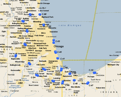 Chicago-Gary Defense Area |
| Site Name | Missile Type | Defense Area | Site Location | Service Dates | Control Site condition/owner | Launch Site condition/owner |
|---|---|---|---|---|---|---|
| C-03 | Nike 3B, 2C/18H, 20A/20L-UA, (12L-H) | Chicago - Gary | Montrose Harbor / Belmont Harbor | Oct 1955 - June 1965 | FDS. Razed and redeveloped into Montrose Harbor Park (part of the Lincoln Park extension) along the Chicago lakefront; on the former site of the control building is a beach restaurant called The Dock at Montrose Harbor. 41°57′51″N 087°38′07″W / 41.96417°N 87.63528°W |
FDS. Totally obliterated. Now a grassy area south of Belmont Harbor along the Chicago lakefront in Lincoln Park. 41°56′18″N 087°38′03″W / 41.93833°N 87.63417°W |
| C-32 | Nike 3B/12H, 20A/12L-U | Chicago - Gary | Porter, Indiana | 1957 - Apr 1974 | Partially redeveloped; now the location of National Park Service Indiana Dunes National Lakeshore offices. Some of the original buildings remain intact, but were repurposed by the NPS. The site is approximately half a mile due west of former launch site. 41°37′50″N 087°05′16″W / 41.63056°N 87.08778°W |
Fenced and behind a locked gate, largely intact. Privately owned, abandoned and overgrown, surrounded on north and east by a new subdivision. Concrete pad still visible. Launch site buildings still have doors and window glass. Magazine launch doors removed; site appears to be filled in, with vegetation covering fill sites. One of the ready buildings on the south end of the site was sold independently of the main parcel, and is now a private residence 41°37′55″N 087°04′28″W / 41.63194°N 87.07444°W |
| C-40 | Nike 1B, 2C/30A/12L-A | Chicago - Gary | Burnham Park (Chicago) | 1955 - Aug 1963 | FDS. Totally obliterated by new construction. You can walk on the former IFC at Lake Shore and E 31st Street; now a nice little park with a playground and good view of downtown, Lake Michigan, Navy Pier and Chicago Harbor Lighthouse. 41°50′16″N 087°36′24″W / 41.83778°N 87.60667°W |
FDS. Totally obliterated; formerly a three-magazine (1B2C)/12-launcher facility with battery at Lake Shore Drive off the end of what’s now I-55, south of the McCormick Place complex. Now part of the McCormick Place Bird Sanctuary. 41°50′54″N 087°36′44″W / 41.84833°N 87.61222°W |
| C-41 | Nike 1B, 2C/18H, 30A/12L-U | Chicago - Gary | Jackson Park (Chicago) | 1955 - Jun 1971 | On the south side in Jackson Park near the Museum of Science and Industry, at approximately 50th Street. The radar/control towers were built on Promontory Point.[10] Redeveloped; now Promontory Point Park. 41°46′46″N 087°34′44″W / 41.77944°N 87.57889°W |
FDS. The silos were on the southern shore of Jackson Park Lagoon facing the Wooded Island, about 3/4 mile away from control site. Paved over; now a parking area for nearby baseball diamonds and tennis courts. 41°46′52″N 087°34′56″W / 41.78111°N 87.58222°W |
| C-44 | Nike 2B, 4C/60A/24L-AA | Chicago - Gary | Hegewisch / Wolf Lake, Illinois (dual site) | 1955 - Mar 1963 | FDS. Abandoned and overgrown site at the south end of lake/state recreation area. Appears to be largely intact underneath vegetation overgrowth; old access road entrance at Ave J & 133 Street largely obliterated. This area is within the SRA on the southern shore of the lake. 41°39′27″N 087°31′55″W / 41.65750°N 87.53194°W |
FDS. Abandoned site at the north end of the SRA/north shore of the lake, where S. Wolf lake Blvd. becomes S. State Line Rd. Roads in very poor condition, main access road overgrown by vegetation. Buildings have been razed but foundations remain; double-Nike-Ajax magazines badly cracked with wild vegetation overgrowing. 41°40′34″N 087°31′40″W / 41.67611°N 87.52778°W |
| C-45 | Nike 2B/20A/8L-A | Chicago - Gary | Gary Municipal Airport, Indiana | 1957 - June 1960 | Redeveloped area in northern tip of airport now has a general aviation hangar, parking lot and ramp area for aircraft parking. Site is across Industrial Highway from former launch site. 41°37′24″N 087°25′02″W / 41.62333°N 87.41722°W |
Razed but broken concrete pads still visible; former Civil Defense site. Also used as police firing range for the City of Gary, with former assembly building berm as the back stop. 41°37′28″N 087°24′43″W / 41.62444°N 87.41194°W |
| C-46 | Nike 1B, 1C/12H, 20A/12L-U, (8L-H) | Chicago - Gary | Munster, Indiana | 1957 - Sep 1974 | Completely redeveloped into industrial park on W side of Calumet Ave. N of 45th St. 41°32′41″N 087°30′29″W / 41.54472°N 87.50806°W (Approximate) |
Launch site on W side of Columbia Ave. razed in 2008, completely obliterated; missile magazines filled in, concrete pads removed. Now privately owned but undeveloped. 41°31′40″N 087°30′53″W / 41.52778°N 87.51472°W |
| C-47 | Nike 1B, 1C/12H, 20A/12L-U, (8L-H) | Chicago - Gary | South Haven / Wheeler, Indiana | 1956 - Mar 1974 | Private ownership. Now Blast Camp paint-ball park.[11] IFC is abandoned and very overgrown with vegetation. All buildings are still standing as well as several radar towers. Site is listed on the National Register of Historic Places. 41°31′25″N 087°10′37″W / 41.52361°N 87.17694°W |
Now owned by Portage Township School Corporation; site is in the middle of farm fields. Locked gate and fence; however, launch facility is abandoned and deteriorating - all buildings are standing, but they are in bad shape.Launch area concrete badly cracked, doors rusting, all of the magazines are filled to surface level with groundwater due the high water table in the area. 41°31′59″N 087°10′01″W / 41.53306°N 87.16694°W |
| C-48 | Nike 2B/20A/8L-A | Chicago - Gary | Gary, Indiana | 1957 - June 1960 | FDS. Redeveloped but abandoned; site of a former automobile dealership on Grant Street, now empty. 41°33′26″N 087°21′16″W / 41.55722°N 87.35444°W |
FDS. Redeveloped into commercial/industrial site near NW corner of 35th Avenue and Grant Street. Some broken concrete remains of launch area. 41°33′20″N 087°21′29″W / 41.55556°N 87.35806°W |
| C-49/50 | Nike 1B, 2C/18H, 30A/11L-U | Chicago - Gary | Homewood, Illinois | 1957 - Apr 1974 | FDS. Leveled and cleared; redeveloped into Patriots Park along 187th Street 41°33′02″N 087°38′51″W / 41.55056°N 87.64750°W |
FDS. Totally obliterated; replaced by a strip mall along Halsted Street, centered on an Auto Zone store. 41°32′53″N 087°38′06″W / 41.54806°N 87.63500°W |
| C-51 | Nike 2B, 1C/30A/12L-A | Chicago - Gary | Alsip, Illinois / Palos Heights, Illinois | 1956 - Mar 1963 | FDS. Being cleared and leveled. 41°39′50″N 087°45′07″W / 41.66389°N 87.75194°W |
FDS. Being cleared and leveled. Some traces of building foundations, nothing of missile launchers or magazine. 41°40′17″N 087°46′23″W / 41.67139°N 87.77306°W |
| C-54 | Nike 1B, 2C/30A/12L-A | Chicago - Gary | Orland Park, Illinois | 1955 - Dec 1961 | FDS. Site razed in 2006; now a vacant lot with visible concrete debris piled up in several places. Located at the north end of Centennial Park along 153rd St. between Huntington Ct. and Hickory Dr. 41°36′40″N 087°52′08″W / 41.61111°N 87.86889°W |
FDS. Totally obliterated and redeveloped. Now a retention pond and parking lot for a Target store along La Grange Road/U.S. 45 at 158th St. 41°36′16″N 087°51′04″W / 41.60444°N 87.85111°W |
| C-61 | Nike 2B/12H, 20A/8L-U | Chicago - Gary | Willowbrook, Illinois / Darien, Illinois | 1955 - Nov 1968 | FDS. Totally obliterated. Now a forest preserve. 41°43′13″N 087°57′23″W / 41.72028°N 87.95639°W |
FDS. Totally obliterated and paved over. Cleared area is just behind the City of Darien Public Works Building, next to a lot for a tractor-trailer leasing office. 41°43′51″N 087°58′05″W / 41.73083°N 87.96806°W |
| C-70 | Nike 1B, 2C/30A/12L-A | Chicago - Gary | Naperville, Illinois | 1956 - Mar 1963 | FDS. Redeveloped into an office park north of I-88. 41°48′36″N 088°08′50″W / 41.81000°N 88.14722°W |
FDS. Redeveloped into Nike Park Sports Complex on Diehl Road 41°47′56″N 088°09′07″W / 41.79889°N 88.15194°W |
| C-72 | Nike 1B, 2C/18H, 30A/10L-U | Chicago - Gary | Addison, Illinois | 1957 - Apr 1974 | IFC Redeveloped into a public park called Nike Park, in the middle of a much larger industrial park. Base of radar tower and control building remain S.E. of baseball diamond. 41°55′24″N 088°01′46″W / 41.92333°N 88.02944°W |
Launch site re-developed into the headquarters building for the Addison Park District; the only remains are the existing fenceline as well as a van pad located to the north of the complex. 41°54′49″N 088°00′59″W / 41.91361°N 88.01639°W |
| C-80/81 | Nike 2B, 4C/60A/24L-AA | Chicago - Gary | Arlington Heights, Illinois (dual site) (Shared by C-80/C-81) | 1950 - Aug 1974 | IFC Redeveloped into 2 parks; no remains. 42°03′11″N 087°59′40″W / 42.05306°N 87.99444°W |
FDS. Redeveloped into part golf course, part U.S. Army Reserve center. The building that housed the Missile Master site is still standing and concrete paddocks that held radar tower are still visible. 42°03′49″N 087°59′52″W / 42.06361°N 87.99778°W |
| C-84 | Nike 1B, 2C/30A/12L-A | Chicago - Gary | Palatine, Illinois | 1956–1963 | FDS. Redeveloped into open greenspace with retention ponds. 42°09′17″N 088°02′49″W / 42.15472°N 88.04694°W |
FDS. Redeveloped into a corporate office complex. 42°09′26″N 088°03′30″W / 42.15722°N 88.05833°W |
| C-92/94 | Nike 1B, 2C/30A/12L-A | Chicago - Gary | Vernon Hills, Illinois | 1955–1963 | FDS. Redeveloped into Nike Park. 42°13′14″N 087°57′11″W / 42.22056°N 87.95306°W |
FDS. Redeveloped into Nike Park. Excavated into a pond. 42°13′32″N 087°57′26″W / 42.22556°N 87.95722°W |
| C-93 | Nike 2B/12H, 20A/8L-U | Chicago - Gary | Northfield/Skokie Lagoons Glencoe, Illinois | 1955 - Apr 1974 | The radar and control facility was located on the west side of Forest Way Drive two blocks north of Tower Road. This was a very compact facility. Cleared land, no evidence except a few pipes emerging from below ground; apron off Forest Way still visible. Site today is on the North Branch Trail on a leveled-off hill. 42°07′13″N 087°46′09″W / 42.12028°N 87.76917°W |
The missile launchers were in a large bermed compound on the other side of the lagoons adjoining the Edens Expressway, about a quarter of a mile south of Dundee Road. Land cleared and being redeveloped into forested area. Launch area now fenced off and used as a dumping ground for dredging operations and is not open to the public, complex perimeter can be viewed from the bicycle trail. Minor remnants are still visible in NE corner. Portion of the bike trail from Tower Road to the launch complex was original road used to access the base. 42°07′36″N 087°46′56″W / 42.12667°N 87.78222°W |
| C-98 | Nike 1B, 2C/30A/12L-A | Chicago - Gary | Fort Sheridan, Illinois | Jul 1954 - 1963 | IFC existed right along the lakefront, but has now been developed and turned into an open prairie as part of the forest preserve. No remnants remain except some small broken chunks of concrete. 42°13′28″N 087°49′26″W / 42.22444°N 87.82389°W |
FDS. At southwest of Fort Sheridan National Cemetery. Concrete pad visible along with launch door (sealed). 42°13′23″N 087°49′22″W / 42.22306°N 87.82278°W |
Kansas
| Schilling AFB Defense Area (SC): Two sites began construction in April 1960, but never made operational. Construction halted in June 1960 and land sold off to private owners. | 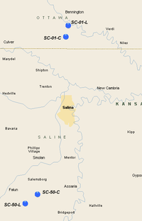 Schilling AFB Defense Area |
| Site Name | Missile Type | Defense Area | Site Location | Service Dates | Control Site condition/owner | Launch Site condition/owner |
|---|---|---|---|---|---|---|
| SC-01 | Nike 3AG | Schilling AFB | Bennington, Kansas (5 mi SSE) | Apr 1960 - Jun 1960 | Site was never operational, Private ownersip, four long military buildings still exist with circular access road, usage unknown. 38°58′59″N 097°36′55″W / 38.98306°N 97.61528°W |
Above-ground Nike-Hercules site. Never operational, Private ownership, berm and assembly building exits. Other buildings erected and still appear to be in use. Site appears to have been leveled, graded and fenced. Outline of fence evident in aerial photography. 39°00′20″N 097°36′32″W / 39.00556°N 97.60889°W |
| SC-50 | Nike | Schilling AFB | Smolan, Kansas (5 mi SSW) | Apr 1960 - Jun 1960 | Site was never operational, Private ownersip, 4 military buildings still exist, usage unknown. 38°40′01″N 097°41′13″W / 38.66694°N 97.68694°W |
Site was never operational. Never completed. Site guard shack and owner' house is a reconstructed Crew quarters. The launcher Area has about 7 launch pads with 3 underground bunkers and 1 barn with rails, about 80% finished when construction halted. 38°38′55″N 097°43′06″W / 38.64861°N 97.71833°W |
Louisiana
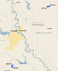
| Barksdale AFB Defense Area (BD): Two Nike Hercules sites, BD-10 at Bellevue and BD-50 northeast of Stonewall, were
installed to provide protection to Shreveport and Barksdale AFB, which hosted Strategic Air Command bombers. U.S. Army Air Defense Command operated the sites with Regular Army units (possibly from 562nd Air Defense Artillery Regiment) from 1960 until 1966. Battalion Headquarters was located at the Louisiana Army Ammunition Plant located north of Doyline. |
 Barksdale AFB Defense Area |
| Site Name | Missile Type | Defense Area | Site Location | Service Dates | Control Site condition/owner | Launch Site condition/owner |
|---|---|---|---|---|---|---|
| BD-10 | Nike 3AG/12H/12L-H | Barksdale | Bellevue, Louisiana | Nov 1960 - Mar 1966 | Almost completely intact, Now Criminal Justice Institute, and Bossier Parish School Board. No radar towers. 32°40′19″N 093°31′18″W / 32.67194°N 93.52167°W |
Above-ground Nike-Hercules site, missiles protected by berms. Largely intact, Louisiana Wildlife and Fisheries Department, Bossier Parish SWAT field training site 32°40′28″N 093°30′35″W / 32.67444°N 93.50972°W |
| BD-50 | Nike 3AG/12H/12L-H | Barksdale | Stonewall, Louisiana (4 mi NE) | Nov 1960 - Mar 1966 | Now LSU School of Medicine, almost all buildings torn down with little evidence of IFC. Mostly vacant land in middle of forested area. 32°18′12″N 093°47′04″W / 32.30333°N 93.78444°W |
FDS. Above-ground magazine protected by berms. Missile launch areas now abandoned and overgrown. Some buildings still standing, unknown condition. 32°17′37″N 093°47′16″W / 32.29361°N 93.78778°W |
Maine
| Loring AFB Defense Area (L): Four Nike Ajax sites were placed around Loring Air Force Base for protection of the USAF Strategic Air Command B-52 Stratofortresses. Headquarters facilities were located at Loring Air Force Base. Manned by the Regular Army 3rd Missile Battalion, 61st Air Defense Artillery, these sites provided defense for Loring and the northeastern approaches to the United States. In 1960, sites L-13 and L-58 underwent conversion from Ajax to Hercules missiles. These sites remained operational until 1966.
An Army Air-Defense Command Post (AADCP) was established at Caswell AFS, ME in 1957 for Nike missile command-and-control functions. It was designed for manual operations, using plexiglass plotting boards and telephonic inputs. The AADCP was later integrated with the USAF Air Defense Command/NORAD Semi Automatic Ground Environment (SAGE) air defense radar network as Site P-80 with FPS-10 (2); FPS-8/GPS-3; FPS-7C and FPS-6A radars. The AADCP inactivated in 1966. |
 Loring Air Force Base Defense Area |
| Site Name | Missile Type | Defense Area | Site Location | Service Dates | Control Site condition/owner | Launch Site condition/owner |
|---|---|---|---|---|---|---|
| L-13 | Nike 2C, 1B/18H, 30A/10L-U | Loring Air Force Base | Caswell, Maine | Sep 1957 - Jun 1966 | L-13's housing area was taken over by the Air Force after the IFC was closed by the Army, and was redesignated as Loring Family Housing Annex #2. It was inactivated on 1 Oct 1980, declared excess on 15 Dec 1980, then reactivated on 12 May 1981 and remained in use until the closure of Loring Air Force Base in 1995. Now well-preserved in private ownership. Buildings standing, several radar towers. 47°02′07″N 067°49′06″W / 47.03528°N 67.81833°W |
FDS. Well-preserved in private ownership. Buildings standing, magazines visible with launch doors visible. Also the lawn is cut! 47°01′42″N 067°48′34″W / 47.02833°N 67.80944°W |
| L-31 | Nike 1B, 2C/30A/12L-A | Loring Air Force Base | Limestone, Maine | Sep 1957 - Sep 1958 | L-31's housing area was taken over by the Air Force after the IFC was closed by the Army, and was redesignated as Loring Family Housing Annex #5. It was inactivated on 1 Oct 1980, declared excess on 15 Dec 1980, then reactivated on 12 May 1981 and remained in use until the closure of Loring Air Force Base in 1995. Now into multiple-family housing. Site obliterated, little evidence of IFC, overgrown. May be a radar platform in SE corner near "Nike Road". 46°55′37″N 067°47′47″W / 46.92694°N 67.79639°W |
FDS. In private ownership, buildings appear standing. Magazines exist, launch doors visible, probably welded shut, appears to be storage area. 46°55′03″N 067°47′31″W / 46.91750°N 67.79194°W |
| L-58 | Nike 1B, 2C/18H, 30A/12L-U | Loring Air Force Base | Caribou, Maine | Sep 1957 - Jun 1966 | FDS. Partially intact. After the Nike-Hercules site was inactivated in 1966, used by the Air Force until Loring's inactivation in the early 1990s as part of SAC's GCCS (Global Command & Control System. L-58's housing area was taken over by the Air Force after the IFC was closed by the Army, and was redesignated as Loring Family Housing Annex #2. It was inactivated on 1 Oct 1980, declared excess on 15 Dec 1980, then reactivated on 12 May 1981 and remained in use until the closure of Loring Air Force Base in 1995. Now L-58C is used as a Long Range Radar (LRR) site by the FAA, designated "J-63" equipped with ARSR-4 Radar. Also used by the Air Force as part of the Joint Surveillance System (JSS) for NORAD. 46°53′10″N 067°58′13″W / 46.88611°N 67.97028°W |
FDS. Partially intact. Buildings standing, magazines visible with launch doors probably welded shut. 46°53′02″N 068°00′33″W / 46.88389°N 68.00917°W |
| L-85 | Nike 1B, 2C/30A/12L-A | Loring Air Force Base | Connor, Maine | Sep 1957 - Jun 1966 | FDS. Well-preserved in private ownership. After the Nike site was closed in 1966, was taken over by the Air Force which used it as a communications facility and satellite tracking site. Closed in 1993 with the inactivation of Loring Air Force Base. Radar towers removed. L-85's housing area was taken over by the Air Force after the IFC was closed by the Army, and was redesignated as Loring Family Housing Annex #3. It was inactivated on 1 Oct 1980, declared excess on 15 Dec 1980, then reactivated on 12 May 1981 and remained in use until the closure of Loring Air Force Base in 1995. 47°00′05″N 068°00′11″W / 47.00139°N 68.00306°W |
FDS. Partially intact. Buildings removed, appears to be totally abandoned with no known use. Missile magazines exist however launchers appear to be concreted over. 47°00′30″N 068°01′06″W / 47.00833°N 68.01833°W |
Maryland/District of Columbia
| Washington-Baltimore Defense Area (BA, W): Numerous Nike installations were built in Maryland to defend Baltimore and the nation's capital. Several also were built in the northern suburbs of Virginia. Baltimore Area Headquarters facilities were located at Towson, Fort Smallwood, Edgewood Arsenal, and Owings Mills. Headquarters facilities on the Maryland side of Washington's defenses were located at Fort Meade and Suitland. During the 1950s, Fort Meade also hosted the Headquarters, 2nd Region, Army Air Defense Command. All but W-44 remained active until 1974.
Army Air-Defense Command Post (AADCP) W-13DC established at Fort Meade, MD in 1957 for Nike missile command-and-control functions. Site was both an AN/FSG-l Missile-Master and later AN/GSG-5(V) BIRDIE Radar Direction Center. W-13DC was the first Missile-Master DC to become operational. On 1 Oct 1961 W-13DC was integrated with USAF Air Defense Command/NORAD Semi Automatic Ground Environment (SAGE) air defense radar network as Site RP-54/Z-227. Air Force operations ended 1 Oct 1972. AADCP inactivated 1 Sep 1974 and dissolved as part of the 1988 Base Realignment and Closure Commission. External links |
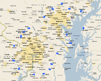 Washington-Baltimore Defense Area |
| Site Name | Missile Type | Defense Area | Site Location | Service Dates | Control Site condition/owner | Launch Site condition/owner |
|---|---|---|---|---|---|---|
| BA-03 | Nike 1B, 2C/18H, 30A/12L-UA, (8L-H) | Washington - Baltimore | Phoenix/ Sweet Air, Maryland | Nov 1955 - Apr 1974 | FDS. Redeveloped into single-family housing. No evidence of IFC site. Manning was by A/602nd (11/55-8/56), A/54th (8/56-9/58), A/4/1st (9/58-12/62) and MDArNG D/1/70th (12/62-4/74). 39°30′31″N 076°34′46″W / 39.50861°N 76.57944°W |
FDS In private ownership, the barracks north of the launch area was demolished in 2010 but was previously used as the Jacksonville Senior Center. The Launch Area is still fenced in, although the access road to the magazine area leads to a maintenance yard. Most structures are still present but have been repurposed as storage buildings. A new structure adjacent to "A" Section houses offices used by the Baltimore County Fire Department Rescue Academy. Magazines are intact, per Baltimore County personnel are locked and dry and were until recently used for fire and rescue training. The training facilities have been relocated to a new underground structure in the SW corner of the former exclusion area. 39°30′59″N 076°34′11″W / 39.51639°N 76.56972°W |
| BA-09 | Nike 1B, 2C/30A/12L-A | Washington - Baltimore | Fork, Maryland | Nov 1955 - Dec 1962 | After being inactivated by the Army, BA-09C was taken over by the Air Force sometime prior to 15 September 1967. It was used until 15 December 1975 for Civil Air Patrol use, being called Fork CAP Annex. Redeveloped into single-family housing. The Integrated Firing Control Site buildings & radars (formerly located at the end of Hutschenreuter Road in Fork were removed sometime in the early 1980s and the property is now in private hands. Manning was by D/54th (11/55-9/58), D/4/1st (9/58-9/59) and MDArNG D/1/70th (9/59-12/62) 39°26′55″N 076°27′41″W / 39.44861°N 76.46139°W |
Launch site with three intact missile pits located at the end of Stocksdale Road in Kingsville, MD. Assembly buildings are still standing but now in private hands. Entrance road has many abandoned trailers, also much junk along the sides. Magazine area is overgrown with vegetation and appears abandoned. Buildings torn down.[12] Magazine area looks like a storage/junkyard, concrete badly cracked. Launch doors visible, probably welded shut more junk lying around as well. 39°26′49″N 076°26′52″W / 39.44694°N 76.44778°W |
| BA-18 | Nike 2B, 4C/18H, 30A/23L-UA (12L-H) | Washington - Baltimore | Edgewood Arsenal, Maryland | 1954 - Apr 1974 | Partially Intact, Maryland Army National Guard. Most buildings razed, no radar towers. Operating units were C/54th (/55-9/58) and C/4/1st (9/58-4/74) 39°24′55″N 076°16′22″W / 39.41528°N 76.27278°W |
Partially Intact, Maryland Army National Guard. Double magazine, launch doors appear to be concreted over, some buildings erected on firing pads. Buildings appear to be in use in good condition. 39°25′27″N 076°15′58″W / 39.42417°N 76.26611°W |
| BA-30/31 | Nike 2B, 4C/18H, 30A/23L-UA, (12L-H) | Washington - Baltimore | Chestertown, Maryland (9 mi W) | 1954 - Apr 1974 | FDS. Buildings in use as "4-H Park and County Fairgrounds". Appears to be in good condition, no evidence of radar towers. Units assigned were D/36th (/54-9/58), D/1/562nd (9/58-12/62) and D/4/1st (12/62-4/74). 39°12′49″N 076°13′54″W / 39.21361°N 76.23167°W |
FDS. Barracks buildings in use, double magazine site. Facility fenced but appears to be open. Roads in fair condition, both magazines appear to be concreted over, large gravel pile on them, generally badly deteriorated. Remaining buildings in deteriorated condition. 39°12′14″N 076°14′12″W / 39.20389°N 76.23667°W |
| BA-43 | Nike 1B, 2C/30A/12L-A | Washington - Baltimore | Jacobsville, Maryland | 1954 - Apr 1974 | FDS. Redeveloped as Anne Arundel County Schools Maint & Operations center. Buildings in good shape, no evidence of radar towers. Manned by C/36th (/54-9/58), C/1/562nd (9/58-3/60) and MDArNG A/1/70th (3/60-12/62) 39°08′13″N 076°29′49″W / 39.13694°N 76.49694°W |
FDS. Double magazine site, now a storage yard. Buildings torn down, Launch doors visible, now welded shut. 39°07′43″N 076°29′48″W / 39.12861°N 76.49667°W |
| BA-79 | Nike 2B, 4C/24H, 20A/24L-UA, (16L-H) | Washington - Baltimore | Granite, Maryland | Dec 1954 - Mar 1974 | FDS. Obliterated. Concrete slabs and some wooden curb stops remain, but all buildings have been removed. Some roads still exist as unconnected concrete. Formerly manned by the A/54th (12/54-8/56), A/602nd (8/56-9/58), A/4/5th (9/58-8/60), B/4/1st (8/60-12/62), MDArNG A/2/70th (12/62-3/63), HHB 1/70th (10/62-8/74) and B/1/70th (12/62-4/74) 39°20′45″N 076°51′23″W / 39.34583°N 76.85639°W |
FDS. Double magazine in good shape. Most buildings still being used by the Maryland Police & Correctional Training Commission. Thoroughly fenced in. Launch area well maintained shows both Ajax and Hercules elevators, per Maryland State Police recently welded shut. The Griggs House featured at the end of the movie, 'The Blair Witch Project' was located immediately behind the site, but has since been torn down. 39°21′19″N 076°51′02″W / 39.35528°N 76.85056°W |
| BA-92 | Nike 1B, 2C/30A | Washington - Baltimore | Cronhardt, Maryland | 1955 - Sep 1963 | Mostly sold off. Small part US Army Reserve center. The buildings are all new; the motor pool, up a rise slightly, has a couple of older structures but the place otherwise has been cleaned off. Units assigned are the 2071st USAR School, 326th Maintenance Battalion and 214th MI Company. Little evidence of IFC site remains. Formerly manned by the B/54th (12/54-9/58), B/4/1st (9/58-9/59) and MDArNG D/2/70th (9/59-9/53) 39°27′24″N 076°43′44″W / 39.45667°N 76.72889°W |
FDS. Redeveloped into high-end single-family housing. A large planter covering the elevator of "B" Section and some berms is all that remains of launch site. 39°26′28″N 076°42′50″W / 39.44111°N 76.71389°W |
| W-25 | Nike 2B/12H, 20A/8L-U | Washington - Baltimore | Davidsonville, Maryland * Nike Missile Base W-25 |
Jun 1955 - Apr 1974 | Private ownership, complete and buildings look in good shape. No towers. After the Army closed the Nike facility, It was gained as an off-base installation of Andrews AFB on 21 Feb 1975, under Headquarters Command. At some later time it transferred to Military Airlift Command, and on 1 Jun 1992 transferred to Air Mobility Command. Closed by 1997. Units assigned: B/36th 96/55-9/58), B/1/562nd (9/58-12/62), B/1/71st (12/62-/65), B/4/1st (/65-11/68) and MDArNG A/1/70th (11/68-4/74). 38°54′12″N 076°39′07″W / 38.90333°N 76.65194°W |
Former twin magazine site, intact, now Anne Arundel County Police Training Academy. Some construction on launching area, launch doors concreted over, but one of the two magazines has been converted into a gym 38°54′09″N 076°38′28″W / 38.90250°N 76.64111°W |
| W-26 | Nike 1B, 2C/18H, 30A/12L-U, (8L-H) | Washington - Baltimore | Skidmore/ Bay Bridge, Maryland | 1955 - Nov 1968 | FDS. Redeveloped into Asbury Broadneck Methodist church. No evidence of IFC site. The units assigned were A/36th (/55-9/58), A/1/562nd (9/58-12/62) and MDArNG A/1/70th (12/62-11/68) 39°01′42″N 076°27′00″W / 39.02833°N 76.45000°W |
FDS. Partial remains. Launch site now parking lot for the Children's Theatre of Annapolis and athletic fields. The generator building, guard house and warheading building are present and largely intact. The northern missile magazine is still exposed but has been fenced off and is modified into an underground machine shop. The elevator is present but the hydraulics have been removed. This magazine is currently abandoned and is flooded to a depth of several inches. The other magazines are buried beneath a modern parking lot and have been filled with soil. 39°01′39″N 076°25′42″W / 39.02750°N 76.42833°W |
| W-35 | Nike 2B/20A/8L-A | Washington - Baltimore | Croom/ Marlboro, Maryland | 1955 - Mar 1963 | FDS. Redeveloped into Croom Vocational High School. Some older buildings deteriorated. No evidence of radar towers. . The units were HHB and B/75th (11/54-9/58), HHB and B/3/562nd (9/58-6/60) and MDArNG B/3/70th (6/60-3/63) 38°46′29″N 076°44′41″W / 38.77472°N 76.74472°W |
FDS Redeveloped into Croom Vocational High School, launch site is identified as the auto, building trades and grounds keeping school. Ajax launch covers visible, some obscured by buildings, two launch doors for Hercules, probably welded shut. 38°46′11″N 076°43′51″W / 38.76972°N 76.73083°W |
| W-36 | Nike 1B, 2C/30A/12L-A | Washington - Baltimore | Brandywine/ Naylor Maryland | 1957 - Dec 1961 | The housing area in Brandywine, Maryland, supported Washington Nike Site W-36 from approximately 1957 - 1961. It was transferred from the Army to the Air Force (Headquarters Command) on 10 Jun 1963. At that time it was redesignated; and Jurisdiction, Control, and Accountability assigned to Andrews AFB. At some later time it transferred to Military Airlift Command, and on 1 Jun 1992 transferred to Air Mobility Command. Current status is unknown.[13] The IFC is now abandoned. Most buildings in deteriorated state, large amount of vegetation overgrowth. Radar towers appear overgrown also. Manned by D/75th (11/54-9/58) and D/3/562nd (9/58-12/61). 38°42′38″N 076°46′14″W / 38.71056°N 76.77056°W |
FDS. Private owners, buildings in good shape, appears to be single-family homes built on site. Magazine area in good shape, launch doors visible, probably welded shut. Looks like some vehicles parked on concrete pads. 38°42′25″N 076°45′38″W / 38.70694°N 76.76056°W |
| W-44 | Nike 2B/12H, 20A/8L-UA | Washington - Baltimore | Mattawoman/ Waldorf, Maryland | 1955 - Jun 1971 | Maryland Indian Heritage Society, Melwood Horticultural Training Center. Buildings mostly razed, part of facility remains in SW corner. Operations were by C/75th (11/54-9/58), C/3/562nd (9/58-12/61), A/1/71st (12/61-3/63), MDArNG A/3/70th (12/61-3/63) and MDArNG C/1/70th (3/63-6/71). 38°39′09″N 076°52′07″W / 38.65250°N 76.86861°W |
Maryland Indian Heritage Society. Launch site looks abandoned, buildings in deteriorated condition. Ajax and Hercules launch doors visible, probably welded shut. 38°39′17″N 076°51′20″W / 38.65472°N 76.85556°W |
| W-45 | Nike 2B/20A/8L-A | Washington - Baltimore | Accokeek, Maryland | 1955 - Dec 1961 | FDS. IFC site largely torn down. A few buildings, mostly forested. W-45 was manned by the A/75th (11/54-9/58), A/3/562nd (9/58-6/60) and MDArNG B/3/70th (6/60-12/61) ADA. 38°38′33″N 077°00′45″W / 38.64250°N 77.01250°W |
FDS. Launch site relatively intact, magazines visible however appears launch doors concreted over. Perimeter fencing is intact and sturdy. Site was formerly the Naval Research Lab-Field Site lower Waldorf; the small observatory on the barracks associated with this usage has been removed. Signage indicates that it is being redeveloped as residential housing. 38°38′37″N 077°00′55″W / 38.64361°N 77.01528°W |
| W-64 | Nike 2B, 2C/24H, 60A/24L-UA, (16L-H) | Washington - Baltimore | Lorton, Virginia (dual site) | 1954 - Sep 1958 | This site was co-located with the now closed Lorton Reformatory. Under construction, all structures razed, land being re-graded. Units assigned were C/71st (7/54-9/58), C/1/71st (9/58-8/63), VAArNG A/1/280th (9/59-3/63) and VAArNG A/4/111th (8/63-4/74). 38°43′15″N 077°14′41″W / 38.72083°N 77.24472°W |
Double launch magazine now District of Columbia minimum security prison. All six magazines are concreted over. Barracks buildings remain intact and little altered. 38°42′32″N 077°15′10″W / 38.70889°N 77.25278°W |
| W-74 | Nike 2B/20A/8L-A | Washington - Baltimore | Fairfax/Pohick, Virginia | 1954 - Mar 1963 | Fairfax County ownership, maintenance yard. Only a couple of buildings standing. Two towers are still standing, covered with corrugated sheet steel. Manned by D/71st (7/54-9/58), D/1/71st (9/58-9/59) and VAArNG B/1/280th (9/59-3/63) 38°48′56″N 077°20′35″W / 38.81556°N 77.34306°W |
Launch area obliterated, owned by Fairfax County and repurposed as Popes Head Park; a marker on the site indicates that the land was transferred to the County by the US Army but does not mention Nike. Both magazines were unroofed and backfilled with earth. Perimeter fencing intact. Some ruins are visible along the west boundary, including the crushed fuelling stand and parts of the acid storage sheds. 38°48′50″N 077°21′21″W / 38.81389°N 77.35583°W |
| W-83 | Nike 1B, 2C/30A/12L-A | Washington - Baltimore | Herndon/ Dranesville, Virginia | 1954 - Nov 1962 | Redeveloped into "Observatory Park". IFC was operated by B/71st (7/54-9/58) and B/1/71st (9/58-11/62)[14] 38°59′43″N 077°18′45″W / 38.99528°N 77.31250°W |
Redeveloped into "Great Falls Nike Missile Park" 38°59′30″N 077°19′44″W / 38.99167°N 77.32889°W |
| W-92 | Nike 1B, 2C/18H, 30A/12L-U | Washington - Baltimore | Rockville, Maryland | 1954 - Apr 1974 | FDS. Redeveloped into US Consumer Products Safety Commission Engineering Laboratory. IFC units assigned were A-71st (/54-9/55), D/602nd (9/55-9/58), D/4/5th (9/58-8/60), D/1/71st (8/60-/65) and A/4/1st (/65-4/74)[15] 39°06′09″N 077°13′23″W / 39.10250°N 77.22306°W |
Remains under US government control, National Institute of Standards and Technology. Remains in secure area, used as a storage area. Apparently magazines still electrified, used for covered underground storage. The elevator still works in one magazine and is used at times to move the larger equipment. 39°07′01″N 077°13′11″W / 39.11694°N 77.21972°W |
| W-93 | Nike 1B, 2C/30A/12L-A | Washington - Baltimore | Derwood, Maryland | 1955 - Aug 1960 | FDS. Redeveloped into American Foundation for Autistic Children. IFC site operated by B/602nd (9/55-9/58) and B/4/5th (9/58-8/60) 39°12′37″N 077°05′24″W / 39.21028°N 77.09000°W |
Still under US government control, Federal Emergency Management Agency. Magazine used as Olney Federal Support Center, within a fenced area, manned and guarded 24/7. . The assembly building still stands and is used as a warehouse. The generator building is still in use. 39°12′33″N 077°06′20″W / 39.20917°N 77.10556°W |
| W-94 | Nike 1B, 2C/30A/12L-A | Washington - Baltimore | Gaithersburg, Maryland | 1955 - Mar 1963 | FDS. Obliterated, residential area. Now NIKE MISSILE PARK run by MNCPPC. 39°09′37.8″N 077°10′33.4″W / 39.160500°N 77.175944°W |
Part of Army Reserve Center, in back of facility. Used as a storage yard/junkyard. Former Ajax installation with 12 launchers. Magazines were sealed during environmental hazards assessment in the 1990s but were then opened and badly vandalized. They have since been demolished to build a training facility. The battery was manned by C/602nd (9/55-9/58), C/4/5th (9/58-6/60) and MDArNG C/2/70th (6/60-3/63) 39°10′51.1″N 077°10′35.5″W / 39.180861°N 77.176528°W |
Massachusetts
| Boston Defense Area (B or BO): Boston's Nike Batteries were manned initially by Regular Army troops. In 1959, National Guard units assumed control of B-03, B-15, B-55, and B-63. In 1964, the Army turned sites B-36 and B-73 over to the Guard. After the phase-out of the Nike Ajax system, sites B-05, B-36, and B-73 remained supplied with Hercules missiles.
Army Air-Defense Command Post (AADCP) B-21DC established at Fort Heath, MA in 1960 for Nike missile command-and-control functions. The site was an AN/FSG-l Missile-Master Radar Direction Center. In early 1965 the AN/TSQ-51 "Missile Mentor" solid-state computer system was installed. B-21DC was integrated with the USAF Air Defense Command/NORAD Semi Automatic Ground Environment (SAGE) air defense radar network as Site MM-1. The Boston Defense Area merged with Hartford & Providence Defense Areas in 1962, becoming the New England Defense Area. Air Force operations at the site ended in 1962, and Nike operations were inactivated in 1974. External links |
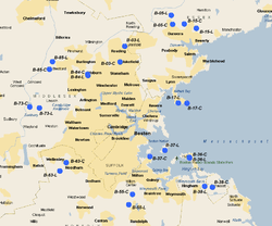 Boston Defense Area |
| Site Name | Missile Type | Defense Area | Site Location | Service Dates | Control Site condition/owner | Launch Site condition/owner |
|---|---|---|---|---|---|---|
| B-03 | Nike 1B, 2C/30A/12L-A | Boston | Reading, Massachusetts | Jun 1955 - Mar 1963 | FDS. Redeveloped into multi-family housing. 42°30′26″N 071°05′53″W / 42.50722°N 71.09806°W |
FDS. Redeveloped into skating rink. 42°32′28″N 071°05′05″W / 42.54111°N 71.08472°W |
| B-05 | Nike 1B, 2C/18H, 30A/12L-UA, (7L-H) | Boston | Danvers, Massachusetts | Nov 1956 - Apr 1974 | Remains an Army Reserve facility. Former buildings still in use, mostly cleared no sign of any radar towers. 42°35′18″N 070°56′43″W / 42.58833°N 70.94528°W |
FDS. Overgrown and abandoned. Mostly intact. 42°36′28″N 070°56′57″W / 42.60778°N 70.94917°W |
| B-15 | Nike 1B, 2C/30A/12L-A | Boston | Beverly, Massachusetts | Feb 1957 - Mar 1963 | FDS. Abandoned. Appears to be a large water tower built on site. 42°34′47″N 070°52′34″W / 42.57972°N 70.87611°W |
FDS. FEMA team headquarters, missile site still accessible. 42°35′21″N 070°54′41″W / 42.58917°N 70.91139°W |
| B-17 | Nike 1B, 2C/30A/12L-A | Boston | Nahant, Massachusetts | Feb 1957 - Mar 1963 | Located at Bailey's Hill Park. Appears to be the base of a radar tower remaining, no buildings. 42°25′09″N 070°55′46″W / 42.41917°N 70.92944°W |
Now Northeastern University Marine Science Center. Launchers obliterated. 42°25′05″N 070°54′14″W / 42.41806°N 70.90389°W |
| B-36 | Nike 2B/12H, 20A/8L-U | Boston | Fort Duvall/ Hull, Massachusetts | Jan 1956 - Apr 1974 | Formerly located on Hog Island, formerly Ft. Duvall. Now obliterated, Private ownership, housing. 42°18′01″N 070°53′46″W / 42.30028°N 70.89611°W |
Formerly located on Hog Island, formerly Ft. Duvall. Now obliterated, Park, ownership by Commonwealth of Massachusetts. 42°18′06″N 070°53′50″W / 42.30167°N 70.89722°W |
| B-37 | Nike 2B/20A | Boston | Webb Memorial State Park/ Weymouth, Massachusetts | Jan 1956 - Dec 1961 | FDS. Now Nickerson Beach/Chappel Rock Park. Obliterated, overgrown. Perhaps some structures in the overgrowth. 42°18′12″N 071°00′41″W / 42.30333°N 71.01139°W |
FDS. Located on Webb State Park/South Shore Association for Retarded Citizens (Mess Hall, EM Barracks and Missile Test & Assembly Building remain, pits buried but vents & ducts are visible). 42°19′01″N 070°58′03″W / 42.31694°N 70.96750°W |
| B-38 | Nike 1B, 2C/30A/12L-A | Boston | Cohasset/ Hingham, Massachusetts | Nov 1956 - Dec 1961 | FDS. Now "Turkey Hill Park". One small IFC building remains. 42°14′23″N 070°51′08″W / 42.23972°N 70.85222°W |
FDS. Now County highway maintenance storage facility. 42°14′14″N 070°49′50″W / 42.23722°N 70.83056°W |
| B-55 | Nike 1B, 2C/30A/12L-A | Boston | Blue Hills/ Milton, Massachusetts | Jun 1955 - Mar 1963 | FDS. Largely obliterated, now Massachusetts Audubon education center. 42°13′20″N 071°03′42″W / 42.22222°N 71.06167°W |
FDS. Former triple Ajax battery. Very deteriorated state. 42°12′00″N 071°04′21″W / 42.20000°N 71.07250°W |
| B-63 | Nike 1B, 2C/30A/12L-A | Boston | Needham, Massachusetts | Jun 1955 - Mar 1963 | FDS. Now Charles River Association for Retarded Persons, 42°17′26″N 071°15′17″W / 42.29056°N 71.25472°W |
FDS. A small not-for-profit community farm provides outdoor education on part of the site. 42°16′20″N 071°16′22″W / 42.27222°N 71.27278°W |
| B-73 | Nike 2B/12H, 20A/8L-U | Boston | South Lincoln/Wayland, Massachusetts | Jan 1956 - Apr 1974 | FDS. Now Massachusetts Audubon Society, Drumlin Farm. 42°24′29″N 071°19′56″W / 42.40806°N 71.33222°W |
FDS. Obliterated, no evidence of launch site. Residential housing built in place. 42°24′35″N 071°21′37″W / 42.40972°N 71.36028°W |
| B-84 | Nike 2B/20A/8L-A | Boston | Burlington, Massachusetts | Jan 1956 - Aug 1963 | FDS. Owned by Burlington Recreation Commission. Buildings are current home to "Burlington Players" community theatre company. Evidence of IFC structures on hill behind buildings. 42°29′24.38″N 071°10′39.49″W / 42.4901056°N 71.1776361°W |
FDS. Parking lot for Northeastern University Suburban Campus. 42°28′41″N 071°11′30″W / 42.47806°N 71.19167°W |
| B-85 | Nike 1B, 2C/30A/12L-A | Boston | Bedford, Massachusetts | Nov 1956 - Dec 1961 | After being closed in 1961, the lease for this former Nike IFC site was transferred to the Air Force in 1965. Used as the Bedford Electronics Research Annex. The Air Force used the property until 1976. Today, partially Intact, Private ownership. Redeveloped into single-family housing. 42°29′29″N 071°18′13″W / 42.49139°N 71.30361°W |
Missile pads partially Intact, Harvard University. 42°30′28″N 071°17′41″W / 42.50778°N 71.29472°W |
Michigan
| Detroit Defense Area (D): Built during the mid-1950. Headquarters facilities were posted at Selfridge AFB as well as the Detroit Artillery Armory. Between 1958 and 1961, the Army converted sites (D-06, D-16, D- 26, D-58, D-61, and D-87) from Nike Ajax to Nike Hercules. The Michigan National Guard assumed manning responsibilities for many of the sites in the 1960s. Sites D-06, D-58, and D-87 Hercules batteries remained active until 1974.
Army Air-Defense Command Post (AADCP) D-15DC established at Selfridge AFB, MI in 1960 for Nike missile command-and-control functions. The site was initially an AN/FSG-l Missile-Master Radar Direction Center. It was later upgraded to the AN/TSQ-51 "Missile Mentor" solid-state computer system. D-15DC was integrated with the USAF Air Defense Command/NORAD Semi Automatic Ground Environment (SAGE) air defense radar network as Site P-20 / Z-20 The Air Force ceased radar operations when the Army no longer needed radar support and the AADCP was inactivated 1 Sep 1974. External links |
 Detroit Defense Area |
| Site Name | Missile Type | Defense Area | Site Location | Service Dates | Control Site condition/owner | Launch Site condition/owner |
|---|---|---|---|---|---|---|
| D-06 | Nike 2B/12H, 20A/8L-U | Detroit | Utica, Michigan | 1955 - Apr 1974 | FDS. Abandoned, now known as the Rochester-Utica State Recreation Area and the Shadebush Environmental Educational Center. 42°38′37″N 083°03′33″W / 42.64361°N 83.05917°W |
FDS. Owned by the Utica School District. New building and landscaping to the west of the former missile pads. Pads have been removed, with just disturbed earth and a cleared area where they were. 42°39′01″N 083°04′06″W / 42.65028°N 83.06833°W |
| D-14 | Nike 2B/20A/8L-A | Detroit | Selfridge AFB, Michigan (Shared with D-16) | 1955 - Feb 1963 | After inactivation, the property reverted to Selfridge AFB. Partially Intact, Army Engineering Support Buildings 42°35′55″N 082°49′04″W / 42.59861°N 82.81778°W |
After inactivation, the property reverted to Selfridge AFB. Now obliterated, although largely intact. Command, maintenance, and fueling buildings now serve as the U.S. Border Patrol's Detroit Sector Headquarters 42°35′45″N 082°50′55″W / 42.59583°N 82.84861°W |
| D-16 | Nike 2B/12H, 20A/8L-U | Detroit | Selfridge AFB, Michigan (Shared with D-14) | 1955 - Jun 1971 | After inactivation, the property reverted to Selfridge AFB. Partially Intact, Army Engineering Support Buildings 42°35′55″N 082°49′04″W / 42.59861°N 82.81778°W |
After inactivation, the property reverted to Selfridge AFB. Now obliterated, although largely intact. Command, maintenance, and fueling buildings now serve as the U.S. Border Patrol's Detroit Sector Headquarters. 42°35′57″N 082°49′50″W / 42.59917°N 82.83056°W |
| D-17 | Nike 1B, 2C/30A/12L-A | Detroit | Algonac/ Marine City, Michigan | 1957 - Feb 1963 | Private ownership, redeveloped into single-family housing. Perimeter fence appears to remain. 42°41′51″N 082°34′30″W / 42.69750°N 82.57500°W |
Private ownership. Appears to be a storage area for tractor trailers. Magazines appear intact. 42°41′41″N 082°33′43″W / 42.69472°N 82.56194°W |
| D-23 | Nike 2B/20A/8L-A | Detroit | Detroit City Airport, Michigan (Shared double Launch facility with D-26, separate IFCs) | 1955 - Dec 1960 | Obliterated, City of Detroit. Land incorporated within Alfred Brush Ford Park (also known as Ford Brush Park) at the foot of Lenox Ave. Nothing remains of the IFC except the MTR and TTR towers. 42°21′24″N 082°56′28″W / 42.35667°N 82.94111°W |
Obliterated, City of Detroit. Located on Belle Isle, south of Blue Heron Lagoon, East side of Lakeside Drive 42°20′43″N 082°57′20″W / 42.34528°N 82.95556°W |
| D-26 | Nike 2B, 2C/12H, 20A/12L-UA, (8L-H) | Detroit | Belle Isle, Michigan (Shared double Launch facility with D-23, separate IFCs) | 1955 - Nov 1968 | Obliterated, City of Detroit. Now a part of Maheras-Gentry Park 42°21′22″N 082°56′58″W / 42.35611°N 82.94944°W |
Obliterated, City of Detroit. Located on Belle Isle, south of Blue Heron Lagoon, East side of Lakeside Drive 42°20′43″N 082°57′20″W / 42.34528°N 82.95556°W |
| D-51 | Nike 1B, 2C/20A/8L-A | Detroit | Naval Air Station Grosse Ile (Now Grosse Ile Airport), Michigan | 1955 - Feb 1963 | FDS. Abandoned lot now filled with junk belongs to the Township of Grosse Ile and is leased to a landscaping company 42°06′28″N 083°09′18″W / 42.10778°N 83.15500°W |
FDS. Has been completely demolished and made into a nature conservatory. A semi-circular embankment protecting the fueling area remains. This area is currently being run by the U.S. Fish and Wildlife Service. 42°05′52″N 083°09′15″W / 42.09778°N 83.15417°W |
| D-54 | Nike 4B, 2C/30A/24L-AA | Detroit | Riverview/ Wyandotte, Michigan (dual site) | 1955 - Feb 1963 | FDS. Redeveloped into Immanuel Lutheran Church and a multi-story light office building 42°10′59″N 083°11′47″W / 42.18306°N 83.19639°W |
FDS. Launcher area is now a public park with a Nike-Hercules missile and plaque dedicating the site. The pits are still there, under the park, behind the fire station. There is one original building left near the launch site, which has been refurbished and turned into a hall to host Cub Scout events and such. 42°10′28″N 083°11′49″W / 42.17444°N 83.19694°W |
| D-57/58 | Nike Carlton: 3B/20A/12L-A Newport: 3B/18H, 30A/12L-UA | Detroit | Carleton/ Newport, Michigan (shared double launch, separate control sites) | 1955 - Apr 1974 | FDS Derelict, but partially intact. The Radar towers, Generator bldg., Van pads, and connecting building foundation are all there. 42°00′06″N 083°22′04″W / 42.00167°N 83.36778°W |
FDS Redeveloped into single-family housing. 42°00′20″N 083°20′35″W / 42.00556°N 83.34306°W |
| D-61 | Nike 1B, 2C/18H, 30A/12L-UA | Detroit | Romulus/ Dearborn, Michigan | 1957 - Jun 1971 | Northwest side of what is now Detroit Metropolitan Wayne County Airport. 42°13′42″N 083°21′34″W / 42.22833°N 83.35944°W |
East side of what is now Detroit Metropolitan Wayne County Airport. 42°12′08″N 083°21′06″W / 42.20222°N 83.35167°W |
| D-69 | Nike 2B/20A/8L-A | Detroit | River Rouge Park, Michigan | 1956 - Feb 1963 | Partially Intact, City of Detroit, River Rouge Park. 42°21′29″N 083°15′12″W / 42.35806°N 83.25333°W |
Obliterated, City of Detroit. Redeveloped into Howard Cassidy Park. 42°20′27″N 083°14′59″W / 42.34083°N 83.24972°W |
| D-86 | Nike 1B, 2C/30A/12L-A | Detroit | Franklin/ Bingham, Michigan | 1957 - Feb 1963 | Site is now the location of a couple of office buildings. 42°29′12″N 083°17′43″W / 42.48667°N 83.29528°W |
Partially intact. It resides within an Army Reserve facility. 42°29′30″N 083°18′29″W / 42.49167°N 83.30806°W |
| D-87 | Nike 1B, 2C/18H, 30A/12L-U, (10L-H) | Detroit | Commerce/ Union Lake, Michigan | 1955 - Apr 1974 | FDS. Almost intact - buildings still exist but are vandalized and a section has major fire damage. It is also owned by the Michigan DNR. It was being used as a Day Camp for children, but is now abandoned.[16] 42°35′48″N 083°28′15″W / 42.59667°N 83.47083°W |
FDS. Demolished, open lot owned by Michigan DNR. 42°35′57″N 083°28′00″W / 42.59917°N 83.46667°W |
| D-97 | Nike 1B, 2C/30A/12L-A | Detroit | Auburn Hills, Michigan | 1955 - Feb 1963 | Obliterated, Oakland Community College 42°38′41″N 083°13′24″W / 42.64472°N 83.22333°W |
Obliterated by 1997. Oakland Community College. Was used as a storage site for construction supplies by the university's building contractors at first. 42°38′35″N 083°14′01″W / 42.64306°N 83.23361°W |
Minnesota
| Minneapolis-St.Paul Defense Area (MS): In operation from 1959 until 1971, the following four Nike Hercules batteries
guarded the approaches to the Twin Cities. The Birdie command and control facility, located at Snelling Air Force Station, provided target designation information to the batteries. Headquarters facilities were also located at Snelling. External links |
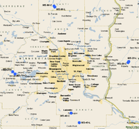 Minneapolis-St Paul Defense Area |
| Site Name | Missile Type | Defense Area | Site Location | Service Dates | Control Site condition/owner | Launch Site condition/owner |
|---|---|---|---|---|---|---|
| MS-20 | Nike 3D/18H/12L-U | Minneapolis - Saint Paul | Roberts, Wisconsin | Oct 1959 - Jun 1971 | Bureau of Outdoor Recreation to Saint Croix County 45°01′18″N 092°33′41″W / 45.02167°N 92.56139°W |
Launch site in good condition. Fenced and gated. Also used as a self-storage site. 45°01′47″N 092°33′13″W / 45.02972°N 92.55361°W |
| MS-40 | Nike 3D/18H/12L-U | Minneapolis - Saint Paul | Castle Rock, Minnesota | Oct 1959 - Jun 1971 | USAR Center. 44°38′36″N 093°09′50″W / 44.64333°N 93.16389°W |
Is on County Road 80S in Castle Rock, Minnesota. Used to be well preserved for its years of age and disuse, but the underground batteries were demolished and filled in 2001. It was formerly under private ownership, used as an Airsoft gaming facility, most notably by the Minnesota Airsoft Association. The owner had planned to use it as a Law Enforcement Training facility, however, after rejecting a bid submitted by a construction company owned by the Planning Commission Chairman, the owners requests for permits were rejected. The site is currently for sale. It is home to a MNDOT radio tower. It is also a safe haven for deer chased by hunters in the area, as it is completely fenced in. 44°34′17″N 093°04′37″W / 44.57139°N 93.07694°W |
| MS-70 | Nike 3D/18H/12L-U | Minneapolis - Saint Paul | Saint Bonifacius, Minnesota | Oct 1959 - Jun 1971 | Private ownership. Partially intact, on "Nike Road". 44°56′07″N 093°45′24″W / 44.93528°N 93.75667°W |
FDS Private ownership in good condition. 44°57′05″N 093°46′52″W / 44.95139°N 93.78111°W |
| MS-90 | 3D/18H/12L-U | Minneapolis - Saint Paul | Bethel/ Isanti, Minnesota | 1959 - Jun 1971 | Isanti County Sheriff's Department. 45°26′22″N 093°20′16″W / 45.43944°N 93.33778°W |
Private ownership, largely intact. 45°26′52″N 093°20′46″W / 45.44778°N 93.34611°W |
Missouri
| Kansas City Defense Area (KC): Two Nike Hercules batteries, dubbed Lawson and Lone Jack, guarded the eastern approaches to Kansas City. The Corps of Engineers Kansas City District commenced work on these sites in late spring 1958. Army Air-Defense Command Post (AADCP) KC-65DC was established at Olathe AFS, KS in 1959 for Nike missile command-and-control functions. The site was equipped with the AN/GSG-5(V) BIRDIE solid-state computer system.
KC-65DC was integrated with the USAF Air Defense Command/NORAD Semi Automatic Ground Environment (SAGE) air defense radar network as Site P-72 / Z-72. Air Force operations ended 8 Sep 1968; the AADCP inactivated in 1969 St. Louis Defense Area (SL): The Chicago District of the Corps of Engineers oversaw the design and construction. Army Air-Defense Command Post (AADCP) SL-47DC was established at Belleville AFS, IL in 1959 for Nike missile command-and-control functions. The site was equipped with the AN/GSG-5(V) BIRDIE solid-state computer system. SL-47DC was integrated with the USAF Air Defense Command/NORAD Semi Automatic Ground Environment (SAGE) air defense radar network as Site P-70 / Z-70. The site was closed on 18 June 1968. External links
|
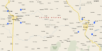 Missouri Nike Missile Sites |
| Site Name | Missile Type | Defense Area | Site Location | Service Dates | Control Site condition/owner | Launch Site condition/owner |
|---|---|---|---|---|---|---|
| KC-10 | Nike 3D/18H/12L-U | Kansas City | Lawson, Missouri | Nov 1959 - Feb 1964 | Private Ownership. 3 Well preserved buildings in good shape, several others deteriorated; sidewalks between buildings exist and also the base of the flagpole. Several radar towers standing, several buildings in radar area deteriorating, some loose concrete on site. Area fenced and gated. 39°24′55″N 094°10′24″W / 39.41528°N 94.17333°W |
Private ownership. Buildings deteriorated but intact. Concreted areas cracked and in poor condition. Magazine area appears to be an auto junkyard, although intact, appears to be a large garage, auto dismantling building erected over the magazine. 39°26′06″N 094°10′22″W / 39.43500°N 94.17278°W |
| KC-30 | Nike 3D/18H/12L-U | Kansas City | Pleasant Hill, Missouri | Nov 1959 - Feb 1969 | Private ownership, development company. Buildings torn down, foundations remain. Roads exist with severe cracking in poor shape. 38°49′52″N 094°09′41″W / 38.83111°N 94.16139°W |
Intact, appears to be in private hands. Buildings torn down, some new structures erected, bunch of old boats and trucks stored on site; may be a junkyard. Concrete around magazines severely cracked, both Ajax and Hercules doors, although appear to be welded shut. 38°48′59″N 094°09′22″W / 38.81639°N 94.15611°W |
| KC-60 | Nike 3D/18H/12L-U | Kansas City | Gardner, Kansas (2 mi S) | Nov 1959 - Feb 1969 | Redeveloped into Gardner Unified School offices. Site totally redeveloped with new buildings. No evidence of IFC remains.... 38°46′34″N 094°55′42″W / 38.77611°N 94.92833°W |
FDS. Located behind single-family home subdivision 20144 South Garner Road. Owned by the Gardner Unified School District. As of 2009, the lot has been renovated as a complete school area. Magazine full of water. The only indication of there ever being a missile site would be the name of the school(Nike) and the books in the library. 38°45′38″N 094°56′04″W / 38.76056°N 94.93444°W |
| KC-80 | Nike 3D/18H/12L-U | Kansas City | Fort Leavenworth, Kansas | Nov 1959 - Feb 1969 | Redeveloped. Single-family home. Large wooded area around home, appears to be totally redeveloped with no evidence of IFC, although may be parts of the facility in the woods to the southwest of the house. 39°20′29″N 094°57′04″W / 39.34139°N 94.95111°W |
Mix of new and old buildings. Currently used as the Rod & Gun Club and the 35th Infantry Division (Mech) motor pool/maintenance facility. The vehicle park is on top of the three magazines. Large number of cars, boats, large RVs. Doors probably welded shut. 39°21′42″N 094°56′24″W / 39.36167°N 94.94000°W |
| SL-10 | Nike 3D/18H/12L-U | Saint Louis | Marine, Illinois | May 1960 - Dec 1968 | Access road to highway 4 only remnants of IFC site. Contaminated soil remediated on site. Village has constructed wastewater treatment lagoons on 1/3 of site. Rest of site is used by farmers. Fenced. 38°47′44″N 089°47′58″W / 38.79556°N 89.79944°W |
Private ownership, Old Army building still standing most in good condition, along with the roads. Concrete area around magazines in good shape, appears to be used as a storage yard. 38°49′56″N 089°47′25″W / 38.83222°N 89.79028°W |
| SL-40 | Nike 3D/18H/12L-U | Saint Louis | Hecker, Illinois | May 1960 - Dec 1968 |
Private Ownership - Purchased 7-12-14 by Ron Mertens of Smithton IL.
Beck VoTech School. Buildings appear in excellent condition. |
FDS. Abandoned. Most buildings remain, Concrete in magazine area cracked. Launchers appear to be concreted over. Fenced. 38°16′11″N 089°57′00″W / 38.26972°N 89.95000°W |
| SL-60 | Nike 3D/18H/12L-U | Saint Louis | Pacific, Missouri (5 mi S) | 1960 - Dec 1968 | Private ownership, now MPL Industries. On "Nike Base Road". Mostly redeveloped, many buildings remain in good shape, sidewalks still connecting buildings. Troop barracks are used for storage for Nike Elementary School in the Meramec Valley R-3 school district. Air strip is now part of Evergreen Lakes subdivision. 38°24′30″N 090°45′16″W / 38.40833°N 90.75444°W |
Road back to launch site from IFC in good shape. Fenced and gated. Site is now used as a bus parking lot for Meremec Valley R-3 school district. Some buildings exist, launcher area intact. 38°24′13″N 090°45′18″W / 38.40361°N 90.75500°W |
| SL-90 | Nike 3D/18H/12L-U | Saint Louis | Alton/ Pere Marquette May, Illinois | 1960 - Dec 1968 | Intact, Abandoned, Pere Marquette State Park. Overgrown, most buildings underneath veneration canopy. Still behind locked gate and fenced. 38°58′55″N 090°30′32″W / 38.98194°N 90.50889°W |
Abandoned, Pere Marquette State Park, kits if debris on the launchers, site used as a storage yard. 38°59′43″N 090°30′36″W / 38.99528°N 90.51000°W |
Nebraska
| Lincoln AFB Defense Area (LI): The missiles provided defense for SAC B-47 bombers and Atlas missiles stationed at and around Lincoln AFB between 1960 and 1966.
Offutt AFB Defense Area (OF): Provided a Nike Hercules defense for Omaha's Offutt AFB, which was the Headquarters of the Strategic Air Command. Offutt also hosted SAC tankers and Atlas missiles were deployed around the area in the early 1960s. An Army Air-Defense Command Post (AADCP) was established at Omaha AFS, NE in 1959 for Nike missile command-and-control functions. The site was equipped with the AN/GSG-5(V) BIRDIE solid-state computer system. The AAFC was integrated with the USAF Air Defense Command/NORAD Semi Automatic Ground Environment (SAGE) air defense radar network as Site P-71 / Z-71. The site was inactivated on 8 Sep 1968. External links |
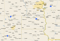 Nebraska Nike Missile Sites |
| Site Name | Missile Type | Defense Area | Site Location | Service Dates | Control Site condition/owner | Launch Site condition/owner |
|---|---|---|---|---|---|---|
| LI-01 | Nike 3AG/12H/12L-H | Lincoln | Ceresco/Davey, Nebraska | 1960 - Jun 1966 | Raymond Central High School some buildings intact but site greatly modified for school 41°01′24″N 096°44′50″W / 41.02333°N 96.74722°W |
Above-ground magazines protected by berms. Abandoned, in private hands. Buildings standing and in use. Being used as an auto junkyard, large numbers of junk cars stored in missile firing pads. 41°02′10″N 096°44′25″W / 41.03611°N 96.74028°W |
| LI-50 | Nike 3AG/12H/!@L-H | Lincoln | Crete, Nebraska | 1960 - Jun 1966 | In private ownership. Buildings in good condition and in use. Undetermined purpose Site largely intact barracks has been torn down. One radar tower standing. 40°39′18″N 096°49′41″W / 40.65500°N 96.82806°W |
Fenced and gated above-ground magazines protected by berms. Buildings still standing, missile firing area in good condition. A few vehicles being stored in abandoned berm area, appears in good shape. 40°38′45″N 096°49′25″W / 40.64583°N 96.82361°W |
| OF-10 | Nike 3AG/12H/12L-H | Offutt AFB | Treynor, Iowa | 1960–1966 | Green Hills Area Education Agency Central Office. Buildings in good shape. 41°13′50″N 095°42′49″W / 41.23056°N 95.71361°W |
Above-ground firing site, although no berms visible. Private ownership, good shape. 41°13′50″N 095°41′57″W / 41.23056°N 95.69917°W |
| OF-60 | Nike 3AG/12H/12L-H | Offutt | Cedar Creek, Nebraska | 1960–1966 | FDS. In private hands. Buildings in good shape, Radar tower bases visible. 40°59′18″N 096°04′26″W / 40.98833°N 96.07389°W |
FDS. In private hands, appears in good shape. 40°59′00″N 096°05′28″W / 40.98333°N 96.09111°W |
New Jersey
External links |
[] |
| Site Name | Missile Type | Defense Area | Site Location | Service Dates | Control Site condition/owner | Launch Site condition/owner |
|---|---|---|---|---|---|---|
| PH23/25 | Nike Ajax and Hercules[17] | Philadelphia | Lumberton | 1956-1974[17] | Demolished Nov 2015 for a housing development. 2 radar towers remain on the property of a landscape business. | Buildings Demolished Sept 2015 Magazines are there and part of a municipal maintenance facility |
New Mexico
Walker AFB Defense Area (W): As a Strategic Air Command base, it was determined that Walker should be defended by a Nike Hercules battalion. The 6/2d was activated at Walker on 20 April 1960; it was then inactivated on 25 June 1960, without ever being declared operational, the construction then subsequently abandoned.
External links |
 Walker AFB Defense Area |
| Site Name | Missile Type | Defense Area | Site Location | Service Dates | Control Site condition/owner | Launch Site condition/owner |
|---|---|---|---|---|---|---|
| W-10 | Nike 3AG (never operational) | Walker | Roswell, New Mexico | Never operational | Intact, NMArNG Miliray Academy. Buildings standing, looks abandoned. 33°25′20″N 104°20′50″W / 33.42222°N 104.34722°W |
Intact, MNArNG training site. Abandoned. 33°26′09″N 104°20′07″W / 33.43583°N 104.33528°W |
| W-50 | Nike 3AG (never operational) | Walker | Hagerman, New Mexico | Never operational | Demolished, Roswell Correctional Center Partially 33°08′27″N 104°32′34″W / 33.14083°N 104.54278°W |
Intact, abandoned. Built on a former World War II auxiliary field (#3) of Roswell AAF. 33°07′34″N 104°32′38″W / 33.12611°N 104.54389°W |
| Launch Site One | Nike 1B, 2C/18H, 30A/12L-UA, (7L-H) | No Defense Area | McGregor Guided Missile Range, New Mexico | 1957 - Dec 1992 | FDS | FDS |
New York
| Niagara Falls-Buffalo Defense Area (NF, BU): Buffalo and Niagara Falls were separate Defense Areas until their merger in December 1961. Before consolidation, the Niagara Falls Defense Area was commanded from historic Fort Niagara. Both Regular Army and Army National Guard Units operated these batteries. The Army Air-Defense Command Post (AADCP) NF-17DC established at Lockport AFS, NY in 1960 for Nike missile command-and-control functions. The site was an AN/FSG-l Missile-Master Radar Direction Center.
NF-17DC was integrated with the USAF Air Defense Command/NORAD Semi Automatic Ground Environment (SAGE) air defense radar network as Site P-21 / Z-21 Nike operations at the site inativated in 1962. New York Defense Area (NY): Combined with the sites located in New Jersey, the New York sites composed one of the largest defensive nets in the nation. Headquarters facilities were located at Tappan, Fort Totten, Fort Wadsworth, and Roslyn. Initially, New York's air defenses had been manually coordinated from Fort Wadsworth on Staten Island. Later, Army Air-Defense Command Post (AADCP) NY-55DC was established at Highlands AFS, NJ in June 1960 for Nike missile command-and-control functions. The site was an AN/FSG-l Missile-Master Radar Direction Center. Later the AN/TSQ-51 "Missile Mentor" solid-state computer system was installed. NY-55DC was integrated with the USAF Air Defense Command/NORAD Semi Automatic Ground Environment (SAGE) air defense radar network as Site P-9 / Z-9 Air Force operations at the site ended on 1 July 1966, and Nike operations were inactivated on 31 Oct 1974. As in several other states, during the 1960s the National Guard assumed a greater role in operating the sites. External links |
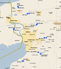 Niagara Falls-Buffalo Defense Area 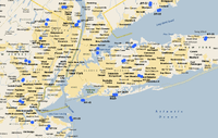 New York Defense Area |
| Site Name | Missile Type | Defense Area | Site Location | Service Dates | Control Site condition/owner | Launch Site condition/owner |
|---|---|---|---|---|---|---|
| BU-09 | Nike 1B, 2C/30A/12L-A | Niagara/ Buffalo | Ransom Creek/ Millersport, New York | 1956 - Dec 1961 | FDS. Some military buildings being used by city as offices. Most of site has been obliterated, fenceline visible in aerial imagery. 43°03′14″N 078°43′13″W / 43.05389°N 78.72028°W |
FDS. Buildings in good condition, magazine area in use by the city police department as a vehicle storage area. 43°03′49″N 078°42′38″W / 43.06361°N 78.71056°W |
| BU-18 | Nike 3B/18H, 30A/12L-U | Niagara/ Buffalo | Lancaster/ Milgrove, New York | 1956 - Mar 1970 | FDS. Lancaster Village Police Department and local government office. Largely redeveloped, although several old IFC buildings still used. 42°55′46″N 078°37′12″W / 42.92944°N 78.62000°W |
FDS. Appears in good condition, buildings in use. Magazine area used by construction company for equipment repair/storage. Electrified with working elevators. 42°55′50″N 078°35′49″W / 42.93056°N 78.59694°W |
| BU-34/35 | Nike 2B, 4C/60A/24L-AA | Niagara/ Buffalo | Orchard Park, New York (dual site) | 1956 - Mar 1963 | FDS. Vacant land. Some IFC roads exist, no structures. 42°47′34″N 078°41′56″W / 42.79278°N 78.69889°W |
FDS. Largely obliterated. Buildings at beginning of entrance road, former underground double magazine. Aireal image shows faint evidence of launcher area appears to be covered with soil. 42°46′34″N 078°40′06″W / 42.77611°N 78.66833°W |
| BU-52 | Nike 2B, 4C/60A/24L-AA | Niagara/ Buffalo | Hamburg, New York (dual site) | 1956 - Dec 1961 | The IFC was located off New Lake View Road, at 2 E. Heltz Road, and is now offices for the Town of Hamburg and as part of Lakeview Road Recreation Area. Obliterated. 42°42′37″N 078°53′30″W / 42.71028°N 78.89167°W |
Was a double-site Launcher and Integrated Fire Control Area for Nike-Ajax Missiles. In use by state highway department and is currently covered by a bike track, a Hamburg Town Park, and Bulk Storage.[18] New buildings erected. 42°42′37″N 078°54′06″W / 42.71028°N 78.90167°W |
| NF-03 | Nike 2B, 4C/60A/24L-AA | Niagara/ Buffalo | Model City, New York (dual site) | 1955–1963 | FDS. Abandoned IFC site. Porter Center Road divides site into west and east sections. Buildings exist on east side of road, appear to be in poor condition and overgrown. West side of site largely forested with little evidence of use. 43°12′59″N 078°57′32″W / 43.21639°N 78.95889°W |
FDS. Former double-magazine site abandoned and mostly overgrown with vegetation. The launcher site was acquired by the USAF in 1965 and become the Youngstown Test Site. This site was the western end of a test range under the jurisdiction of Griffiss AFB. Closed at an unknown date, Today, a few foundations of buildings visible, launch area exists, condition unknown probably filled with water. 43°13′43″N 078°57′46″W / 43.22861°N 78.96278°W |
| NF-16 | Nike 2B, 4C/18H, 30A/24L-UA, (11L-H) | Niagara/ Buffalo | Sanborn/ Cambria, New York (dual site) | 1955 to Mar 1970 | Private ownership. Barracks building in use, several radar towers still standing. Appears to be light office building. 43°09′31″N 078°50′23″W / 43.15861°N 78.83972°W |
Cambria Municipal offices, appears to be converted into maintenance storage yard. Few buildings left, faint traces of one magazine but very little of Launch site remains. 43°09′41″N 078°49′06″W / 43.16139°N 78.81833°W |
| NF-41 | Nike 1B, 2C/18H/11L-U | Niagara/ Buffalo | Grand Island, New York (Formerly dual NF-74/NF-75) | Apr 1959 - Mar 1970 | Private ownership. Is now known as Nike Base Town Park; as such, it hosts Grand Island's Senior Citizen Center, a town-sponsored safe hangout for teens known as Reality Cafe, and space for group meetings. A few military buildings still in use, new construction. 43°01′07″N 079°00′47″W / 43.01861°N 79.01306°W |
Is now used as the Grand Island Central School District's Eco Island Ecology Reserve. Former triple-magazine site now abandoned. Large piles of earth on top of magazines, some vehicles parked in magazine area visible in aerial images. LC buildings along Stanley road still in use. 43°00′32″N 079°00′56″W / 43.00889°N 79.01556°W |
| NY-03/04 | Nike 2B, 1C/18H, 30A/24L-UA, (12L-H) | New York | Orangeburg/ Mount Nebo, New York (dual site) | 1955 - Apr 1974 | Some old IFC buildings in use being used by the Town of Orangeburg. 41°01′57″N 073°57′03″W / 41.03250°N 73.95083°W |
Intact, USAR Center - Orangeburg. Batteries paved over with asphalt, new building construction. 41°02′16″N 073°56′29″W / 41.03778°N 73.94139°W |
| NY-09 | Nike 1B, 2C/30A/12L-A | New York | Kensico/ White Plains, New York | 1955–1963 | FDS. Now "Nike Overlook Park". IFC mostly taken over by woods, some buildings still stand, asphalted area badly cracked. 41°03′19″N 073°55′41″W / 41.05528°N 73.92806°W |
FDS Launch site adjacent to NY-03/04. 41°02′16″N 073°56′33″W / 41.03778°N 73.94250°W |
| NY-15 | Nike 2B/20A/8L-A | New York | Fort Slocum, New York | 1955 - Jul 1960 | Abandoned. David's Island. Buildings torn down, some sidewalks left. Not much else. 40°53′07″N 073°46′09″W / 40.88528°N 73.76917°W |
Abandoned. Hart Island, Double Magazines covered over with vegetation on north end of island; Buildings spread out all over the island, all appear in highly deterioration condition. 40°51′29″N 073°46′16″W / 40.85806°N 73.77111°W |
| NY-20 | Nike 1B, 2C/20A/12L-A | New York | Lloyd Harbor/ Huntington, New York | Jan 1957 - 1962. In the 1970s, the partially dismantled site was part of the Friends World College campus. | Now obliterated, High-end single-family housing, no evidence of IFC. 40°54′22″N 073°27′33″W / 40.90611°N 73.45917°W |
Obliterated, High-end single-family housing, possibly some partial remains covered by trees and vegetation. 40°53′50″N 073°28′21″W / 40.89722°N 73.47250°W |
| NY-23 | Nike 1B, 2C/20A/12L-A | New York | Brookville/ Oyster Bay, New York | 1955–1963 | Obliterated, High-end single-family housing, no evidence of IFC. 40°48′22″N 073°33′37″W / 40.80611°N 73.56028°W |
Magazine remains, concreted over. Owned by the Nassau Board of Cooperative Education, which uses the site as the Brookville Nature Park and Outdoor Education Center. 40°48′38″N 073°32′53″W / 40.81056°N 73.54806°W |
| NY-24 | Nike 3B/18H, 30A/12L-U | New York | Amityville/ Farmingdale, New York | 1957 - Apr 1974 | Obliterated, new office building construction, in highly urban area. No evidence of IFC. 40°42′49″N 073°25′35″W / 40.71361°N 73.42639°W |
Either Army Reserve or NY National Guard site. New building for armory, no FC buildings remain. Missile launchers asphalted over but some doors still visible. Launcher area now motor pool for military vehicles. 40°42′30″N 073°24′20″W / 40.70833°N 73.40556°W |
| NY-25 | Nike 1B, 2C/18H, 30A/10L-U | New York | Defense Hill Rd, East Shoreham, New York | 1957 - Jun 1971 | Mostly cleared land, some roads of IFC remain but that's about it Perimeter fence appears to be still standing, taken over by vegetation, however outline is clear in aerial imagery. Housing area intact, in private ownership. Former access road to IFC remains, highly deteriorated and partially taken over by vegetation. Part of the IFC has been redeveloped into unorganized sports facility. 40°57′00″N 072°52′07″W / 40.95000°N 72.86861°W |
Double magazine now motor pool area for Army Reserve unit. Also storage yard. 40°56′25″N 072°52′20″W / 40.94028°N 72.87222°W |
| NY-29/30 | Nike 2B, 4C/60A/24L-AA | New York | Lido Beach, New York (dual site) | 1955–1963 | Redeveloped into large school and recreational area of the Long Beach School District. IFC Obliterated. 40°35′36″N 073°38′04″W / 40.59333°N 73.63444°W |
Triple magazines visible, overgrown and abandoned. Many of the original structures, fencing, pavement, light poles, etc., still remain. Also being used by School District for school bus parking 40°35′33″N 073°36′54″W / 40.59250°N 73.61500°W |
| NY-49 | Nike 4B/18H, 30A/16L-U | New York | Fort Tilden, Rockaway Point Road, New York | 1955 - Apr 1974 | Intact, Gateway National Recreation Area. All buildings razed, partially reused by parking lot and West Bayshore Blve. No evidence of IRC except some disturbed land where structures once were. 40°33′30″N 073°53′49″W / 40.55833°N 73.89694°W |
Intact, US Park Service, very deteriorated condition. 40°33′32″N 073°53′17″W / 40.55889°N 73.88806°W |
| NY-53 | Nike 1B, 2C/30A/12L-A | New York | Leonardo/ Belford, New Jersey | 1957–1963 | FDS Location Undetermined Possibly incorporated into Naval Weapons Station Earle. | FDS Location Undetermined. Redeveloped into single-family home sites. 40°23′26″N 74°05′16″W / 40.39052°N 74.08783°W |
| NY-54 | Nike 2B/12H, 20A/8L-U | New York | Holmdel/Hazlet, New Jersey | 1955 - Nov 1968 | Redeveloped into Phillips Park. No evidence of IFC. 40°23′40″N 074°10′17″W / 40.39444°N 74.17139°W |
Redeveloped into park and recreation area. No evidence of LS. 40°22′39″N 074°11′15″W / 40.37750°N 74.18750°W |
| NY-56 | Nike 4B/24H, 40A/16L-UU | New York (dual site) | Sandy Hook, New Jersey | 1960 - Jun 1971 | Located on the former Sandy Hook Proving Ground (now a part of the Gateway National Recreation Area) in New Jersey, has been preserved and is open to the public. The IFC area is open one weekend a month from April to October. Numerous buildings and radar platforms exist. 40°26′53″N 073°59′36″W / 40.44806°N 73.99333°W |
The launcher area has occasional tours. The park currently owns three Ajax missiles and one Hercules. Every fall, the park holds a Cold War Day event. Site NY-56 is listed in the National Register of Historic Places as part of the Sandy Hook Proving Ground Historic District. Twin magazine, abandoned, buildings in use, concrete in launcher area weathered by ocean and salt air. 40°26′01″N 073°59′07″W / 40.43361°N 73.98528°W |
| NY-58/60 | Nike 2B/12H, 20A/8L-U | New York | Old Bridge, New Jersey | 1955 - Nov 1968 | Obliterated, only foundations remain, Township owned 40°25′05″N 074°18′45″W / 40.41806°N 74.31250°W |
Obliterated, paved over for tractor trailer parking lot. No evidence remains of LS. 40°25′02″N 074°18′34″W / 40.41722°N 74.30944°W |
| NY-65 | Nike 2B/12H, 20A/8L-U | New York | South Plainfield, New Jersey | 1955 - Jun 1971 | Redeveloped into single-family housing, no evidence of IFC. 40°32′37″N 074°23′34″W / 40.54361°N 74.39278°W |
Redeveloped into Hadley Shopping Center and a light industrial park. Obliterated. 40°33′02″N 074°24′40″W / 40.55056°N 74.41111°W |
| NY-73 | Nike 1B, 2C/30A/12L-A | New York | Summit/ Watchung, New Jersey | 1958 - Apr 1963 | Redeveloped into Governor Livingston Regional High School. 40°41′11″N 074°23′14″W / 40.68639°N 74.38722°W |
Abandoned, deteriorating, 40°40′48″N 074°23′28″W / 40.68000°N 74.39111°W |
| NY-79/80 | Nike 2B, 4C/18H, 30A/23L-UA, (12L-H) | New York | Livingston, New Jersey (dual site) | 1955 - Apr 1974 | Essex County Park District, developed into Riker Hill Park. The control area was located atop Riker Hill (now Riker Hill Art Park) in Livingston in order to obtain good radar coverage of the region. IFC now obliterated. 40°47′57″N 074°20′19″W / 40.79917°N 74.33861°W |
This double Nike site was operational with both Ajax and Hercules missiles. Largely Obliterated, some remains in semi-wooded area. 40°48′22″N 074°21′54″W / 40.80611°N 74.36500°W |
| NY-88 | Nike 1B, 2C/30A/12L-A | New York | Mountain View/ Wayne, New Jersey | 1955–1963 | Redeveloped into high-end single-family housing. No evidence of IFC. 40°56′57″N 074°14′43″W / 40.94917°N 74.24528°W |
Site used as vehicle storage for county vehicles, and other public services. Guard shack still visible, launcher site clearly visible, and administrative buildings still in use. 40°55′49″N 074°15′52″W / 40.93028°N 74.26444°W |
| NY-93/94 | Nike 4B, 2C/18H, 30A/24L-UA, (12L-H) | New York | Ramsey/ Darlington/ Mahwah, New Jersey | 1955 - Jun 1971 | Now wooded area. 41°02′14″N 074°11′54″W / 41.03722°N 74.19833°W |
Now upscale housing development 41°03′55″N 074°11′18″W / 41.06528°N 74.18833°W |
| NY-99 | Nike 3B/30A/12L-A | New York | Spring Valley/ Ramapo, New York | 1956–1963 | Partially Intact, East Ramapo School District. 41°08′47″N 074°03′35″W / 41.14639°N 74.05972°W |
Partially Intact, East Ramapo School District. Paved over parking lot for trucks.. 41°08′47″N 074°02′21″W / 41.14639°N 74.03917°W |
Ohio
| Cincinnati-Dayton Defense Area (CD): The sites became operational in 1960 to defend the industrial centers of the upper Ohio River Valley. A "BIRDIE" site collocated at C-27 hosted missile command and control functions for the region. The sites remained active until 1970-1971.
Cleveland Defense Area (CL): Headquarters facilities were located at the Shaker Heights Armory and in Cleveland. Sites CL-02, CL-ll, and CL-69 were converted to fire Nike Hercules missiles. In 1968, the Cleveland Defense Area merged with Detroit's. In June 1971, the three remaining Nike Hercules batteries were deactivated. External links |
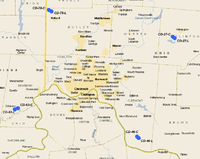 Cincinnati-Dayton Defense Area  Cleveland Defense Area |
| Site Name | Missile Type | Defense Area | Site Location | Service Dates | Control Site condition/owner | Launch Site condition/owner |
|---|---|---|---|---|---|---|
| CD-27 | Nike 3D/18H/12L-U | Cincinnati - Dayton | Wilmington, Ohio | Mar 1960 - Mar 1970 | Now light industrial area, some old IFC buildings still in use 39°24′31″N 083°53′44″W / 39.40861°N 83.89556°W |
Intact, Private ownership. Most buildings in good condition, magazine in good condition. 39°24′02″N 083°52′57″W / 39.40056°N 83.88250°W |
| CD-46 | Nike 3D/18H/12L-U | Cincinnati - Dayton | Felicity, Ohio | Apr 1960 - Mar 1970 | OHArNG, C Company, 216th Engineers. Buildings in good condition, no radar towers. 38°51′05″N 084°09′20″W / 38.85139°N 84.15556°W |
Buildings in good condition, magazine being used as tractor trailer parking and storage site. 38°50′38″N 084°08′35″W / 38.84389°N 84.14306°W |
| CD-63 | Nike 3D/18H/12L-U | Cincinnati - Dayton | Dillsboro, Indiana | Apr 1960 - Mar 1970 | Buildings in good condition, the old radar towers are still standing. 39°00′28″N 085°00′36″W / 39.00778°N 85.01000°W |
Missile Launching site converted to a private residence (including old missile silos) on Ind. 262 just outside the town limits. Buildings in good condition, magazine being used as tractor trailer parking and storage site. 39°00′04″N 085°02′02″W / 39.00111°N 85.03389°W |
| CD-78 | Nike 3D/18H/12L-U | Cincinnati - Dayton | Oxford, Ohio | Mar 1960 - Mar 1970 | Private ownership, in excellent condition. Buildings in good condition, also several radar towers. 39°33′01″N 084°46′22″W / 39.55028°N 84.77278°W |
Private ownership, Radio transmitter, Cell tower built on site. Magazine area has been partially filled in, severe cracking of concrete, abandoned. 39°33′27″N 084°47′32″W / 39.55750°N 84.79222°W |
| CL-02 | Nike 3B/18H, 30A/12L-U | Cleveland | Bratenahl, OH | 1956 - Jun 1971 | Some buildings standing, Now USG Plant. They were disguised as Propane tanks.no radar towers. 41°32′28″N 081°37′33″W / 41.54111°N 81.62583°W |
Triple battery next to Lake Erie. Now a parking lot. 41°32′35″N 081°37′37″W / 41.54306°N 81.62694°W |
| CL-11 | Nike 3B/18H, 30A/12L-U | Cleveland | Painesville, Ohio | 1958 - Jun 1971 | Private ownership, some buildings still standing, most torn down. Remains in wooded area look abandoned. 41°43′20″N 081°16′27″W / 41.72222°N 81.27417°W |
County Engineers Office. Used as a storage area. Appears in good condition. 41°43′39″N 081°17′10″W / 41.72750°N 81.28611°W |
| CL-13 | Nike 3B/30A/12L-A | Cleveland | Willowick, Ohio | 1956–1963 | Redeveloped into Robert Manry Park. The only IFC building left is a small pump house. 41°37′41″N 081°28′09″W / 41.62806°N 81.46917°W |
Wiloughby - Eastlake School District. In reasonable condition. The magazines have a one-foot thick cap of concrete on them. All air vents, stairwells, hatches, etc. have been removed. Magazine area used for school bus parking. 41°37′53″N 081°27′06″W / 41.63139°N 81.45167°W |
| CL-34 | Nike 3B/30A/12L-A | Cleveland | Warrensville, Ohio | 1956–1963 | Obliterated. All buildings torn down, only disturbed areas with some concrete building pads and former streets. 41°27′08″N 081°30′11″W / 41.45222°N 81.50306°W |
Obliterated. Redeveloped into shopping center. 41°26′48″N 081°29′44″W / 41.44667°N 81.49556°W |
| CL-48 | Nike 1B, 2C/30A/12L-A | Cleveland | Garfield Heights, Ohio | 1956 - Aug 1961 | Some buildings still standing and in use by Garfield Heights Board of Education. 41°24′27″N 081°36′26″W / 41.40750°N 81.60722°W |
Used by the Garfield Heights Board of Education., magazine paved over for school bus parking. 41°23′13″N 081°38′01″W / 41.38694°N 81.63361°W |
| CL-59 | Nike 1B, 2C/30A/12L-A | Cleveland | Parma/ Midpark Station, Ohio | 1956 - Aug 1961 | Redeveloped into Nathan Hale Park. 41°22′14″N 081°45′40″W / 41.37056°N 81.76111°W |
Redeveloped into Cuyahoga Community College, Western Campus 41°21′52″N 081°45′54″W / 41.36444°N 81.76500°W |
| CL-67 | Nike 3B/30A/12L-A | Cleveland | Lakefront Airport, Ohio | 1956–1963 | Now City of Cleveland J L Stamps District Service Center 41°31′19″N 081°39′55″W / 41.52194°N 81.66528°W |
Part of Runway L6 Cleveland Lakefront Airport 41°31′13″N 081°40′57″W / 41.52028°N 81.68250°W |
| CL-69 | Nike 3B/18H, 30A/12L-U | Cleveland | Fairview Park, Ohio | 1956 - Jun 1971 | Baseball Field, Part of Cleveland Tri-City Park 41°27′06″N 081°52′25″W / 41.45167°N 81.87361°W |
Tennis Courts, Part of Cleveland Tri-City Park 41°27′11″N 081°52′23″W / 41.45306°N 81.87306°W |
Pennsylvania
| Philadelphia Defense Area (PH): In the mid-1950s, the Philadelphia District of the Corps of Engineers supervised the construction of a circle of 12 Nike Ajax sites averaging 25 miles from center city. Nike Ajax sites were deactivated from 1961 to 1963. Site PH-75 was deactivated in 1968; PH-99 stayed on duty until 1971. These batteries were manned by both Regular Army and Pennsylvania Army National Guard units.
Army Air-Defense Command Post (AADCP) PH-64DC established at Gibbsboro AFS, NJ in 1960 for Nike missile command-and-control functions. The site was an AN/FSG-l Missile-Master Radar Direction Center. On 1 May 1961 PH-64DC was integrated with the USAF Air Defense Command/NORAD Semi Automatic Ground Environment (SAGE) air defense radar network as Site RP-63/Z-63 Nike operations were inactivated on 30 Sep 1966 Pittsburgh Defense Area (PI): At first, three active Army battalions manned the ring around "Steel City". Later manning responsibilities would eventually be supplied by one active duty unit (3rd Missile Battalion, 1st Artillery) and one Pennsylvania Army National Guard battalion (The Duquesne Greys-2nd Missile Battalion, 176th Artillery). Operations at five of these Nike Hercules sites lasted until 1974. Army Air-Defense Command Post (AADCP) PI-70DC established at Oakdale AI, PA in 1960 for Nike missile command-and-control functions. The site was initially an AN/FSG-l Missile-Master Radar Direction Center. It was later upgraded to the AN/TSQ-51 "Missile Mentor" solid-state computer system. PI-70DC was integrated with the USAF Air Defense Command/NORAD Semi Automatic Ground Environment (SAGE) air defense radar network as Site RP-62 / Z-62 Air Force operations ended 31 Dec 1969. The AADCP inactivated on 1 Sep 1974. External links |
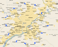 Philadelphia Defense Area 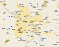 Pittsburgh Defense Area |
| Site Name | Missile Type | Defense Area | Site Location | Service Dates | Control Site condition/owner | Launch Site condition/owner |
|---|---|---|---|---|---|---|
| PH-07 | Nike 2B/30A/8L-A | Philadelphia | Richboro, Pennsylvania | 1956 - Sep 1961 | The IFC area is occupied by the Council Rock School District administration. Some IFC buildings still in use. 40°13′41″N 074°59′56″W / 40.22806°N 74.99889°W |
Launch site is part of the Northampton Township Recreation Center. Batting cages have been placed on top of the two missile magazines, which appear otherwise intact. 40°13′15″N 074°59′41″W / 40.22083°N 74.99472°W |
| PH-15 | Nike 1B. 2C/30a/12L-A | Philadelphia | Bristol / Newportville/ Croydon, Pennsylvania | 1955–1964 | Private ownership. Wooded area behind Bristol Plaza Shopping Center. Broken up concrete of building foundations, some partial streets, not much else. 40°07′39″N 074°53′14″W / 40.12750°N 74.88722°W |
Private ownership. Obliterated by new construction. Nothing left. 40°06′59″N 074°53′30″W / 40.11639°N 74.89167°W |
| PH-23/25 | Nike 2B, 4C/24H, 60A/22L-UA, (14L-H) | Philadelphia | Lumberton, New Jersey | 1958 - Apr 1974 | Township of Lumberton and private owner. Was Midway School. Demolished in 2016 to make way for housing. Two radar towers remain on private property owned by a landscaping company 39°57′51″N 074°47′01″W / 39.96417°N 74.78361°W |
Former double magazine. Township of Lumberton. Municipal complex storage yard. Some buildings still in use. Magazines visible and fully functional. 39°57′40″N 074°47′51″W / 39.96111°N 74.79750°W |
| PH-32 | Nike 2B/30A/8L-A | Philadelphia | Marlton, New Jersey | 1956–1963 | Obliterated, Redeveloped into single-family housing. 39°52′21″N 074°53′41″W / 39.87250°N 74.89472°W |
Abandoned site, magazine area visible. Not much left. 39°52′16″N 074°52′53″W / 39.87111°N 74.88139°W |
| PH-41/43 | Nike 2B, 4C/16H, 60A/23L-UA | Philadelphia | Erial, New Jersey | 1956 - Apr 1974 | After being closed by the Army in 1974, in 1976 the housing part of PH-41/43 was transferred to the Air Force for use by Gibbsboro AFS, New Jersey. It was designated as Gibbsboro Family Housing Annex. At some later time, probably about 1984, it was transferred back to the Army and assigned to Fort Dix. It was subsequently closed by 1990. Purchased by Gloucester Township and designated as a redevelopment site.[19] 39°45′04″N 074°59′58″W / 39.75111°N 74.99944°W |
Gloucester Township, IFC is a vacant lot with woods, some old roads. Appears magazines were removed and filled in with dirt. 39°44′28″N 075°00′03″W / 39.74111°N 75.00083°W |
| PH-49 | Nike 1B, 2C/30A/12L-A | Philadelphia | Mantua Township, New Jersey | 1956–1963 | Redeveloped into Bethel Church and Glouchester County Christian School. Part of old access road still visible from Pitman Road. 39°44′13″N 075°09′36″W / 39.73694°N 75.16000°W |
Private ownership, Kraemer Construction Company. Buildings in use by company, magazine area visible being used as storage yard. Condition unknown. 39°44′40″N 075°10′03″W / 39.74444°N 75.16750°W |
| PH-58 | Nike 1B, 2C/18H, 30A/12L-UA, (7L-H) | Philadelphia | Woolwich Township, New Jersey | 1957 - Apr 1974 | Site is abandoned, four radar towers standing. Barracks remaining. 39°45′57″N 075°18′15″W / 39.76583°N 75.30417°W |
Abandoned. May be some building foundations and old roads. Serverly overgrown with vegetation. Magazine area visible from aerial imagery. Very deteriorated. 39°46′21″N 075°18′1″W / 39.77250°N 75.30028°W |
| PH-67 | Nike 1B, 2C/30A/12L-A | Philadelphia | Village Green / Chester/Media, Pennsylvania | 1955–1964 | School and athletic fields. 39°51′45″N 075°25′45″W / 39.86250°N 75.42917°W |
Hilltop Elementary School, no remains. Magazines probably under asphalted parking lot. 39°51′00″N 075°26′15″W / 39.85000°N 75.43750°W |
| PH-75 | Nike 2B, 4C/18H, 60A/23L-UA, (11L-H) | Philadelphia | Edgemont/ Delaware City, Pennsylvania | 1955 - Nov 1968 | Abandoned in heavy woods. A few buildings overgrown with vegetation, some streets heavily overgrown. Not much left. 39°58′23″N 075°28′33″W / 39.97306°N 75.47583°W |
USAR Center. Magazines under motor pool parking area asphalted over. 39°57′48″N 075°28′11″W / 39.96333°N 75.46972°W |
| PH-82 | Nike 1B, 2C/30A/12L-A | Philadelphia | Paoli/ Valley Forge, Pennsylvania | 1955–1962 | Empty field, nothing remains. 40°05′02″N 075°27′23″W / 40.08389°N 75.45639°W |
High-end housing development, nothing remains. 40°03′57″N 075°28′47″W / 40.06583°N 75.47972°W |
| PH-91 | Nike 1B, 2C/30A/12L-A | Philadelphia | Worcester, Pennsylvania | 1956–1963 | Light office building, parking lot, also Worcester Nike Park. Some foundations of buildings, remainder of streets. 40°10′56″N 075°20′59″W / 40.18222°N 75.34972°W |
USAR Center. Magazines visible behind parking lot. 40°10′51″N 075°20′21″W / 40.18083°N 75.33917°W |
| PH-99 | Nike 4B, 2C/36H, 60A/22L-UU | Philadelphia | Warrington/ Eureka, Pennsylvania | 1956 - Jul 1971 | Twin Oaks Summer Camp. several buildings still in use. 40°14′33″N 075°10′13″W / 40.24250°N 75.17028°W |
Now "Lower Nike Park" some old roads remain, Magazines appear to be covered over with dirt but location still visible on aerial imagery. 40°14′21″N 075°09′49″W / 40.23917°N 75.16361°W |
| PI-02 | Nike 1B, 2C/30A/12L-A | Pittsburgh | Rural Ridge | Apr 1955 - Apr 1963 | A few buildings in use by Teen Challenge; drug & alcohol rehab center. No radar towers. 40°34′15″N 079°49′47″W / 40.57083°N 79.82972°W |
PennDOT equipment yard. Magazine area appears to be undergoing redevelopment, Magazines visible, some snow plows being stored on them. 40°35′48″N 079°49′21″W / 40.59667°N 79.82250°W |
| PI-03 | Nike 3B/18H, 30A/12L-U | Pittsburgh | Dorseyville/ Indianola | Oct 1956 - Mar 1974 | American Indian Center Singing Winds Site. Well preserved site with numerous IFC buildings in use. Several radar towers standing. 40°34′49″N 079°53′43″W / 40.58028°N 79.89528°W |
Barracks building in use, most other buildings razed. Large areas of concrete piles visible in aerial imagery. Magazines visible, earth grading equipment moving dirt around area. 40°35′54″N 079°53′31″W / 40.59833°N 79.89194°W |
| PI-25 | Nike 1B, 2C/30A/12L-A | Pittsburgh | Plum, Pennsylvania/ Monroeville, Pennsylvania | Apr 1955 - 1960 | Barracks and some minor buildings intcdt, also new industrial building constructed on back of site. No radar towers. 40°27′40″N 079°43′24″W / 40.46111°N 79.72333°W |
Redeveloped into A.E. O'Block Junior High, and Adlai Stevenson Elementary School. Some concrete foundations visible, Magazine now used as auxiliary gym. 40°28′20″N 079°42′52″W / 40.47222°N 79.71444°W |
| PI-36 | Nike 1B, 2C/18H, 30A/10L-U | Pittsburgh | Irwin, Pennsylvania | Apr 1955 - Dec 1968 | Some IFC buildings in use. Redeveloped into Norwin Soccor Club, Norwin YMCA, Oak Hollow Seniors Center. 40°20′42″N 079°41′55″W / 40.34500°N 79.69861°W |
Off Nike Road. Obliterated. Residential housing plan. 40°20′46″N 079°41′01″W / 40.34611°N 79.68361°W |
| PI-37 | Nike 3B/18H, 30A/12L-U | Pittsburgh | Cowansburg/ Herminie, Pennsylvania | 1956 - Mar 1974 | Site appears unused. Many buildings standing, some razed. Several radar towers standing. 40°16′22″N 079°45′48″W / 40.27278°N 79.76333°W |
In use for light industry. Many buildings still in use, magazines still electrified and operable, used by owner for storage. 40°15′45″N 079°45′54″W / 40.26250°N 79.76500°W |
| PI-42 | Nike 1B, 2C/30A/12L-A | Pittsburgh | Elizabeth, Pennsylvania | 1956 - Apr 1963 | A few old IFC buildings in use, no radar towers. used by the Elizabeth Forward School District. 40°15′02″N 079°51′23″W / 40.25056°N 79.85639°W |
Some buildings standing, used by the Twin Pines Council of Governments as a Police Firing Range. Magazine exists, concreted over. May be used as a parking lot. 40°13′54″N 079°50′12″W / 40.23167°N 79.83667°W |
| PI-43 | Nike 3B/18H, 30A/12L-U | Pittsburgh | Elrama, Pennsylvania | 1955 - Mar 1974 | Still in Army control, being used by the PAArNG; D/876th Engineer Battalion. Some buildings still in use, others torn down. No radar towers standing. 40°15′09″N 079°57′06″W / 40.25250°N 79.95167°W |
Abandoned. Was in use by Army Reserve and PA National Guard. Buildings still standing. Magazines visible, concrete heavily cracked. 40°15′15″N 079°57′59″W / 40.25417°N 79.96639°W |
| PI-52 | Nike 1B, 2C/30A/12L-A | Pittsburgh | Finleyville, Pennsylvania | 1958 - Jul 1960 | Most of site now South Hills Christian School. Some buildings in use, others very deteriorated. No signs of radar towers. 40°16′37″N 080°01′42″W / 40.27694°N 80.02833°W |
Mostly redeveloped, magazine area in poor condition, used as storage yard and parking lot. 40°15′53″N 080°01′04″W / 40.26472°N 80.01778°W |
| PI-62 | Nike 1B, 2C/30A/12L-A | Pittsburgh | Bridgeville/Hickman, Pennsylvania | 1956 - Apr 1963 | Appears abandoned. One building standing, empty parking lots in deteriorating condition. No radar towers. 40°23′14″N 080°08′22″W / 40.38722°N 80.13944°W |
Some buildings standing, used for school bus storage. Magazines visible, condition unknown. 40°22′16″N 080°09′51″W / 40.37111°N 80.16417°W |
| PI-71 | Nike 1B, 2C/18H, 30A/10L-U | Pittsburgh | Corapolis/Beacon, Pennsylvania | 1955 - Mar 1974 | Robinson Dept. of Public Works, poor condition, being used as a storage yard. 40°28′54″N 080°08′36″W / 40.48167°N 80.14333°W |
Abandoned. No buildings or signs of magazines. Appear to have been dug up and filled with earth. 40°29′01″N 080°09′50″W / 40.48361°N 80.16389°W |
| PI-92 | Nike 1B, 2C/30A/12L-A | Pittsburgh | Bryant/North Park | 1956 - Apr 1963 | Property given to North Allegheny School District. 40°34′31″N 080°00′05″W / 40.57528°N 80.00139°W |
Part of Allegheny County Police and Fire Training Academy. Magazines badly deteriorated, some used as parking lot. 40°35′25″N 080°00′33″W / 40.59028°N 80.00917°W |
| PI-93 | Nike 1B, 2C/18H, 30A/10L-H | Pittsburgh | West View, Pennsylvania | Oct 1956 - Jun 1971 | Used by Army Corps of Engineers. 40°31′38″N 080°03′44″W / 40.52722°N 80.06222°W |
Obliterated, residential housing plan. 40°30′53″N 080°04′49″W / 40.51472°N 80.08028°W |
Rhode Island
| Providence Defense Area (PR): Sites located in Rhode Island and southern Massachusetts for the defense of Rhode Island's capital city. From 1959 through 1960, sites PR-38 and PR-99 were upgraded to launch Nike Hercules missiles.
Site PR-79 at Foster was preserved, to be used as a State Police facility. Site PR-99 at North Smithfield stayed in operation until 1971 while PR-38 at Bristol held on until 1974. External links
|
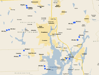 Providence Defense Area |
| Site Name | Missile Type | Defense Area | Site Location | Service Dates | Control Site condition/owner | Launch Site condition/owner |
|---|---|---|---|---|---|---|
| PR-19 | Nike 1B, 2C/30A/12L-A | Providence | Rehoboth, Massachusetts | 1956 - Jun 1971 | MAArNG/USAR Center 41°53′02″N 071°12′25″W / 41.88389°N 71.20694°W |
Sports Complex, some old military buildings still in use. 41°53′05″N 071°11′57″W / 41.88472°N 71.19917°W |
| PR-29 | Nike 1B, 2C/30A/12L-A | Providence | Swansea, Massachusetts | 1956 - Jun 1959 | Now a sports complex. Some old military buildings, off "Nike Site Road" 41°46′59″N 071°10′38″W / 41.78306°N 71.17722°W |
Iron Mountain storage building erected on old Missile pad. Part of magazine visible. Old FC buildings in area in various states of deterioration and abandoned. 41°47′59″N 071°09′52″W / 41.79972°N 71.16444°W |
| PR-38 | Nike 1B, 2C/18H, 30A/10L-U | Providence | Bristol, Rhode Island | 1956 - Apr 1974 | Abandoned, overgrown with trees and vegetation. Likely most of site is under vegetation cover. 41°40′26″N 071°14′29″W / 41.67389°N 71.24139°W |
Redeveloped as Bristol County Development Center, no remains. 41°40′29″N 071°15′56″W / 41.67472°N 71.26556°W |
| PR-58 | Nike 1B, 2C/30A/12L-A | Providence | North Kingston/ Davisville, Rhode Island | 1956–1963 | North Kingston Parks and Recreation Department sports complex. One old military building remains. 41°37′48″N 071°26′11″W / 41.63000°N 71.43639°W |
Most of LS removed. Empty lot with scrub vegetation. Remainder of some roads. 41°36′58″N 071°25′58″W / 41.61611°N 71.43278°W |
| PR-69 | Nike 1B, 2C/30A/12L-A | Providence | Coventry, Rhode Island | 1956 - Oct 1974 | After its closure by the Army, on 25 Sep 1975 the control site property was designated the Coventry ANG Station, Air National Guard. It was assigned to the United States Property and Fiscal Officer, State of Rhode Island for real property jurisdiction and control. Still in use by the RIANG, 281st, 282d Combat Communications Squadrons. Off "Nike Site Road" 41°43′15″N 071°35′51″W / 41.72083°N 71.59750°W |
Coventry Park. Most buildings remain, appears some of the magazine as well. 41°41′29″N 071°37′50″W / 41.69139°N 71.63056°W |
| PR-79 | Nike 1B, 2C/30A/12L-A | Providence | Foster Center/ Foster, Rhode Island | 1956 - Jun 1963 | Some buildings remain, part of Foster/Gloucester Regional School District 41°50′33″N 071°42′56″W / 41.84250°N 71.71556°W |
State of Rhode Island, State Police Academy and Training Center, buildings in use; magazines visible. 41°50′23″N 071°43′55″W / 41.83972°N 71.73194°W |
| PR-99 | Nike 1B, 2C/18H, 30A/11L-U, (10L-H) | Providence | North Smithfield/ Woonsocket, Rhode Island | 1956 - Jun 1971 | RIANG/USAFR Center, some old buildings in use. 41°58′15″N 071°34′26″W / 41.97083°N 71.57389°W |
Rhode Island Army National Guard, most buildings intact, Magazine area used as a motor pool. 41°58′57″N 071°34′40″W / 41.98250°N 71.57778°W |
South Dakota
| Ellsworth AFB Defense Area (E): Four Nike Ajax batteries were positioned around Ellsworth AFB in 1957. E-01 was north, E-20 was east-northeast, E-40 was south-southeast, and E-70 was west-southwest. Headquarters facilities were located at Ellsworth. In 1958, batteries E-20, E-40, and E-70 were removed from service and E-01 was converted to fire Nike Hercules missiles. This battery remained in service until 1961.
An Army Air-Defense Command Post (AADCP) was established at Ellsworth AFB, SD in 1960 for Nike missile command-and-control functions. It was equipped with the AN/GSG-5(V) BIRDIE solid-state computer system. The post was integrated with the USAF Air Defense Command/NORAD Semi Automatic Ground Environment (SAGE) air defense radar network as Site M-97. The radar site ceased all operations on 15 August 1962. |
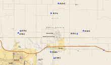 Ellsworth AFB Defense Area |
| Site Name | Missile Type | Defense Area | Site Location | Service Dates | Control Site condition/owner | Launch Site condition/owner |
|---|---|---|---|---|---|---|
| E-01 | Nike 1B, 2C/30A/12L-A | Ellsworth | 5.2 miles N Ellsworth AFB | 1957–1961 | In use, some buildings still standing. No radar towers. 44°13′46″N 103°04′17″W / 44.22944°N 103.07139°W |
Abandoned. On or about 30 Dec 1963 the housing area next to the Launch Site was designated Ellsworth Family Housing Annex No 1, activated, and assigned to Ellsworth AFB. It was inactivated on 4 Nov 1970. Today, the housing is abandoned and the homes had been removed, leaving the basements exposed. Magazine visible, covered with vegetation and refuse. 44°12′15″N 103°05′52″W / 44.20417°N 103.09778°W |
| E-20 | Nike 1B, 2C/30A/12L-A | Ellsworth | 5.3 miles ENE Ellsworth AFB | 1957–1958 | The IFC was assigned as an off-base installation to Ellsworth AFB on 25 May 1961. The Army housing was commonly referred to as East Nike Housing Area, and was controlled by Ellsworth AFB until about 2000. Today, the site is in use, some buildings still standing. No radar towers. 44°09′31″N 102°58′52″W / 44.15861°N 102.98111°W |
IFC buildings in use, housing adjacent abandoned and torn down. Magazine visible, covered with vegetation and refuse. 44°09′02″N 103°00′12″W / 44.15056°N 103.00333°W |
| E-40 | Nike 1B, 2C/30A/12L-A | Ellsworth | 3.5 miles SSE Ellsworth AFB | 1957–1958 | In use, some buildings still standing. No radar towers. 44°05′16″N 103°05′12″W / 44.08778°N 103.08667°W |
After the Nike base was closed, it was gained by Ellsworth AFB on 30 Sep 1963, as Ellsworth Academic Annex (also referred to as South Nike Education Annex). As of Nov 1999, it was still on the Ellsworth AFB real property books, excess and awaiting disposition. Today, most buildings had recently been demolished. Magazine now an auto junkyard. 44°06′13″N 103°05′55″W / 44.10361°N 103.09861°W |
| E-70 | Nike 1B, 2C/30A/12L-A | Ellsworth | 4.9 miles WSW Ellsworth AFB | 1957–1958 | The IFC was assigned as an off-base installation to Ellsworth AFB on 25 May 1961. The Army housing was commonly referred to as West Nike Housing Area, and was controlled by Ellsworth AFB until about 2000. Today, the buildings are still in use, some buildings still standing. No radar towers. 44°09′29″N 103°12′29″W / 44.15806°N 103.20806°W |
Abandoned, vegetation (tall trees) growing in Magazine concrete 44°09′11″N 103°12′59″W / 44.15306°N 103.21639°W |
Texas
| Bergstrom AFB Defense Area (BG): Headquartered at Bergstrom AFB, Army units defended this Strategic Air Command
Base and the Austin region from two Nike Hercules sites between 1960-1966. Dallas-Fort Worth Defense Area (DF): For air defense of Dallas/Fort Worth Metroplex. These Nike Hercules sites were manned by Regular Army and National Guard units and operated from 1960 to 1968. Army Air-Defense Command Post (AADCP) DF-30DC was established at Duncanville AFS, TX in 1959 for Nike missile command-and-control functions. The site was equipped with the AN/GSG-5(V) BIRDIE solid-state computer system. DF-30DC was integrated with the USAF Air Defense Command/NORAD Semi Automatic Ground Environment (SAGE) air defense radar network as Site P-78 / Z-78. Air Force operations ended 31 July 1964. The AADCP was inactivated in 1969. Dyess AFB Defense Area (DY): Installed to defend the SAC bombers and Atlas F missile silos stationed at and around Dyess AFB. Site DY-10, located at Fort Phantom Hill and site DY-50, located southwest of Abilene, remained operational from 1960 until 1966. An Army Air-Defense Command Post (AADCP) was established at Sweetwater AFS, TX in 1960 for Nike missile command-and-control functions. The site was equipped with the AN/GSG-5(V) BIRDIE solid-state computer system. The AADCP was integrated with the USAF Air Defense Command/NORAD Semi Automatic Ground Environment (SAGE) air defense radar network as Site M-89 / Z-89. The AADCP was inactivated in Sep 1969. External links |
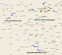 Texas Nike Missile Sites |
| Site Name | Missile Type | Defense Area | Site Location | Service Dates | Control Site condition/owner | Launch Site condition/owner |
|---|---|---|---|---|---|---|
| BG-40 | Nike 3AG/12H/12L-H | Bergstrom | Elroy, Texas (SE) | Nov 1960 - Jun 1966 | Abandoned. Appears to be mostly intact with buildings in various states of deterioration, several radar towers visible on aerial imagery. 30°06′18″N 097°35′30″W / 30.10500°N 97.59167°W |
Abandoned. Above-ground Nike-Hercules pads within protective berms. Missile assembly building appears standing, concrete missile pads deteriorated concrete. 30°05′30″N 097°35′16″W / 30.09167°N 97.58778°W |
| BG-80 | Nike 3AG/12H/12L-H | Bergstrom | Austin, Texas (WNW) | Nov 1960 - Jun 1966 | Intact, TXArNG 111th Support Group 30°18′20″N 097°50′24″W / 30.30556°N 97.84000°W |
Above-ground Nike-Hercules pads within protective berms. Site is now the location of the University of Texas System Police Academy. [20] 30°18′52″N 097°52′00″W / 30.31444°N 97.86667°W |
| DF-01 | Nike 3D/18H/12L-U | Dallas Fort Worth | Denton, Texas (N) | Sep 1960 - Oct 1968 | Intact, located off North Locust Street just north of Denton, Texas was converted for use as an astronomical observatory of the University of North Texas after decommissioning. Aside from its use as a laboratory for the school's astronomy program, the site has been used for storage, research and experimentation. A broadcasting tower is also located on site. The site's housing and administrative complex was sold to a private owner and is currently being used as a residence. Has radar towers. 33°16′28″N 097°07′55″W / 33.27444°N 97.13194°W |
Underground single-magazine intact, no buildings, appears abandoned. 33°17′25″N 097°08′02″W / 33.29028°N 97.13389°W |
| DF-20 | Nike 3D/18H/12L-U | Dallas Fort Worth | Terrell, Texas (NE) | Aug 1960 - Feb 1964 | Abandoned, most buildings collapsed, one radar tower still standing. 32°45′47″N 096°18′44″W / 32.76306°N 96.31222°W |
Underground single-magazine intact, Terrell FFA, school bus storage/maintenance. 32°46′00″N 096°17′42″W / 32.76667°N 96.29500°W |
| DF-50 | Nike 3D/18H/12L-U | Dallas Fort Worth | Alvarado, Texas | Aug 1960 - Oct 1968 | Intact, Private ownership in good condition. Appears to be a tower also present. 32°23′26″N 097°10′01″W / 32.39056°N 97.16694°W |
Private ownership, mostly returned to agricultural use, single magazine is about all that is left. 32°23′50″N 097°09′57″W / 32.39722°N 97.16583°W |
| DF-70 | Nike 3D/18H/12L-U | Dallas Fort Worth | Fort Wolters, Texas | Sep 1960 - Oct 1968 | Originally established during World War II as Camp Wolters. On 6 Mar 1951 it was redesignated Wolters Air Force Base. On 15 Dec 1956 jurisdiction, control, and accountability transferred back to the Army. Still in use, with a few buildings, one radar tower, TXArNG training. 32°50′48″N 098°02′42″W / 32.84667°N 98.04500°W |
Intact double underground magazine, Small arms storage, firing, and maneuvering range 32°51′00″N 098°03′35″W / 32.85000°N 98.05972°W |
| DY-10 | Nike 3AG/12H/12L-H | Dyess | Fort Phantom Hill, Texas (N) | Oct 1960 - Jun 1966 | Intact, Abilene Independent School District, in good shape. 32°33′52″N 099°43′00″W / 32.56444°N 99.71667°W |
Above ground magazines protected by berms. Appears abandoned, covered by wild vegetation, Private ownership. 32°34′49″N 099°43′02″W / 32.58028°N 99.71722°W |
| DY-50 | Nike 3AG/12H/12L-H | Dyess | Abilene, Texas (12 mi SW) | Oct 1960 - Jun 1966 | Complete with radar towers, in use, use unknown. 32°17′05″N 099°56′37″W / 32.28472°N 99.94361°W |
Above ground magazines protected by berms. Appears abandoned. 32°16′16″N 099°57′30″W / 32.27111°N 99.95833°W |
Virginia
| Norfolk Defense Area (N): Headquarters facilities were located at Fort Monroe, Ballantine School in Norfolk, Reedsville/South Norfolk, Craddock Branch/Portsmouth, and Newport News. The world's largest naval complex received an extensive air defense network. Sites N-25, N-52, and N-85 were modernized to fire the Nike Hercules missile. Site N-63 held the distinction of being the last to operate Nike Ajax, being deactivated in November 1964. Both Regular Army and Virginia Army National Guard units contributed to the manning of the sites.[21] Sites at (N-52) Deep Creek/Portsmouth and (N-85) Denbigh/Patrick Henry remained active until April 1974.
An Army Air-Defense Command Post (AADCP) was established at Cape Charles AFS, VA in 1958 for Nike missile command-and-control functions. The site was equipped with the AN/GSG-5(V) BIRDIE solid-state computer system. The AADCP was later integrated with the USAF Air Defense Command/NORAD Semi Automatic Ground Environment (SAGE) air defense radar network as Site P-56 / Z-56'. The AADCP inactivated in June 1974. External links |
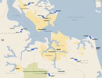 Norfolk Defense Area |
| Site Name | Missile Type | Defense Area | Site Location | Service Dates | Control Site condition/owner | Launch Site condition/owner |
|---|---|---|---|---|---|---|
| N-02 | Nike 2C, 1B/30A/12L-A | Norfolk | Fox Hill, Virginia | 1955–1963 | Fort Monroe, HQ Training and Doctrine Command. Buildings in good shape, no radar towers. 37°05′02″N 076°17′55″W / 37.08389°N 76.29861°W |
Fort Monroe, HQ Training and Doctrine Command, Buildings in good shape, magazines covered with earth. 37°05′29″N 076°17′12″W / 37.09139°N 76.28667°W |
| N-25/29 | Nike 4B, 2C/18H, 30A/24L-UA | Norfolk | Fort Story, Virginia | 1957 - Jun 1971 | Army amphibious training site. Some buildings still in use, no towers. 36°55′51″N 076°01′28″W / 36.93083°N 76.02444°W |
Army amphibious training site. Buildings in use. Magazines visible, status unknown. 36°55′23″N 076°01′07″W / 36.92306°N 76.01861°W |
| N-36 | Nike 1B, 2C/30A/12L-A | Norfolk | Kempsville, Virginia | 1955–1964 | City of Virginia Beach, Parks and Recreation offices. Also juvenile detention facility. 36°47′22″N 076°08′31″W / 36.78944°N 76.14194°W |
Parks and Recreation, maintenance, building in use. Magazine area now storage yard. 36°47′15″N 076°07′46″W / 36.78750°N 76.12944°W |
| N-52 | Nike 2B/18H, 30A/8L-UA | Norfolk | Deep Creek/ Chesapeake, Virginia | 1955 - Apr 1974 | Chesapeake Alternative School. 36°41′59″N 076°20′45″W / 36.69972°N 76.34583°W |
Public Safety Training Center. Buildings in use, magazines still intact, being used as a parking lot. 36°41′25″N 076°20′29″W / 36.69028°N 76.34139°W |
| N-63 | Nike 2B, 1C/30A/12L-A | Norfolk | Nansemond/ Suffolk, Virginia | 1955 - Nov 1964 | Being redeveloped into high-end single-family housing. Foundations visible in construction site. 36°51′11″N 076°28′02″W / 36.85306°N 76.46722°W |
Bennett's Creek Park. Some buildings in use, magazine area obliterated however land scarring visible where overfilled with soil. 36°51′04″N 076°28′42″W / 36.85111°N 76.47833°W |
| N-75 | Nike 1B, 2C/30A/12L-A | Norfolk | Smithfield/ Carrolton, Virginia | 1955 - Jun 1961 | Isle of Wight County Park "Nike Park". Some old buildings remain. Also quite a few junk vehicles. 36°58′32″N 076°33′28″W / 36.97556°N 76.55778°W |
Isle of Wight County Park. Magazine site is still very recognizable, with the surface concrete pad / blast deflectors and raised areas surrounding the former elevator doors still in place. 36°57′44″N 076°33′49″W / 36.96222°N 76.56361°W |
| N-85 | Nike 2B, 1C/18H, 30A/12L-UA, (8L-H) | Norfolk | Denbigh/ Patrick Henry, Virginia | 1955 - Apr 1974 | Peninsula Airport Commission. Abandoned and overgrown with weeds. Some buildings standing as well as radar towers. 37°08′24″N 076°29′57″W / 37.14000°N 76.49917°W |
Abandoned area, weeds, no remains of launchers. Some buildings may still be standing. 37°08′01″N 076°30′19″W / 37.13361°N 76.50528°W |
| N-93 | Nike 1B, 2C/30A/12L-A | Norfolk | Hampton/ Spiegelville, Virginia | 1955–1963 | USAR Center 37°03′08″N 076°23′17″W / 37.05222°N 76.38806°W |
USAR Center Magazine area remains, concrete badly deteriorated.BR>37°03′34″N 076°23′44″W / 37.05944°N 76.39556°W |
Washington
| Fairchild AFB Defense Area (F): Four sites initially protected the Spokane region and the Strategic Air Command Base at Fairchild. Medical Lake was converted to Hercules missiles in 1960 and 1961. Headquarters facilities were located at Fairchild AFB. The Army deactivated the Nike Ajax batteries in 1960. An Army Air-Defense Command Post (AADCP) was established at Mica Peak AFS in 1958 for Nike missile command-and-control functions. The site was equipped with the AN/GSG-5(V) BIRDIE solid-state computer system.
The AAFC was integrated with the USAF Air Defense Command/NORAD Semi Automatic Ground Environment (SAGE) air defense radar network as Site SM-151 / Z-151. The AADCP was inactivated in May 1972. Hanford Defense Area (H): Nike missiles replaced and augmented gun batteries that had been previously installed to defend this nuclear industrial complex. Headquarters facilities were located at Camp Hanford. Three sites were deactivated in December 1958 as only Saddle Mountain was converted to the new Nike Hercules. Upon deactivation of this Hercules battery in 1960, the equipment was forwarded to the Norfolk site at Deep Creek/Portsmouth. Seattle Defense Area (S): Home of Boeing Aircraft Company and military installations, Seattle was ringed with defenses manned by both Regular Army and Washington National Guard units. Nike Ajax sites were phased out from 1960 to 1963. Sites at (S-13) Redmond, (S-61) Vashon Island, and (S-92) Bainbridge Island were upgraded to launch Nike Hercules missiles and survived until 1974. Army Air-Defense Command Post (AADCP) S-90DC established at Fort Lawton AFS, WA in 1960 for Nike missile command-and-control functions. The site was initially an AN/FSG-l Missile-Master Radar Direction Center. It was later equipped with the AN/GSG-5(V) BIRDIE solid-state computer system. S-90DC was integrated with the USAF Air Defense Command/NORAD Semi Automatic Ground Environment (SAGE) air defense radar network as Site RP-1 / Z-1 The Air Force ceased radar operations in March 1963 and the AADCP was inactivated 1 Sep 1974. External links |
 Fairchild AFB Defense Area  Hanford Defense Area  Seattle Defense Area |
| Site Name | Missile Type | Defense Area | Site Location | Service Dates | Control Site condition/owner | Launch Site condition/owner |
|---|---|---|---|---|---|---|
| F-07 | Nike 2B, 1C/30A/12L-A | Fairchild | Spokane, Washington | 1957 - Jun 1960 | Was acquired by the United States Air Force during 1963 to be used as one of the command readout stations for the DMSP mission. It was operated by Detachment 1, 4000 Aerospace Applications Group, which was later designated as Detachment 1, 1000th Satellite Operations Group, and later the 5th Satellite Control Squadron part of the 50th Space Wing. It was later converted to the Fairchild Satellite Operations Center to support MILSTAR/GPS and other programs under Air Force Space Command.[22] Some IFC buildings still in use. 47°42′10″N 117°34′39″W / 47.70278°N 117.57750°W |
Private Ownership. Magazines visible. 47°40′48″N 117°36′24″W / 47.68000°N 117.60667°W |
| F-37 | Nike 1B, 2C/30A/12L-A | Fairchild | Cheney, Washington | 1957 - Jun 1960 | Operated by the Washington Air National Guard as the Four Lakes Communications Station (1961-2009); operated by the Cheney School District (2009–present)[23] 47°33′05″N 117°33′14″W / 47.55139°N 117.55389°W |
Operated by the Washington Air National Guard as the Four Lakes Communications Station (1961-2009); operated by the Cheney School District (2009–present)[23] 47°32′31″N 117°32′46″W / 47.54194°N 117.54611°W |
| F-45 | Nike 2B, 1C/18H, 30A/12L-UA | Fairchild | Medical Lake, Washington | 1957 - Mar 1966 | Being used as an auto junkyard. Some buildings standing, even a few radar towers. 47°33′09″N 117°43′39″W / 47.55250°N 117.72750°W |
Abandoned, some buildings standing, magazine deteriorating but visible. 47°35′10″N 117°40′31″W / 47.58611°N 117.67528°W |
| F-87 | Nike 2B, 1C/18H/11L-U | Fairchild | Deep Creek, Washington | Sep 1958 - Mar 1966 | Private ownership, electrical service, buildings and radar towers standing. 47°42′09″N 117°44′33″W / 47.70250°N 117.74250°W |
Private ownership. Some military buildings in use, new buildings erected over magazine. 47°39′38″N 117°42′55″W / 47.66056°N 117.71528°W |
| H-06 | Nike 2B/12H, 20A/8L-U | Hanford | Saddle Mountain, Washington | 1955 - Dec 1960 | Obliterated and abandoned, Department of Energy 46°47′33″N 119°26′54″W / 46.79250°N 119.44833°W |
Obliterated and abandoned, Department of Energy 46°44′54″N 119°25′26″W / 46.74833°N 119.42389°W |
| H-12 | Nike 2B/20A/8L-A | Hanford | Othello, Washington | 1955 - Dec 1958 | Obliterated and abandoned, Department of Energy 46°41′33″N 119°23′09″W / 46.69250°N 119.38583°W |
Obliterated and abandoned, Department of Energy 46°41′11″N 119°24′29″W / 46.68639°N 119.40806°W |
| H-52 | Nike 2B/20A/8L-A | Hanford | Rattlesnake Mountain, Washington | 1955–1960 | Intact, Department of Energy, facilities used as auxiliary research labs under Pacific Northwest National Laboratories oversight, currently scheduled for demolition. 46°23′42″N 119°35′45″W / 46.39500°N 119.59583°W |
Intact, Department of Energy, silo currently used as lab for University of Washington research projects. 46°23′31″N 119°32′03″W / 46.39194°N 119.53417°W |
| H-83 | Nike 2B/20A/8L-A | Hanford | Priest Rapids, Washington | 1955 - Dec 1958 | Obliterated and abandoned, Department of Energy 46°40′22″N 119°42′18″W / 46.67278°N 119.70500°W |
Obliterated and abandoned, Department of Energy 46°41′46″N 119°42′13″W / 46.69611°N 119.70361°W |
| S-03 | Nike 2B/20A/8L-A | Seattle | Bothell, Washington | 1957 - Mar 1964 | Obliterated, Horizon Heights Park and grass runway airfield 47°46′26″N 122°16′40″W / 47.77389°N 122.27778°W |
Partially Intact, FEMA Agency Region X HQ and US Army Reserve Hooper Center. Magazines appear to be once under asphalted-over parking lot, however, access to one lift platform is now covered with dirt and the magazine is filled with water. 47°47′24″N 122°14′11″W / 47.79000°N 122.23639°W |
| S-13/14 | Nike 2B, 4C/18, 60A/23L-UA, (11L-H) | Seattle | Redmond, Washington (dual site) | 1957 - Mar 1974 | Is owned by the Lake Washington School District and was previously used for the district's NEVAC work study programs. All the structures remain intact, though some are in disrepair. The radar site to the west of the launchers has been renovated and is now owned by the United States Air Force. The radars have been removed and portions of the site have been converted into "Nike Park" 47°41′06″N 122°06′33″W / 47.68500°N 122.10917°W |
Dual magazines, in overgrown area, visible. 47°41′00″N 122°04′24″W / 47.68333°N 122.07333°W |
| S-20 | Nike 2B/20A/8L-A | Seattle | Cougar Mountain/ Issaquah, Washington | 1957 - Mar 1964 | Obliterated, Cougar Mountain County Park 47°32′26″N 122°05′50″W / 47.54056°N 122.09722°W |
Obliterated, Cougar Mountain Regional Wildlife Park 47°32′00″N 122°06′49″W / 47.53333°N 122.11361°W |
| S-32 | Nike 1B, 2C/20A/12L-A | Seattle | Lake Young, Washington | 1956 - Dec 1961 | Partially Intact, King County Sheriff's Department 47°26′09″N 122°07′01″W / 47.43583°N 122.11694°W |
Intact, Maple Valley Christian School, South King County Activity Center (shared launch with S-33) 47°27′07″N 122°06′51″W / 47.45194°N 122.11417°W |
| S-33 | Nike 1B, 2C/20A/12L-A | Seattle | Lake Young/ Renton, Washington | 1956 - Dev 1961 | Intact, USAR Center, 104th Division, Training 47°25′49″N 122°08′42″W / 47.43028°N 122.14500°W |
Intact, Maple Valley Christian School, South King Counth Activity Center (shared launch with S-32) 47°27′07″N 122°06′51″W / 47.45194°N 122.11417°W |
| S-43 | Nike 1B, 2C/30A/10L-A | Seattle | Kent/Midway, Washington | 1956 - Feb 1963 | Now Grandview Park. 47°23′50″N 122°17′06″W / 47.39722°N 122.28500°W |
Intact, King County Parks and Kent School District, magazines removed. 47°22′52″N 122°16′58″W / 47.38111°N 122.28278°W |
| S-61 | Nike 1B, 2C/18H, 30A/12L-UA, (7L-H) | Seattle | Vashon Island, Washington | 1956 - Mar 1974 | Partially Intact, Vashon High School 47°25′01″N 122°27′46″W / 47.41694°N 122.46278°W |
Has been turned into a public horse park named Paradise Ridge. The buildings are now used as a thrift store, Granny's Attic, and a medical clinic. Also Nike Site Park 47°24′39″N 122°29′01″W / 47.41083°N 122.48361°W |
| S-62 | Nike 1B, 2C/30A/12L-A | Seattle | Ollala, Washington | 1958 - Mar 1963 | Intact, Ollala Guest Lodge 47°25′52″N 122°32′28″W / 47.43111°N 122.54111°W |
Partially Intact, Private ownership, being used as a junkyard for old vehicles. 47°25′10″N 122°33′20″W / 47.41944°N 122.55556°W |
| S-81 | Nike 1B, 2C/30A/12L-A | Seattle | Poulsbo, Washington | 1956 - Nov 1960 | Intact, North Kitsap School District and Frank Raab Municipal Park 47°43′30″N 122°37′21″W / 47.72500°N 122.62250°W |
Redeveloped into retail center. 47°45′26″N 122°39′39″W / 47.75722°N 122.66083°W |
| S-92 | Nike 2B/12H, 20A/8L-U | Seattle | Bainbridge Island, Washington | 1958 - Mar 1974 | Eagledale Park, 47°36′33″N 122°31′23″W / 47.60917°N 122.52306°W |
Launch structures completely removed except for some fences and a road and other infrastructure built for the missile site, Bainbridge Island Metropolitan Parks and Recreations District 47°38′17″N 122°32′46″W / 47.63806°N 122.54611°W |
Wisconsin
| Milwaukee Defense Area sites (code M) were all in Wisconsin, including 3 launch sites in the Milwaukee city limits (M-02, -20, & -96). The 2 battalion headquarters and nearby headquarters batteries were the 401st Antiaircraft Missile Bn & M-54's A Btry at "Hales Corner" and the 852nd Bn & M-96's D Btry[24]:2 at Maitland Field[24]:17 which was planned for 26 acres (11 ha) in 1954.[25][26] The defense area with 5 sites was reorganized in 1961 "from group status to a battalion status",[27] and its Army Air Defense Command Post near M-96[27] for integrating fire control began using an AN/GSG-5 BIRDIE[28] after the solid-state CCCS became available in 1961. M-64 & -96 had transferred to the Wisconsin National Guard by August 1961[27] (M-74 in June 1964),[29] and command of the area transferred from the 61st Artillery Group to the 45th Artillery Brigade (Air Defense) on August 1, 1964.[24]:2 In 1968, the Milwaukee Defense Area merged with the Chicago-Gary Defense Area and was controlled using the latter's Arlington Heights AADCP with a 1967 AN/TSQ-51. The resulting Chicago-Milwaukee Defense Area included Wisconsin sites at Argyle (CM-71R), Princeton (CM-97R), and Tisch Mills (CM-01R 44°19′28″N 87°34′45″W / 44.32444°N 87.57917°W) and 3 in Illinois and 4 in Michigan.[30] One of the last sites transferred from the federal government was Waukesha's "Nike Hill"[31] Integrated Fire Control site for M-74 in March 2006.[32] |

| Code & location | Missile Type | Defense Area | Dates | Control Site condition/owner | Launch Site condition/owner |
|---|---|---|---|---|---|
| M-02 Brown Deer Rd[27] | 1B, 2C/18H, 30A/12L-U | Milwaukee | 1957-1971 Jun | Woods & subdivision 43°10′35″N 087°56′01″W / 43.17639°N 87.93361°W |
Obliterated 43°10′41″N 087°56′24″W / 43.17806°N 87.94000°W |
| M-20 Harbor Drive | 3B/18H, 30A/12L-U | Milwaukee | 1957-1971 Jun | Grant Park 42°55′32″N 087°50′56″W / 42.92556°N 87.84889°W |
lakefront office buildings 42°56′00″N 087°50′57″W / 42.93333°N 87.84917°W |
| M-42 Cudahy | 1B, 2C/30A/12L-A | Milwaukee | 1956-1961 Aug | Warnimont Golf Course 42°56′40″N 087°50′56″W / 42.94444°N 87.84889°W |
Cudahy High School 42°57′13″N 087°50′51″W / 42.95361°N 87.84750°W |
| M-54 "Hales Corners"[24]:2 | 1B, 2C/30A/12L-A | Milwaukee | 1956-1961 Aug | Obl. Franklin "Root River" site 42°52′26″N 087°56′24″W / 42.87389°N 87.94000°W |
Oak Creek industrial site 42°51′49″N 087°55′03″W / 42.86361°N 87.91750°W |
| M-64 Muskego/Prospect | 1B, 2C/30A/12L-A | Milwaukee | 1956-1963 Mar | machine shop on Martin Dr. 42°56′29″N 088°08′50″W / 42.94139°N 88.14722°W |
Obliterated, being redeveloped 42°55′42″N 088°09′43″W / 42.92833°N 88.16194°W |
| M-74 Waukesha | 1B, 2C/18H, 30A/12L-U, (10L-H) | Milwaukee | 1956-1971 Jun | structures remain in Hillcrest Park[29] 43°01′23″N 088°11′28″W / 43.02306°N 88.19111°W |
Obliterated, being redeveloped 43°00′16″N 088°11′35″W / 43.00444°N 88.19306°W |
| M-86 Lannon | 1B, 2C/30A/12L-A | Milwaukee | 1956–1958 | Demolished as of 2014. Radar facility used as dumping grounds for Lannon County Park offices. Barracks are demolished and land is unused. 43°09′43″N 088°09′49″W / 43.16194°N 88.16361°W |
Largely intact, private owner 43°10′19″N 088°09′34″W / 43.17194°N 88.15944°W |
| M-96 Silver Springs Dr. | 1B, 2C/30A/12L-A | Milwaukee | 1956-1963 Mar[33] | Carleton Elementary School 43°07′12″N 087°57′50″W / 43.12000°N 87.96389°W |
Army Reserve Complex 43°07′11″N 087°58′37″W / 43.11972°N 87.97694°W |
| Wikimedia Commons has media related to Project Nike. |
See also
- Project Nike topics
- U.S. Army Nike sites
| Wikimedia Commons has media related to Nike missile sites. |
References
- ↑ (PDF) https://web.archive.org/web/20101106141225/http://www.redstone.army.mil/history/nikesite/sites/summary.pdf. Archived from the original (PDF) on November 6, 2010. Retrieved November 26, 2010. Missing or empty
|title=(help) - ↑ "Nikesummit.org : Friends of Nike Site Summit". Nikesitesummit.org. Retrieved 2013-10-24.
- ↑ "Mount Gleason". Geographic Names Information System. United States Geological Survey. Retrieved 15 November 2009.
- ↑ "Barley Flats". Geographic Names Information System. United States Geological Survey. Retrieved 15 November 2009.
- ↑ "Magic Mountain". Geographic Names Information System. United States Geological Survey. Retrieved 15 November 2009.
- ↑ "Lang". Geographic Names Information System. United States Geological Survey. Retrieved 15 November 2009.
- ↑ "Nike Missile Site - Golden Gate National Recreation Area (U.S. National Park Service)". Nps.gov. 2013-10-20. Retrieved 2013-10-24.
- ↑ Leary, Joseph (2004). A Shared Landscape: A Guide & History of Connecticut's State Parks & Forests. Hartford, CT: Friends of Connecticut State Parks Inc. pp. 84–85. ISBN 0-9746629-0-9. Retrieved 2009-09-20.
- ↑ "Nike Missile IFC Site HM-95, D Battery | Abandoned Florida". 2011-04-28. Retrieved 2016-07-17.
- ↑ "Nike Missile Site C-41 - Promontory Point - Jackson Park, Chicago IL - Michael Epperson". M-epperson.home.comcast.net. Retrieved 2013-10-24.
- ↑ "Blast Camp Paintball - Welcome to Blastcamp Paintball & Airsoft". Blastcamp.com. Retrieved 2013-10-24.
- ↑ "BA-09 Former NIKE Missile Launch Site". Wikimapia.org. Retrieved 2013-10-24.
- ↑ "Nike Sites with Earlier or Later Use by the Air Force". Airforcebase.net. Retrieved 2013-10-24.
- ↑ "Abandoned & Little-Known Airfields: Virginia: Western Fairfax County". Airfields-freeman.com. 1949-07-10. Retrieved 2013-10-24.
- ↑ "At missile site, 'on our toes' day and night". Gazette.net. 2007-04-18. Retrieved 2013-10-24.
- ↑ Workman, Karen. "Fire at old Commerce Twp. missile site called suspicious". The Oakland Press. Retrieved 2 June 2011.
- 1 2 "Lumberton's Cold War Legacy: Nike Missile Battery PH-23/25. By Donald E. Bender". alpha.fdu.edu. Retrieved 2015-12-04.
- ↑ "Hamburg Nike Base". Dmna.state.ny.us. 2006-02-19. Retrieved 2013-10-24.
- ↑ "Sports Complex Coming to Former Military Base", Gloucester Township Patch, 25 Jan 2011.
- ↑ http://www.utsystem.edu/pol/academy.htm
- ↑ http://www.techbastard.com/missile/nike/norfolk-vi.php
- ↑ Zambos, Ted. "History of the Four Grand". The Four Grand. Retrieved 2006-12-06.
- 1 2 "Former Four Lakes Communications Station". U.S. Air Force Civil Engineering Center. May 10, 2013. Retrieved May 26, 2013.
- 1 2 3 4 "Nike Missile: To Defend and Deter" (website). NikeSite.org. Retrieved 2012-04-01. Webpages: 2) "Site M-74 Waukesha, Wisconsin;". 3) "Nike Overview / History;". … 17) "Milwaukee Defense Area locations;".
- ↑
- ↑ "Army Repeats Need For Maitland Field" (Google News Archive). The Milwaukee Sentinel. October 18, 1955. Retrieved 2012-04-01.
- 1 2 3 4 "Air Defense Command in Area Reorganized" (Google News Archive). The Milwaukee Journal. August 24, 1961. Retrieved 2012-04-18.
Milwaukee air defense…consists of…three Nike Hercules missile batteries and two national guard Nike Ajax missile batteries. The Nike Hercules batteries are at Maitland airstrip…Brown Deer rd., River Hills, and on Davidson rd. near Waukesha county trunk Y … Ajax batteries are at Martin rd. east [sic] of Little Muskego lake and at 4828 W. Silver Spring dr. … air defense command [post] 4828 W. Silver Spring dr.
- ↑ "US Nike Missile Sites" (KML spreadsheet). Ed Thelen's Nike Missile Web Site. Ed-Thelen.org. Retrieved 2012-04-01. External link in
|work=(help) - 1 2 "M-74 Nike Missile Site". www.ericapp.weebly.com. Retrieved 2013-10-24.
- ↑ Morgan, Mark L; Berhow, Mark A (2002). Rings of Supersonic Steel (Google Books) (second ed.). Hole in the Head Press. ISBN 0-615-12012-1. Retrieved 2011-09-13.
- ↑ Archived April 12, 2008, at the Wayback Machine.
- ↑ https://web.archive.org/web/20080412011735/http://www.jsonline.com/story/?id=408024. Archived from the original on April 12, 2008. Retrieved November 27, 2010. Missing or empty
|title=(help) - ↑ "The Nike Missile Bases of the Milwaukee Area Pool". Flickr. Retrieved 2013-10-24.
External links
- Nike Missile System, techbastard
- John C. Lonnquest, David F. Winkler (November 1996). To Defend and Deter: The Legacy of the United States Cold War Missile Program (USA-CERL Special Report, 97/01). US Army. ISBN 9996175715.