Nieuw Nickerie
| Nieuw Nickerie | |
|---|---|
| Resort and City | |
|
Street in Nieuw Nickerie | |
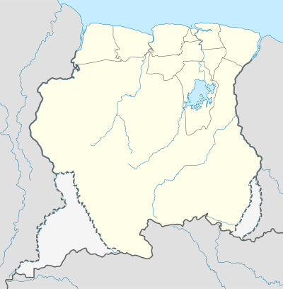 Nieuw Nickerie Location in Suriname | |
| Coordinates: 05°56′N 56°59′W / 5.933°N 56.983°WCoordinates: 05°56′N 56°59′W / 5.933°N 56.983°W | |
| Country | Suriname |
| District | Nickerie |
| Area | |
| • Total | 30 km2 (10 sq mi) |
| Elevation | 0 m (0 ft) |
| Population (2012 census) | |
| • Total | 12,818 |
| • Density | 430/km2 (1,100/sq mi) |

Nieuw Nickerie[1] (pronounced 'Niekérie') is the third largest city in Suriname with a population estimated at 12,818. It is the capital city of the Nickerie district, and the terminus of the East-West Link.
Nieuw Nickerie lies on the mouth of the Nickerie river on the Atlantic coast, opposite the mouth of the Corantijn river (Courantyne) and the Guyanese town of Corriverton (Springlands), to which a ferry service operates.
The main industries are bananas and rice. The town contains a market and several hotels, including the Hotel Ameerali, Hotel de President, Hotel Tropical, Hotel de Vesting and Residence Inn. The only Surinamese hospital outside of Paramaribo, Lachmipersad Mungra Regional Hospital Nickerie, is located on the Annastraat in Nieuw-Nickerie.
Nieuw Nickerie was built after the former center of the district, Nieuw Rotterdam, was destroyed by floods.
Majoor Henry Fernandes Airport, also known as Nieuw Nickerie Airport,[2][3] is located near the city.
Climate
| Climate data for Nickerie, Suriname | |||||||||||||
|---|---|---|---|---|---|---|---|---|---|---|---|---|---|
| Month | Jan | Feb | Mar | Apr | May | Jun | Jul | Aug | Sep | Oct | Nov | Dec | Year |
| Record high °C (°F) | 32.5 (90.5) |
32.4 (90.3) |
32.5 (90.5) |
33.2 (91.8) |
34.8 (94.6) |
34.0 (93.2) |
34.5 (94.1) |
35.6 (96.1) |
35.4 (95.7) |
36.3 (97.3) |
34.9 (94.8) |
33.8 (92.8) |
36.3 (97.3) |
| Average high °C (°F) | 28.9 (84) |
29.0 (84.2) |
29.2 (84.6) |
29.5 (85.1) |
29.8 (85.6) |
29.8 (85.6) |
30.3 (86.5) |
31.1 (88) |
31.7 (89.1) |
31.7 (89.1) |
30.9 (87.6) |
29.8 (85.6) |
30.1 (86.2) |
| Daily mean °C (°F) | 26.5 (79.7) |
26.6 (79.9) |
26.9 (80.4) |
27.2 (81) |
27.2 (81) |
27.1 (80.8) |
27.2 (81) |
27.8 (82) |
28.3 (82.9) |
28.2 (82.8) |
27.8 (82) |
27.0 (80.6) |
27.3 (81.1) |
| Average low °C (°F) | 23.5 (74.3) |
23.7 (74.7) |
24.0 (75.2) |
24.2 (75.6) |
24.2 (75.6) |
23.9 (75) |
23.7 (74.7) |
24.0 (75.2) |
24.2 (75.6) |
24.0 (75.2) |
23.9 (75) |
23.7 (74.7) |
24.0 (75.2) |
| Record low °C (°F) | 18.3 (64.9) |
18.2 (64.8) |
19.1 (66.4) |
19.9 (67.8) |
20.7 (69.3) |
20.6 (69.1) |
20.9 (69.6) |
19.9 (67.8) |
20.9 (69.6) |
20.3 (68.5) |
20.0 (68) |
20.1 (68.2) |
18.2 (64.8) |
| Average precipitation mm (inches) | 191 (7.52) |
114 (4.49) |
111 (4.37) |
191 (7.52) |
246 (9.69) |
316 (12.44) |
266 (10.47) |
168 (6.61) |
61 (2.4) |
61 (2.4) |
79 (3.11) |
176 (6.93) |
1,980 (77.95) |
| Average relative humidity (%) | 82 | 81 | 80 | 80 | 82 | 83 | 82 | 80 | 78 | 78 | 79 | 82 | 80.6 |
| Source: Deutscher Wetterdienst[4] | |||||||||||||
References
- ↑ Nieuw Nickerie, Nickerie, Suriname at GEOnet Names Server. Retrieved 17 November 2009.
- ↑ Airport information for SMNI at Great Circle Mapper.
- ↑ Accident history for ICK at Aviation Safety Network
- ↑ "Klimatafel von Nickerie / Surinam" (PDF). Federal Ministry of Transport and Digital Infrastructure. Retrieved 21 June 2016.
