Nidamanuru, Krishna district
| Nidamanuru నిడమానూరు | |
|---|---|
| Out Growth | |
|
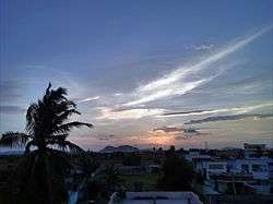
Sunset in Nidamanuru, Vijayawada | |
 Nidamanuru Location in Andhra Pradesh, India | |
| Coordinates: 16°30′24″N 80°43′20″E / 16.5066°N 80.7222°ECoordinates: 16°30′24″N 80°43′20″E / 16.5066°N 80.7222°E | |
| Country | India |
| State | Andhra Pradesh |
| District | Krishna district |
| Mandal | Vijayawada (rural) |
| Population (2011) | |
| • Total | 10,375 |
| Languages | |
| • Official | Telugu |
| Time zone | IST (UTC+5:30) |
| PIN | 521104 |
| Telephone code | +91-(0)866 |
| Vehicle registration | AP-16 |
Nidamanuru is an out growth to Vijayawada in Krishna district of the Indian state of Andhra Pradesh. It forms a part of Vijayawada urban agglomeration and is located in Vijayawada (rural) mandal of Vijayawada revenue division.[1][2]
Geography
The Ryve’s canal, that originates from the Krishna river[3] flows through the village[4] and is the main source of irrigation water.[5]
Transport
Nidamanuru lies on National Highway 16.[6] Nidamanuru railway station serves with rail services.
Education
School of Planning and Architecture was established by Ministry of Human Resource Development, Government of India.[7]
References
- ↑
- ↑ "Name of Urban Agglomeration and its State constituent Units-2011" (PDF). Census of India. p. 22–23. Retrieved 6 February 2016.
- ↑ "The Hindu".
- ↑ "Many bridges in Vijayawada need immediate attention".
- ↑ "Delta works to be speeded up".
- ↑ "NH-16 Strewn with Garbage, CM Reproaches Civic Officials". The New Indian Express. 13 February 2016. Retrieved 6 June 2016.
- ↑ "School of Planning and Architecture, Vijayawada".
This article is issued from Wikipedia - version of the 11/8/2016. The text is available under the Creative Commons Attribution/Share Alike but additional terms may apply for the media files.