New York State Route 442
| ||||
|---|---|---|---|---|
| Bear Swamp Road | ||||
|
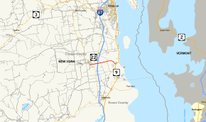
Map of Clinton County in northeastern New York with NY 442 highlighted in red | ||||
| Route information | ||||
| Maintained by NYSDOT | ||||
| Length: | 3.95 mi[1] (6.36 km) | |||
| Existed: | early 1970s[2][3] – present | |||
| Major junctions | ||||
| West end: |
| |||
|
| ||||
| East end: |
| |||
| Location | ||||
| Counties: | Clinton | |||
| Highway system | ||||
| ||||

New York State Route 442 (NY 442) is a state highway located within the town of Peru in Clinton County, New York, in the United States. It is an east–west highway that connects the hamlet of Peru with the Adirondack Northway (Interstate 87). The western terminus of the route is at an intersection with NY 22 in the hamlet of Peru. Its eastern terminus is at a junction with US 9 near the shore of Lake Champlain. NY 442 was assigned in the early 1970s as a town-maintained, state-numbered route. It became state-maintained in 1988.
Route description
NY 442 begins at an intersection with NY 22 (Main Street) in the hamlet of Peru within the town of the same name. The route heads eastward, intersecting with local roads before leaving Peru. For a brief distance, NY 442 and NY 22 parallel, but NY 22 turns to the north while NY 442 continues eastward. Soon after the intersection with Dashnaw Road, NY 442 connects with the Adirondack Northway (I-87) by way of an interchange (exit 35). The highway heads through the small hamlet of Laphams Mills and terminates at an intersection with US 9 (the Lakes to Locks Passage), just east of Ausable Point and west of Lake Champlain.[4]
History
NY 442 was assigned to its current alignment in the early 1970s.[2][3] Although it was signed as a state route, NY 442 was initially maintained by the town of Peru. On September 1, 1988, ownership and maintenance of NY 442 was transferred from the town to the state of New York as part of a highway maintenance swap between the town, the state, and Clinton County. In exchange, the state ceded maintenance of NY 22 north of US 11 in Mooers to the county.[5]
Major intersections
The entire route is in Peru, Clinton County.
| mi[1] | km | Destinations | Notes | ||
|---|---|---|---|---|---|
| 0.00 | 0.00 | ||||
| 1.08 | 1.74 | Exit 35 (I-87) | |||
| 3.95 | 6.36 | ||||
| 1.000 mi = 1.609 km; 1.000 km = 0.621 mi | |||||
See also
.svg.png) New York Roads portal
New York Roads portal
References
- 1 2 "2008 Traffic Data Report for New York State" (PDF). New York State Department of Transportation. June 16, 2009. pp. 315–316. Retrieved January 10, 2010.
- 1 2 State of New York Department of Transportation (January 1, 1970). Official Description of Touring Routes in New York State (PDF). Retrieved June 11, 2010.
- 1 2 New York and New Jersey Tourgide Map (Map) (1972 ed.). Cartography by Rand McNally and Company. Gulf Oil Company. 1972.
- ↑ Google (March 6, 2008). "overview map of NY 442" (Map). Google Maps. Google. Retrieved March 6, 2008.
- ↑ New York State Legislature. "New York State Highway Law § 341". Retrieved June 11, 2010.
External links
- New York State Route 442 at New York Routes • New York State Highway Termini