Neiva, Huila
| Neiva | |||
|---|---|---|---|
| City | |||
| Municipio de Neiva | |||
| |||
| Nickname(s): "Magdalena River's Capital" | |||
 Location in the Huila Department. Urban in red, municipality in dark gray | |||
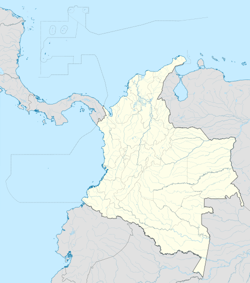 Neiva Location in Colombia | |||
| Coordinates: 2°59′55″N 75°18′16″W / 2.99861°N 75.30444°WCoordinates: 2°59′55″N 75°18′16″W / 2.99861°N 75.30444°W | |||
| Country |
| ||
| Region | Andean | ||
| Department | Huila | ||
| Foundation | May 24, 1612 | ||
| Government | |||
| • Mayor | Pedro Hernán Suárez Trujillo | ||
| Area | |||
| • Total | 1,553 km2 (600 sq mi) | ||
| Elevation | 442 m (1,450 ft) | ||
| Population (2005-2006 Census) | |||
| • Total | 372,859 | ||
| • Density | 240/km2 (620/sq mi) | ||
| Demonym(s) | Neivano | ||
| Time zone | Eastern Time Zone (UTC-05) | ||
| Postal code | 410001-18 | ||
| Area code(s) | 57 + 8 | ||
| Website | Official website (Spanish) | ||

Neiva is the Capital of the Department of Huila. It is located in the valley of the Magdalena River in south central Colombia with a population of about 378,857 inhabitants. It is one of the most important cities in Southern Colombia, mainly because of its strategic geographical location.
History
Neiva was first founded in 1539 by Juan de Cabrera in an area now belonging to the municipality of Campoalegre. In 1550, Juan de Alonso y Arias relocated the city to the place that is now the municipality of Villavieja. At this location, the city was destroyed by indigenous tribes in 1560. The city was founded, at its actual location, for the third and final time in 1612 by Diego de Ospina y Medinilla.
Neiva became important during the colonial times because of its strategic location. It was located in the trade route that communicated the Viceroyalty of Peru with Bogotá and Caracas. The city was declared as the capital of the Province of Neiva, made up of the Neiva, La Plata, Timaná, Purificación cabildos. In 1905 the city became the capital of the newly created Huila Department, which had been severed from the Tolima Department by the national government.
In 1967, the city was hit severely by an earthquake of magnitude 7.2. The earthquake destroyed several buildings including the Palacio de las 57 ventanas, the Governor's building.
Geography and climate
Due to its location near the equator and its low altitude, the city has a hot annual average climate with daytime temperatures ranging from 88 to 95 degrees Fahrenheit.[1] It is about 300 kilometers / 186.4 miles (about a five-hour drive) from the Colombian capital, Bogotá.
The city of Palembang in Indonesia is the antipode of Neiva.
| Climate data for Neiva (1971–2000) | |||||||||||||
|---|---|---|---|---|---|---|---|---|---|---|---|---|---|
| Month | Jan | Feb | Mar | Apr | May | Jun | Jul | Aug | Sep | Oct | Nov | Dec | Year |
| Average high °C (°F) | 32.8 (91) |
33.0 (91.4) |
32.7 (90.9) |
32.3 (90.1) |
32.5 (90.5) |
33.2 (91.8) |
33.7 (92.7) |
34.5 (94.1) |
34.6 (94.3) |
32.8 (91) |
31.5 (88.7) |
31.9 (89.4) |
32.96 (91.33) |
| Average low °C (°F) | 22.3 (72.1) |
22.4 (72.3) |
22.5 (72.5) |
22.4 (72.3) |
22.3 (72.1) |
22.2 (72) |
22.5 (72.5) |
22.9 (73.2) |
23.0 (73.4) |
22.4 (72.3) |
22.2 (72) |
22.1 (71.8) |
22.43 (72.37) |
| Average rainfall mm (inches) | 106 (4.17) |
130 (5.12) |
151 (5.94) |
135 (5.31) |
89 (3.5) |
37 (1.46) |
33 (1.3) |
23 (0.91) |
65 (2.56) |
203 (7.99) |
216 (8.5) |
158 (6.22) |
1,346 (52.98) |
| Average rainy days (≥ 1 mm) | 11 | 12 | 14 | 15 | 15 | 12 | 10 | 8 | 10 | 16 | 18 | 14 | 155 |
| Average relative humidity (%) | 69 | 68 | 70 | 72 | 70 | 64 | 58 | 55 | 57 | 67 | 75 | 73 | 66.5 |
| Mean monthly sunshine hours | 198 | 156 | 153 | 149 | 165 | 169 | 173 | 170 | 160 | 172 | 165 | 190 | 2,020 |
| Source: Instituto de Hidrología, Meteorología y Estudios Ambientales (IDEAM)[2] | |||||||||||||
Tourist attractions
Throughout the city a tourist might enjoy the scattered city monuments, especially around the edges of the Magdalena River, where the local government has been maintaining the recently built sanctuary meant to safeguard the Magdalena from any pollutants and human produced contamination. Around this sanctuary there are parks and gardens usually crowded by locals and tourists who came to the growing city. The city can be reached by road travel, or by all major national airlines, coming to the Benito Salas Airport.
Education
Neiva is home to several universities which serve primarily Southern Colombia. Among the most important are the Universidad Surcolombiana, the Corporación Universitaria del Huila and the Universidad Cooperativa de Colombia.
Transport
Air Transportation
The Benito Salas Airport named after Benito Salas Vargas is located inside the city and serves domestic destinations.
Culture
The city is known as the Bambuco capital. José Eustasio Rivera, born in Rivera, is the most famous writer of a "pléyade" of creators that lived in Neiva (Regulo Suárez, Eustaquio Álvarez, Felio Andrade, Antonio Iriarte, Yezid Morales, Humberto Calderón, Jorge Guebelly, Luis Alberto Campos, Winston Morales, Jader Rivera, David Alberto Campos)
Festivals and events
This city is known for the Festival Folclórico y Reinado Nacional del Bambuco festivities held between the last two weeks of June and early July. During this time, there are daily parades through the downtown area and showings of the Sanjuanero, a folk dance, where the participants dress in a typical costumes and compete for being the best performers of the Sanjuanero choreography.
Sports
Soccer is currently the most popular sport in the city. The city is the base for the Atlético Huila club which competes in the top division of the Colombian professional football (soccer) league. The games are played at the Guillermo Plazas Alcid Stadium.
Basketball had historically a high popularity, although it has decreased in recent years. The cities Basketball games are played at the Coliseo Álvaro Sánchez Silva court.
The city has host important national and international sport events. For example:
- XI National Games of Colombia 1980
- Juvenile Finswimming World Championship 2008
- South American Basketball Championship 2010
- FIBA Americas Championship for Women 2011
The Colombian Football Association announced that Neiva will be one of the venue cities to host the 2016 FIFA Futsal World Cup.[3]
Sister cities
-
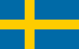 Kungsbacka, Sweden
 -
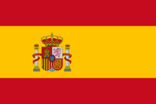 Cadiz, Spain
 -
 Gold Coast, Queensland, Australia
 -
 Los Angeles, United States
 -
 Milan, Italy
 -
 Bogotá, Colombia
 -
 Lyon, France
 - Malmö, Sweden
- Cartagena de Indias, Colombia
- Perth, Western Australia, Australia
- Leesburg, Florida, United States
-
 Palembang,[4] South Sumatra, Indonesia
Gallery
 Catedral de Neiva
References
- ↑ http://www.weather.com/weather/wxclimatology/monthly/graph/COXX0037
- ↑ "Promedios 71-00" (in Spanish). IDEAM. Retrieved 15 August 2012.
- ↑ "Copa Mundial de Futsal de la FIFA se jugará en Colombia en 2016". http://fcf.com.co/. 28 May 2013. External link in
|publisher=(help) - ↑ Embajada de Indonesia en Colombia (25 February 2011). "Página traducida en Google Translate de la Embajada de la República de Indonesia en Bogotá". Retrieved 12-10-2006. Check date values in:
|access-date=(help)
External links
- (Spanish) Neiva official website
- (Spanish) Opanoticias Daily Newspaper from Neiva
- (Spanish) La Nación Daily Newspaper from Neiva
- (Spanish) Diario del Huila Daily Newspaper