Negoiu Peak
For Negoiu village in Hunedoara County, see Lunca Cernii de Jos.
| Negoiu | |
|---|---|
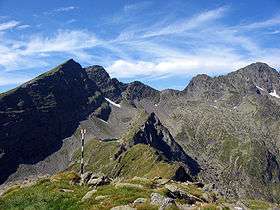 Negoiu, first from the right. At the middle-left, Caltun Lake and Lespezi Peak 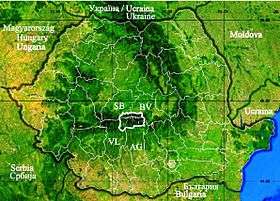 | |
| Highest point | |
| Elevation | 2,535 m (8,317 ft) |
| Coordinates | 45°35′13″N 24°33′21″E / 45.5870°N 24.5557°ECoordinates: 45°35′13″N 24°33′21″E / 45.5870°N 24.5557°E |
| Geography | |
 Negoiu Location of Negoiu in the Făgăraş Mountains | |
| Location | Sibiu County, Romania |
| Parent range | Făgăraş Mountains, Southern Carpathians |
| Climbing | |
| Easiest route | Scramble |
Negoiu Peak (Romanian: Vârful Negoiu pronounced [neˈɡoju]) is a mountain peak in the Făgăraş Mountains of the Southern Carpathians, being located in Sibiu County, Romania, with an elevation of 2,535 metres (8,317 ft). It is the second highest peak in Romania after Moldoveanu Peak (2544m).
External links
 3D rendering of Negoiu |
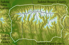
 Făgăraş mountain range |
This article is issued from Wikipedia - version of the 8/9/2016. The text is available under the Creative Commons Attribution/Share Alike but additional terms may apply for the media files.