Neffes
| Neffes | ||
|---|---|---|
|
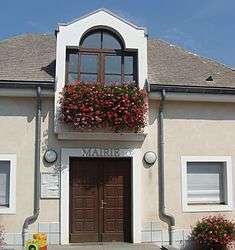
The town hall of Neffes | ||
| ||
 Neffes | ||
|
Location within Provence-A.-C.d'A. region  Neffes | ||
| Coordinates: 44°30′19″N 6°01′22″E / 44.5053°N 6.0228°ECoordinates: 44°30′19″N 6°01′22″E / 44.5053°N 6.0228°E | ||
| Country | France | |
| Region | Provence-Alpes-Côte d'Azur | |
| Department | Hautes-Alpes | |
| Arrondissement | Gap | |
| Canton | Tallard | |
| Intercommunality | Tallard-Barcillonnette | |
| Government | ||
| • Mayor (2014–2020) | Michel Gay-Para[1] | |
| Area1 | 8.36 km2 (3.23 sq mi) | |
| Population (2012)2 | 749 | |
| • Density | 90/km2 (230/sq mi) | |
| Time zone | CET (UTC+1) | |
| • Summer (DST) | CEST (UTC+2) | |
| INSEE/Postal code | 05092 / 05000 | |
| Elevation |
633–892 m (2,077–2,927 ft) (avg. 750 m or 2,460 ft) | |
|
1 French Land Register data, which excludes lakes, ponds, glaciers > 1 km² (0.386 sq mi or 247 acres) and river estuaries. 2 Population without double counting: residents of multiple communes (e.g., students and military personnel) only counted once. | ||

Neffes is a commune in the Hautes-Alpes department in southeastern France.
Population
| Historical population | ||
|---|---|---|
| Year | Pop. | ±% |
| 1962 | 183 | — |
| 1968 | 187 | +2.2% |
| 1975 | 247 | +32.1% |
| 1982 | 432 | +74.9% |
| 1990 | 510 | +18.1% |
| 1999 | 570 | +11.8% |
| 2008 | 726 | +27.4% |
| 2012 | 749 | +3.2% |
See also
References
- ↑ "List of mayors of the Hautes-Alpes department". Prefecture of Hautes-Alpes (in French). 3 June 2014. Retrieved 20 March 2015.
| Wikimedia Commons has media related to Neffes. |
This article is issued from Wikipedia - version of the 3/20/2015. The text is available under the Creative Commons Attribution/Share Alike but additional terms may apply for the media files.