Natonin, Mountain Province
| Natonin | ||
|---|---|---|
| Municipality | ||
| ||
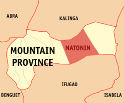 Map of Mountain Province showing the location of Natonin | ||
.svg.png) Natonin Location within the Philippines | ||
| Coordinates: 17°06′N 121°17′E / 17.100°N 121.283°ECoordinates: 17°06′N 121°17′E / 17.100°N 121.283°E | ||
| Country | Philippines | |
| Region | Cordillera Administrative Region (CAR) | |
| Province | Mountain Province | |
| District | Lone District | |
| Barangays | 11 | |
| Government[1] | ||
| • Mayor | Mateo L. Chiyawan | |
| Area[2] | ||
| • Total | 252.00 km2 (97.30 sq mi) | |
| Population (2010)[3] | ||
| • Total | 10,048 | |
| • Density | 40/km2 (100/sq mi) | |
| Time zone | PST (UTC+8) | |
| ZIP code | 2624 | |
| Dialing code | 74 | |
| Income class | 4th class | |

Natonin is a fourth class municipality in the province of Mountain Province, Philippines. According to the 2010 census, it has a population of 10,048 people.[3]
Geography
The municipality is very mountainous, with very little level ground lending itself to agriculture. The barangays are geographically isolated by high (700m) mountains covered in jungle.
Barangays
Natonin is politically subdivided into 11 barangays.[2]
- Alunogan
- Balangao
- Banao
- Banawel
- Butac
- Maducayan
- Poblacion
- Saliok
- Santa Isabel
- Tonglayan
- Pudo
Demographics
| Population census of Natonin | ||
|---|---|---|
| Year | Pop. | ±% p.a. |
| 1990 | 9,813 | — |
| 1995 | 8,997 | −1.61% |
| 2000 | 9,065 | +0.16% |
| 2007 | 9,431 | +0.55% |
| 2010 | 10,048 | +2.33% |
| Source: National Statistics Office[3] | ||
The town is composed from people of two ethnic groups, the Balangaos and the Majukayongs. Most of the population refer to themselves as Igorots. The traditions and dialect of the Majukayongs are more closely related to Kalingan. It could be argued that the Majukayong are the southernmost Kalingan tribe. Headhunting was practiced in Maducayan as late as the mid-1930s, and was set aside in favor of Christianity and education after World War II.
Economy
The primary crop is rice, although a lack of arable land, lack of mechanization and no access to fertilizers limits the harvest to a subsistence level only. Families rely on small livestock populations to supplement the diet. Fruits and wild coffee are harvested from the forest. Poblacion boasts of numerous family ponds which raise tilapia for consumption. Due to the terrain, rice is planted on terraced fields. Locals consider the rice terraces of Natonin to be equal or surpassing those of Banaue to the south.
Transportation
Transportation throughout Natonin is largely undeveloped roads. The only paved roads (as of 2007) are in Poblacion proper. Roads frequently become impassable in the rainy seasons. Some barangays (notably Maducayan) are inaccessible by road. Maducayan lies one mile beyond a recent road extension from the center of Saliok to the western most situ of Saliok.
Tourism
Natonin have the following tourism sites:
- The Legendary Silent Mountain of Binaratan - located in Barangay Maducayan.
- The Apatan Rice Terraces
- The Balococ Waterfall
- The Naropaan Waterfall
- Tongalayan Rice Terraces
- Lagan river in Balangao
References
- ↑ "Official City/Municipal 2013 Election Results". Intramuros, Manila, Philippines: Commission on Elections (COMELEC). 11 September 2013. Retrieved 23 December 2013.
- 1 2 "Province: Mountain Province". PSGC Interactive. Makati City, Philippines: National Statistical Coordination Board. Retrieved 23 December 2013.
- 1 2 3 "Total Population by Province, City, Municipality and Barangay: as of May 1, 2010" (PDF). 2010 Census of Population and Housing. National Statistics Office. Retrieved 23 December 2013.
External links
 |
Tanudan, Kalinga | | ||
| Barlig | |
Paracelis | ||
| ||||
| | ||||
| Mayoyao, Ifugao | Aguinaldo, Ifugao | Alfonso Lista, Ifugao |
Bontoc (capital) | |
| Municipalities | |
| Barangays | |