National Register of Historic Places listings in Tillamook County, Oregon
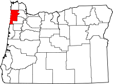
Location of Tillamook County in Oregon
This list presents the full set of buildings, structures, objects, sites, or districts designated on the National Register of Historic Places in Tillamook County, Oregon, and offers brief descriptive information about each of them. The National Register recognizes places of national, state, or local historic significance across the United States.[1] Out of over 90,000 National Register sites nationwide,[2] Oregon is home to over 2,000,[3] and 29 of those are found in Tillamook County.
- This National Park Service list is complete through NPS recent listings posted December 2, 2016.[4]
Current listings
| [5] | Name on the Register | Image | Date listed[6] | Location | City or town | Description |
|---|---|---|---|---|---|---|
| 1 | 35-TI-4 – Cronin Point Site | Upload image | (#01000128) |
Address restricted[7] |
Manzanita vicinity | This archeological site, occupied probably between 1600 and 1800 CE, is characterized by a quantity of burned rock, indicating a possible village site. Shards of Asian ceramicware link the site to the Nehalem Beeswax shipwreck and early contact with Europeans. Studies suggest that occupation ended abruptly, likely due to earthquake-related subsidence.[8] |
| 2 | 35-TI-75 – Spruce Tree Site | Upload image | (#01000127) |
Address restricted[7] |
Manzanita vicinity | |
| 3 | 35-TI-76 – North Trail House Site | Upload image | (#01000129) |
Address restricted[7] |
Manzanita vicinity | |
| 4 | Archeological Site (35TI39) | Upload image | (#97000993) |
Address restricted[7] |
Netarts vicinity | |
| 5 | Archeological Site 35-TI-40 | Upload image | (#01000136) |
Address restricted[7] |
Netarts vicinity | |
| 6 | Archeological Site 35TI1 | Upload image | (#97000989) |
Address restricted[7] |
Netarts vicinity | |
| 7 | Archeological site 35TI36 | Upload image | (#97001000) |
Address restricted[7] |
Netarts vicinity | |
| 8 | Archeological site 35TI38 | Upload image | (#97000997) |
Address restricted[7] |
Netarts vicinity | |
| 9 | Archeological Site 35TI44 | Upload image | (#97000990) |
Address restricted[7] |
Netarts vicinity | |
| 10 | Archeological Site 35TI45 | Upload image | (#97000994) |
Address restricted[7] |
Netarts vicinity | |
| 11 | Archeological site 35TI54 | Upload image | (#97001001) |
Address restricted[7] |
Netarts vicinity | |
| 12 | Cape Canyon Midden (35TI61) | Upload image | (#97000998) |
Address restricted[7] |
Netarts vicinity | |
| 13 | Cape Meares Lighthouse |  |
(#73002341) |
Cape Meares, 5 miles (8.0 km) south of Tillamook Bay entrance 45°29′11″N 123°58′42″W / 45.486474°N 123.978309°W |
Tillamook | |
| 14 | Cove Creek Midden (35TI35) | Upload image | (#97000999) |
Address restricted[7] |
Netarts vicinity | |
| 15 | A. E. Doyle Cottage | 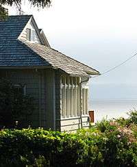 |
(#91000066) |
37480 2nd St. 45°43′45″N 123°56′30″W / 45.729217°N 123.941605°W |
Neahkahnie Beach | |
| 16 | Mary Frances Isom Cottage |  |
(#91000065) |
37465 Beulah Reed Rd. 45°43′43″N 123°56′34″W / 45.728541°N 123.942738°W |
Neahkahnie Beach | |
| 17 | Nehalem Bay Dune Site | Upload image | (#97000986) |
Address restricted[7] |
Nehalem vicinity | |
| 18 | Nehalem Boat Ramp Midden (35TI62) | Upload image | (#97000987) |
Address restricted[7] |
Manzanita vicinity | |
| 19 | Netarts FCR Camp (35TI67) | Upload image | (#97000992) |
Address restricted[7] |
Netarts vicinity | |
| 20 | Netarts Marsh Site (35TI68) | Upload image | (#97000991) |
Address restricted[7] |
Netarts vicinity | |
| 21 | Netarts Spit FCR-Elko Site (35TI65) | Upload image | (#97000996) |
Address restricted[7] |
Netarts vicinity | |
| 22 | Netarts Spit Lithic Site | Upload image | (#97000995) |
Address restricted[7] |
Netarts vicinity | |
| 23 | Oceanside Site (35TI47) | Upload image | (#97000988) |
Address restricted[7] |
Oceanside vicinity | |
| 24 | Smuggler Cove Shell Midden (35TI46) | Upload image | (#97000985) |
Address restricted[7] |
Neahkahnie Beach vicinity | The contents of this shell midden, including mussels, barnacles, and chiton, have been dated to around 1660 CE. The supposed wreck of a European ship nearby in the same period suggests the site may preserve information from both before and after contact between local people and Europeans.[9] |
| 25 | U.S. Coast Guard Station – Tillamook Bay |  |
(#93001337) |
US 101 45°33′31″N 123°55′13″W / 45.558550°N 123.920319°W |
Garibaldi | |
| 26 | U.S. Naval Air Station Dirigible Hangar B | |
(#89000201) |
Off US 101 2.5 mi. SE of Tillamook 45°25′13″N 123°48′17″W / 45.420391°N 123.804835°W |
Tillamook | Originally listed in 1989 along with Hangar A, which burned down in 1992. |
| 27 | U.S. Post Office |  |
(#85000546) |
210 Laurel Ave. 45°27′24″N 123°50′33″W / 45.456692°N 123.842395°W |
Tillamook | |
| 28 | Harry F. Wentz Studio |  |
(#76001589) |
North of Manzanita off U.S. Highway 101 45°44′00″N 123°56′41″W / 45.733318°N 123.944819°W |
Neahkahnie Beach | Artist Harry F. Wentz and architect A. E. Doyle designed this 1916 bungalow, which came to be regarded as a prototype of the Northwest Regional style. Some characteristic features include: colors and materials associated with the Northwest; low massing with simple wall surfaces; porches with slender wooden supports; and siting to harmonize with the surrounding landscape.[10] |
| 29 | Wilson River Bridge No. 01499 | 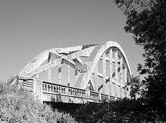 |
(#05000825) |
OR Coast 9, US101, MP 64.23 45°28′42″N 123°50′40″W / 45.478284°N 123.844503°W |
Tillamook |
See also
- National Register of Historic Places listings in Oregon
- Listings in neighboring counties: Clatsop, Lincoln, Polk, Washington, Yamhill
- Historic preservation
- History of Oregon
- Lists of Oregon-related topics
References
- ↑ Andrus, Patrick W.; Shrimpton, Rebecca H.; et al. (2002), How to Apply the National Register Criteria for Evaluation, National Register Bulletin (15), National Park Service, U.S. Department of the Interior, OCLC 39493977, archived from the original on April 6, 2014, retrieved June 20, 2014.
- ↑ National Park Service, National Register of Historic Places Program: Research, archived from the original on February 1, 2015, retrieved January 28, 2015.
- ↑ Oregon Parks and Recreation Department, Oregon Historic Sites Database, retrieved August 6, 2015. Note that a simple count of National Register records in this database returns a slightly higher total than actual listings, due to duplicate records. A close reading of detailed query results is necessary to arrive at the precise count.
- ↑ "National Register of Historic Places: Weekly List Actions". National Park Service, United States Department of the Interior. Retrieved on December 2, 2016.
- ↑ Numbers represent an ordering by significant words. Various colorings, defined here, differentiate National Historic Landmarks and historic districts from other NRHP buildings, structures, sites or objects.
- ↑ The eight-digit number below each date is the number assigned to each location in the National Register Information System database, which can be viewed by clicking the number.
- 1 2 3 4 5 6 7 8 9 10 11 12 13 14 15 16 17 18 19 20 21 Federal and state laws and practices restrict general public access to information regarding the specific location of sensitive archeological sites in many instances. The main reasons for such restrictions include the potential for looting, vandalism, or trampling. See: Knoerl, John; Miller, Diane; Shrimpton, Rebecca H. (1990), Guidelines for Restricting Information about Historic and Prehistoric Resources, National Register Bulletin (29), National Park Service, U.S. Department of the Interior, OCLC 20706997.
- ↑ Losey, Robert; Erlandson, Jon (August 9, 1999), National Register of Historic Places Registration Form: 35-TI-4, Cronin Point Site (redacted PDF), retrieved October 4, 2015.
- ↑ Erlandson, Jon M.; Moss, Madonna L. (August 31, 1996), National Register of Historic Places Registration Form: 35-TI-46, Smuggler Cove Shell Midden (redacted PDF), retrieved October 20, 2015.
- ↑ Hartwig, Paul B.; Powers, D.W., III (July 26, 1974), National Register of Historic Places Inventory — Nomination Form: Wentz (Harry F.) Studio/Bungalow (PDF), retrieved March 17, 2013.
External links
- Oregon Parks and Recreation Department, National Register Program
- National Park Service, National Register of Historic Places site
 Media related to National Register of Historic Places in Tillamook County, Oregon at Wikimedia Commons
| Lists by county |  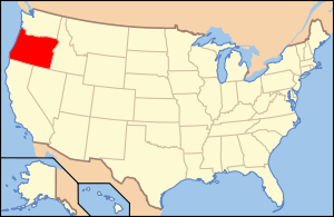 | |
|---|---|---|
| Portland lists | ||
| Other lists |
| |
| Topics | |
|---|---|
| Lists by states |
|
| Lists by insular areas | |
| Lists by associated states | |
| Other areas | |
| |
Municipalities and communities of Tillamook County, Oregon, United States | ||
|---|---|---|
| Cities | | |
| CDPs |
| |
| Unincorporated communities | ||
This article is issued from Wikipedia - version of the 3/9/2016. The text is available under the Creative Commons Attribution/Share Alike but additional terms may apply for the media files.