National Register of Historic Places listings in Saunders County, Nebraska

Location of Saunders County in Nebraska
This is a list of the National Register of Historic Places listings in Saunders County, Nebraska. It is intended to be a complete list of the properties and districts on the National Register of Historic Places in Saunders County, Nebraska, United States. The locations of National Register properties and districts for which the latitude and longitude coordinates are included below, may be seen in a map.[1]
There are 21 properties and districts listed on the National Register in the county.
- This National Park Service list is complete through NPS recent listings posted December 16, 2016.[2]
Listings county-wide
| [3] | Name on the Register | Image | Date listed[4] | Location | City or town | Description |
|---|---|---|---|---|---|---|
| 1 | Ashland Archeological District | Upload image | (#00001376) |
Address Restricted |
Ashland | |
| 2 | Ashland Bridge | |
(#92000721) |
Silver St. over Salt Creek 41°02′21″N 96°21′52″W / 41.039096°N 96.364501°W |
Ashland | One of 2 surviving Warren pony truss bridges in Nebraska |
| 3 | Ashland Public Library |  |
(#83001102) |
207 N. 15th St. 41°02′27″N 96°22′08″W / 41.040833°N 96.368889°W |
Ashland | |
| 4 | Barnes Oil Company |  |
(#02001475) |
Junction of Silver St. and U.S. Route 6 41°02′20″N 96°21′26″W / 41.038889°N 96.357222°W |
Ashland | |
| 5 | Israel Beetison House |  |
(#77000839) |
Southeast of Ashland 41°01′54″N 96°21′12″W / 41.031667°N 96.353333°W |
Ashland | |
| 6 | Howard Hanson House |  |
(#83001103) |
12th and Linden Sts. 41°12′59″N 96°37′07″W / 41.216389°N 96.618611°W |
Wahoo | |
| 7 | Hoffman Building | Upload image | (#14000441) |
1325 & 1341 Silver St. 41°02′20″N 96°22′04″W / 41.0390°N 96.3677°W |
Ashland | |
| 8 | Old Ithaca Grain Elevator |  |
(#01000168) |
One block south of 4th St. 41°09′27″N 96°32′19″W / 41.1575°N 96.538611°W |
Ithaca | |
| 9 | Kacirek-Woita General Store | Upload image | (#14000397) |
250 N. Elm St. 41°11′31″N 96°44′37″W / 41.192°N 96.7437°W |
Weston | |
| 10 | F.J. Kirchman House | _from_NE_2.JPG) |
(#03000796) |
957 Beech St. 41°12′52″N 96°37′02″W / 41.214444°N 96.617222°W |
Wahoo | |
| 11 | Leshara Site | Upload image | (#72000759) |
Address Restricted |
Leshara | |
| 12 | McClean Site | Upload image | (#72000758) |
Address Restricted |
Inglewood | |
| 13 | National Bank of Ashland | 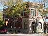 |
(#83001104) |
1442 Silver St. 41°02′21″N 96°22′09″W / 41.039167°N 96.369167°W |
Ashland | |
| 14 | O.K. Market | _1.jpg) |
(#91000835) |
542 N. Linden Ave. 41°12′38″N 96°36′23″W / 41.210556°N 96.606389°W |
Wahoo | |
| 15 | Pahuk | |
(#73001074) |
Address Restricted |
Cedar Bluffs | |
| 16 | Rad Plzen cis. 9 Z.C.B.J. (SD10-6) |  |
(#86000440) |
Off Nebraska Highway 79 41°25′52″N 96°45′58″W / 41.431111°N 96.766111°W |
Morse Bluff | |
| 17 | St. Stephen's Episcopal Church |  |
(#79001454) |
16th and Adams Sts.[5] 41°02′25″N 96°22′16″W / 41.040278°N 96.371111°W |
Ashland | |
| 18 | Saunders County Courthouse |  |
(#89002220) |
Chestnut between 4th and 5th Sts. 41°12′34″N 96°37′24″W / 41.2095°N 96.6232°W |
Wahoo | |
| 19 | Wahoo Burlington Depot |  |
(#85000955) |
431 W. 3rd 41°12′27″N 96°36′44″W / 41.2075°N 96.612222°W |
Wahoo | |
| 20 | Woodcliff Burials | Upload image | (#73001075) |
Address Restricted |
Inglewood | |
| 21 | Yutan Site | Upload image | (#72000760) |
Address Restricted |
Yutan |
See also
| Wikimedia Commons has media related to National Register of Historic Places in Saunders County, Nebraska. |
- List of National Historic Landmarks in Nebraska
- National Register of Historic Places listings in Nebraska
References
- ↑ The latitude and longitude information provided in this table was derived originally from the National Register Information System, which has been found to be fairly accurate for about 99% of listings. For about 1% of NRIS original coordinates, experience has shown that one or both coordinates are typos or otherwise extremely far off; some corrections may have been made. A more subtle problem causes many locations to be off by up to 150 yards, depending on location in the country: most NRIS coordinates were derived from tracing out latitude and longitudes off of USGS topographical quadrant maps created under the North American Datum of 1927, which differs from the current, highly accurate WGS84 GPS system used by most on-line maps. Chicago is about right, but NRIS longitudes in Washington are higher by about 4.5 seconds, and are lower by about 2.0 seconds in Maine. Latitudes differ by about 1.0 second in Florida. Some locations in this table may have been corrected to current GPS standards.
- ↑ "National Register of Historic Places: Weekly List Actions". National Park Service, United States Department of the Interior. Retrieved on December 16, 2016.
- ↑ Numbers represent an ordering by significant words. Various colorings, defined here, differentiate National Historic Landmarks and historic districts from other NRHP buildings, structures, sites or objects.
- ↑ The eight-digit number below each date is the number assigned to each location in the National Register Information System database, which can be viewed by clicking the number.
- ↑ See photo.
| Topics | |
|---|---|
| Lists by states |
|
| Lists by insular areas | |
| Lists by associated states | |
| Other areas | |
| |
Municipalities and communities of Saunders County, Nebraska, United States | ||
|---|---|---|
| Cities | ||
| Villages | ||
| Townships | ||
| CDP | ||
| Unincorporated communities | ||
This article is issued from Wikipedia - version of the 6/6/2016. The text is available under the Creative Commons Attribution/Share Alike but additional terms may apply for the media files.