National Register of Historic Places listings in Mineral County, Montana
Location of Mineral County in Montana
This is a list of the National Register of Historic Places listings in Mineral County, Montana.
This is intended to be a complete list of the properties and districts on the National Register of Historic Places in Mineral County, Montana, United States. The locations of National Register properties and districts for which the latitude and longitude coordinates are included below, may be seen in a map.[1]
There are 16 properties and districts listed on the National Register in the county.
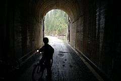
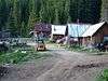
- This National Park Service list is complete through NPS recent listings posted December 16, 2016.[2]
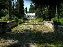
Current listings
| [3] |
Name on the Register |
Image |
Date listed[4] |
Location |
City or town |
Description |
|---|
| 1 |
Alberton School |
|
000000001997-01-13-0000January 13, 1997
(#96001599) |
216 Railroad Street
47°00′17″N 114°28′50″W / 47.004722°N 114.480556°W / 47.004722; -114.480556 (Alberton School) |
Alberton |
|
| 2 |
Bestwick's Market |
|
000000001997-01-13-0000January 13, 1997
(#96001600) |
Railroad Street east of its junction with Interstate 90
47°00′13″N 114°28′36″W / 47.003611°N 114.476667°W / 47.003611; -114.476667 (Bestwick's Market) |
Alberton |
|
| 3 |
Brinks House |
Upload image |
000000001997-01-13-0000January 13, 1997
(#96001601) |
416 Railroad Street
47°00′14″N 114°28′42″W / 47.003889°N 114.478333°W / 47.003889; -114.478333 (Brinks House) |
Alberton |
|
| 4 |
Chadwick House |
Upload image |
000000001997-01-13-0000January 13, 1997
(#96001602) |
320 Railroad Street
47°00′15″N 114°28′45″W / 47.004167°N 114.479167°W / 47.004167; -114.479167 (Chadwick House) |
Alberton |
|
| 5 |
Chicago, Milwaukee, St. Paul and Pacific Railroad Company Historic District |
|
000000002000-10-26-0000October 26, 2000
(#00001269) |
Idaho Panhandle National Forest
47°21′46″N 115°39′30″W / 47.362778°N 115.658333°W / 47.362778; -115.658333 (Chicago, Milwaukee, St. Paul and Pacific Railroad Company Historic District) |
St. Regis |
|
| 6 |
De Borgia Schoolhouse |
|
000000001979-12-27-0000December 27, 1979
(#79001405) |
Thompson Falls De Borgia Rd.
47°22′50″N 115°20′49″W / 47.380556°N 115.346944°W / 47.380556; -115.346944 (De Borgia Schoolhouse) |
De Borgia |
|
| 7 |
Gildersleeve Mine |
|
000000002002-06-26-0000June 26, 2002
(#02000723) |
Lolo National Forest
47°02′09″N 115°02′04″W / 47.035833°N 115.034444°W / 47.035833; -115.034444 (Gildersleeve Mine) |
Superior |
|
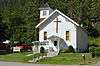
| 8 |
Methodist Church of Alberton |
|
000000001997-01-13-0000January 13, 1997
(#96001604) |
802 Railroad Street
47°00′10″N 114°28′26″W / 47.002778°N 114.473889°W / 47.002778; -114.473889 (Methodist Church of Alberton) |
Alberton |
|
| 9 |
Railroad Depot |
Upload image |
000000001997-01-13-0000January 13, 1997
(#96001603) |
701 Railroad Street
47°00′10″N 114°28′30″W / 47.002778°N 114.475°W / 47.002778; -114.475 (Railroad Depot) |
Alberton |
|
| 10 |
Natural Pier Bridge |
|
000000002010-01-04-0000January 4, 2010
(#09001182) |
Milepost 1 on S. Frontage Rd.
47°00′50″N 114°30′28″W / 47.013942°N 114.507642°W / 47.013942; -114.507642 (Natural Pier Bridge) |
Alberton |
|
| 11 |
Point of Rocks Historic Transportation Corridor |
Upload image |
000000002009-09-04-0000September 4, 2009
(#09000683) |
2 miles (3.2 km) west of Alberton
47°00′42″N 114°32′52″W / 47.011667°N 114.547778°W / 47.011667; -114.547778 (Point of Rocks Historic Transportation Corridor) |
Alberton |
|
| 12 |
Savenac Nursery Historic District |
|
000000001999-08-16-0000August 16, 1999
(#99000988) |
Interstate 90 south of Haugan
47°23′07″N 115°23′47″W / 47.385278°N 115.396389°W / 47.385278; -115.396389 (Savenac Nursery Historic District) |
Haugan |
|
| 13 |
Scenic Bridge |
|
000000002010-01-04-0000January 4, 2010
(#09001183) |
Milepost 0 on Old U.S. Route 10 W.
47°01′12″N 114°39′27″W / 47.020092°N 114.657436°W / 47.020092; -114.657436 (Scenic Bridge) |
Tarkio |
|
| 14 |
Superior School |
Upload image |
000000001997-03-21-0000March 21, 1997
(#97000253) |
River Road, approximately 0.25 miles (0.40 km) north of U.S. Route 10
47°11′42″N 108°53′22″W / 47.195°N 108.889444°W / 47.195; -108.889444 (Superior School) |
Superior |
|
| 15 |
Thorn House |
Upload image |
000000001997-01-13-0000January 13, 1997
(#96001605) |
140 2nd Street
47°00′19″N 114°28′54″W / 47.005278°N 114.481667°W / 47.005278; -114.481667 (Thorn House) |
Alberton |
|
| 16 |
Wilson House |
Upload image |
000000001997-01-13-0000January 13, 1997
(#96001606) |
114 Adams Street
47°00′06″N 114°28′14″W / 47.001667°N 114.470556°W / 47.001667; -114.470556 (Wilson House) |
Alberton |
|
See also
References
- ↑ The latitude and longitude information provided in this table was derived originally from the National Register Information System, which has been found to be fairly accurate for about 99% of listings. For about 1% of NRIS original coordinates, experience has shown that one or both coordinates are typos or otherwise extremely far off; some corrections may have been made. A more subtle problem causes many locations to be off by up to 150 yards, depending on location in the country: most NRIS coordinates were derived from tracing out latitude and longitudes off of USGS topographical quadrant maps created under the North American Datum of 1927, which differs from the current, highly accurate WGS84 GPS system used by most on-line maps. Chicago is about right, but NRIS longitudes in Washington are higher by about 4.5 seconds, and are lower by about 2.0 seconds in Maine. Latitudes differ by about 1.0 second in Florida. Some locations in this table may have been corrected to current GPS standards.
- ↑ "National Register of Historic Places: Weekly List Actions". National Park Service, United States Department of the Interior. Retrieved on December 16, 2016.
- ↑ Numbers represent an ordering by significant words. Various colorings, defined here, differentiate National Historic Landmarks and historic districts from other NRHP buildings, structures, sites or objects.
- ↑ The eight-digit number below each date is the number assigned to each location in the National Register Information System database, which can be viewed by clicking the number.
|
|---|
|
| Topics | |
|---|
|
| Lists by states | |
|---|
|
| Lists by insular areas | |
|---|
|
| Lists by associated states | |
|---|
|
| Other areas | |
|---|
|
-
 Portal Portal
-
 WikiProject WikiProject
|
.jpg)
.jpg)
.jpg)
.jpg)
.jpg)